October 12 , 2019.
Mexico , Colima :
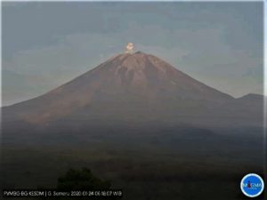
Weekly technical bulletin of the activity of the volcano Colima. Date: October 11, 2019, Bulletin No. 142.
Seismic activity:
During the past week, 14 high frequency (HF) events, 2 landslides and 5.4 min of low amplitude tremors were automatically recorded.
Visual observations:
Intermittent steam and gas emissions on the northeast side of the crater continue to be recorded during the reporting period, although fumaroles have also been observed in the western part. When clouds allowed, the fixed thermal camera located south of the volcano recorded thermal anomalies related to the fumaroles activity.
Geochemistry:
The flow of SO2 was not measured during the week.
Remote perception:
No thermal anomalies detected by the MIROVA satellite system were observed during the last week.
Diagnostic:
The volcano maintains an explosive activity of low intensity. The occurrence of these events indicates that the gas probably associated with the moving magma has reached surface levels. This activity can continue and increase in intensity over the following days, weeks or months. The staff responsible for monitoring the volcano monitors any changes and developments in the activity.
Possible scenarios from days to weeks:
1. Low to moderate explosions continue.
2. There is new growth of lava dome on top with collapses of glowing material and lava flows.
Source : RESCO-CUEV-Facultad de Ciencias Universidad de Colima .
Photo : Protección Civil Jalisco Uepcbj .
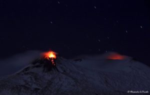
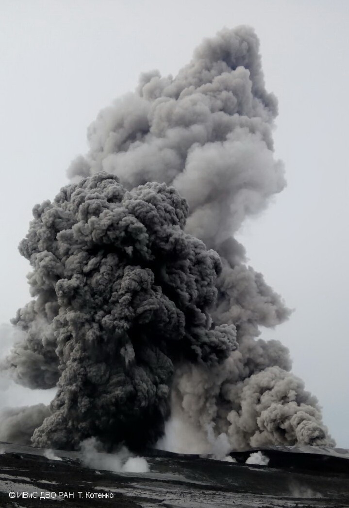
Kamchatka , Ebeko :
VOLCANO OBSERVATORY NOTICE FOR AVIATION (VONA).
Issued: October 10 , 2019
Volcano: Ebeko (CAVW #290380)
Current aviation colour code: ORANGE
Previous aviation colour code: orange
Source: KVERT
Notice Number: 2019-155
Volcano Location: N 50 deg 41 min E 156 deg 0 min
Area: Northern Kuriles, Russia
Summit Elevation: 3791.68 ft (1156 m)
Volcanic Activity Summary:
A moderate eruptive activity of the volcano continues. According to visual data by volcanologists from Severo-Kurilsk, explosions send ash up to 2.6 km a.s.l., an ash cloud drift to the north-east of the volcano.
This moderate eruptive activity of the volcano continues. Ash explosions up to 19,700 ft (6 km) a.s.l. could occur at any time. Ongoing activity could affect low-flying aircraft and airport of Severo-Kurilsk.
Volcanic cloud height:
8200-8528 ft (2500-2600 m) AMSL Time and method of ash plume/cloud height determination: 20191010/2115Z – Visual data
Other volcanic cloud information:
Distance of ash plume/cloud of the volcano: 6 mi (10 km)
Direction of drift of ash plume/cloud of the volcano: NE
Time and method of ash plume/cloud determination: 20191010/2115Z – Visual data
Source : Kvert.
Photo : T. Kotenko, IVS FEB RAS , 2017.
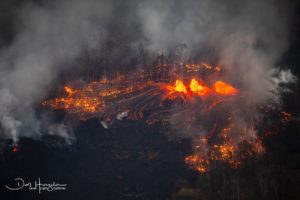
Chile , Nevados de Chillan :
Special volcanic activity report (REAV) of the Ñuble region, Nevados de Chillán Volcanic Complex, October 11, 2019, at 1:15 local time (mainland Chile).
The National Geological and Mining Service of Chile (Sernageomin) discloses the following PRELIMINARY information, obtained through the monitoring equipment of the National Volcanic Monitoring Network (NVRN), processed and analyzed at the Volcanological Observatory of the South Andes (OVDAS) ):
Yesterday, Friday October 11 at 00:41 and 00:56 local time (03:41 and 03:56 UTC), the control stations installed near the Nevados Volcanic Complex of Chillán recorded two explosions related to the dynamics of the fluids inside the volcanic system with emission of gases and particulate materials.
The characteristics of the earthquakes are as follows:
Earthquake 1:
TIME OF ORIGIN: 00h41 local time (03:41 UTC)
LATITUDE: 36 882 ° S
LONGITUDE: 71.385 ° W
DEPTH: 0.2 km
REDUCED TRAVEL: 540 cm2
ACOUSTIC SIGNAL: 4.0 [Pa · Km].
Earthquake 2:
TIME OF ORIGIN: 00h56 local time (03h56 UTC)
LATITUDE: 36,860 ° S
LONGITUDE: 71,368 ° W
DEPTH: 0.8 km
REDUCED TRAVEL: 603 cm2
ACOUSTIC SIGNAL: 0.8 [Pa · Km].
OBSERVATIONS:
The explosions produced a column of gas and low-grade particulate materials.
The volcanic technical alert is maintained at the Orange level.
Source : Sernageomin.
Video : Nicolas Luengo.
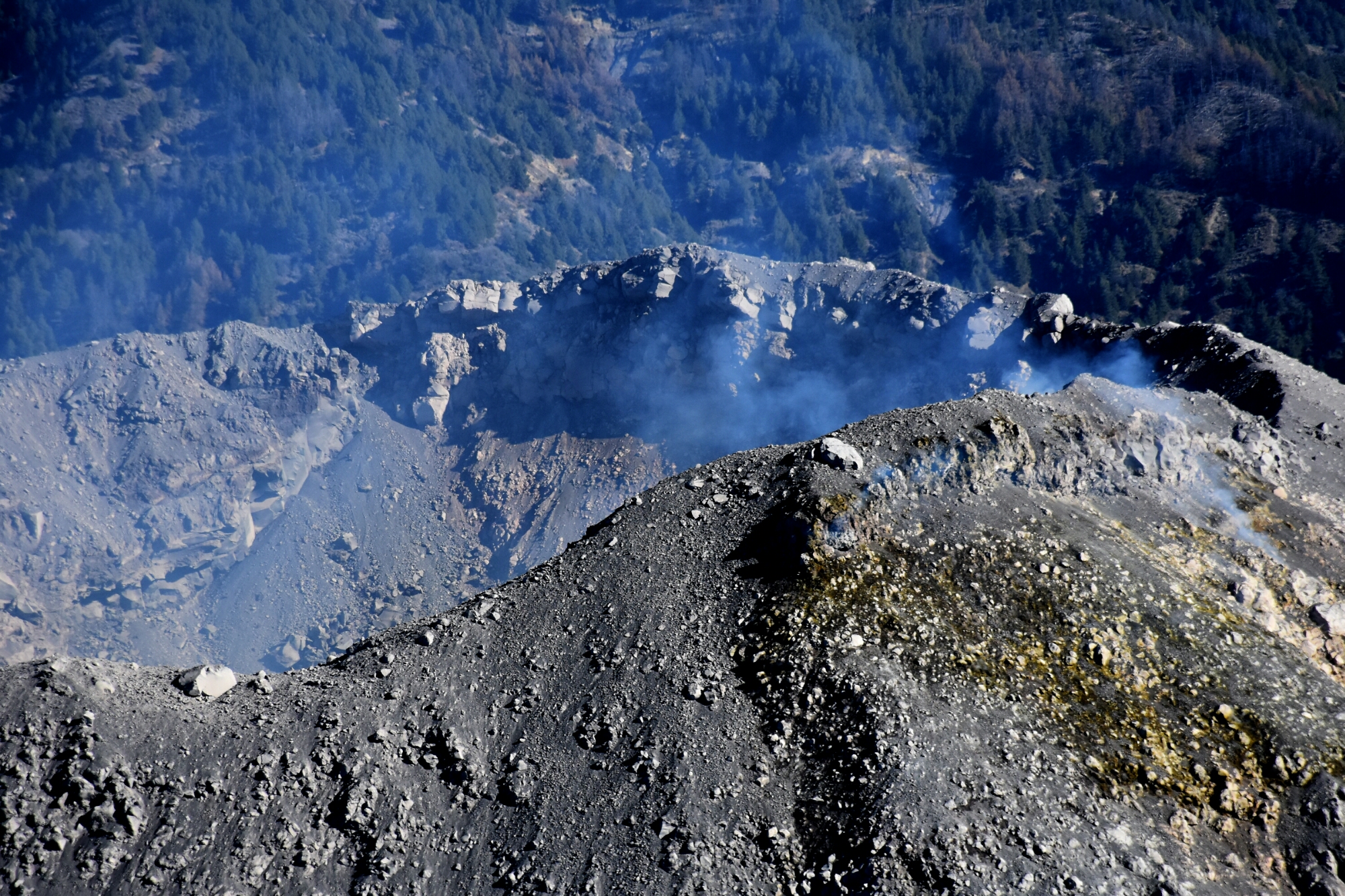
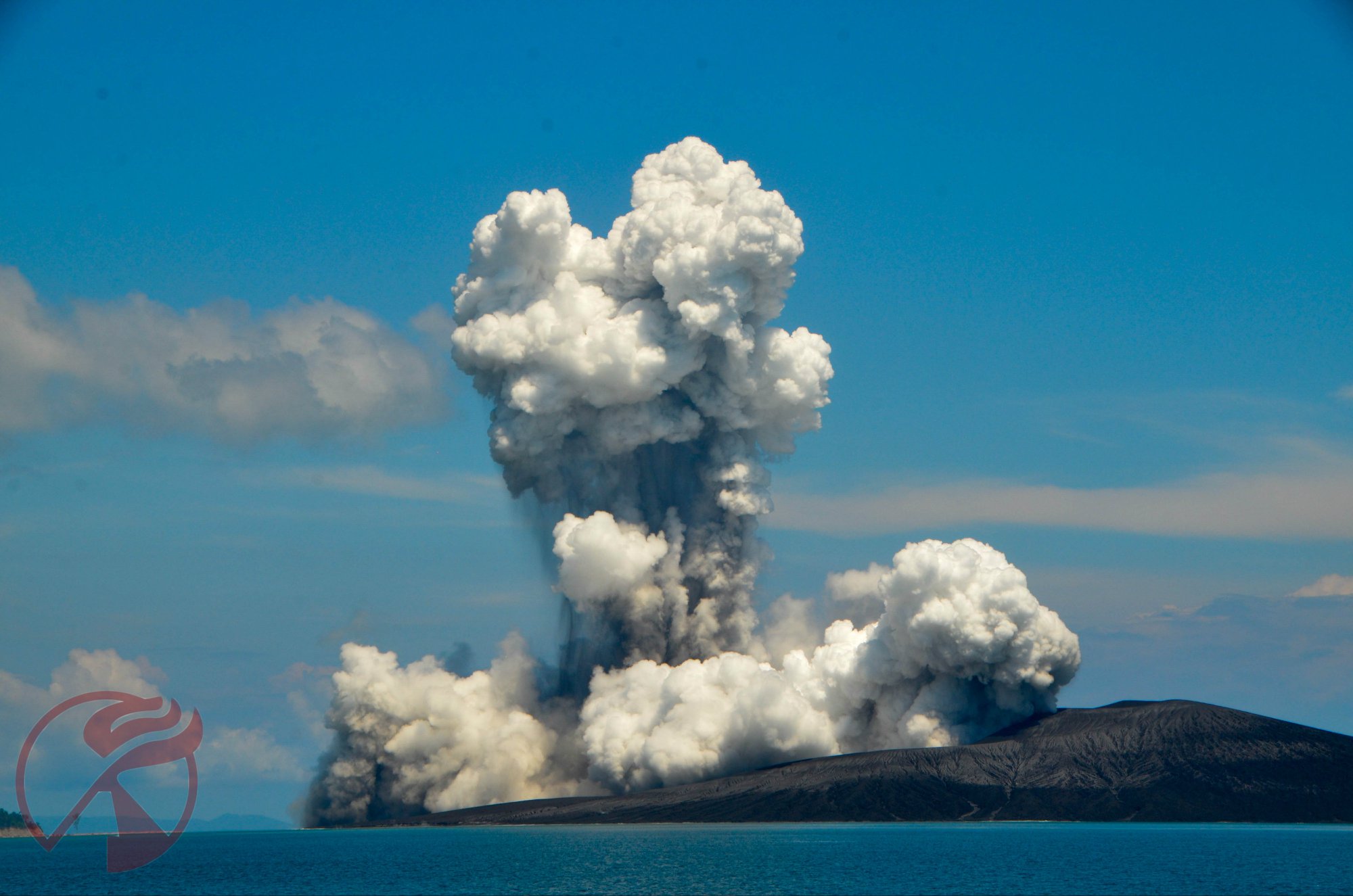
Indonesia , Anak Krakatau :
Level of activity at level II (Waspada), since March 25, 2019. The Anak Krakatau (157 m altitude) has experienced an increase in its volcanic activity since June 18, 2018, which was followed by a series of eruptions from September 2018 to February 2019. In October 2019, eruptions still occur but the intensity decreases.
The weather is sunny to cloudy with low winds to the northeast and northwest. The ambient temperature is 24 to 29.2 ° C. The volcano is covered with fog. CCTV observed a fine white smoke at a height of 25 to 50 m from the bottom of the crater.
The seismographs of October 10, 2019 recorded:
1 explosion earthquake.
1 low frequency earthquake.
1 shallow volcanic earthquake
3 volcanic earthquakes
1 distant tectonic earthquake
Continuous tremor with an amplitude of 1 – 6 mm, dominant value of 1 mm
Recommendation:
The public / tourists are not allowed to approach the crater within a radius of 2 km.
VOLCANO OBSERVATORY NOTICE FOR AVIATION – VONA.
Issued: October 12 ,2019
Volcano: Anak Krakatau (262000)
Current Aviation Colour Code: ORANGE
Previous Aviation Colour Code: orange
Source: Anak Krakatau Volcano Observatory
Notice Number: 2019KRA171
Volcano Location: S 06 deg 06 min 07 sec E 105 deg 25 min 23 sec
Area: Lampung, Indonesia
Summit Elevation: 502 FT (157 M)
Volcanic Activity Summary:
recorded eruption at 05:26UTC (12:26 local)
Volcanic Cloud Height:
Ash-cloud is not visible
Other Volcanic Cloud Information:
visually from cctv crater seen volcanic ash moving to north, volcanic ash gray-black thick 200 meters high from the bottom of the crater.
Remarks:
Eruption recorded on seismogram with maximum amplitude 42 mm and duration 107 second.
Source : PVMBG , Magma Indonésie.
Photo : Sylvain Chermette / 80 Jours voyages.