October 04 , 2019.
Hawaii , Kilauea :
19°25’16 » N 155°17’13 » W,
Summit Elevation 4091 ft (1247 m)
Current Volcano Alert Level: NORMAL
Current Aviation Color Code: GREEN
Activity Summary:
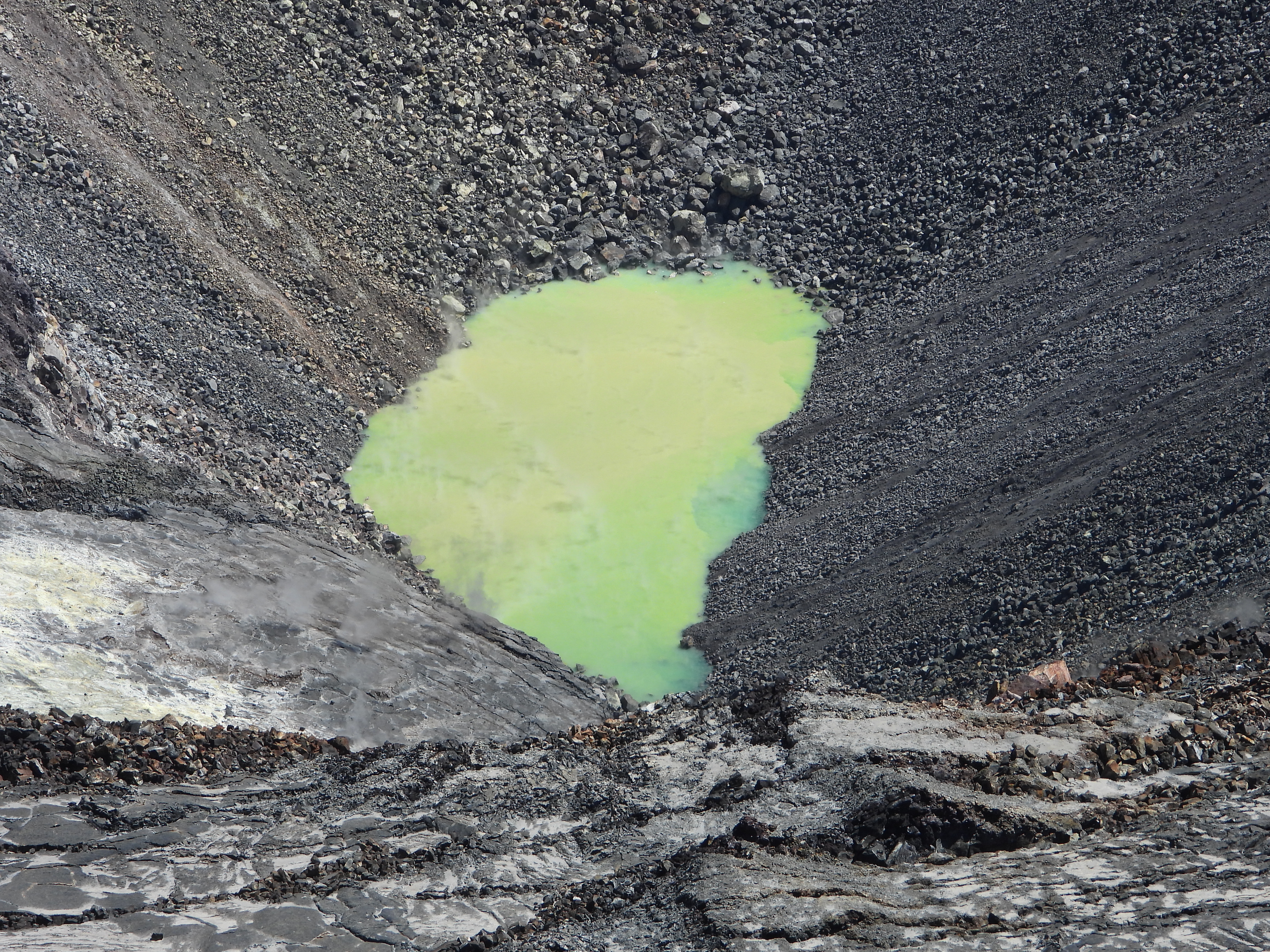
Kīlauea Volcano is not erupting. Monitoring data continue to show steady rates of seismicity and ground deformation, low rates of sulfur dioxide emission, and only minor geologic changes since the end of eruptive activity in September 2018. Water continues to pond at the bottom of Halema’uma’u inside the summit caldera.
Observations:
Monitoring data have shown no significant changes in volcanic activity during September. Rates of earthquake activity or seismicity across the volcano remain largely steady with three periods of increased microseismic activity each lasting a couple of days. Sulfur dioxide emission rates are low at the summit and are below detection limits at Puʻu ʻŌʻō and the lower East Rift Zone. The pond at the bottom of Halema’uma’u, which began forming on July 25, 2019, continues to slowly expand and deepen.
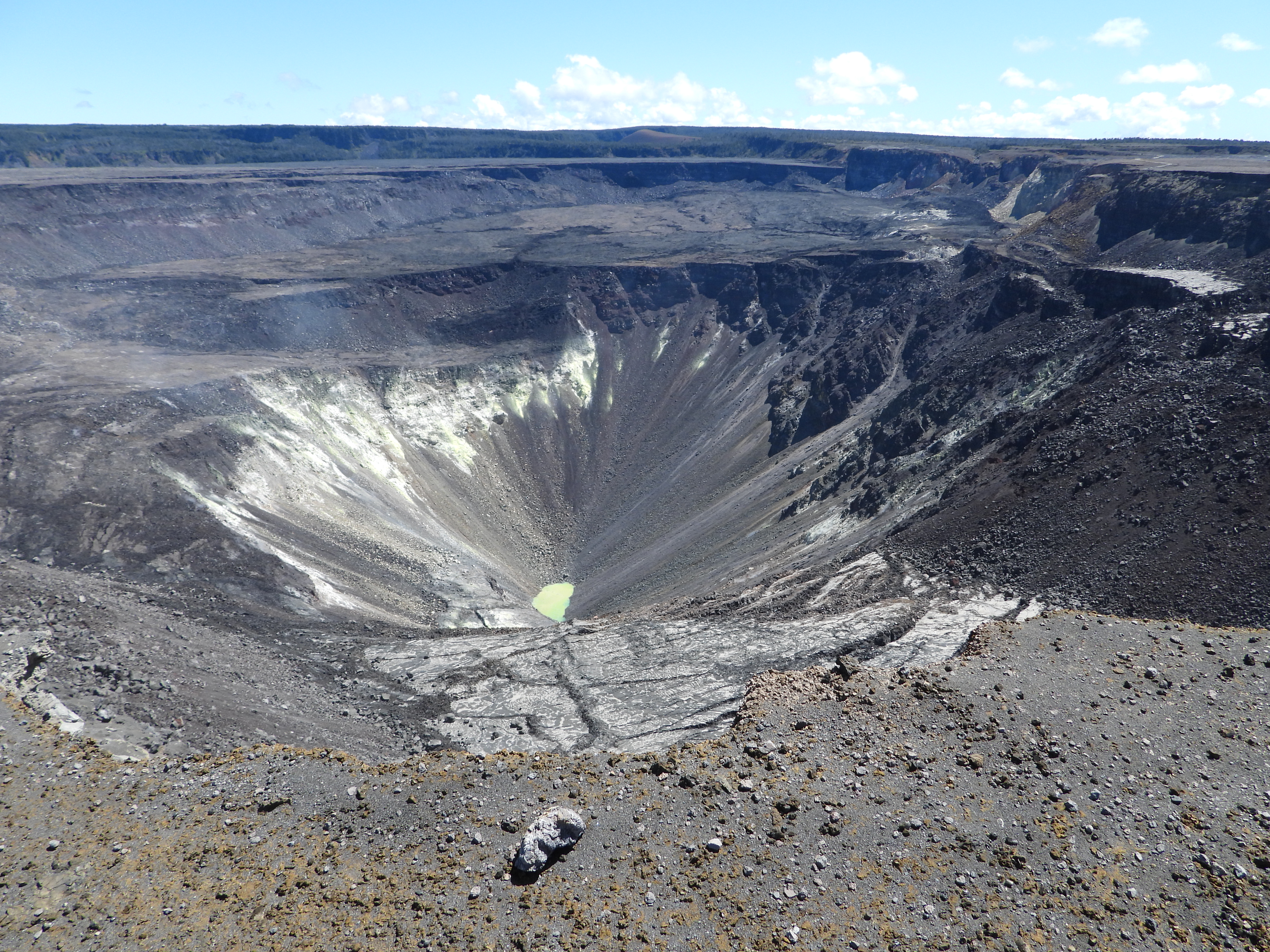
On a beautiful and clear day at the summit of Kīlauea, no changes were observed in the water pond within Halema‘uma‘u. The pond of water continues to slowly rise. USGS photo by K. Mulliken, 09-27-2019.
Although not currently erupting, areas of persistently elevated ground temperatures and minor release of gases are still found in the vicinity of the 2018 lower East Rift Zone fissures. These include steam (water), very small amounts of hydrogen sulfide, and carbon dioxide. These conditions are expected to be long-term. Similar conditions following the 1955 eruption continued for years to decades.
Since early March 2019, GPS stations and tiltmeters at the Kīlauea summit have recorded deformation consistent with slow magma accumulation within the shallow portion of the Kīlauea summit magma system (1-2 km or approximately 1 mile below ground level). However, gas measurements have yet to indicate significant shallowing of magma. HVO continues to carefully monitor all data streams at the Kīlauea summit for important changes.
Telephoto view of the water pond within Halema‘uma‘u at Kīlauea’s summit. Little steam was emanating from the hot crater lake, likely as a result of the warm air temperature on this sunny day. USGS photo by K. Mulliken, 09-27-2019.
Farther east, GPS stations and tiltmeters continue to show motions consistent with slowed refilling of the deep East Rift Zone magmatic reservoir in the broad region between Puʻu ʻŌʻō and Highway 130. Monitoring data do not suggest any imminent change in volcanic hazard for this area. In addition to motion along the East Rift Zone, the south flank of Kīlauea continues to creep seaward at elevated rates following the May 4, 2018 M6.9 earthquake near Kalapana. HVO continues to carefully monitor all data streams along the Kīlauea East Rift Zone and south flank for important changes.
Hazards:
Hazards remain in the lower East Rift Zone eruption area and at the Kīlauea summit. Residents and visitors near the 2018 fissures, lava flows, and summit collapse area should heed Hawaii County Civil Defense and National Park warnings. Lava flows and features created by the 2018 eruption are primarily on private property and persons are asked to be respectful and not enter or park on private property.
Source : HVO.
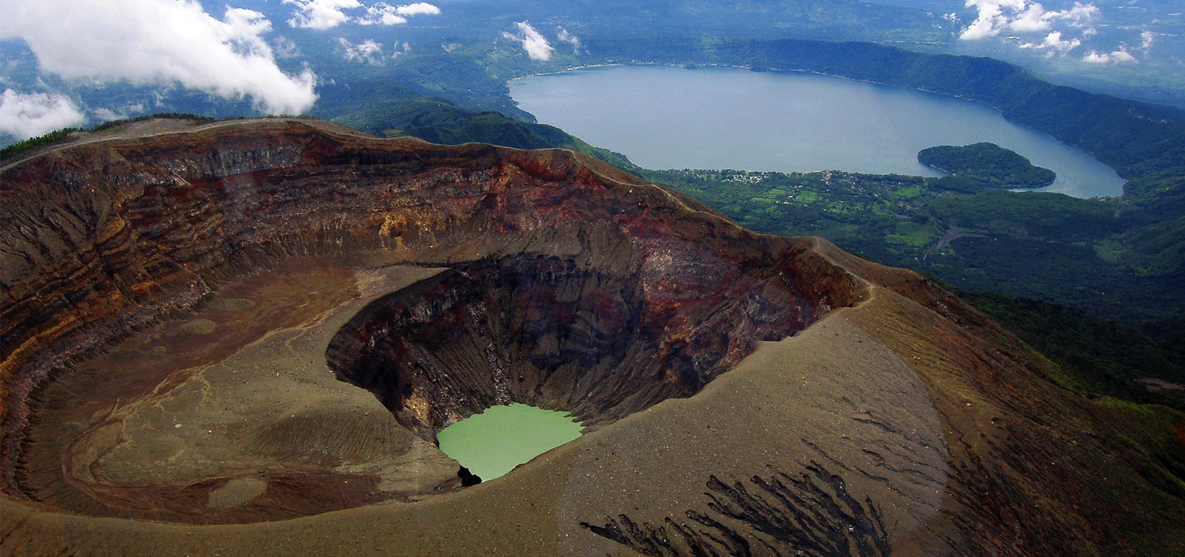
El Salvador , Santa Ana (Ilamatepec) :
Location: shared by the departments of Santa Ana and Sonsonate
Altitude: 2381 meters
Type of volcano: Stratovolcano
Attraction type: Vulcanian – Strombolian
Last eruption: October 1, 2005.
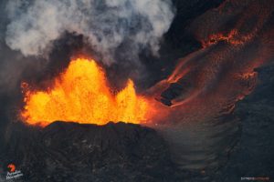
The seismic vibration of the volcano remained between 16 and 18 RSAM units per day, that is to say in the normal range. In September, a total of 58 earthquakes related to fluid circulation in the volcanic system were recorded. With regard to the earthquakes associated with the rupture of solid media, 3 were recorded and two were located on the north-west flank of the volcano crater, with a depth of less than 6 kilometers and a magnitude less than M2, 0. Due to their small magnitude, no residents of the region felt it. According to the monitoring, the activity of the volcano remains normal.
For sulfur dioxide (SO2) emissions, they fluctuated between 34 and 281 tonnes per day, with an average of 176 t / d, the threshold being 300 t / d.
Source : Marn.
Photo : kaytetours.com.
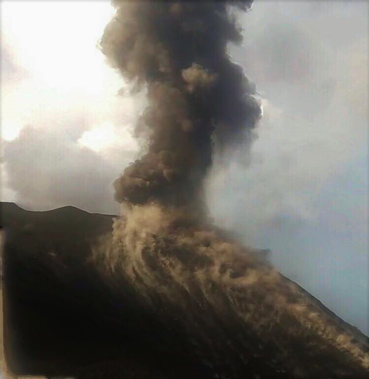
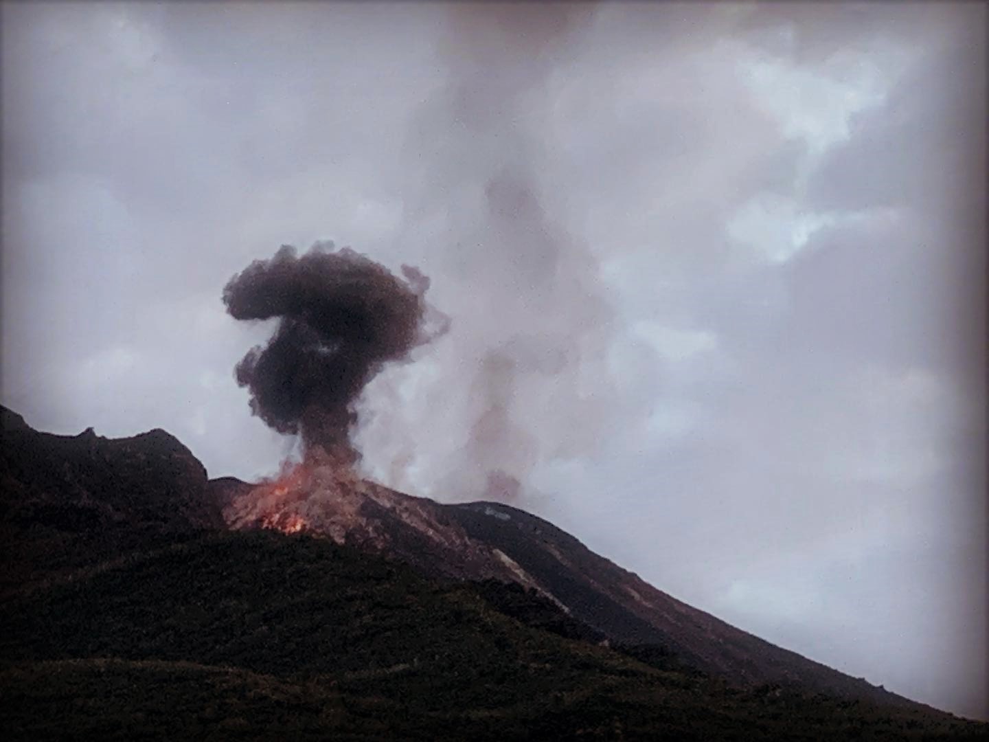
Italy , Stromboli :
Daily bulletin of 03 October 2019.
SUMMARY OF THE ACTIVITY.
In light of the surveillance data, we highlight:
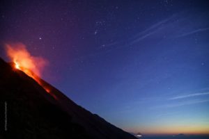
1) VOLCANOLOGICAL OBSERVATIONS: Normal explosive activity of Strombolian type accompanied by degassing activities.
2) SISMOLOGY: The seismological parameters do not show any significant changes.
3) DEFORMATIONS: No significant changes to report
4) GEOCHEMISTRY: The flow of SO2 is at an average level. The CO2 / SO2 ratio measured by the station restored on October 02, 2019, is at a medium-low value. The helium isotopic ratios remain unchanged for the mean-low values.
VOLCANOLOGICAL OBSERVATIONS
Due to adverse weather conditions, which caused a decrease in visibility and subsequently caused an interruption in Stromboli’s video information flow, observations were temporally more limited than in previous days. The analysis of the available images, from surveillance cameras located at 400 m altitude (SQV and SQT) and Punta dei Corvi (SCPT), revealed an ordinary Strombolian explosive activity, carried by several vents, located in both in the North and Center-South zones of the crater terrace. The explosions, of varying frequency and intensity, produce coarse materials that often fall outside the crater terrace and settle on the upper part of the Sciara del Fuoco, rolling along the slope towards the coast. The total number of explosive events in both areas of the crater was 11 to 13 events / h (average frequency). In detail, in the North zone, the explosive activity was characterized by 4-5 low intensity events / h (explosions with a height of less than 80 m) producing coarse materials (lapilli and bombs) covering the slopes of the cone face at the Sciara del Fuoco. In the Center-Sud zone, there was an average frequency of explosions of 7 to 8 events of low explosive (explosions less than 80 m high) and medium (explosions less than 150 m high). The explosions generated by the Center-South zone produced coarse materials mixed with purposes.
Seismology:
The bulletin is established with data acquired from a maximum of 8 stations. The seismic activity recorded during the last 24 hours has the following characteristics: No seismic signal associated with a landslide has been recorded. The number of Very Long Period Type (VLP) events provides an average of approximately 17 events / hour.
The magnitude of the VLP events showed generally low values. The amplitude of the explosion earthquakes showed values between low and medium-low The amplitude of the volcanic tremor, estimated at the station STR1, had values between medium-low and medium-high with an increase towards the values because of a moderate increase in the number and extent of explosive earthquakes. The lack of data between 17:30 UTC 02/10 and 00 h 10 UTC 03/10 was determined by the persistence of the absence of electricity for the acquisition systems … / …
Source : INGV.
Read the full article : file:///C:/Users/Utilisateur/AppData/Local/Packages/Microsoft.MicrosoftEdge_8wekyb3d8bbwe/TempState/Downloads/BollettinoGiornalieroStromboli20191003%20(1).pdf
Photos : Web cam , stromboli aventures .
Guatemala , Fuego :
LAHAR IN THE BARRANCA LAS LAJAS.
Heavy rains in the Fuego Volcano region and the prevailing humidity are currently causing the descent of a small lahar, which may become moderate in the next few minutes, in the Las Lajas ravine, a tributary of Rio Guacalate. This lahar carries volcanic materials such as ashes, sand and blocks one meter in diameter, trunks and tree branches. Trained materials have been deposited by constant eruptive activity and it is expected that this type of event will continue to be generated.
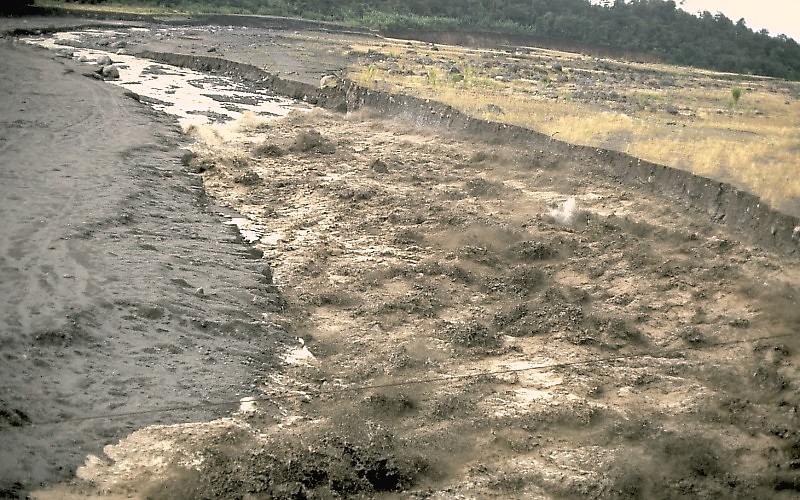
As the rains continue during the afternoon and evening, the likelihood of similar or larger lahars will descend in the next few minutes and hours through the various ravines and other channels of the Fuego Volcano. is not excluded.
Source : Insivumeh .
Photo : Wikipédia , USGS geologist Jeff Marso — http://volcanoes.usgs.gov/Hazards/What/Lahars/Santiaguito_89.html
Hot lahar in the Nima II river, near El Palmar, Guatemala, 1989.