September 08 , 2018.
Alaska , Veniaminof :
56°11’52 » N 159°23’35 » W,
Summit Elevation 8225 ft (2507 m)
Current Volcano Alert Level: WATCH
Current Aviation Color Code: ORANGE
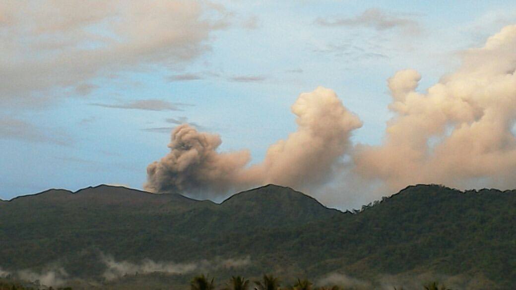
Modest eruptive activity continues at Veniaminof. Seismicity at the volcano picked up starting on Sunday, September 2, and AVO raised the Aviation Color Code and Alert Level to Yellow/Advisory the next day. On Tuesday, September 4, seismic activity increased and low-level pulsatory ash plumes from Veniaminof’s summit were reported by residents of Perryville and observed in images from the FAA Perryville web camera. Thus AVO raised the Aviation Color Code and Alert Level to Orange/Watch on Tuesday. Pilot reports confirmed low altitude ash clouds (less than 10,00 ft asl) and ash fall on the summit ice field, and thermal features consistent with a hot vent as well as deposited ash on the ice field were observed in satellite data.
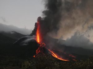
Veniaminof volcano in eruption, August 18, 2013. Pulses of ash and ballistics erupt from the intracadera cinder cone. Two streams of lava flow down the east flank into an ice cauldron to produce roiling steam clouds. The lava flows are pouring from vents located below the crater rim, the highest (left in this image) of which likely marks the level of a lava lake within the cone. Photo taken by Game McGimsey, AVO/USGS. This overflight of Veniaminof was co-sponsored by the National Geographic Society.
Unrest continues this morning with seismicity remaining elevated. Incandescence was observed at the summit in the Perryville web camera early this morning and a very hot thermal feature was observed in satellite data. The hot feature observed at the summit suggests that lava fountaining may be occurring at summit of Veniaminof.
Source : AVO.
Photo : McGimsey, R. G.
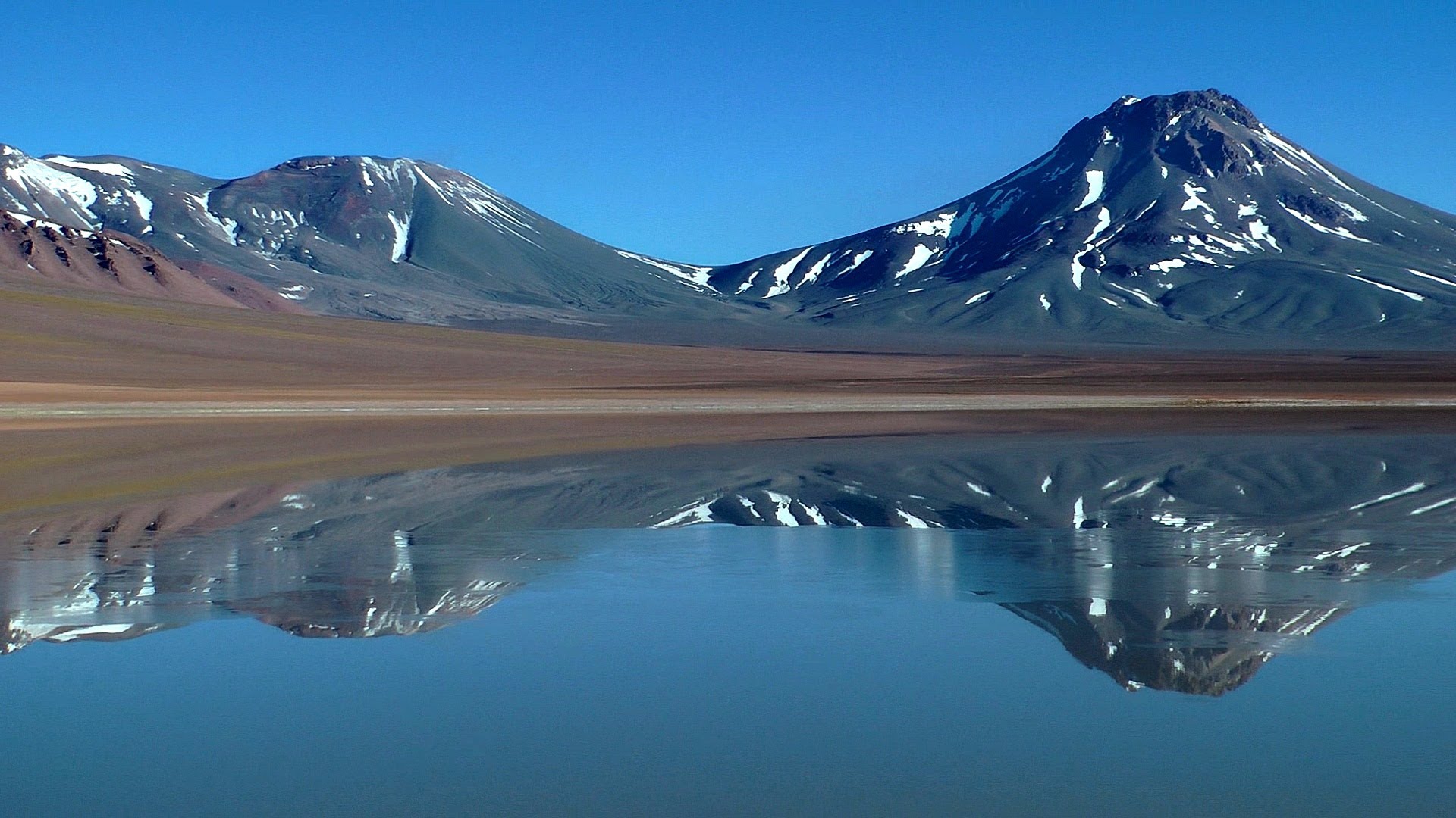
Chile , Lascar :
During the evaluated period, a total of 105 seismic events were recorded, of which 30 were classified as volcano-tectonic earthquakes (VT) in relation to rock fracturing processes within the volcanic edifice. with local magnitudes less than M1.3. The event of greatest energy was located in the active crater, at a depth of 3 km.
There were also 75 long-period (LP) earthquakes recorded in relation to fluid dynamics within the volcano with reduced displacement values (DRc) of less than 6.8 cm2.
The images provided by the IP cameras installed around the volcano show a recurrent degassing from the main crater, reaching a maximum of 300 m above the active crater.
According to the data provided by three GNSS stations, no displacement of the components is observed, which implies that there is no evidence of deformation for the period evaluated.
Sulfur dioxide (SO2) emissions, recorded by Differential Absorption Spectrometry Equipment (DOAS), have a value for the evaluated period of 822 +/- 99 T / day and a maximum value of 1455 t / d recorded on the August 29th. SO2 emissions are at moderate levels for this volcano, returning to levels observed in previous periods.
6 thermal alerts were reported in the area associated with the volcanic complex during the period, with a maximum 0.9 MW of Peak Radar Power (PVR), values considered low, according to the data processed by infrared observation. Volcanic Activity (MIROVA) (http://www.mirovaweb.it/) and Temporal Thermal Monitoring of Global Hot Spots (MODVOLC) (http://modis.higp.hawaii.edu/).
The seismic activity of type VT like type LP « Tornillos » is decreasing since the recording of the seismic swarm of superficial nature of 25/26/27 July, emphasizing that during these days, the nebulosity presents on the zone did not allow a clear visual of the activity that may have occurred. On the other hand after this episode, it was recorded a decrease of SO2 emissions by the DOAS teams and the return of the recording of thermal anomalies. All these processes suggest a partial release of the duct, which produces a rise of superficial seismicity, which contributes to the change on this volcano leaving the free passage to the passive release of a possible magmatic « plug » under the crater of the volcano.
Due to the above, the volcanic warning is reduced to the level:
GREEN LEVEL: Active volcano with stable behavior – Probable time for eruption: MONTH / YEARS.
Observation:
A zone of danger is considered as an area of 500 m around the crater.
Source : Sernageomin
Photo : Amazing places on our planet.
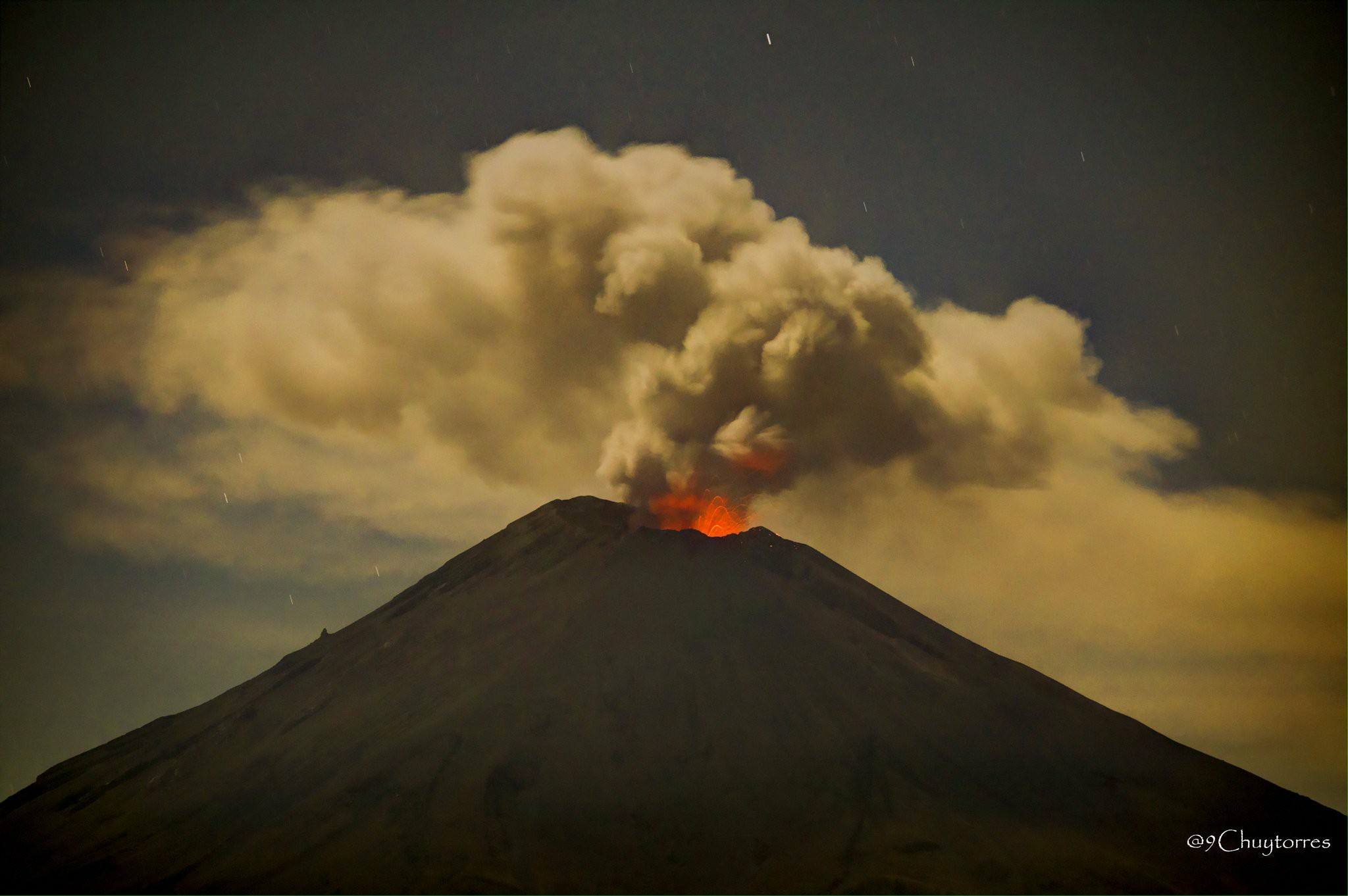
Mexico , Popocatepetl :
September 7th, 11:00 am (September 7th, 4:00 pm GMT)
In the last 24 hours, according to the monitoring systems of the Popocatepetl volcano, 98 low intensity exhalations accompanied by steam, gas and sometimes small amounts of ash dispersed to the northwest have been identified. In addition, four volcano-tectonic earthquakes, recorded at 19:24 yesterday and three today at 05:01 h, 06:09 h and 07:03 h, respectively calculated magnitude of M 2, M2,1, M2,1 and M1,9 were recorded. In addition, a total of 55 minutes of low amplitude harmonic tremor was recorded.
During the night, an incandescence was observed which increased during certain episodes.
At the time of this report, we have visibility towards the volcano, we observe the slight emission of water vapor and other gases that disperse in the North-West direction.
CENAPRED asked not to approach the volcano and in particular the crater, because of the risk of falling of projectiles, and in case of heavy rain to stay away from the bottom of gullies because of the danger of landslides and flows of mud.
The alert level of the Popocatepetl volcano is located at Amarillo Phase 2.
Source : Cenapred
Photo : Chuytorres
La Réunion , Piton de la Fournaise :
Activity Bulletin from Saturday, September 8, 2018 at 10:00 am (local time)
Since the beginning of September, inflation (swelling) of the base and top of the Piton de la Fournaise building has been observed again by the OVPF deformation network (Figure 1). This recovery in inflation is accompanied by a low seismicity. This inflation is for the moment slow and its evolution will be to follow these next days.
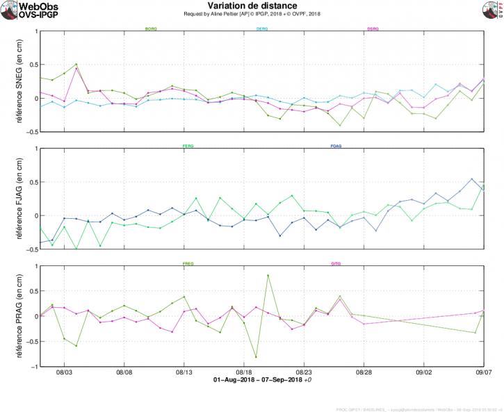
Figure 1: Illustration of the deformation since 01/08/2018. Here are shown baselines (variation of distance between two GPS receivers) crossing the Piton de la Fournaise building, at the top (at the top), at the base of the terminal cone (in the middle) and in the far field (at the bottom ). A rise is synonymous with elongation and therefore swelling of the volcano; conversely, a decrease is synonymous with contraction and therefore deflation of the volcano. (© OVPF-IPGP)
This recovery of the building’s inflation is synonymous with a pressurization of the superficial magmatic reservoir. The concentrations of CO2 in the far-field soil (Plaine des Cafres and Plaine des Palmistes sectors), which have been maintained at intermediate values since the end of the July 13 eruption, are consistent with a deep rise in magma. The change in trend observed in the deformations of the building (resumption of inflation) since early September attests to a possible transfer to lower depths (to the superficial reservoir).
It should be noted that such pressurization phases had preceded by about three weeks the eruption of April 27 – June 1, 2018, and one week only the eruption of July 13, 2018, before the roof of the tank is weakened and does not breaks, giving rise to an injection of magma towards the surface and an eruption.
Alert level: Vigilance.
Source : OVPF
Indonesia , Dukono :
VOLCANO OBSERVATORY NOTICE FOR AVIATION – VONA.
Issued: September 06 , 2018.
Volcano: Dukono (268010)
Current Aviation Colour Code: ORANGE
Previous Aviation Colour Code: orange
Source: Dukono Volcano Observatory
Notice Number: 2018DUK169
Volcano Location: N 01 deg 41 min 35 sec E 127 deg 53 min 38 sec
Area: North Maluku, Indonesia
Summit Elevation: 3933 FT (1229 M)
Volcanic Activity Summary:
Eruption with volcanic ash cloud at 00h24 UTC (09h24 local).
Volcanic Cloud Height:
Best estimate of ash-cloud top is around 5213 FT (1629 M) above sea level, may be higher than what can be observed clearly. Source of height data: ground observer.
Other Volcanic Cloud Information:
Ash cloud moving to east.
Remarks:
Eruption and ash emission is continuing
Source : Magma Indonésie