July 15 , 2018.
La Réunion , Piton de la Fournaise :
Activity bulletin of Saturday, July 14, 2018 at 16:00 (local time).
Following the end of the eruption on July 13 at 22:00, a strong seismic activity is still recorded.
Since the end of the eruption and until 15:30 this day (July 14), 51 superficial volcano-tectonic earthquakes (<2 km below the surface) have been recorded, an average of about 3 events per hour. The majority of these earthquakes are located under the northern edge of the crater Dolomieu. This shows that the feeding system of the deep volcano remains under pressure.
No significant deformities were observed today.
No assumptions are made about future developments in the near future (resumption of activity on the same site, resumption of activity elsewhere, permanent shutdown).
The OVPF survey this morning made it possible to map all the lava flows emitted during the July 13 eruption (Figure 1) and to estimate its volume at around 0.3 million m3. These flows covered approximately 400 m of markers on the trail leading to the summit (Figure 2).
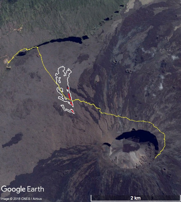
Figure 1: Mapping lava flows emitted during the eruption of July 13, 2018 made from aerial images processed by stereophotogrammetry. The flows are represented in white, the cracks in red and the hiking trail leading to the summit in yellow. (© OVPF / IPGP)
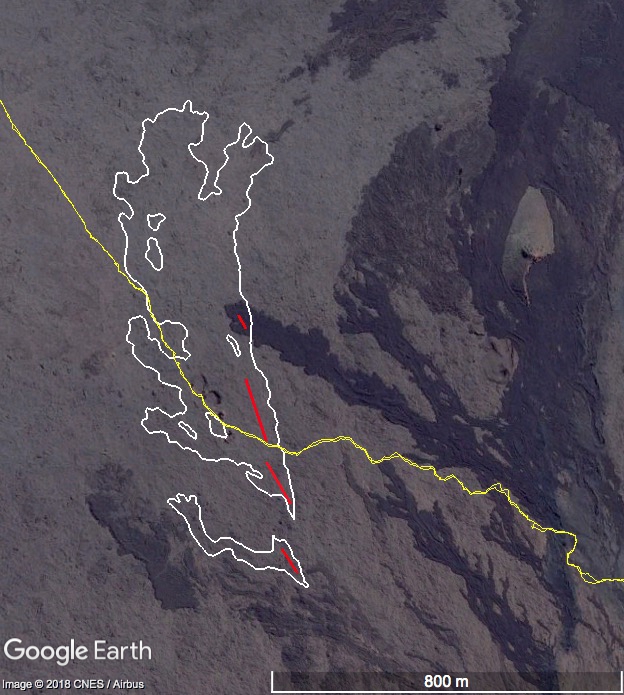
Figure 2: Zoom on the cartography of lava flows emitted during the July 13, 2018 eruption made from aerial images processed by stereophotogrammetry. The flows are represented in white, the cracks in red and the hiking trail leading to the summit in yellow. (© OVPF / IPGP)
Alert level: Backup.
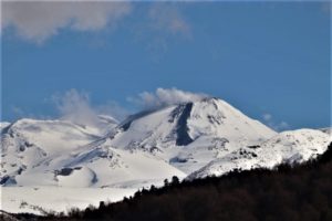
The third eruption of the year, Friday, will last only 17:30, but it has seriously impacted the landscapes of the volcano that are most familiar to us by covering a section of the classic route that provides access to the peak of the peak of the Fournaise.
Visitors who crowded Friday at the Bellecombe Lookout barriers probably did not realize that the path taken each year by more than 120,000 hikers may not reopen anytime soon. The lava fountains and the flows that briefly delighted the spectators covered about 400 meters of the route that crosses the bottom of the enclosure before the attack on the climb to the summit, at Rosemont Chapel . Another hundred meters of a secondary use trail – the one from the Chapel that led to Rivals crater on the west side of the volcano – was cleared by the flows .
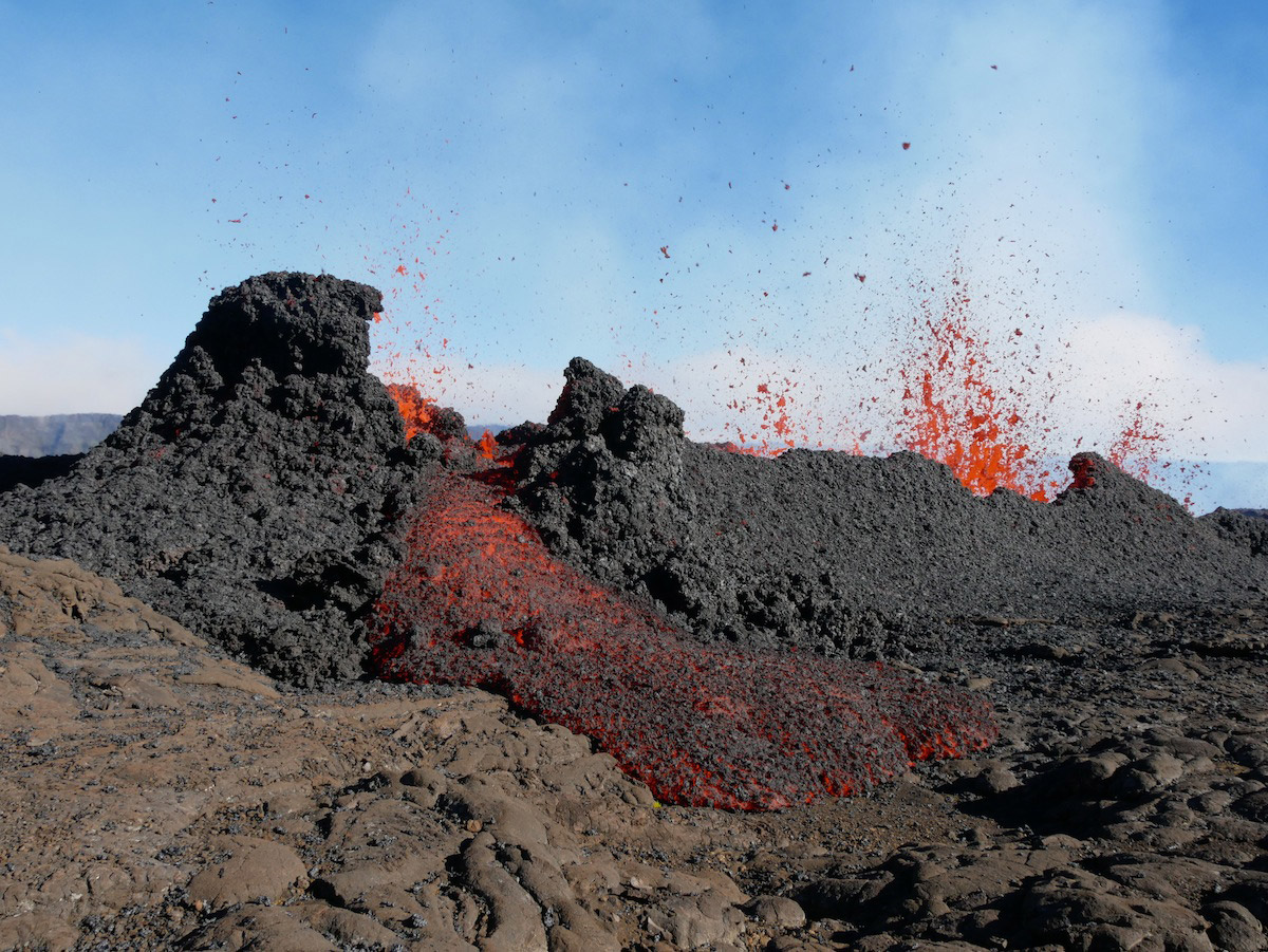
A chaos of slag engulfed all this area, Rosemont Chapel included, eliminating in passing a piece of heritage..
The National Forest Office will probably have to draw a new route to circumvent the obstacle, as this casting does not lend itself to a direct crossing even at the cost of a development as was done in similar cases of flows covering the summit trail, in December 2010 for the last time. Nearly one kilometer of route will be created this time (a simple markup with paint), lengthening a little more the route to the belvedere on the crater Dolomieu (summit), already considerably lengthened after its displacement consecutive to the eruption from April 2007.
Source : OVPF , Clicanoo.
Texte et photos : François Martel-Asselin.
Indonesia , Merapi :
Merapi Alert Status; Hikers Banned to Go Near 3 Km Radius Area
Jakarta – Mount Merapi in Yogyakarta and Central Java is still bearing alert status. The Research Center and Geological Technology Development calls on the public, through its Instagram account @bpptkg, to not approach the peak of Merapi.
The report was released on Friday, July 13, based on the observation at the volcano’s visual monitoring, earthquake, emissions measurement, deformation, and recording of rain and lava from July 6 to 12. It suggests the climbers, hikers and the community living around the slopes of Merapi to empty the area within the 3-kilometer radius from the top of the volcano and are asked to raise awareness.
The people can monitor the actual activity of Merapi through the nearest observation post, via radio frequency of 165.075 MHz, and website merapi.bgl.esdm.go.id, or BPPTKG social media. In this week, Merapi volcano has experienced two shallow volcano-tectonic earthquakes, 13 earthquake gusts, 22 multiphase earthquakes, 52 earthquakes, and 14 tectonic earthquakes. Meanwhile, the weather is observed to be bright in the morning and evening, while foggy at noon and in the afternoon. As for this week, there was no rain at the observation post of Mount Merapi.
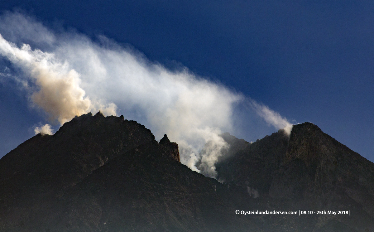
Level II Activity Level (WASPADA). G. Merapi (2968 m altitude) has a dotted eruption state.
Since yesterday until this morning, visually the volcano can be observed clearly until the appearance of fog. Crater smoke is not observed above the peak. The wind is blowing weakly to moderately east and west.
Thanks to the seismographs on July 13, 2018, it was recorded:
1 Avalanche earthquake
1 hybrid earthquake / multiple phase
2 distant tectonic earthquakes
Source : TEMPO.CO, FRANCISCA CHRISTY ROSANA , PVMBG.
Photo : Oystein Lund Andersen.
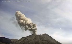
Kamchatka , Karymsky :
VOLCANO OBSERVATORY NOTICE FOR AVIATION (VONA).
Issued: July 15 , 2018 .
Volcano:Karymsky (CAVW #300130)
Current aviation colour code:YELLOW
Previous aviation colour code:yellow
Source:KVERT
Notice Number:2018-62
Volcano Location:N 54 deg 2 min E 159 deg 26 min
Area:Kamchatka, Russia
Summit Elevation:4874.08 ft (1486 m)
Volcanic Activity Summary:
According satellite data ash cloud extending for about 77 km to the west-south-west from the volcano.
A moderate activity of the volcano continues. Ongoing activity could affect low-flying aircraft.

Volcanic cloud height:
9840 ft (3000 m) AMSL Time and method of ash plume/cloud height determination: 20180715/0212Z – MODIS AQUA (31m32)
Other volcanic cloud information:
Distance of ash plume/cloud of the volcano: 48 mi (77 km)
Direction of drift of ash plume/cloud of the volcano: WSW / azimuth 246 deg
Time and method of ash plume/cloud determination: 20180715/0212Z – MODIS AQUA (31m32)
Start time of explosion and how determined: 20180714/2110Z – Video data
Source : Kvert
Photo : 9/12/2015 , G. Volynets, KamchatkAdventures / http://www.kamchatkadventures.ru
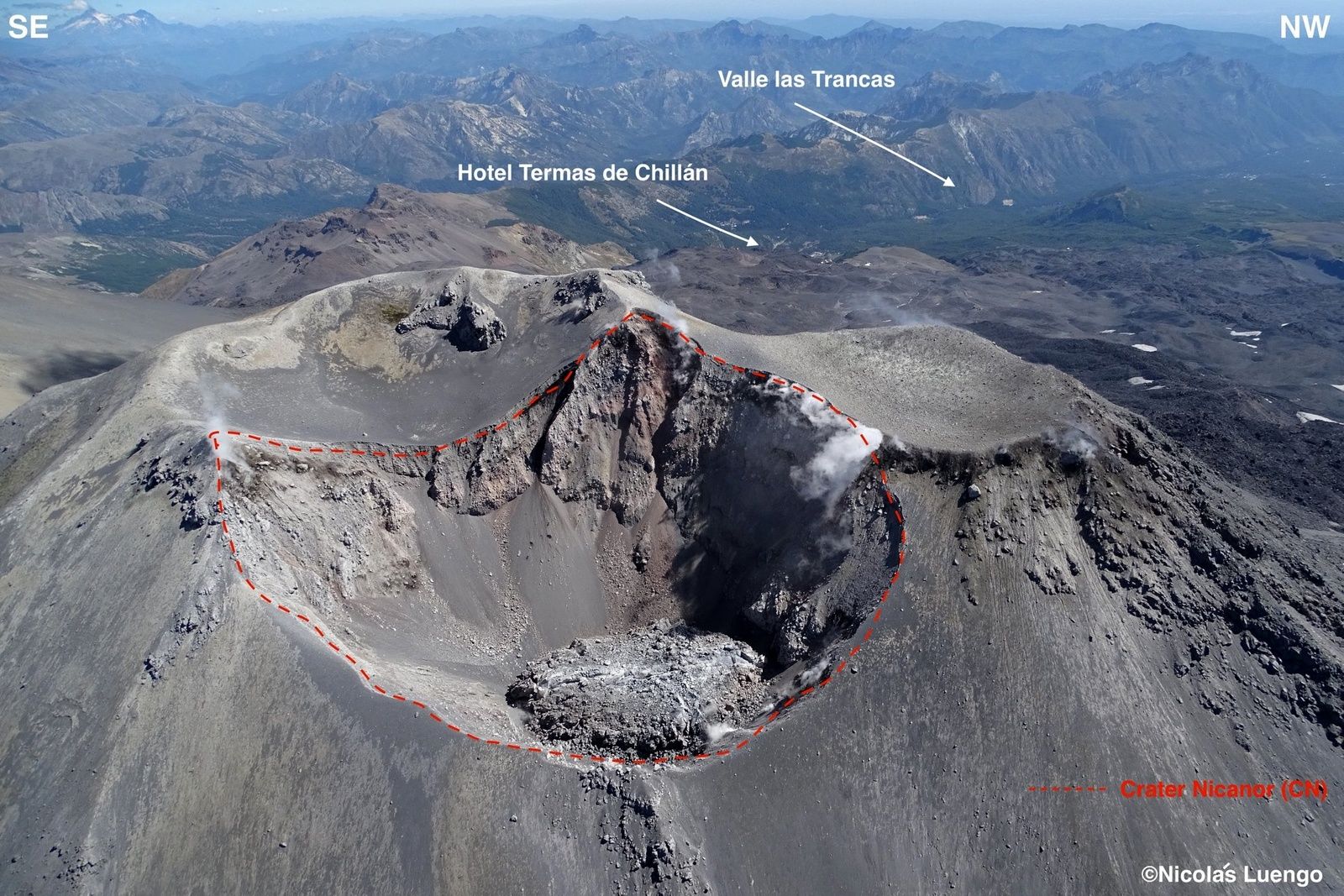
Chile , Nevados de Chillan :
Special Report on Volcanic Activity (REAV).
Del Bio Bio Region, C.V. Nevados de Chillan, 14 July 2018, 17:00 Local time (Continental Chile)
The National Geological and Mining Service of Chile (Sernageomin) publishes the following PRELIMINARY information, obtained through the monitoring equipment of the National Volcanic Monitoring Network (RNVV), processed and analyzed at the Volcanological Observatory of the Andes. South (OVDAS):
Yesterday, July 14th at 15:30 local time (19:30 GMT), the monitoring stations installed in the vicinity of the Nevados volcano of Chillan recorded an earthquake associated with an explosion driven by the dynamics of the fluids inside the volcanic system, in the around Nicador crater, 1.4 km deep.
The characteristics of the earthquake are as follows:
TIME OF ORIGIN: 15h30 Local time (19h30 GMT)
LATITUDE: 36 ° 871 ‘S
LONGITUDE: 71 ° 374 ‘W
DEPTH: 1.4 km
LOCAL MAGNITUDE: 3.9 (ML)
ACOUSTIC SIGNAL: 2 Pa reduced to 1 km
REDUCED DISPLACEMENT: 1588 cm2
OBSERVATIONS:
Climatic conditions did not allow a clear recording of the explosion. However, it was possible to observe part of the explosion through the thermal camera, with which a maximum temperature of 300 ° C could be noted.
The recording of this explosion, just after yesterday’s, suggests that the volcanic system could further increase its level of activity. The energy of the explosions thus knows an increase compared to the previous periods, it is possible that other similar or greater energy explosions occur, implying an increase of the level of activity.
For the moment, the technical alert level is maintained at the ORANGE level.
Source : Sernageomin.
Photo : Nicolas Luengo
Hawai , Kilauea :
Saturday, July 14, 2018, 11:23 AM HST (Saturday, July 14, 2018, 21:23 UTC)
19°25’16 » N 155°17’13 » W,
Summit Elevation 4091 ft (1247 m)
Current Volcano Alert Level: WARNING
Current Aviation Color Code: ORANGE
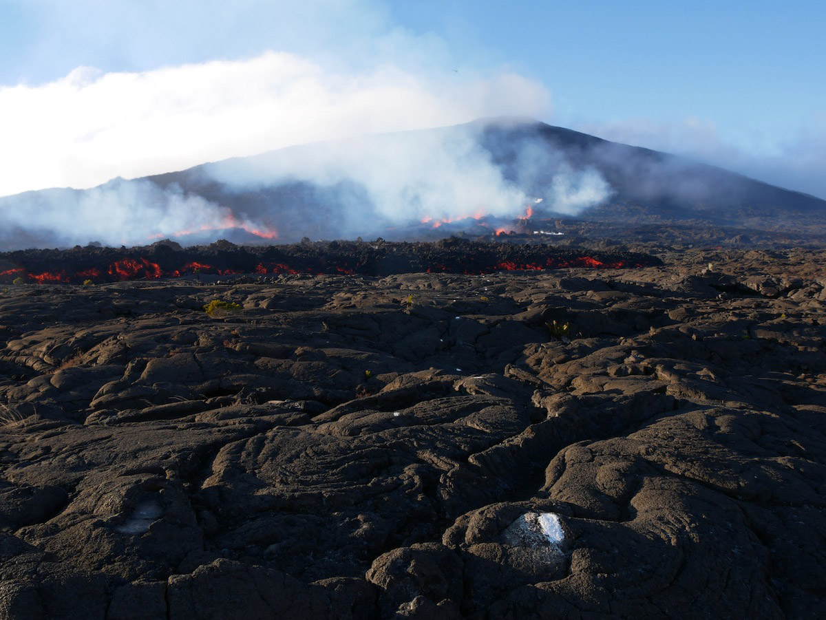
Kīlauea Volcano Lower East Rift Zone
Fissure 8 continues to erupt lava into the perched channel leading northeastward from the vent. Lava levels in the upper channel increased for several hours after the summit collapse-explosion event yesterday at 7:08 p.m. and returned to lower levels this Morning.
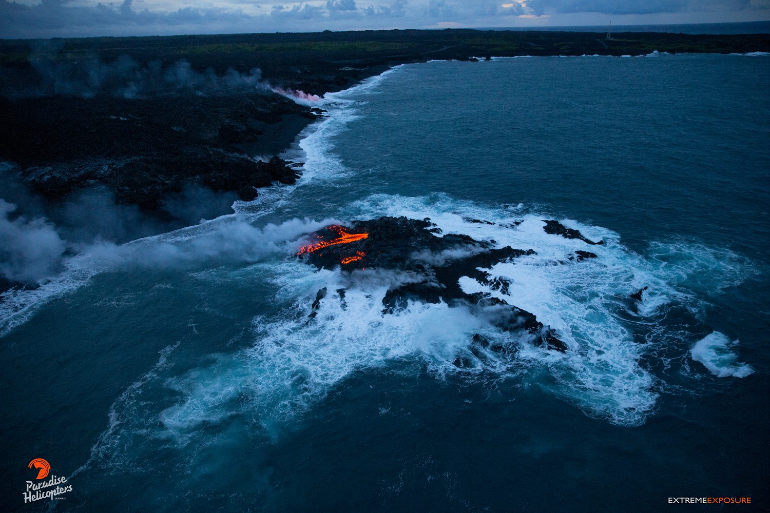
A short-lived overflow of the channel near the vent spread east-southeast, but did not advance beyond the existing flow field. The channelized ʻaʻā flow west of Kapoho Crater continues to be the main ocean entry at the southern edge of the flow front this morning. The southern margin of the flow was about 1 km (0.6 mi) from Isaac Hale Park this morning. Despite no visible surface connection to the fissure 8 channel, lava continues to ooze out at several points on the 6 km (3.7 mi) wide flow front into the ocean.
No other fissures are active this morning.
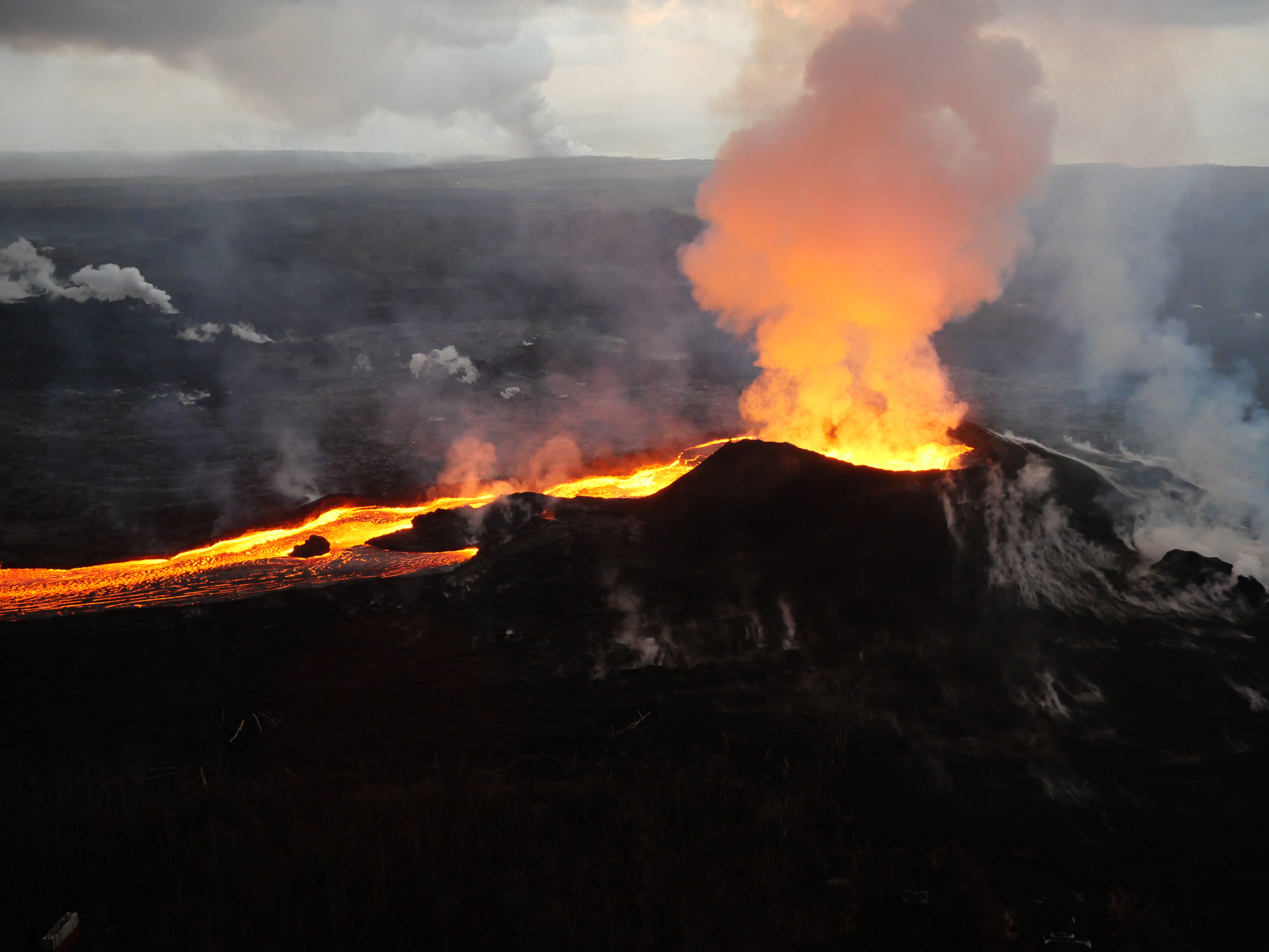
Early morning view of fissure 8 and lava channel looking toward the east. Laze plume from the ocean entry is visible in distance (left of the fissure 8 plume). Geologists did not observe activity from any of the other fissures during this morning’s overflight.
Kīlauea Volcano Summit
Earthquakes in the summit area have resumed following yesterday’s collapse/explosion event at 7:08 p.m. HST, which had an energy equivalent to a magnitude-5.3 earthquake. The current rate of earthquakes ranges from 25-35/hr and is expected to continue leading up to another collapse/explosion event, which is expected to occur this evening or early Sunday morning. Inward slumping of the rim and walls of Halemaʻumaʻu continues in response to the ongoing subsidence at the summit.
Source : HVO.
Photos : Bruce Omori , USGS.