July 10 , 2018.
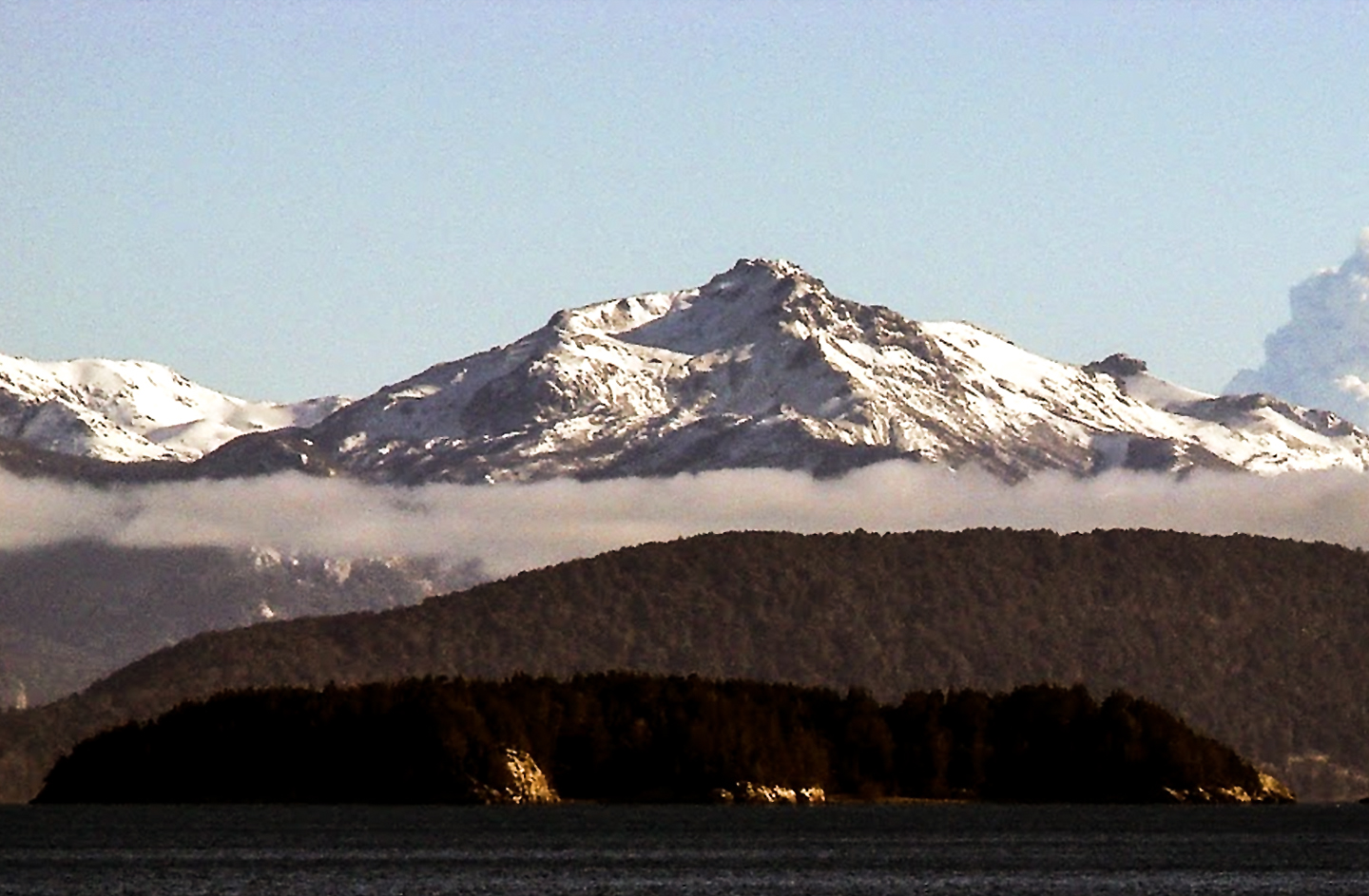
Chile , Puyehue-Cordon Caulle :
During this period, 333 seismic events were recorded, of which 48 were classified as long-period type (LP) earthquakes, related to fluid dynamics within the volcanic system, the largest of them had a reduced displacement value (DRC) of 15.2 cm.
In addition, 276 volcano-tectonic (VT) earthquakes associated with rock fracturing processes, with maximum local magnitudes of M 2.3 corresponding to events located 0.6 km west of the center. 2011 issue and at a depth of 2.8 km. Finally, 9 Hybrid events (HB) were recorded, with a complex mechanism (rock fracturing process and fluid dynamics inside the volcanic system), the largest of which had maximum local magnitudes of M 2.3 and a reduced displacement value (DRC) equal to 300 cm and was located 5.2 km southeast of the 2011 emission center and at a depth of 1.7 km.
The images provided by the IP cameras installed around the volcano did not show any superficial changes.
According to the data provided by three GNSS stations, it can be observed that the previously reported inflationary process is continuing. The maximum horizontal rate recorded is 0.4 cm / month and the vertical rate is 0.3 for the station closest to the point of maximum deformation.
No emissions of sulfur dioxide (SO2) to the atmosphere in the volcano area have been reported, according to data published by the Ozone Monitoring Instrument (OMI) Sulfur Dioxide Group (http: / /so2.gsfc.nasa.gov/) and the National Environmental Satellite Data and Information Service (NESDIS) (http://satepsanoine.nesdis.noaa.gov).
No thermal warning was reported in the volcano area throughout the month, according to data processed by infrared, a means of observing volcanic activity (Mirova) (http://www.mirovaweb.it/) and real-time monitoring of global thermal hot spots (MODVOLC) (http://modis.higp.hawaii.edu/).
The activity of Hybrid type events, of moderate magnitude associated with the increase of volcano – tectonic seismicity, the occurrence of long period type events and the evidence of the deformation of the volcanic edifice indicates the occurrence processes that can unbalance the volcanic system. In addition, the presence of a remanent magmatic body, located at the location of the 2011 emission center, relatively superficial, (lacolito: Voluminous mass of volcanic materials that forms in the earth’s crust due to an increase in lava that does not reach the surface) could facilitate this imbalance.
For all this, the level of volcanic alert is maintained at the level:
YELLOW LEVEL: Changes in the behavior of volcanic activity – Probable time for an eruption: WEEKS / MONTH.
Source : Sernageomin
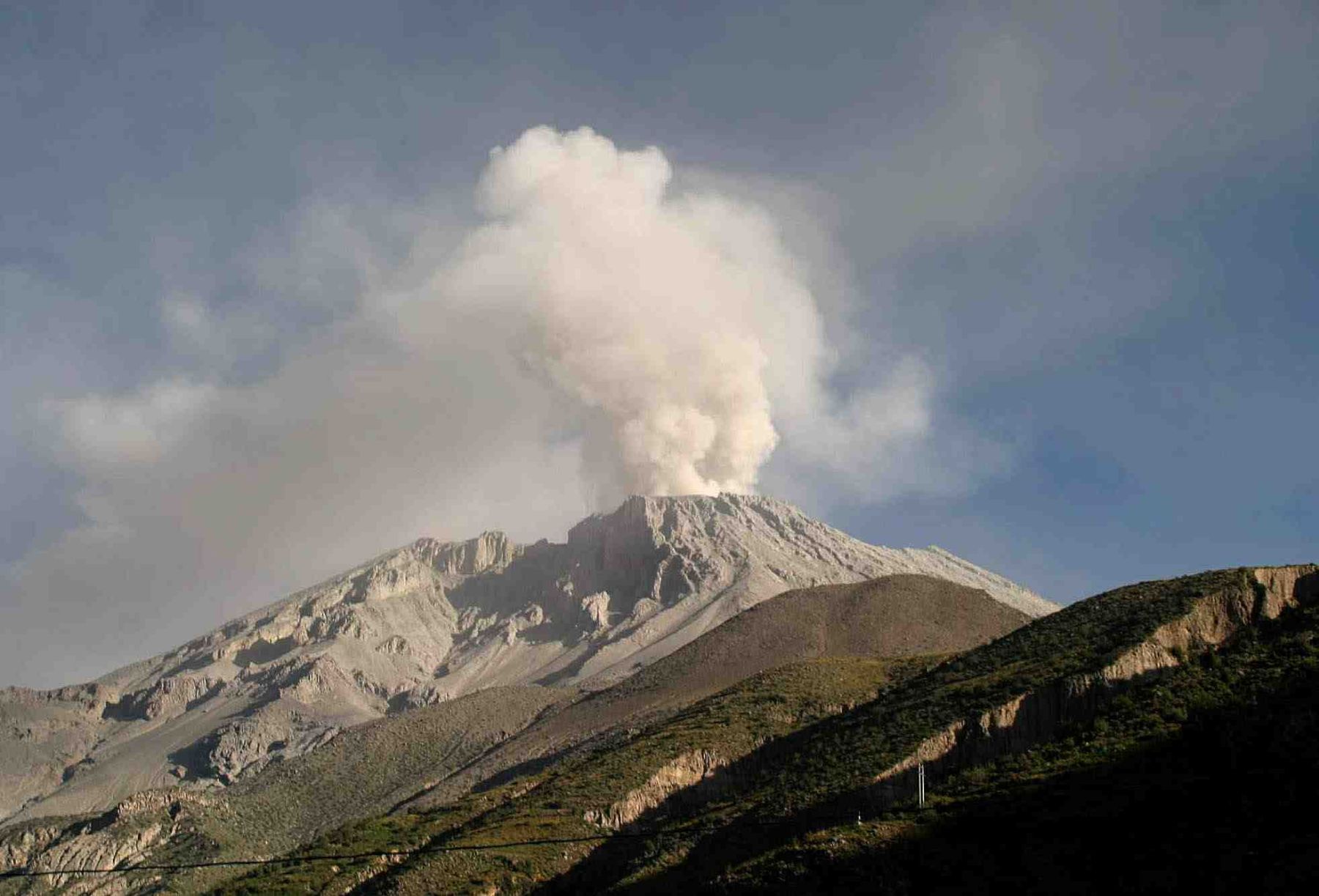
Peru , Sabancaya :
An average of 22 EXP / day was recorded. Earthquakes associated with the rise of magma (Hybrid type) remain very low in number and energy.
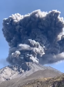
Eruptive columns of gas and ash reached a maximum height of about 2500 m above the crater. The dispersion of these materials occurred within a radius of about 30 km, mainly to the South, Southeast, and East.
The volcanic gas flow (SO2) recorded on July 3 had a maximum value of 4715 tons / day, a value considered large.
In the last period, the SBSE GPS station recorded an inflationary process probably associated with volcanic activity.
There were 9 thermal anomalies recorded according to the MIROVA system, with values between 1 MW and 21 MW VRP (Radiated Volcano Power).
In general, eruptive activity maintains moderate levels. No significant changes are expected in the following days.
Source : IGP.
Indonesia , Agung :
VOLCANO OBSERVATORY NOTICE FOR AVIATION – VONA .
Issued: July 09 ,2018.
Volcano: Agung (264020)
Current Aviation Colour Code: ORANGE
Previous Aviation Colour Code: orange
Source: Agung Volcano Observatory
Notice Number: 2018AGU51
Volcano Location: S 08 deg 20 min 31 sec E 115 deg 30 min 29 sec
Area: Bali, Indonesia
Summit Elevation: 10054 FT (3142 M)
Volcanic Activity Summary:
Eruption with volcanic ash cloud at 03h20 UTC (11h20 local). Eruption and ash emission is continuing.
Volcanic Cloud Height:
Best estimate of ash-cloud top is around 16454 FT (5142 M) above sea level, may be higher than what can be observed clearly. Source of height data: ground observer.
Other Volcanic Cloud Information:
Ash-cloud moving to west.
Remarks:
Recorded on seismogram with maximum amplitude 24 mm and duration 162 second.
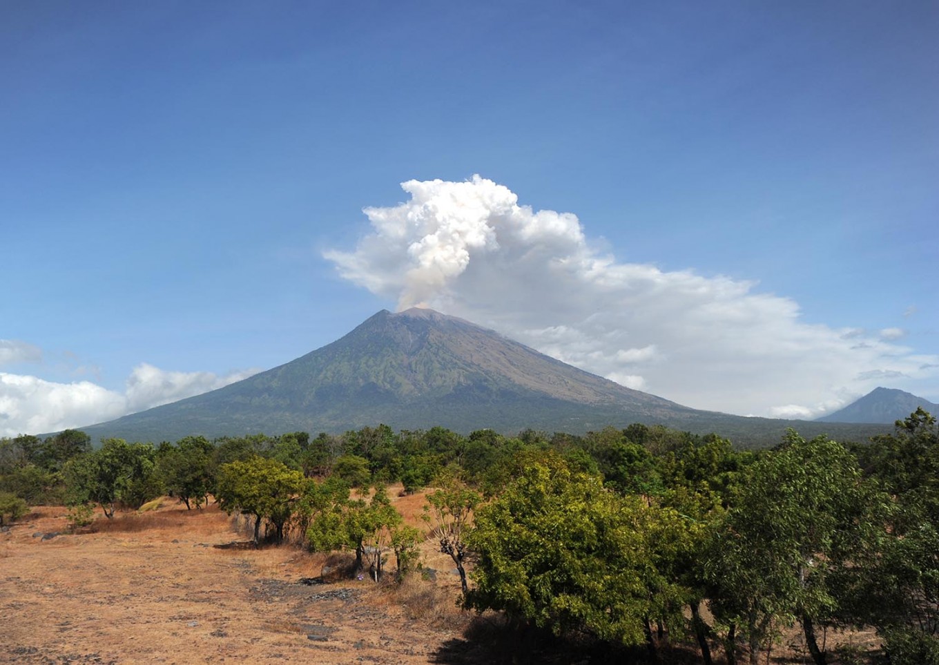
Level III Activity Level (SIAGA). The G. Agung (3142 m above sea level) has erupted since November 21, 2018. Since yesterday and until this morning, the weather is sunny to cloudy, the wind is weak to the West . The volcano was clearly visible until it was covered with fog. The smoke of the crater is observed of white color with a weak intensity to thick. The smoke column rises about 1500 meters above the summit. The columns of eruptions are observed with a height of 500-1500 meters and white / gray color.
The seismographs dated July 8, 2018 recorded:
3 earthquakes of eruption.
17 emission earthquakes
3 shallow volcanic earthquakes
2 distant tectonic earthquakes
On July 9, 2018 (00:00 to 18:00) it was recorded:
7 eruption earthquakes
1 volcanic earthquake
2 distant tectonic earthquakes
Source : Magma Indonesia , PVMBG.
Photo : The Jakartapost
Mexico , Popocatepetl :
July 09, 11:00 am (July 09, 16:00 GMT)
In the last 24 hours, through the monitoring systems of the Popocatepetl volcano, 29 low intensity exhalations accompanied by water vapor and gas have been identified. In addition, 134 minutes of harmonic tremors of low amplitude were recorded.
During the night, an incandescence was observed.
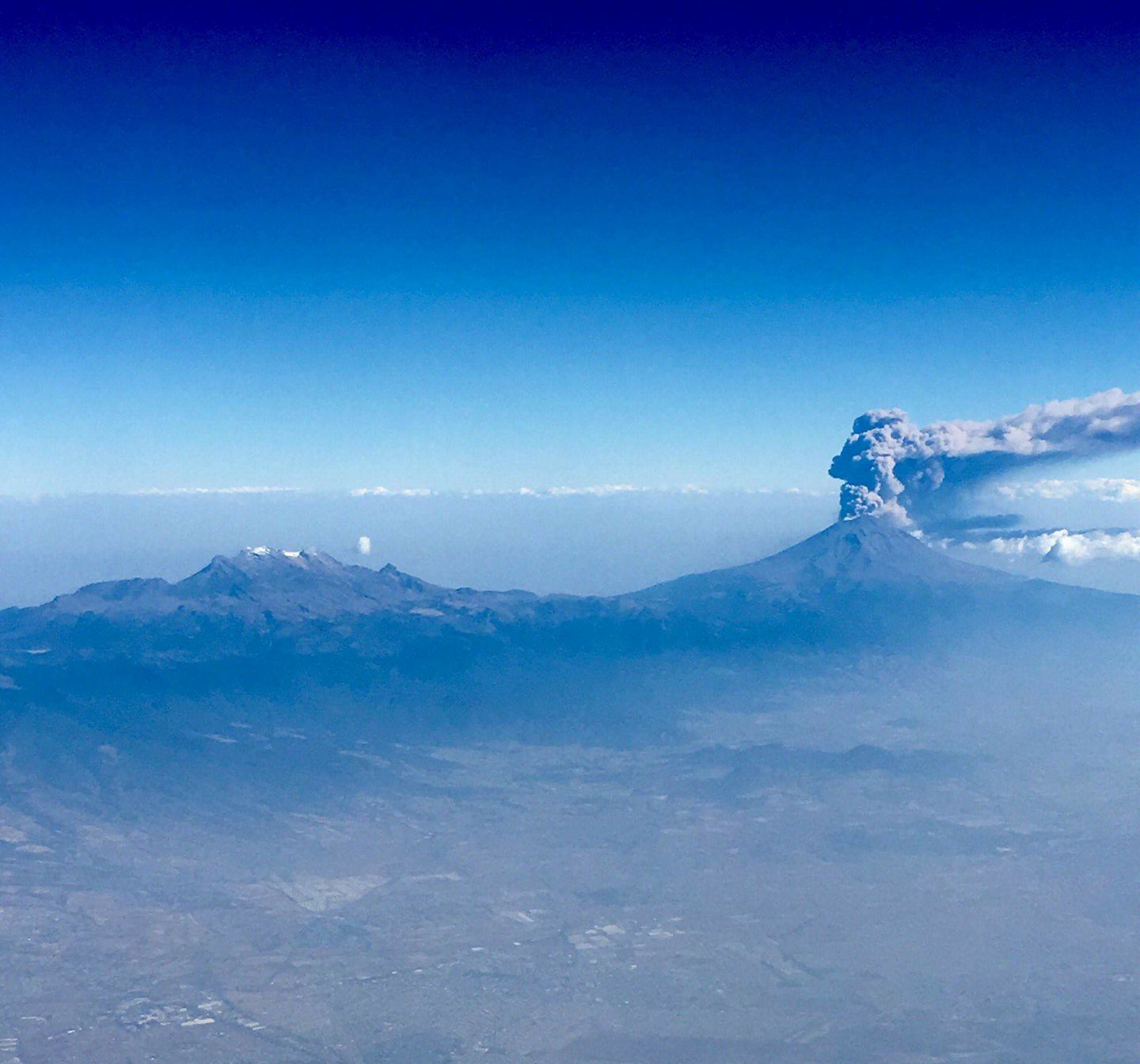
At the time of this report, there is a continuous emission of volcanic gases that the winds scatter to the northwest.
CENAPRED urges not to approach the volcano and especially the crater, because of the risk of falling ballistic fragments and in case of heavy rains to move away from the bottom of the ravines because of the risk of landslides and floods. mud.
The volcanic warning light of the Popocatepetl volcano is located at Amarillo Phase 2.
Source : Cenapred.
Hawai , Kilauea :
Monday, July 9, 2018, 5:05 PM HST (Tuesday, July 10, 2018, 03:05 UTC)
19°25’16 » N 155°17’13 » W,
Summit Elevation 4091 ft (1247 m)
Current Volcano Alert Level: WARNING
Current Aviation Color Code: ORANGE
Kīlauea Volcano Lower East Rift Zone
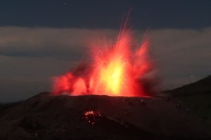
Early this afternoon observers reported multiple overflows occurring along both sides of the main lava channel, in an area extending from near the « Y » intersection at Pohoiki Road eastwards to an area just west of Kapoho Crater. Overflows on the upper part of the channel did not extend beyond areas previously covered in lava. Overflows further down the channel have reached beyond the flow field, including one flow lobe that is moving northeast from the main channel towards Cinder Rd.
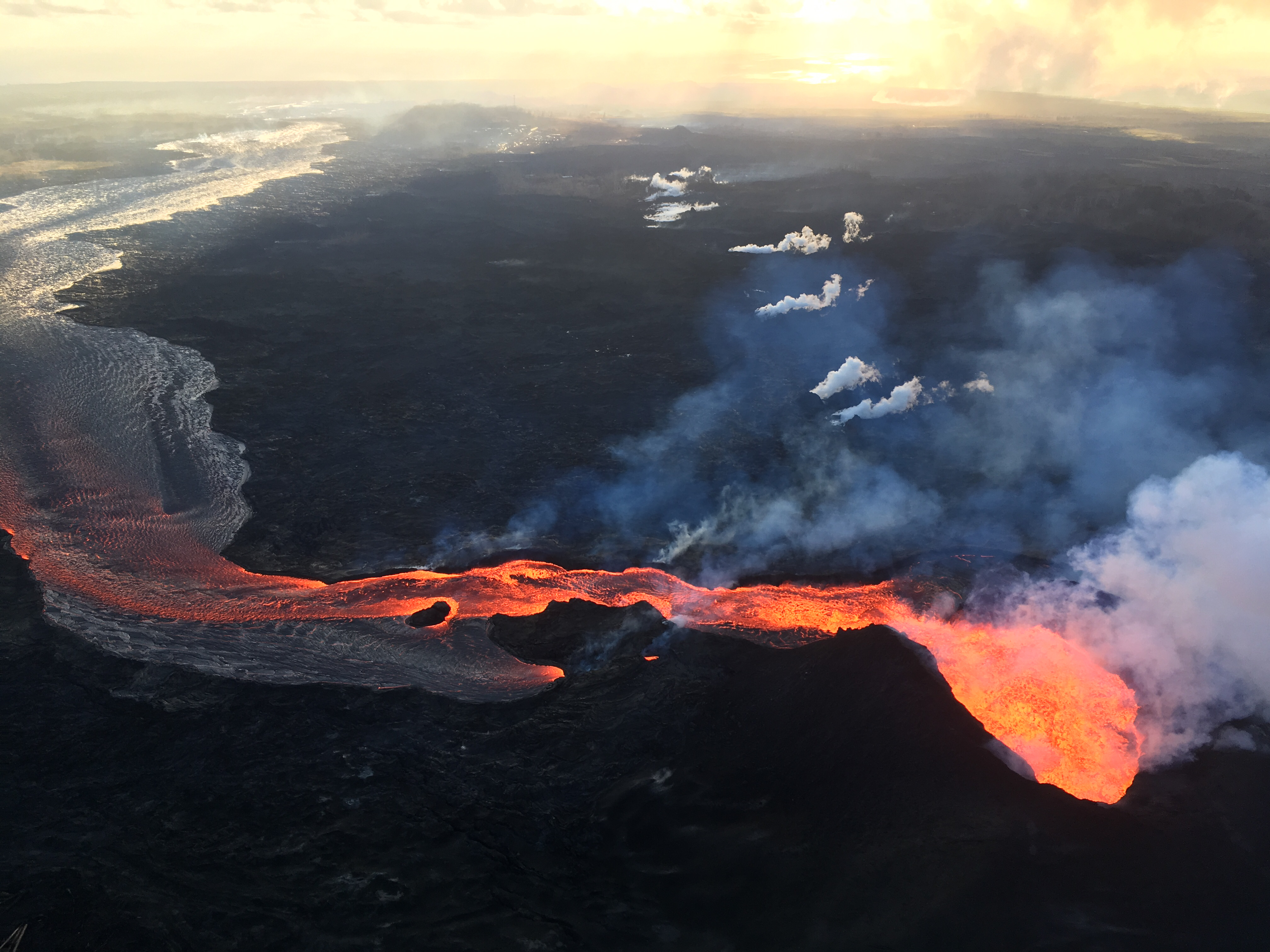
Fissure 8 (lower right) and open lava channel leading to the northeast. Geologists noted small lava-level fluctuations in the open channel overnight, which indicates intermittent variations in lava discharge from fissure 8. An increase in lava levels was noted about 1.5 hours after the collapse-explosion event at the volcano’s summit at 02:55 a.m. HST. Evidence of a couple of recent, short-lived channel overflows were observed early this morning, but they had not reached the edge of the flow field. The small steam plumes in distance mark locations of fissures that erupted in early May at the beginning of the ongoing eruption.
Residents are urged to heed warnings and notices from Hawaii County Civil Defense.
Based on information from ground observers and morning and afternoon overflights, the lower part of the main lava channel has undergone significant reorganization. In particular, the channel that had been open near Four Corners is now mostly crusted over, and plumes from ocean entry are significantly reduced.
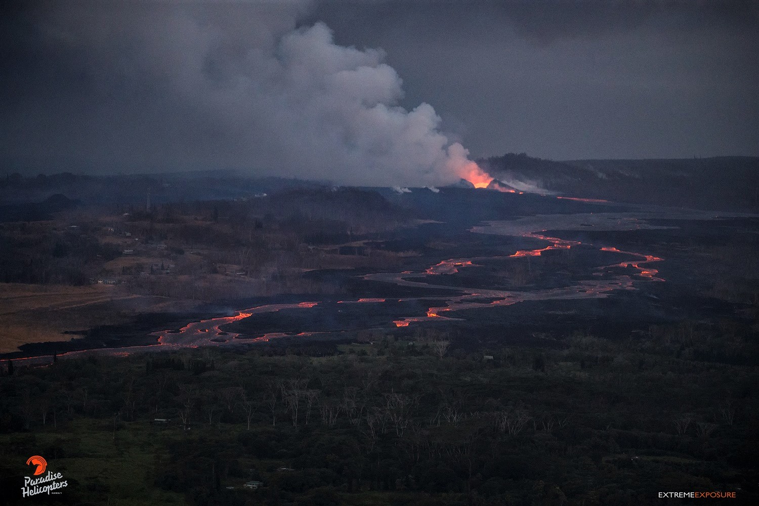
It is likely this is due to a blockage that formed in the early morning in the main channel upstream of Kapoho Crater. Flow volumes coming out of Fissure 8 remain significant, and it is possible that changes in flow channels will continue to occur in the coming days.
Fissure 22 continues to exhibit weak spattering.
Kīlauea Volcano Summit

Small, ash-poor plume associated with the summit collapse explosion event at 9:20 a.m. HST. The pinkish gray plume can be seen on left side of image near the ground.
At 9:20 AM HST on July 9, a collapse/explosion occurred beneath Kilauea caldera with energy equivalent to a magnitude-5.3 earthquake. The number of earthquake dropped from 25-40/hr to less than 10/hr. We expect the earthquakes to increase over the next day until the next collapse/explosion tomorrow. Inward slumping of the rim and walls of Halemaʻumaʻu continues in response to the ongoing subsidence at the summit.
Source : HVO.
Photos : HVO , Bruce Omori