June 27 , 2018.
Sierra Negra , Galapagos , Ecuador :
The chronology of the eruption
Volcán Sierra Negra Special Report N ° 6 – 2018
Increased seismic activity in the last hours
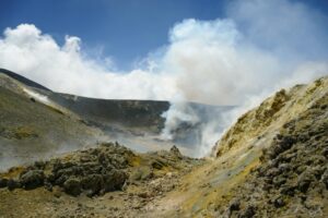
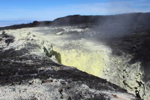
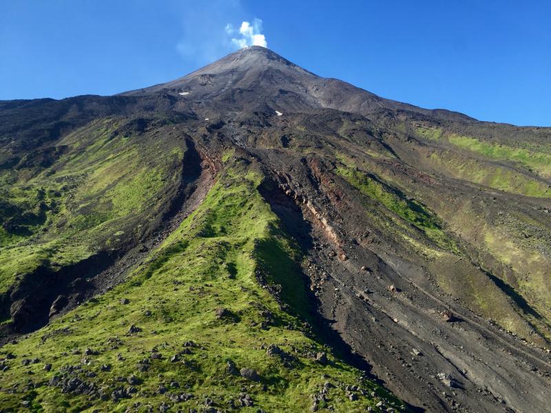
The Sierra Negra volcano (0.81 ° S, 91.13 ° W, 1124 m), located in the province of Galapagos, 23 km northwest of Puerto Villamil and 90 km northeast of Puerto Ayora , has presented significant seismic activity since mid-2016, and also exhibits a large deformation as indicated in previous reports, in particular SIERRA NEGRA SPECIAL REPORT No. 4.
At 3:15, Galapagos Time (Ecuador time – 1h), a seismic event occurred with coordinates 91.1377 0.8407 ° S ° W, 5.3 km deep and a magnitude of 5.3 MLV. These coordinates indicate that the event is located under the Sierra Negra volcano. This event was felt strongly in the upper part of the volcano and also in Puerto Villamil. The earthquake was preceded by an event of magnitude M3.0 at 3:10 (Galapagos time). After the earthquake, several replicas were generated and the presence of tremors is observed. The increase in seismic activity and the presence of tremors could be precursors of an eruptive activity.
Immediately following the occurrence of this event, the Geophysical Institute reported this abnormal behavior to the appropriate authorities.
The IGEPN continues volcanic monitoring and will inform if changes in the internal or external activity of the volcano are observed.
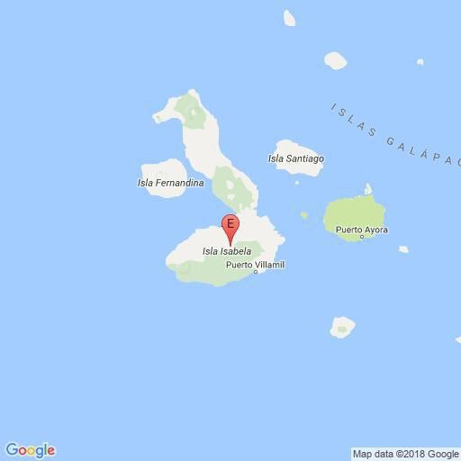
Figure 1. Location of the magnitude 5.3 earthquake under the Sierra Negra volcano (Source: Institute of Geophysics).
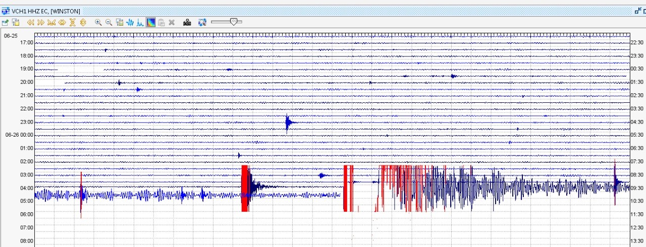
Figure 2. Seismogram showing the recording of the magnitude 5.3 earthquake and tremor observed after its occurrence.
Volcán Sierra Negra Special Report N ° 7 – 2018
New seismic swarm
From 11:17 Galapagos time (Ecuador time +1 h), a new swarm of earthquakes occurred under the Sierra Negra volcano. Depths vary between 3 and 5 km and the maximum magnitude was 4.6 MLv. At this moment, the swarm persists and could be the precursor of an eruptive activity.
In the vicinity, these events were felt by the population.
The IGEPN continues monitoring in case of starting an eruptive process.
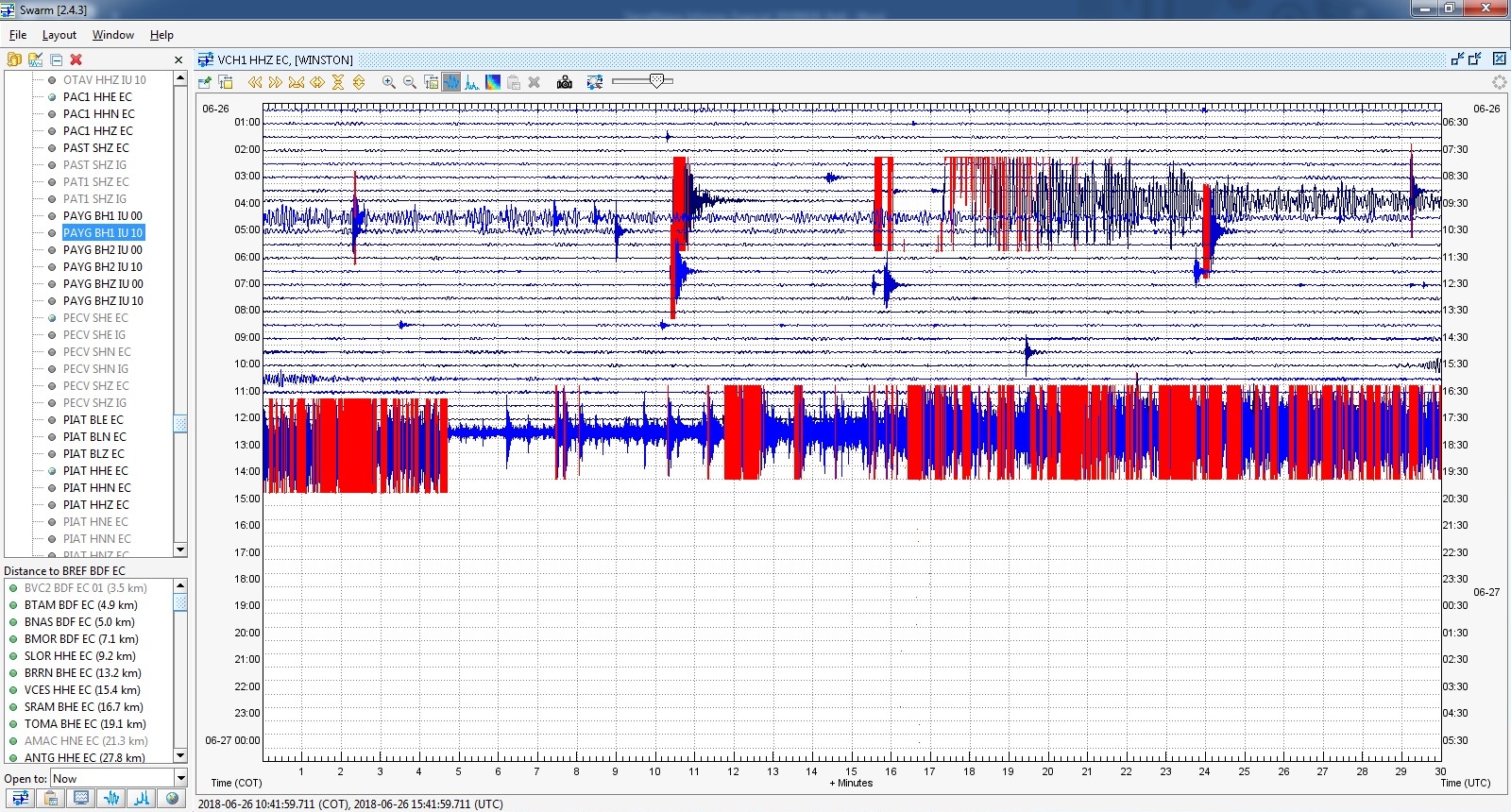
Figure Seismogram showing the recording of this magnitude 5.3 morning earthquake and the swarm that started at 11:17 Galapagos time.
Special Report Volcán Sierra Negra Nº 8 – 2018
Start of a new eruption
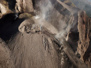
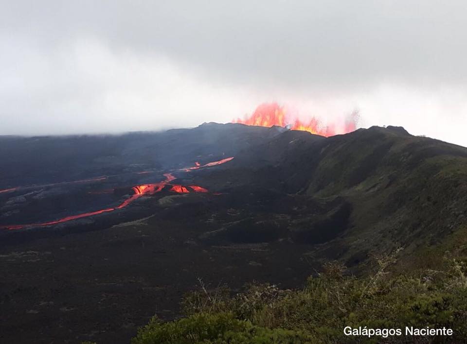
Tuesday, June 26, 2018, after the start of the swarm at 11:17 (Galapagos time, Ecuador -1h) (Special file No. 7), which persists so far, and after the earthquake of 13:38 TG of M4,2 a signal began to show a constant increase in the amplitudes between the infrasonic signal and the seismic signal. Galapagos National Park staff reported noises, such as rumblings, likely from the Volcan Chico region. These signs suggest the beginning of an eruptive process.
It is not recommended to approach the area of activity. In the case of an ash fall or volcanic ash area, it is recommended that appropriate precautions be taken.
The IG-EPN maintains its vigilance and will report any significant change in volcanic activity.
Special Report Volcán Sierra Negra Nº 9 – 2018
Update on the status of the activity:
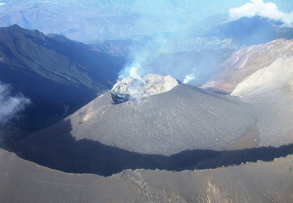
The seismic and infrasound stations installed on the Sierra Negra volcano on Isabela Island continue to show a steady increase in their amplitudes, as reported in report No. 8. In addition, the GOES-16 satellite images show a strong thermal anomaly. in the northern part of the caldera near the volcano Chico. This suggests the presence of lava flows in this area of the volcano. The National Park staff reports that part of the lava flows go inside the caldera and another part towards the north side, towards Bahía Elízabeth.
This zone corresponds to Area A mentioned in Special Report No. 3, in which the possible eruption scenarios are detailed.
In addition, there is currently the presence of an ash column with a west direction.
It is not recommended to approach the area of activity. In the case of an ash fall or volcanic ash area, it is recommended that appropriate precautions be taken.
The IG-EPN maintains its vigilance and will report any significant change in volcanic activity.
Source : SV, AA, MR , Institut de géophysique , École nationale polytechnique.
Photo : BMtours.ec, Galapagos Naciente
Cleveland , Alaska :
AVO/USGS Volcanic Activity Notice
Current Volcano Alert Level: WATCH
Previous Volcano Alert Level: ADVISORY
Current Aviation Color Code: ORANGE
Previous Aviation Color Code: YELLOW
Issued: Tuesday, June 26, 2018, 1:07 PM AKDT
Source: Alaska Volcano Observatory
Location: N 52 deg 49 min W 169 deg 56 min
Elevation: 5676 ft (1730 m)
Area: Aleutians
Volcanic Activity Summary:
Satellite observations of Cleveland Volcano on June 25, 2018 indicate the presence of a small circular lava flow, about 80 meters in diameter, covering the floor of the summit crater. Geophysical monitoring data from Cleveland Volcano has been unavailable since early yesterday afternoon and thus it is unknown if the effusion of lava within the crater generated detectable seismicity or infrasound. However, the presence of a lava flow over the active vent increases the possibility of a vent clearing explosion over the coming days to weeks and thus AVO is raising the Aviation Color Code and Volcano Alert Level to ORANGE/WATCH. The last detected explosive activity at Cleveland volcano occurred May 5, 2018 UTC (May 4 local time).
Occasional, short duration explosive activity with minimal to no precursory signals is common at Cleveland Volcano, and explosions may occur without warning. Explosions typically produce relatively small volcanic ash clouds that dissipate within hours; however, more significant ash emissions may occur as they have in the past.
Cleveland volcano is monitored by only two seismic stations, which restricts AVO’s ability to detect precursory unrest that may lead to an explosive eruption. Rapid detection of an ash-producing eruption may be possible using a combination of seismic, infrasound, lightning, and satellite data.
Recent Observations:
[Volcanic cloud height] None
[Other volcanic cloud information] n/a
Source : AVO
Photo : Lyons John , 25 Juillet 2016
Galeras , Colombia :
Subject: Weekly activity bulletin of Galeras volcano
The level of activity of the volcano continues at the level:
YELLOW LEVEL ■ (III): CHANGES IN THE CONDUCT OF VOLCANIC ACTIVITY.
Following the activity of the GALERAS volcano, the COLOMBIAN GEOLOGICAL SERVICE informs:
For the period from June 19 to June 25, 2018 and compared to the previous week, there was a gradual decrease, with fluctuations, energy levels and the occurrence of earthquakes associated with rock fracturing ( Volcano-Tectonic type), representing a total of 127 earthquakes during this period, four of which were reported as felt by the inhabitants of the Galeras Volcanic Complex’s area of influence, particularly located near the epicentral zone.
These earthquakes are located in a band located between 1 and 9 km north-east of the top of the volcanic building, with depths between 1 and 8 km below the summit of the volcano (reference level greater than 4200 m). The most significant earthquake this week occurred on 22 June 2018 at 15:14, with a local magnitude of M2.1 on the Richter scale, reported by residents of the Briceño and Chachatoy areas, at the extreme North. from the city of San Juan de Pasto. Since the beginning of this seismic episode, on June 12, 2018, 1107 earthquakes have been recorded, of which 26 have been reported as felt.
This week, when weather conditions were favorable, it was possible to observe and record white gas emissions from certain areas of the active cone, with low exit pressure, low height and direction. variable according to the prevailing wind regime. The area. The other geophysical and geochemical parameters of the Galeras volcanic monitoring have not recorded any variations showing a change in the level of activity of the volcano.
The COLOMBIAN GEOLOGICAL SERVICE remains attentive to the evolution of the volcanic phenomenon and will continue to inform in a timely manner of the observed changes.
Source : SGC.
Kilauea , Hawai :
Tuesday, June 26, 2018, 9:13 AM HST (Tuesday, June 26, 2018, 19:13 UTC)
19°25’16 » N 155°17’13 » W,
Summit Elevation 4091 ft (1247 m)
Current Volcano Alert Level: WARNING
Current Aviation Color Code: ORANGE
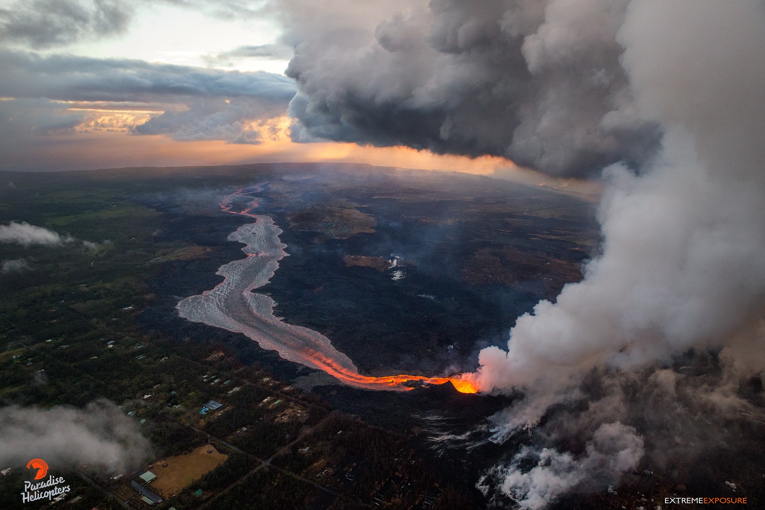
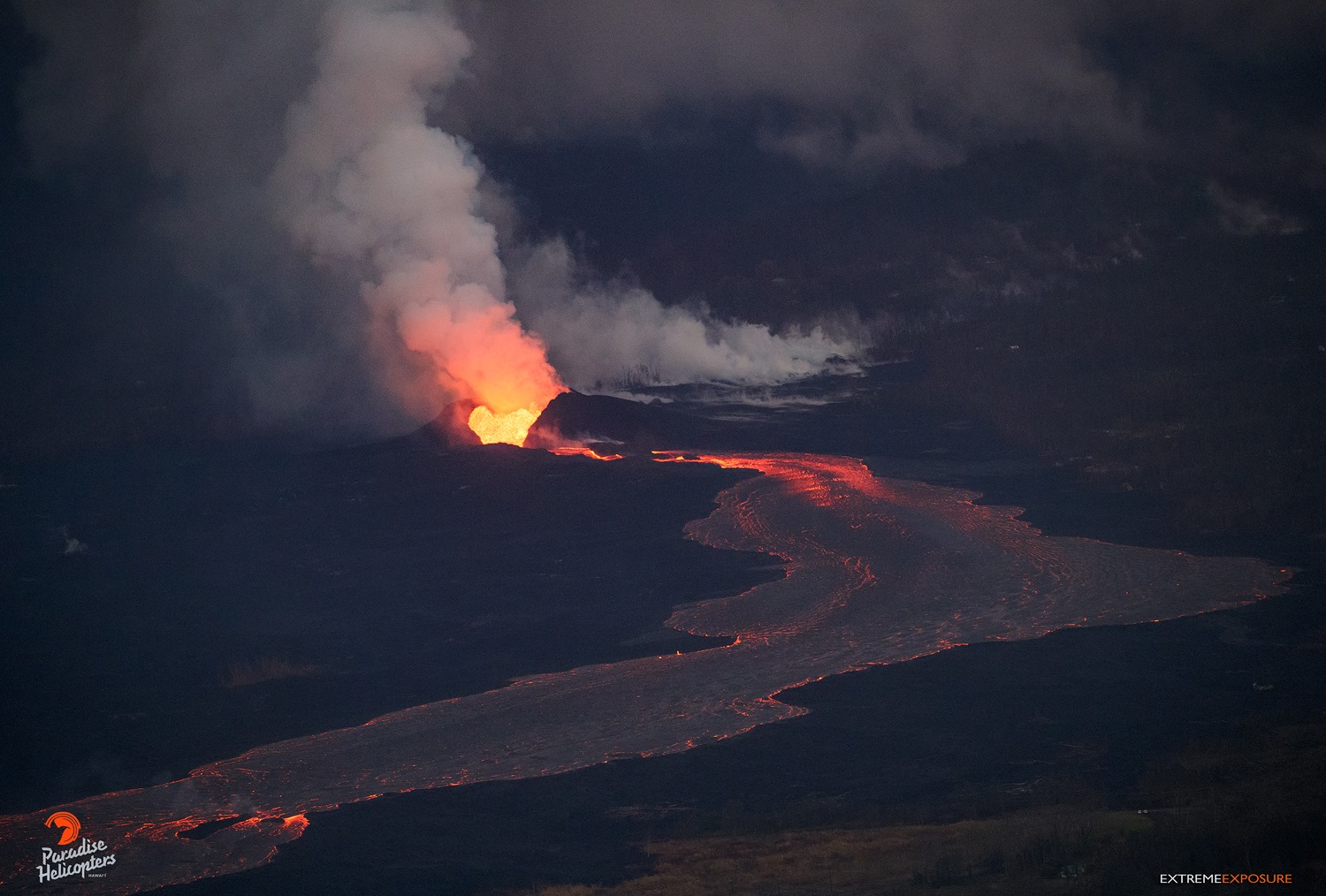
Kīlauea Volcano Lower East Rift Zone
The eruption in the lower East Rift Zone (LERZ) continues with no significant change during the past 24 hours.
Fountains from Fissure 8 spatter cone continue to supply lava to the open channel with only small, short-lived overflows. The spatter cone is now 180 ft tall at its highest point, and fountains only occasionally rise above that point. The lava flow front at the coast broadened southward and is now nearly 2 miles in width. Lava is entering the sea this morning on the southern portion of the flow front primarily through the open channel, but also along a 0.6 mi wide area with multiple laze plumes from smaller oozing lobes.
Fissure 22 showed weak spattering and tiny flows around the base of the cone. This morning’s overflight crew also observed minor incandescence at Fissure 16/18.
Pele’s hair and other lightweight volcanic glass fragments from the lava fountain at Fissure 8 continue to fall downwind of the fissure, dusting the ground within a few hundred meters (yards) of the vent. High winds may waft lighter particles to greater distances. Residents are urged to minimize exposure to these volcanic particles, which can cause skin and eye irritation similar to volcanic ash.
HVO field crews are on site tracking the fountains, lava flows, and spattering from Fissure 8 as conditions allow and are reporting information to Hawaii County Civil Defense. Observations are also collected on a daily basis from cracks in the area of Highway 130; no changes in temperature, crack width, or gas emissions have been noted for several days.
Volcanic gas emissions remain very high from Fissure 8 eruptions. Continuing trade wind conditions are expected to bring VOG to the southern and western parts of the Island of Hawaii.
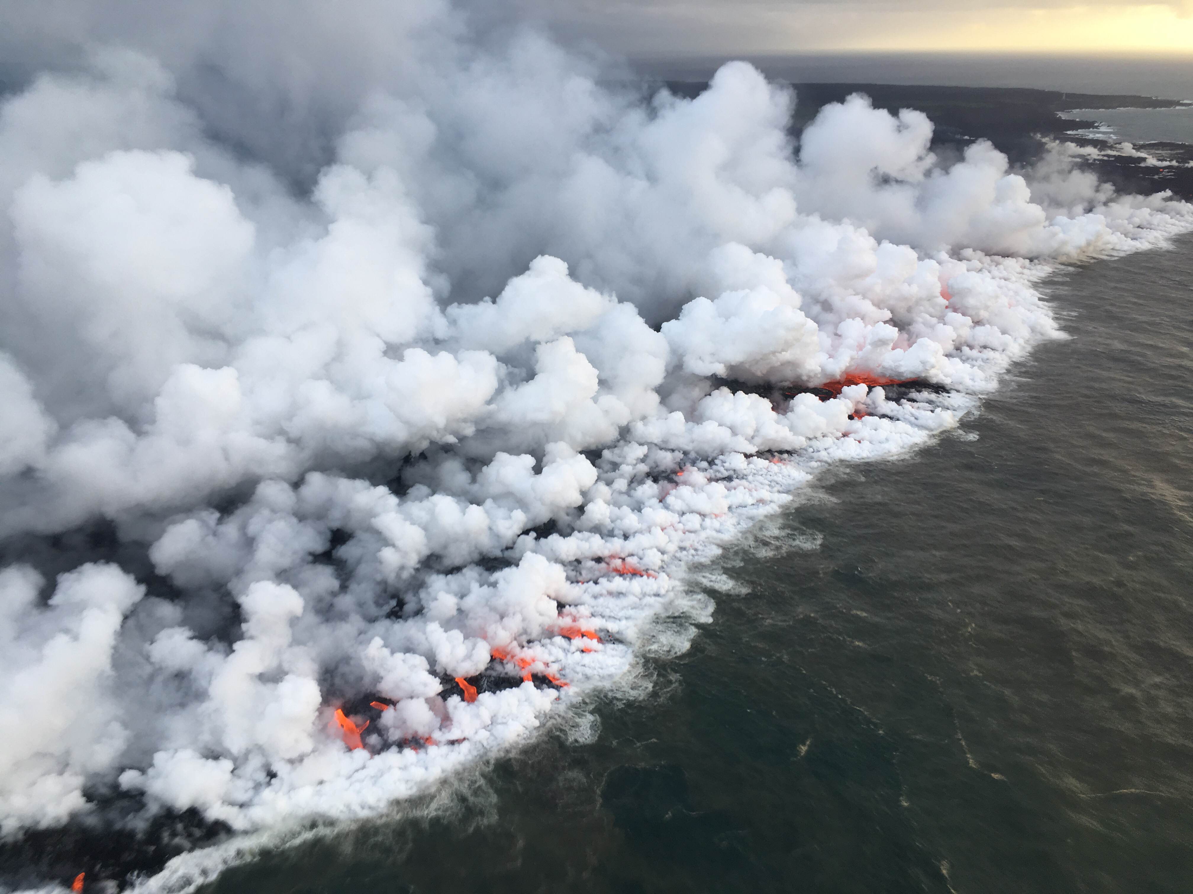
North facing view of the 1 km (0.6 mi) long ocean entry with multiple lobes of lava flowing into the sea.
The ocean entry is a hazardous area. Venturing too close to an ocean entry on land or the ocean exposes you to flying debris from sudden explosive interaction between lava and water. Also, the lava delta is unstable because it is built on unconsolidated lava fragments and sand. This loose material can easily be eroded away by surf, causing the new land to become unsupported and slide into the sea. Additionally, the interaction of lava with the ocean creates « laze », a corrosive seawater plume laden with hydrochloric acid and fine volcanic particles that can irritate the skin, eyes, and lungs.
Magma continues to be supplied to the Lower East Rift Zone. Seismicity remains relatively low in the area with numerous small magnitude earthquakes and low amplitude background tremor. Higher amplitude tremor is occasionally being recorded on seismic stations close to the ocean entry.
Additional ground cracking and outbreaks of lava in the area of the active fissures are possible. Residents downslope of the region of fissures should heed all Hawaii County Civil Defense messages and warnings.
Kīlauea Volcano Summit
At 5:03 p.m. HST on June 25, after approximately 21 hours of elevated seismicity, a collapse explosion occurred at the summit producing an ash-poor steam plume that went undetected by the weather radar. Visual observations suggested the plume rose about 700 ft above the caldera before drifting downwind to the southwest. The energy released by the event was equivalent to a magnitude 5.3 earthquake. Seismicity dropped abruptly from a high of 25-35 earthquakes per hour (many in the magnitude in the 3 range) prior to the collapse explosion down to less than 10 per hour afterwards. Within 3 hours seismicity began to creep up again averaging about 40 earthquakes per hour at the time of this posting. Inward slumping of the rim and walls of Halemaʻumaʻu continues in response to ongoing subsidence at the summit.
https://www.facebook.com/USGSVolcanoes/videos/2083897078305509/
Sulfur dioxide emissions from the volcano’s summit have dropped to levels that are about half those measured prior to the onset of the current episode of eruptive activity. This gas and minor amounts of ash are being transported downwind, with small bursts of ash and gas accompanying intermittent explosive activity.
Source : HVO
Photos : Bruce OMORI , USGS.
Vidéo : USGS