December 18 , 2025.
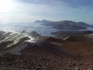
India / Andaman Islands , Barren Island :
Satellite images showed that the lava flows on the N flank of Barren Island that began to be active in mid-November continued to be active in December. Satellite images acquired on 2, 5, 10, and 15 December showed that the lower half of the flows were hot and active. Thermal anomalies over two vents at the summit were also identified in the images, though weather clouds obscured the summit area on 15 December.
Barren Island, a possession of India in the Andaman Sea about 135 km NE of Port Blair in the Andaman Islands, is the only historically active volcano along the N-S volcanic arc extending between Sumatra and Burma (Myanmar). It is the emergent summit of a volcano that rises from a depth of about 2250 m. The small, uninhabited 3-km-wide island contains a roughly 2-km-wide caldera with walls 250-350 m high. The caldera, which is open to the sea on the west, was created during a major explosive eruption in the late Pleistocene that produced pyroclastic-flow and -surge deposits. Historical eruptions have changed the morphology of the pyroclastic cone in the center of the caldera, and lava flows that fill much of the caldera floor have reached the sea along the western coast
Sources: Copernicus , GVP.
Photo : Arunava Pramanick
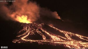
Japan , Sakurajima :
The Japan Meteorological Agency (JMA) reported ongoing eruptive activity at Minamidake Crater (Aira Caldera’s Sakurajima volcano) during 8-15 December with five eruptive events and four explosions. Ash plumes rose as high as 2.2 km above the crater rim and large blocks were ejected as far as 600 m from the vent. Nightly crater incandescence was visible in webcam images. Eruptive events during 8-11 December produced ash plumes that rose as high as 2.2 km above the crater rim and drifted E and SE. Explosions at 10h14 on 10 December and at 13h34 and at 16h06 on 13 December generated ash plumes that rose 500-1,800 m above the crater rim and drifted S and N. The Alert Level remained at 3 (on a 5-level scale), and the public was warned to be cautious within 2 km of both the Minimadake and Showa craters.
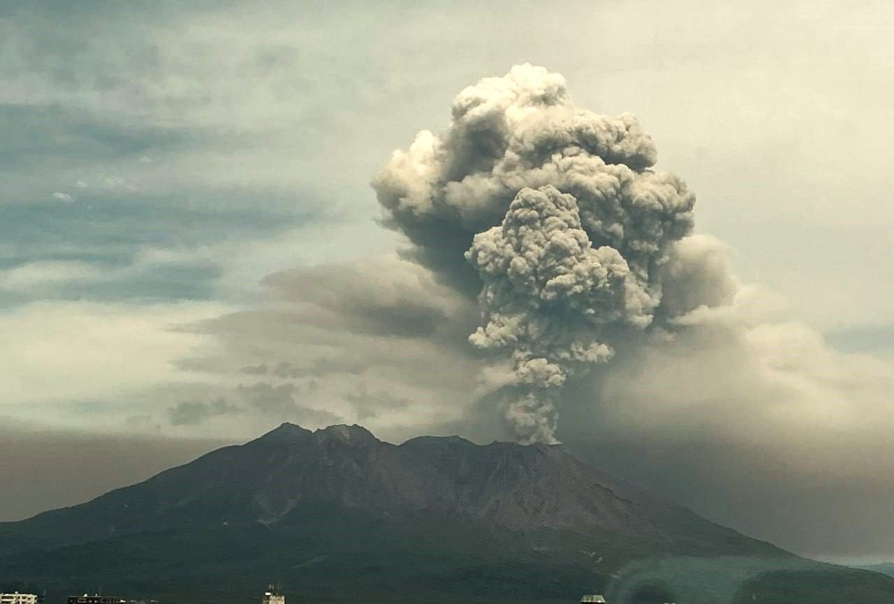
The Aira caldera in the northern half of Kagoshima Bay contains the post-caldera Sakurajima volcano, one of Japan’s most active. Eruption of the voluminous Ito pyroclastic flow accompanied formation of the 17 x 23 km caldera about 22,000 years ago. The smaller Wakamiko caldera was formed during the early Holocene in the NE corner of the caldera, along with several post-caldera cones. The construction of Sakurajima began about 13,000 years ago on the southern rim and built an island that was joined to the Osumi Peninsula during the major explosive and effusive eruption of 1914. Activity at the Kitadake summit cone ended about 4,850 years ago, after which eruptions took place at Minamidake. Frequent eruptions since the 8th century have deposited ash on the city of Kagoshima, located across Kagoshima Bay only 8 km from the summit. The largest recorded eruption took place during 1471-76.
Sources : Japan Meteorological Agency (JMA) , GVP.
Photo : via Alex Tor / FB.
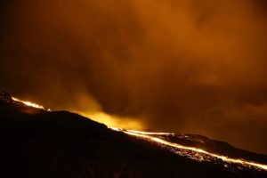
United – States , Westdahl :
The Anchorage Volcanic Ash Advisory Center (VAAC) reported that during 14-15 December plumes of unconsolidated ash in the vicinity of Westdahl were visible in satellite images rising to 1.8 km (6,000 ft) a.s.l. The Volcano Alert Level remained at Normal (the lowest level on a four-level scale) and the Aviation Color Code remained at Green (the lowest level on a four-color scale).
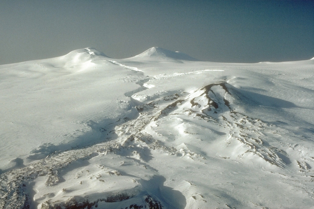
The summit area of Westdahl, located on the southwestern part of Unimak Island in the eastern Aleutians, is seen here from the east. Westdahl Peak (left) and Faris Peak (right) formed on the broad main edifice. The scoria cone in the center was the principal eruption site for the 1991-92 activity, producing the snow-covered lava flow in the foreground. . The sinuous fissure cutting across the glacial icecap from the summit formed in the opening phases of the eruption and produced lava fountaining.
Westdahl is a broad glacier-covered volcano occupying the SW end of Unimak Island. Two peaks protrude from the summit plateau, and a new crater formed in 1978 cuts the summit icecap. The volcano has a somewhat of a shield-like morphology and forms one of the largest volcanoes of the Aleutian Islands. The sharp-topped, conical Pogromni stratovolcano, 6 km N, rises several hundred meters higher than Westdahl, but is moderately glacially dissected and presumably older. Many satellitic cones of postglacial age are located along a NW-SE line cutting across the summit of Westdahl. Some of the historical eruptions attributed to the eroded Pogromni may have originated instead from Westdahl (Miller et al. 1998). The first historical eruption occurred in 1795. An 8-km-long fissure extending east from the summit produced explosive eruptions and lava flows in 1991.
Sources: Anchorage Volcanic Ash Advisory Center (VAAC), US Geological Survey Alaska Volcano Observatory (AVO)
Photo : C.F. Zeillemaker, 1993 (U.S. Fish and Wildlife Service, courtesy of Alaska Volcano Observatory).
Colombia , Puracé – Los Coconucos volcanic chain :
Popayán, December 17, 2025, 10:30 AM
Regarding the monitoring of activity in the Los Coconucos volcanic chain, the Colombian Geological Survey (SGC), an agency under the Ministry of Mines and Energy, reports the following:
Since the publication of yesterday’s extraordinary bulletin, and continuing to this day, earthquakes related to fluid movements within the volcanic edifice have persisted. These include long-period (LP) earthquakes, seismic pulses (TR), and continuous tremor. This seismicity has been localized beneath the Puracé volcano crater, at a depth of less than 2 km, and is linked to the internal dynamics of gases and their emission into the atmosphere. In addition, low-magnitude seismic signals, associated with rock fracturing, were recorded within a radius of less than 1.5 km around the crater of the Purace volcano, at depths between 1 and 2 km.
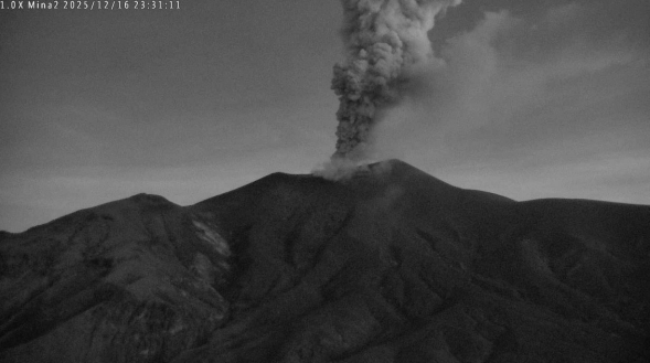
Recording from the Mina camera, located 2.2 km north of the Puracé volcano. Gas and ash column recorded at 6:31 PM on December 16, 2025.
Some of these seismic signals were associated with ash emissions that dispersed primarily to the northwest, following the wind direction, and reached an altitude of up to 1,500 m above the volcano’s summit. A total of six (6) ash emissions were recorded, for which alerts were issued to the Civil Aviation Authority. Ashfall was reported in the village of Cristales and near the Cabildo building of the Puracé Indigenous Reserve, northwest of the volcano.
Significant emissions of sulfur dioxide (SO₂) into the atmosphere continue to be detected by satellite, with a predominant dispersion toward the Northwest, within a radius of approximately 250 km around the volcano. Similarly, temperatures comparable to those observed in previous days continue to be recorded in the crater area, possibly linked to the emission of hot gases from within the volcano.
The volcanic activity level remains at ORANGE alert: Volcano exhibiting significant variations in monitored parameters.
Source et photo : SGC.
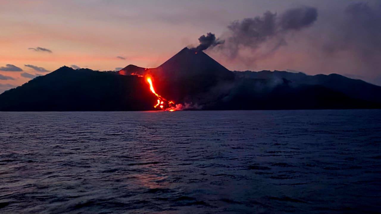
Indonesia , Semeru :
Mount Semeru experienced an eruption on Thursday, December 18, 2025 at 06:51 WIB. An ash column was observed approximately 800 meters above the summit (at an altitude of about 4,476 meters). This gray ash column was of moderate intensity and directed east and southeast. The eruption was recorded by a seismograph, with a maximum amplitude of 22 mm and a duration of 114 seconds.
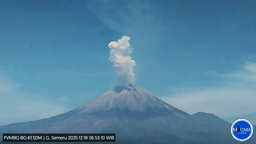
The Pusat Vulkanologi dan Mitigasi Bencana Geologi (PVMBG) reported that activity continued at Semeru during 10-16 December, with daily eruptive events recorded by the seismic network. White-and-gray or gray ash plumes were observed almost daily rising 400-1,100 m above the summit and drifting in multiple directions; weather conditions prevented views on 14 December though eruptive events were detected. Incandescence at the summit on the upper SE flank was visible in several nighttime webcam images. The Alert Level remained at 3 (the second lowest level on a scale of 1-4) and the public was warned to stay at least 5 km away from the summit in all directions, 13 km from the summit on the SE flank along the Kobokan drainage, and 500 m from the banks of the Kobokan drainage as far as 17 km SE of the summit.
Sources : Pusat Vulkanologi dan Mitigasi Bencana Geologi (PVMBG, also known as CVGHM) , GVP.