April 11 , 2025.
Indonesia , Ibu :
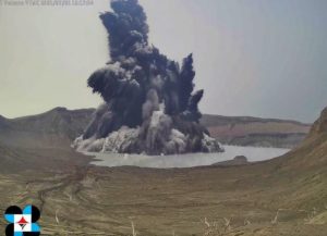
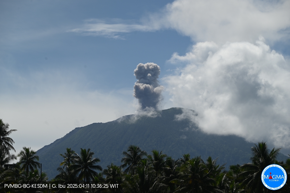
An eruption of Mount Ibu occurred on Friday, April 11, 2025, at 10:36 WIT with an observed ash column height of ± 500 m above the peak (± 1825 m above sea level). The ash column was observed to be gray in color with a thick intensity, oriented toward the south. This eruption was recorded on a seismograph with a maximum amplitude of 28 mm and a duration of 50 seconds.
VOLCANO OBSERVATORY NOTICE FOR AVIATION – VONA
Issued : April 11 , 2025
Volcano : Ibu (268030)
Current Aviation Colour Code : ORANGE
Previous Aviation Colour Code : orange
Source : Ibu Volcano Observatory
Notice Number : 2025IBU615
Volcano Location : N 01 deg 29 min 17 sec E 127 deg 37 min 48 sec
Area : North Maluku, Indonesia
Summit Elevation : 4240 FT (1325 M)
Volcanic Activity Summary :
Eruption with volcanic ash cloud at 01h36 UTC (10h36 local).
Volcanic Cloud Height :
Best estimate of ash-cloud top is around 5840 FT (1825 M) above sea level or 1600 FT (500 M) above summit. May be higher than what can be observed clearly. Source of height data: ground observer.
Other Volcanic Cloud Information :
Ash cloud moving to south. Volcanic ash is observed to be gray. The intensity of volcanic ash is observed to be thick.
Remarks :
Eruption recorded on seismogram with maximum amplitude 28 mm and maximum duration 50 second.
Source et photo : Magma Indonésie .
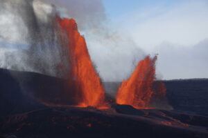
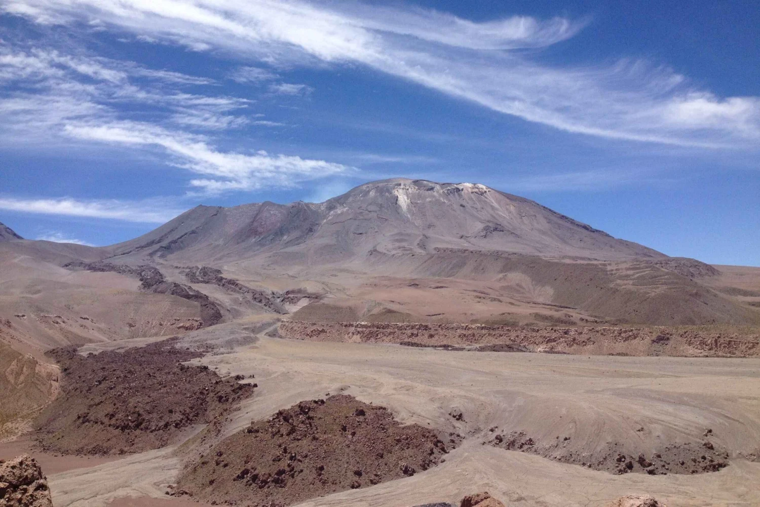
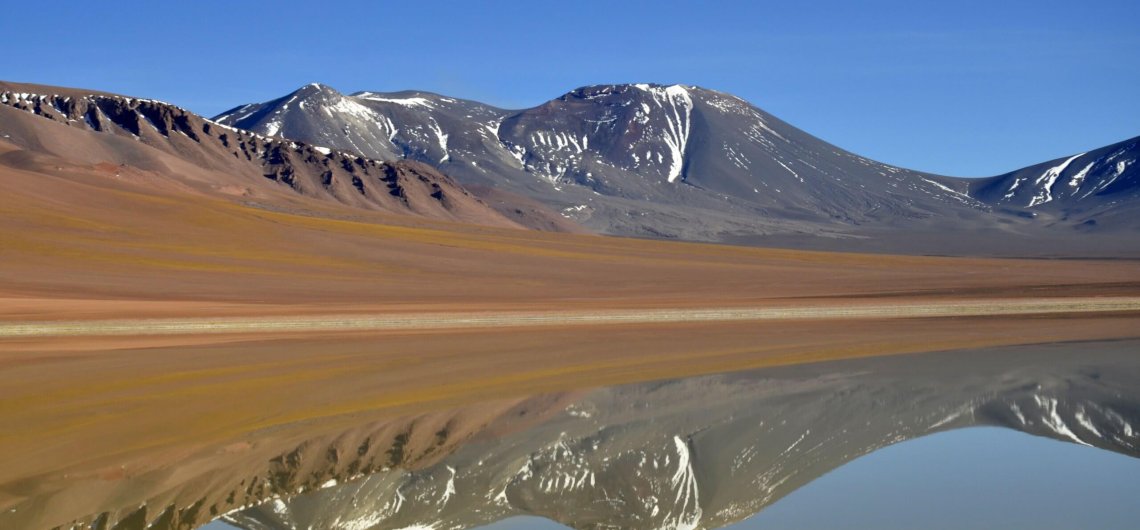
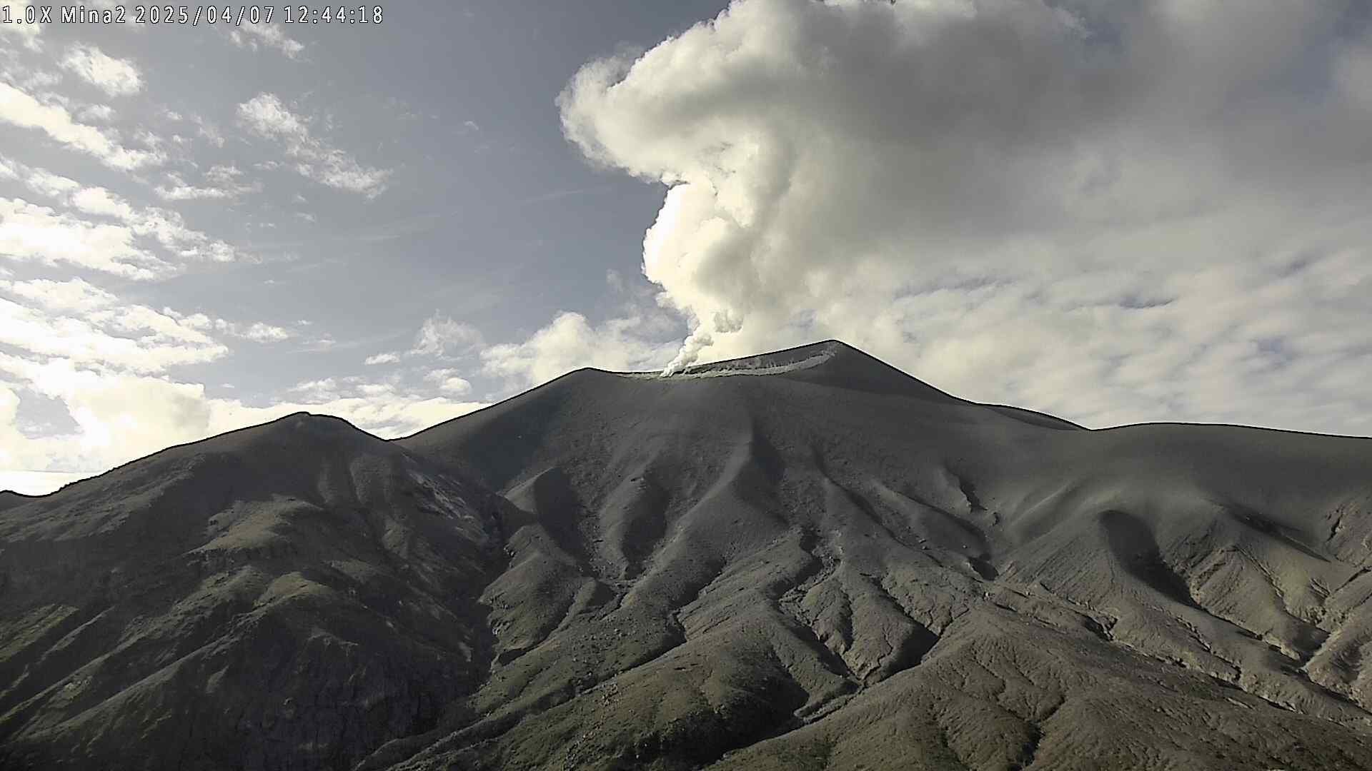
Chile , Lascar :
Seismology
The seismological activity for the period was characterized by the recording of:
6 VT-type seismic events, associated with rock fracturing (Volcano-Tectonic). The most energetic earthquake had a local magnitude (LM) value of 1.5, located 0.7 km east-southeast of the volcanic structure, at a depth of 2.7 km.
10 LP-type seismic events, associated with fluid dynamics within the volcanic system (Long Period). The size of the largest earthquake, estimated using the reduced displacement (RD) parameter, was 5 cm².
Fluid Geochemistry
Sulfur dioxide (SO2) emission data obtained using Differential Optical Absorption Spectroscopy (DOAS) equipment at the Emu station, located 6 km east-southeast (ESE) of the active crater, showed an average SO2 flux value of 1,105 t/d for the period under evaluation, with a maximum daily value of 1,512 t/d on March 26.
Fifteen anomalies were reported in satellite images obtained by the Tropospheric Monitoring Instrument (TROPOMI) in sulfur dioxide (SO2) emissions into the atmosphere in areas near the volcano. On March 15, the maximum emission value was recorded, reaching 360 tons of SO2 mass.
Satellite Thermal Anomalies
During the period, 43 thermal alerts were recorded in the area associated with the volcano, on the MIROVA platform. The maximum values were 6.5 MW in MODIS (March 28 and 30) and 7.5 MW in VIIRS (March 16, 22, and 30). Sentinel 2-L2A satellite images from March 18, 20, 23, and 28, in a combination of bands, allow us to observe that a radiance pattern characterized by three zones is maintained within the active crater. Similarly, the total radiant area of the hotspots calculated by the NHI TOOLS platform is 8,100 m² for March 14, a value considered moderate.
Geodesy
The geodetic activity during the period was characterized by:
– Low-amplitude displacements of the vertical components of the GNSS stations, not exceeding 0.4 cm/month.
– Low-amplitude displacements of the GNSS monitoring line crossing the massif (line between GNSS stations), not exceeding 0.3 cm/month.
– No evidence of deformation by radar interferometry.
Therefore, there is no evidence of changes in the deformation of the volcanic system.
Surveillance Cameras
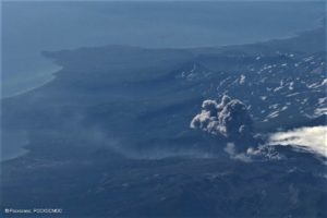
Images provided by surveillance cameras installed around the volcano, when weather conditions permitted, recorded white columns of degassing in north and northwest directions, with the maximum value being 920 m above the crater on March 29. The incandescence is visible continuously during the night.
Satellite Geomorphological Analysis
Based on high-resolution satellite images from the Pleiades and Planet Scope and SKYSAT COLLECT (March 29, 2025), no morphological changes have been identified in the volcanic system.
According to the analysis of the data from this fortnight, there is continuity in the anomalous indicators of volcanic activity for Láscar. According to the recordings of the equipment belonging to the instrumental network, fixed cameras and DOAS, columns of incandescence and degassing were observed less than 1 km above the crater level. Furthermore, the SO2 flux is continuous and the daily averages are still low, around 1,000 t/d. Likewise, satellite alerts related to SO2 emissions into the atmosphere, thermal anomalies and radiation in the active crater demonstrate the continuation of this anomalous process. The seismicity record is remarkably weak and absent for a few days, mainly since mid-March. The few recordings and characteristics of this seismicity show similarities with the signals that occurred at the beginning of the previous three-year cycles, which evolved towards low-energy emissions. The current cycle could involve a greater contribution from the magmatic component, as evidenced by SO2 and persistent thermal anomalies, and could evolve toward states of greater instability. It is important to note that the anomalous activity that occurred in December 2022 and January 2023, resulting in alert changes on these occasions, may have affected the aforementioned marked three-year cyclicity. The current conditions cited during this process allow us to infer that the anomalous state persists. The above indicates that the system remains above its baseline activity threshold.
Therefore, the technical alert remains in effect at:
YELLOW TECHNICAL ALERT: Changes in the behavior of volcanic activity.
Source : Sernageomin
Photos : Myguidechile . com , 80 jours voyages / Sylvain Chermette.
Colombia , Puracé – Los Coconucos Volcanic chain:
Popayán, April 8, 2025, 3:30 p.m.
According to monitoring of the activity of the Puracé Volcano – Los Coconucos Volcanic Chain, the Colombian Geological Survey (SGC), an entity affiliated with the Ministry of Mines and Energy, reports that:
During the week of April 1-7, seismic activity associated with rock fracturing and fluid dynamics increased compared to previous weeks. These events were located mainly to the northeast of the Puracé Volcano, at a distance of between 2 and 6 km from the summit of the volcanic edifice, with magnitudes of up to 2.8 and depths of between 3 and 6 km. as well as between the Puracé and Piocollo volcanoes, with depths between 1 and 2 km and magnitudes less than 1.
Moderate sulfur dioxide (SO2) and carbon dioxide (CO2) emissions were recorded by satellite and field instruments, with more significant degassing on April 1, 4, and 6. Furthermore, the slow deformation process continued between the Puracé, Piocollo, and Curiquinga volcanic edifices.
In images captured by visible and infrared webcams, degassing processes were observed during the week in the lateral fumarole and inside the crater of the Puracé volcano, characterized by gas columns that reached heights above the summit of the volcanic chain of 1.6 km on April 1 and 1.4 km on April 7. It is concluded that degassing continues in the lateral fumarole and crater of the Puracé volcano, in addition to seismic activity beneath the volcano edifice, slow deformation changes, and surface thermal anomalies.
Under Yellow alert status, phenomena such as sporadic ash emissions (minor eruptions of limited magnitude and impact, whose dispersion depends on wind direction), the presence of incandescent light, small explosions in the crater, low-energy thermal anomalies, noise, felt earthquakes, odors, precipitation of elemental sulfur near the crater and in hot springs and fumaroles, as well as degassing in areas outside the crater, may occur. Fissure formation and the occurrence of minor lahars, among other things, are also observed.
Based on the above, the SGC recommends closely monitoring the evolution of volcanic activity through weekly bulletins and other information published through official channels, as well as complying with the instructions of local and departmental authorities and the National Disaster Risk Management Unit (UNGRD). The alert status for volcanic activity remains at yellow alert: active volcano with changes in the behavior of the base level of monitored parameters and other manifestations.
Source et photo : SGC
Costa Rica , Poas :
The Observatorio Vulcanológico y Sismológico de Costa Rica-Universidad Nacional (OVSICORI-UNA) reported elevated levels of activity at Poás during 2-8 April. Inflation continued to be detected, though the rate of uplift had slowed. Sulfur dioxide emissions remained high; values over 2,200 tonnes per day (t/d) were identified in satellite data on 30 March and were followed by two days of values exceeding 1,000 t/d. Emissions recorded by a mobile Differential Optical Absorption Spectroscopy (DOAS) instrument averaged 5,300 ± 500 t/d on 1 April.
Phreatomagmatic events at Boca C occurred about every 4-12 minutes on most days during the week. The events produced almost continuous gas, steam, and ash plumes that generally rose up to 500 m and mostly drifted SE, S, SW, W, and NW, though the plumes occasionally rose higher. Notably, gas, steam, and ash plumes rose to 1 km on 29 March, to 3 km at 12h52 on 4 April, to heights greater than 1 km at 17h01 on 6 April and at 02h03 on 7 April, and to 1.5 km at 02h18 and 02h24 on 8 April.
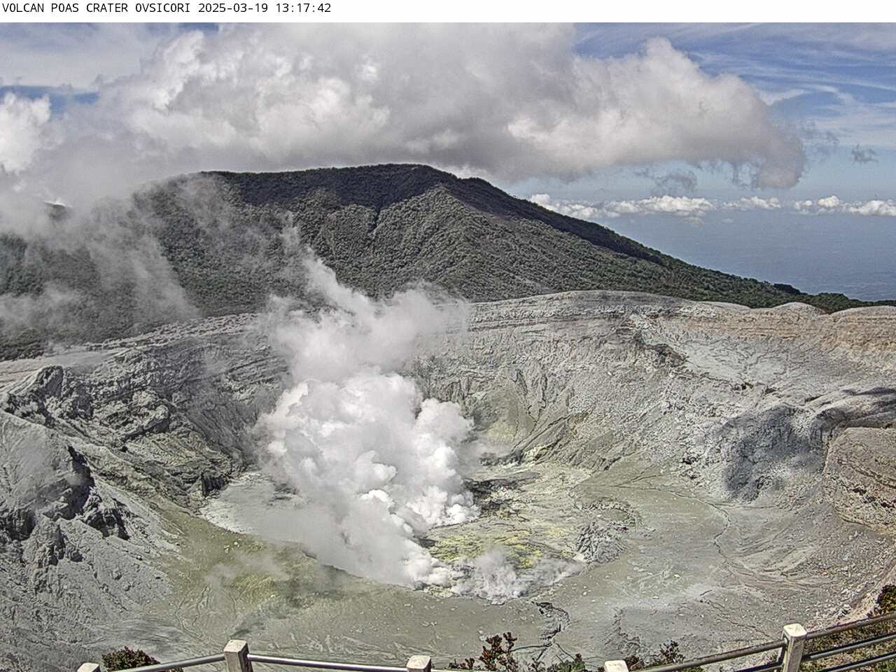
Ashfall was reported by residents through the week. Explosions sometimes ejected incandescent blocks onto the crater floor. Weather conditions sometimes obscured views of the crater.
According to the Comisión Nacional de Emergencias (CNE) on 8 April the Alert Level Orange for the Parque Nacional volcán Poás remained in effect as well as for the district of Toro Amarillo in the Canton of Sarchí due to activity at the crater, ashfall and sulfur odors impacting areas downwind, and a higher potential of lahars in drainages. The volcano’s Alert Level remained at 3 (the second highest level on a four-level scale) and the Aviation Color Code remained at Orange (the second highest color on a four-color scale).
Sources et photo : OVSICORI-UNA , Comisión Nacional de Prevención de Riesgos y Atención de Emergencias (CNE) , GVP.
Guatemala , Santiaguito :
Weather Conditions: Clear
Wind: North.
Precipitation: 10.8 mm (0.42 in).
Activity:
Activity is reported at the Caliente dome of the Santa María-Santiaguito volcanic complex, characterized by white outgassing reaching an approximate height of 500 meters above the crater level. Weak to moderate explosions are recorded at a frequency of one to two events per hour, generating columns of gas and ash that rise up to 800 meters and are carried southward by the wind.
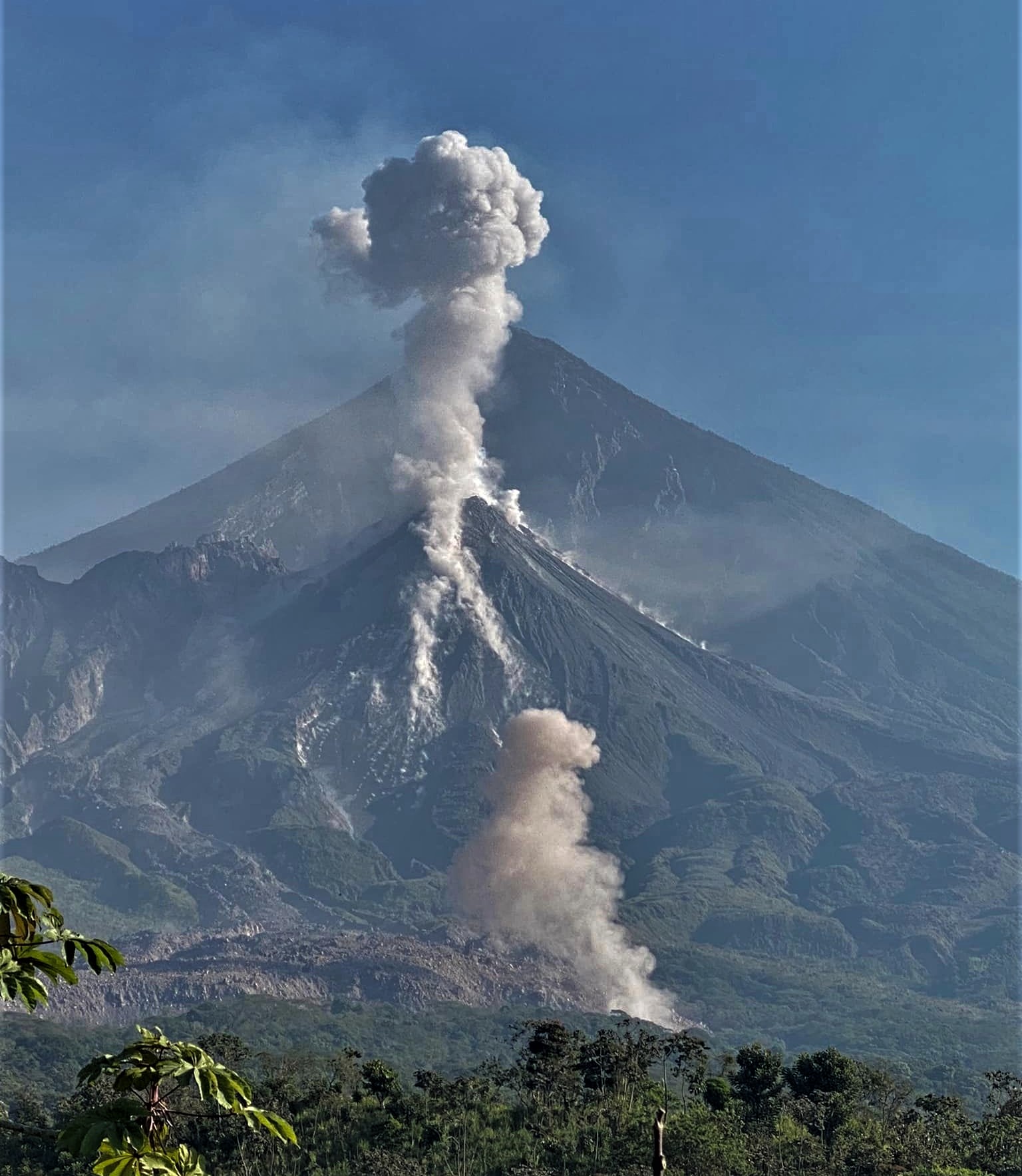
During the night and early morning, intense incandescence was observed in the dome’s crater. Ashfall was also reported in farms and communities near the volcano. Collapses and falls of flaming volcanic material occurred toward the southeast, south, and southwest flanks of the dome. Activity remains high, so it is possible that due to the accumulation of material, explosions, or the action of gravity, new collapses could occur, generating large-scale pyroclastic flows toward the southwest, south, and southeast.
Source : Insivumeh
Photo : Armando Pineda