Novembre 25 , 2019.
New Zealand , White Island :
Whakaari/White Island: Moderate volcanic unrest continues
Published: Mon Nov 25 2019 2:00 PM
Volcanic Alert BulletinWI – 2019/10
Mon Nov 25 2019 2:00 PM; White Island Volcano
Volcanic Alert Level remains at 2
Aviation Colour Code remains at Yellow
Moderate volcanic unrest continues at Whakaari/White Island, but no new changes are observed in the monitored parameters. The Volcanic Alert Level remains at Level 2.
There has been no change in activity at the volcano after the deep magnitude 5.9 earthquake, that occurred beneath eastern Bay of Plenty on Sunday 24 November.
Gas emissions continue to be high to moderate in the last week, since Monday 18 November, and volcanic tremor remains at moderate levels. There have been few earthquakes near the island.

The crater lake level has not changed for the last week, and gas-driven fountaining activity continues to be observed around the active vents on the west side of the crater floor. This fountaining is regularly throwing mud a few metres into the air at the vent but at current levels does not pose a hazard to visitors.
Overall, the monitored parameters continue to be in the expected range for moderate volcanic unrest and associated hazards. The monitoring observations are similar to those seen in the more active 2011—2016 period and suggest that Whakaari/White Island may be entering a period where eruptive activity is more likely than normal.
GNS Science and the National Geohazards Monitoring Centre continues to closely monitor Whakaari/White Island for further signs of activity. Volcanic Alert Level 2 is mostly associated with unrest hazards on the volcano and could include eruptions of steam, gas, mud and rocks. These eruptions can occur with little or no warning.
Source : Agnes Mazot / Geonet , Duty Volcanologist.
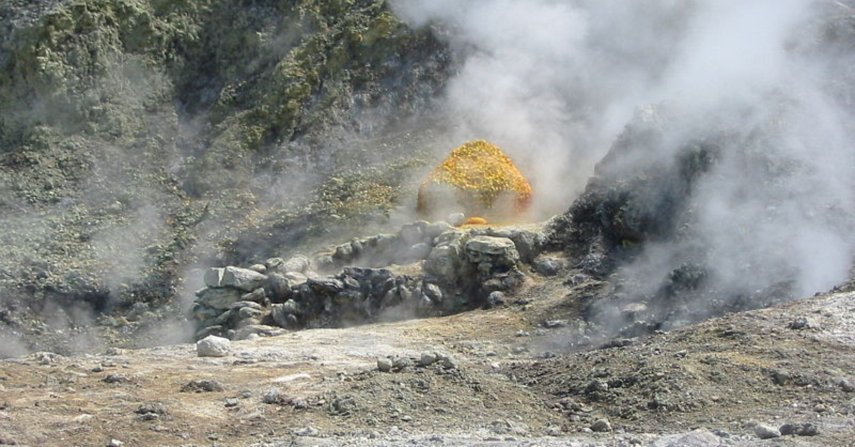
Italy , Campi Flegrei :
The data of caldera variations studied from the seismic tremor of fumaroles.
With the measurement of the seismic tremor generated by the fumaroles of Pisciarelli, it is possible to monitor the variations of the caldera of Campi Flegrei. This is the result of a new study conducted by INGV in collaboration with Savoie Mont Blanc University.
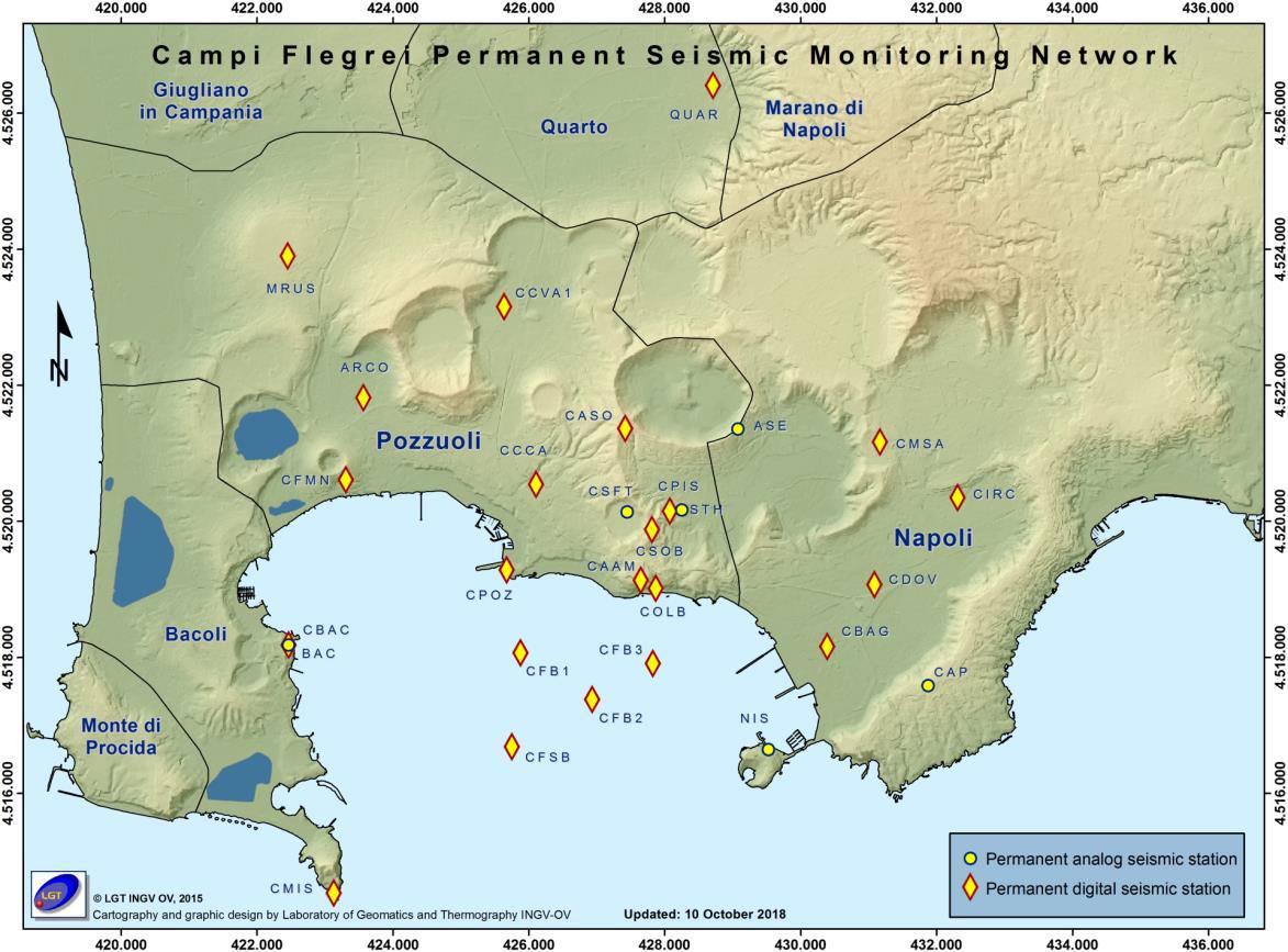
The hydrothermal zone of Pisciarelli is a key site for monitoring Phlegrean fields and the analysis of fumarole seismic tremors can provide information on the status of caldera activity. This is the result of research on Phlegrean field disturbances through measurements of seismic tremors of the fumarole field of Pisciarelli, conducted by a team of geophysicists and geochemists from the recently published National Institute of Geophysics and Volcanology (INGV). in the journal « Geochemistry, Geophysics, Geosystems » From the American Geophysical Union.
« The Campi Flegrei, » says Flora Giudicepietro, a researcher at the Vesuvian Observatory of the INGV (OV-INGV), « is a volcanic caldera, formed following the emptying of a superficial magma chamber, due to the a large eruption of the Ignimbrite of Campania about 40 000 years ago This region rich in history is characterized, like many calderas in the world, by deformations, seismicity and the presence of a vast hydrothermal system. .
Since the 1950s, there have been episodes of intensification of volcanic phenomena characterized by earthquakes and soil uplift, known as bradyseism, in this region.
« In the past, we have witnessed on several occasions an intensification of the bradyseism: especially around 1950, in the period 1968-1972 and in the period 1982-1985.From 2004, in the Campi Flegrei, there was a variation moderate but progressive volcanic manifestations such as uplift, seismicity represented by low energy earthquakes and the activity of the hydrothermal system which has become more intense.
The variation of these processes between late 2012 and early 2013 led the National Department of Civil Protection (DPC) to raise the alert level from green (basic) to yellow (caution).
« The long-term analysis of the seismic tremors generated by the fumaroles in question indicates an increase in the magnitude of the fumarolic tremors between May 2017 and the end of April 2019, an increase which is reflected in the trends of geochemical parameters recorded in the Phlegraean Fields. Seismicity after 2000 provides a clear picture of this process: seismic locations and hypocentral density delineate the fluid pathways that move from a large area of the hydrothermal system to a depth of 1-2 km to the hydrothermal sites of Pisciarelli -Solfatara, where events are concentrated at very low depths (<1 km). By analyzing the extent of fumarolic tremors « , concludes the expert, » it was also possible to identify an episode of expansion of the emission zone near the main fumarole of Pisciarelli
Sources : www.lescienze.it , INGV.
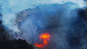
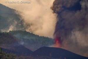
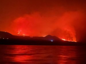
Chile , Nevados de Chillan :
Seismic activity: in the past 24 hours, CVNCh’s instrumental monitoring network has recorded volcano-tectonic (VT) type seismicity, long period type (LP), tremor type (TR) and very long period type ( VLPs), releasing seismic energy at moderate levels. This LP seismicity is frequently related to the occurrence of explosions (EX), which cause surface activity.
Notes: The higher energy VT earthquake was located 2 km west of the active crater at a depth of 3.6 km.
Observations: An explosive activity was recorded, with pulsatile emission of gases and particles. During the night, it was possible to observe explosions with projection of incandescent volcanic material around the active crater.
– Infrasound sensors recorded explosion-related signals (EX) with a maximum value of 2.5 Pa reduced to 1 km.

– The extrusion of the lava flow called L4 continues, descending along the North-North-East slope of the volcano, adjacent to the other lava flows previously reported: L1, L2, L3. The L4 flowconsists of 2 lobes, with an extension to date located about 90 m from the edge of the crater Nicanor and an average speed of 0.4 m / h, similar to that observed in the locations L1, L2 and L3. The L4 emitting center is located about 60 m south-south-east of the L1, L2 and L3 emission center.
– The network of GNSS stations which makes it possible to measure the deformation of the volcanic complex, continues to record an inflationary process, highlighted by the lengthening of the control lines crossing the active crater and the altitude of the 5 monitoring stations. The largest vertical deformation is recorded at the nearest active crater station (1.5 km) and is recorded at 7.3 ± 0.4 cm, at an average speed of 1.7 ± 0.3 cm / month for the last 30 days. The rates of elongation of the control lines have decreased by about 30% since the beginning of the inflationary process, recording a maximum rate of 0.8 ± 0.06 cm / month for the last 30 days.
Source : Sernageomin.
Photo : Publimetro .
Mexico , Popocatepetl :
November 24 at 11:15 (November 24 at 17:15 GMT).
According to the monitoring systems of the Popocatepetl volcano, 238 exhalations have been identified, accompanied by water vapor, volcanic gases and sometimes light amounts of ash. Two explosions were recorded today at 4: 57h and today at 05: 14h. In addition, 118 minutes of tremor were recorded.
An incandescence was observed during the night. Early in the morning, volcanic gas emissions and sometimes small amounts of scattered ash were observed to the east.

CENAPRED urges NOT to approach the volcano and in particular the crater because of the risk of falling ballistic fragments, and in case of heavy rains to stay away from the bottom of the ravines due to the risk of mudslides and debris.
The warning light of Popocatépetl is in YELLOW PHASE 2.
Source : Cenapred.
Photo : Enricoguasch.