January 26 , 2025.
Hawaii , Kilauea :
Saturday, January 25, 2025, 1:31 PM HST (Saturday, January 25, 2025, 23:31 UTC)
19°25’16 » N 155°17’13 » W,
Summit Elevation 4091 ft (1247 m)
Current Volcano Alert Level: WATCH
Current Aviation Color Code: ORANGE
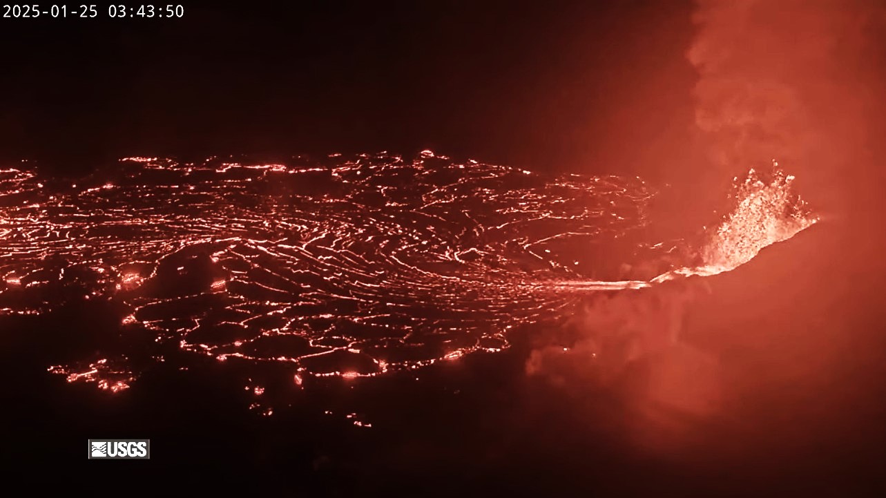
The eruption of Kīlauea within Halemaʻumaʻu crater paused at 12:36 p.m. HST on January 25, 2025, when fountain-fed lava flows stopped erupting out of the north vent.
Episode 6 began at 11:28 p.m. on January 24 and lasted for just over 13 hours.
Fountains of episode 6 had been gradually declining throughout the morning and lava had covered nearly half of the floor of Halemaʻumaʻu crater by the time the eruption paused. Seismic tremor began dropping and deflationary tilt stopped around noon, about 30 minutes before the eruption paused. Overall, the tiltmeter at Uēkahuna (UWD) recorded about 3 microradians of deflation during episode 6, about the same as episode 5 and appears to be recording the start of inflationary tilt at 1:00 p.m. HST.
Currently light winds are blowing at less than 10 mph out of the north-northeast sending the gas plume to the south into the Kaʻū Desert. Winds were not conducive to measuring the amount of SO2 in the plume this morning, but in prior episodes it dropped to about 1,000 tonnes a day during pauses.
No changes have been detected in seismicity and deformation in either the East Rift Zone or Southwest Rift Zone. Both remain at very low levels.
Analysis:
Each episode of lava fountaining since December 23, 2024, has continued for 14 hours to 8 days and episodes have been separated by pauses in eruptive activity lasting a less than 24 hours to 12 days. Episode 6 began after recovering only 3 microradians of tilt, the amount lost during episode 5. Only 3 microradians of deflationary tilt were recorded during episode 6 as well, so it is likely that another episode could start within 1-2 days if inflation rates are similar to prior pauses.
Source : HVO
Photo : USGS
Indonesia , Ibu :
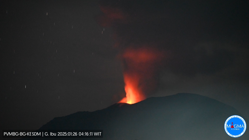
An eruption of Mount Ibu occurred on Sunday, 26 January 2025 at 04:12 WIT with an observed ash column height of ± 800 m above the peak (± 2125 m above sea level). The ash column was observed to be white to grey in colour with a thick intensity, oriented towards the South-West. This eruption was recorded on a seismograph with a maximum amplitude of 28 mm and a duration of 59 seconds.
The volcano continues its eruptive cycle. Explosions at 03:15, 04:27, 06:05, 08:22, etc…
VOLCANO OBSERVATORY NOTICE FOR AVIATION – VONA
Issued : January 26 , 2025
Volcano : Ibu (268030)
Current Aviation Colour Code : ORANGE
Previous Aviation Colour Code : orange
Source : Ibu Volcano Observatory
Notice Number : 2025IBU178
Volcano Location : N 01 deg 29 min 17 sec E 127 deg 37 min 48 sec
Area : North Maluku, Indonesia
Summit Elevation : 4240 FT (1325 M)
Volcanic Activity Summary :
Eruption with volcanic ash cloud at 19h12 UTC (04h12 local).
Volcanic Cloud Height :
Best estimate of ash-cloud top is around 6800 FT (2125 M) above sea level or 2560 FT (800 M) above summit. May be higher than what can be observed clearly. Source of height data: ground observer.
Other Volcanic Cloud Information :
Ash cloud moving to southwest. Volcanic ash is observed to be white to gray. The intensity of volcanic ash is observed to be thick.
Remarks :
Eruption recorded on seismogram with maximum amplitude 28 mm and maximum duration 59 second.
Source et photo : Magma Indonésie .
Costa Rica , Poas :
Latitude: 10.20°N;
Longitude: 84.23°W;
Altitude: 2687 m
Current activity level: Warning
This week, three eruptive events were detected seismically and acoustically without visual confirmation on the 17th, during the night of the 18th to the 19th and on the 23rd. The dominant seismic signal during this week is the tremor, which showed significant changes in its amplitude and frequency. The peaks of greater amplitude are related to eruptive events. Before the last event, a decrease in the amplitude of the tremor was observed, an increase in the number of LP events but with a decrease in their amplitude.
Geodetic monitoring: following a period of crustal inflation in the northern sector of the crater, observed between the end of November and the beginning of December 2024, a new, more significant volcanic inflation has been recorded in recent days. At the station north of the crater, the movement reaches several centimeters, which is significant for the volcano. Gas monitoring has shown significant changes over the last month, with a significant increase in SO2 degassing and variations in gas compositions. The MultiGAS station recorded high SO2 concentrations (weekly average of 16 ppm, with a value of 90 ppm SO2 recorded on 5 January) and an increase in SO2/CO2 from values close to 0.5 in December 2024 to an average of 1.1 ± 0.4 this week. Before each eruptive event in this period, a CO2 pulse is observed, which could indicate a deep magma injection. The H2S/SO2 ratio remains low with values below 0.1.
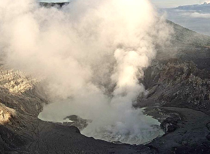
SO2 concentrations recorded at Mirador reached a maximum of 7.9 ppm on January 23, two hours after the eruptive activity. During the last week, the average SO2 flux was 403 ± 94 t/d, similar to that of the previous week (456 ± 218 t/d). The OMI instruments of the SENTINEL satellite continue to detect SO2 in the atmosphere almost daily, with values ranging from 8 to 235 tons. The lake level reached a maximum at the end of 2024 and began a slow decline with about -0.4 m in 3 weeks. But during this period, the weather remained rainy for more than 10 days. The temperature of the lake remains stable at a high level (55-60°C) since the beginning of the month with a slight upward trend. The eruption of January 5 was observed and ejected ash and bombs that fell on the Playón (the crater floor south of the lake). Some bombs measuring more than 60 cm in diameter reached a distance of more than 150 m horizontally. Much of this material is similar to the material ejected on April 22, 2017, that is, material that was juvenile in 2017 and still well preserved in 2025. Sometimes, secondary mineralization is observed, indicating that it is not juvenile material at all in 2025. Despite a similar seismic amplitude, the eruption of January 23 did not eject material. No ash fall or new blocks were detected on the crater floor.
Source et photo : Ovsicori
Colombia , Nevado del Ruiz :
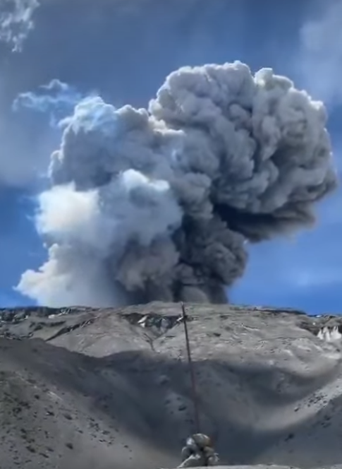
Manizales, January 21, 2025, 7:20 p.m. .
Following the monitoring of the activity of the Nevado del Ruiz volcano, the Colombian Geological Survey (SGC), an entity attached to the Ministry of Mines and Energy, reports that:
During the week of January 14 to 20, 2025, the volcano continued to display unstable behavior. Compared to the previous week, the main variations in the monitored parameters were:
– The recording of long-period seismicity related to fluid dynamics inside volcanic conduits associated with the continuous emission of ash continued. This seismicity increased from January 14, as mentioned in the bulletin released the same day, by the number of episodes and their duration, as well as by their energy level. Regarding the seismic signals associated with the emission of pulsatile ash, these have slightly decreased in the number of earthquakes and have maintained similar levels in the seismic energy released. Thanks to the cameras (conventional or thermographic) used to monitor the volcano and the reports of the inhabitants of the surroundings of the volcano and the managers of the Los Nevados National Natural Park and the SGC, it has been possible to confirm some emissions of ash and changes in the temperature of the emitted material, in relation to several of the recorded events.
– Seismic activity associated with rock fracturing processes within the volcanic structure decreased the number of recorded earthquakes and the seismic energy released.
The recorded earthquakes were of magnitude less than 1 (low energy level) and were located mainly in the Arenas crater and in the South-Southeast, South-Southwest, Northeast and North sectors, at distances up to 9 km from the crater with a predominance of distances less than 4 km from the Arenas crater. The depth of the earthquakes varied from less than 1 km to 6 km from the summit of the volcano.
– The emission of water vapor and gases, mainly sulfur dioxide (SO₂), into the atmosphere through the Arenas crater was variable and increased compared to the previous week. Satellite monitoring, carried out in a complementary manner to evaluate this parameter, shows significant SO₂ releases.
– The vertical height of the gas column showed a similar behavior to the previous week, maintaining values mainly below 800 m measured on the volcanic summit, except on January 19 and 20 when it reached values of 1600 m and 1400 m respectively. In dispersion, it reached 2000 m on January 15 and 20 during the pulsatile ash emissions recorded at 21:45 and 19:57 respectively.
Regarding the direction of dispersion of the gas column, it went towards the west side (from the northwest to the southwest of the volcano), generating ash falls in the municipalities of Manizales and Villamaría (Caldas department).
– When monitoring thermal anomalies at the floor of Arenas Crater, from satellite monitoring platforms, some reports of anomalies with low to moderate energy levels were obtained.
Source : SGC
Photo : Capture d’écran via Alex Terry FB
Ecuador , Sangay :
DAILY STATE REPORT OF SANGAY VOLCANO, Saturday, January 25, 2025.
Information Geophysical Institute – EPN.
Surface Activity Level: Moderate, Surface Trend: No Change
Internal Activity Level: Moderate, Internal Trend: No Change
Seismicity: From January 24, 2025, 11:00 a.m. to January 25, 2025, 11:00 a.m.:
Seismicity:
Below is the count of seismic events recorded at the reference station
Explosion (EXP): 52
Rainfall/Lahars:
The presence of rain in the area of the volcano or its surroundings, which could generate mud and debris flows, has not been recorded by surveillance cameras. **In the event of heavy rain, it could remobilize the accumulated materials, generating mud and debris flows that would descend the sides of the volcano and flow into adjacent rivers.
Emission/Ash Column:
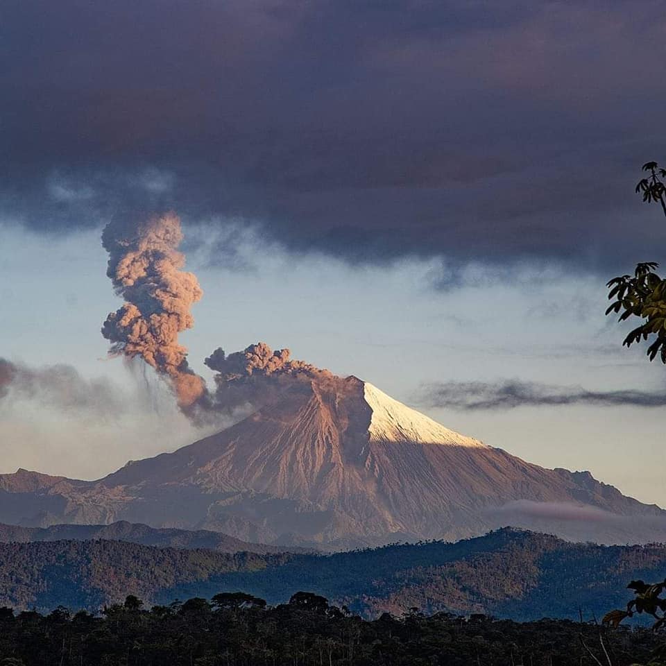
Since yesterday, due to unfavorable weather conditions, no emissions of gas and ash have been observed through surveillance camera monitoring and satellite images. The Washington VAAC agency has not published any activity reports in the last 24 hours.
Observation:
In the last 24 hours, due to unfavorable weather conditions, no fall of incandescent material has been reported, according to surveillance camera monitoring. On the other hand, the volcano has remained completely cloudy for most of the time.
Alert level: yellow
Source : IGEPN
Photo : volcan sangay / FB

