December 21 , 2024.
Alaska , Spurr :
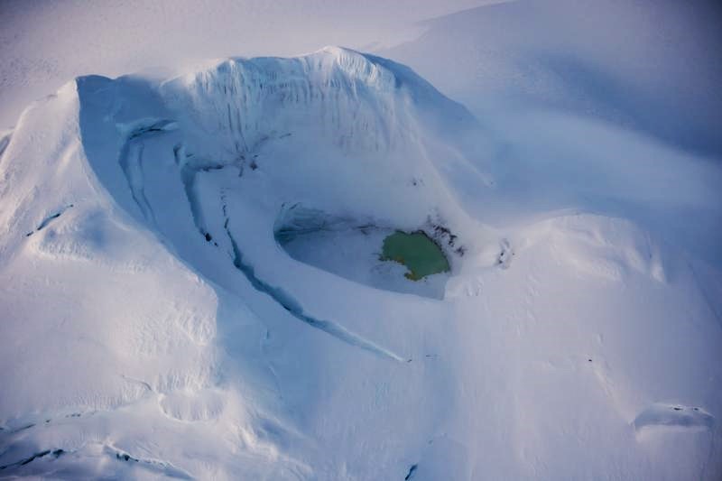
Unrest persists at Mount Spurr with small, shallow earthquakes beneath the summit continuing over the past week. An AVO crew conducted an overflight of Mount Spurr on Wednesday, December 18. Gas measurements yielded similar results to those obtained on a flight on June 23, 2024, and remain consistent with typical background values. A lake that formed in the summit crater during the summer has grown indicating continued heat flow through the summit cone causing minor ice and snow melt. No other activity was observed in satellite or webcam images throughout the week.
Summit and summit crater of Mount Spurr with a partially ice-covered crater lake on December 18, 2024. Photo taken part of a photo and gas survey following recent seismic unrest at the volcano.
AVO is closely monitoring Mount Spurr for signs of increased unrest using local seismic, infrasound, web camera, and GNSS stations, along with regional infrasound and lightning networks and satellite data. We would expect changes in earthquakes, ground deformation, summit lake, and fumaroles if magma began to move closer to the surface. Thus, if an eruption were to occur, it would be preceded by additional signals that would allow advance warning.
Source : AVO
Photo : Loewen, Matt (18/12/2024)
Indonesia , Merapi :
MOUNT MERAPI ACTIVITY REPORT, December 13 to December 19, 2024, published on December 20, 2024
OBSERVATION RESULT
Visual
The weather around Mount Merapi is generally clear in the morning and night, while it is foggy from noon to evening. White smoke, thin to thick, low to moderate pressure and 100 m high was observed from the Kaliurang Mount Merapi observation post on December 16, 2024 at 05:21 WIB.
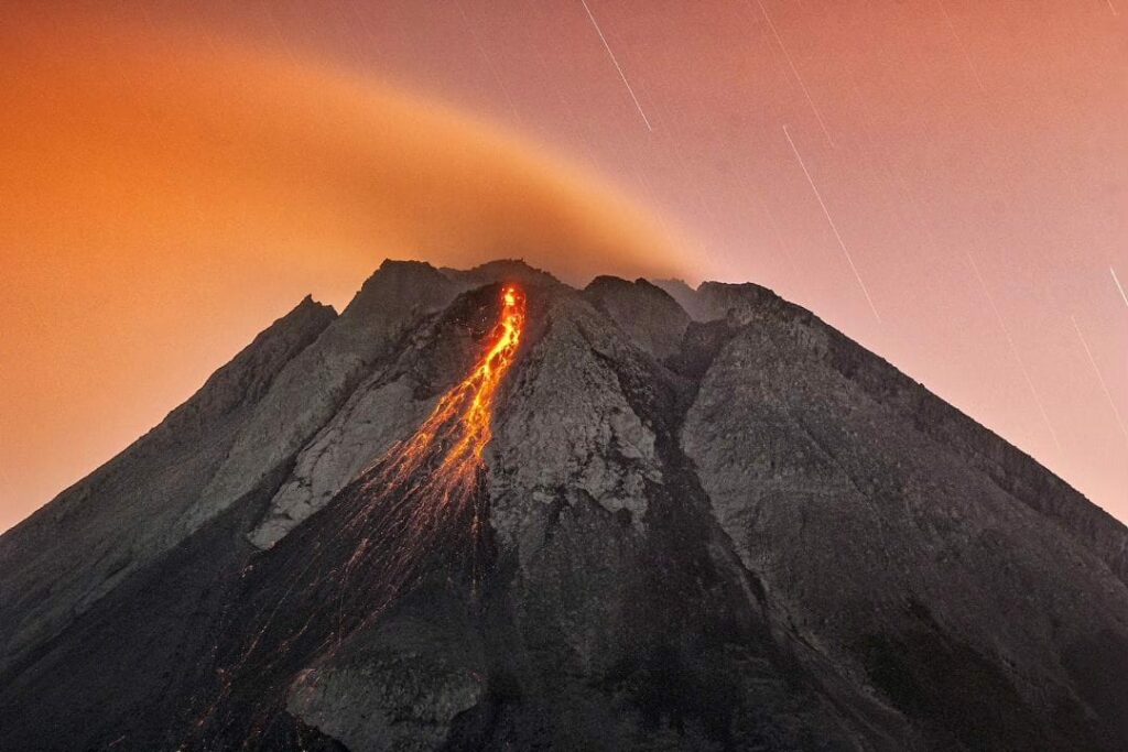
This week, lava avalanches were observed 66 times in the Southwest (upstream of the Bebeng River) up to a maximum of 1,700 m, 18 times upstream of the Krasak River up to a maximum of 1,600 m. Changes were observed in the morphology of the Southwest dome due to dome growth activity, lava avalanches and hot cloud avalanches. For the morphology of the middle dome, there is no significant morphological change. Based on the morphological analysis of the Babadan2 camera, the volume of the Southwest dome has experienced a measurable growth of 3,342,300 m3. As for the central dome, it is 2,361,800 m3.
Seismicity
This week, the seismicity of Mount Merapi recorded
118 shallow volcanic earthquakes (VTB),
368 multi-phase earthquakes (MP),
1301 avalanche earthquakes (RF),
9 tectonic earthquakes (TT).
The intensity of earthquakes this week is still quite high.
Deformation
The deformation of Mount Merapi monitored by EDM this week shows an average shortening rate of 0.6 cm/day, higher than last week.
Rainfall and Lahars
This week, there was rain at Mount Merapi observation post with a rainfall intensity of 37 mm/hour for 85 minutes at Kaliurang post on 17 December 2024 and additional discharge was reported in the Boyong River.
Conclusion
Based on the results of visual and instrumental observations, it was concluded that:
The volcanic activity of Mount Merapi is still quite high in the form of effusive eruptive activity. The activity status is set at the « SIAGA » level.
Source : BPPTKG
Photo : Merapi news / FB ( 12/07/2024).
Indonesia , Lewotobi Laki-laki :
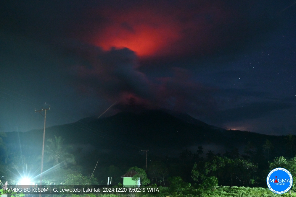
An eruption of Mount Lewotobi Laki-laki occurred on Friday, December 20, 2024, at 18:58 WITA with the height of the ash column observed at ± 700 m above the summit (± 2284 m above sea level). The ash column was observed to be gray with a thick intensity, oriented towards the North. This eruption was recorded on a seismograph with a maximum amplitude of 5.9 mm and a duration of 41 seconds.
VOLCANO OBSERVATORY NOTICE FOR AVIATION – VONA
Issued : December 20 , 2024
Volcano : Lewotobi Laki-laki (264180)
Current Aviation Colour Code : ORANGE
Previous Aviation Colour Code : orange
Source : Lewotobi Laki-laki Volcano Observatory
Notice Number : 2024LWK814
Volcano Location : S 08 deg 32 min 20 sec E 122 deg 46 min 06 sec
Area : East Nusa Tenggara, Indonesia
Summit Elevation : 5069 FT (1584 M)
Volcanic Activity Summary :
Eruption with volcanic ash cloud at 10h58 UTC (18h58 local).
Volcanic Cloud Height :
Best estimate of ash-cloud top is around 7309 FT (2284 M) above sea level or 2240 FT (700 M) above summit. May be higher than what can be observed clearly. Source of height data: ground observer.
Other Volcanic Cloud Information :
Ash cloud moving to north. Volcanic ash is observed to be gray. The intensity of volcanic ash is observed to be thick.
Remarks :
Eruption recorded on seismogram with maximum amplitude 5.9 mm and maximum duration 41 second.
Source et photo : Magma Indonésie.
Hawaii , Kilauea :
Friday, December 20, 2024, 8:42 AM HST (Friday, December 20, 2024, 18:42 UTC)
19°25’16 » N 155°17’13 » W,
Summit Elevation 4091 ft (1247 m)
Current Volcano Alert Level: ADVISORY
Current Aviation Color Code: YELLOW
Activity Summary:
Kīlauea volcano is not erupting. Continued summit inflation and recent increased seismic activity suggests an increasing amount of magma is being stored underneath the summit area.
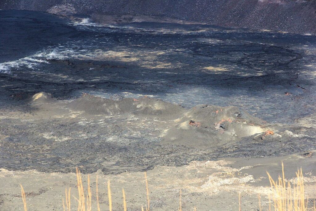
While servicing the B1cam, HVO staff captured this telephoto view of the cones that formed on the floor of Kaluapele (Kīlauea summit caldera) during the September 2023 summit eruption.
Summit Observations:
Seismicity at the summit over the last 24 hours has been low with approximately 6 earthquakes, all below magnitude-2.0. Since the September eruption in the East Rift Zone, there have been sustained rates of inflation at the summit. The most recent measurement of the sulfur dioxide (SO2) emission rate from the summit was approximately 70 tonnes per day on October 17, a value representative of noneruptive conditions at Kīlauea. Unfavorable weather and wind conditions have delayed acquisition of a new SO2 emission rate measurement.
Rift Zone Observations:
Shallow earthquake counts in the upper and middle East Rift Zone (ERZ) remain at low levels. Over the last 24 hours, there were no recorded earthquakes in the middle ERZ and approximately 3 in the upper ERZ, all below magnitude-2.0. Deformation remains low in the ERZ, as recorded by GPS instruments and tiltmeters. There are no indications of any changes downrift in the lower East Rift Zone.
Source : HVO
Photo : USGS / H. Winslow. 10/12/2024
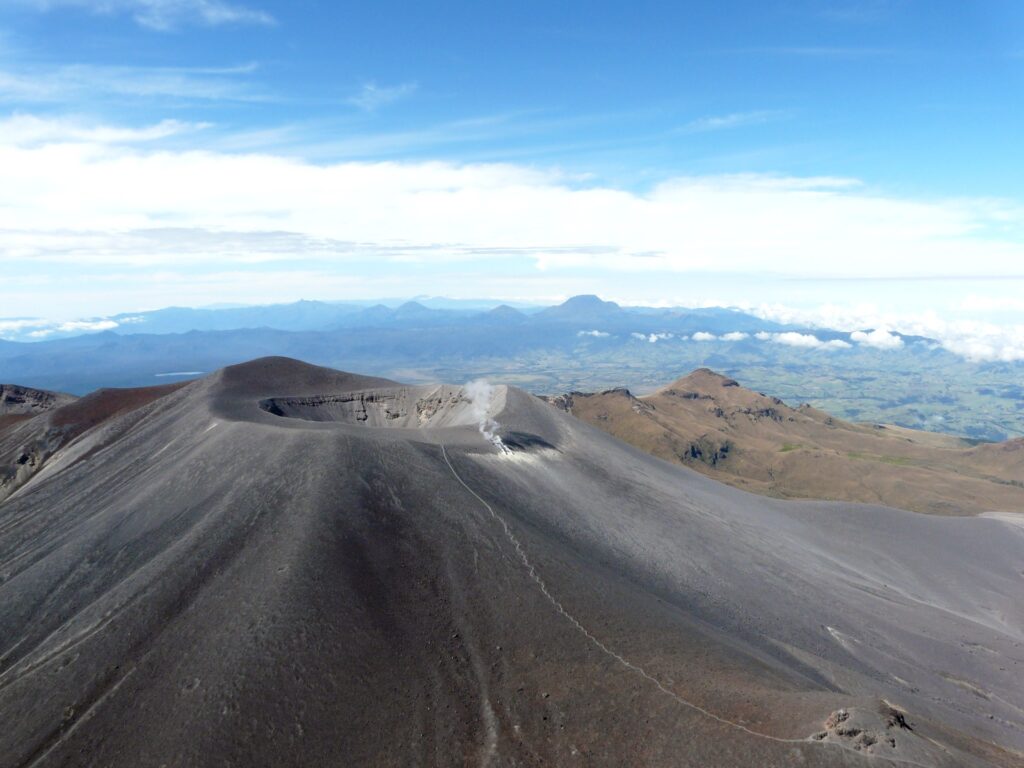
Colombia , Puracé – Los Coconucos volcanic chain :
Popayán, December 17, 2024, 4:00 p.m. .
From the monitoring of the activity of the Puracé volcano – Los Coconucos volcanic chain, the Colombian Geological Survey (SGC), an entity attached to the Ministry of Mines and Energy, reports that:
In the week of December 10 to 16, 2024, seismic activity continued to show a trend similar to that observed in previous weeks, a behavior that was observed both for earthquakes related to rock fracturing (VT) and for seismicity associated with the transit of fluids inside the volcano. Events related to fluid movement were located mainly under the Puracé volcano, at depths of less than 1 km, while fracture seismicity (VT type) was concentrated under the Puracé and Piocollo craters, with depths of up to 4 km.
Regarding deformations, electromagnetic fields and acoustic sensors, no significant variation was observed. Regarding the monitoring of volcanic gases, the satellite detection of SO2 emissions on December 12, 13 and 15, considered low, stood out. Likewise, in the images captured by visible spectrum and infrared webcams, the maintenance of high degassing in the fumarole fields and the detection of thermal anomalies in the same sector were observed.
Based on the above, the SGC recommends closely monitoring the evolution of volcanic activity through weekly bulletins and other information published in official channels, as well as following the instructions of local, departmental authorities and the National Disaster Risk Management Unit (UNGRD).
The state of alert for volcanic activity remains at yellow alert: active volcano with changes in the behavior of the base level of the monitored parameters and other manifestations.
Source et photo : SGC

