December 15 , 2024.
Indonesia , Semeru :
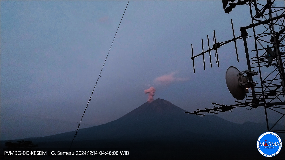
Semeru erupted on Saturday, December 14, 2024 at 04:44 WIB with the height of the ash column observed at ± 900 m above the summit (± 4576 m above sea level). The ash column was observed to be white to gray in color with a thick intensity, oriented towards the Southeast and South. This eruption was recorded on a seismograph with a maximum amplitude of 22 mm and a duration of 113 seconds.
VOLCANO OBSERVATORY NOTICE FOR AVIATION – VONA
Issued : December 14 , 2024
Volcano : Semeru (263300)
Current Aviation Colour Code : ORANGE
Previous Aviation Colour Code : orange
Source : Semeru Volcano Observatory
Notice Number : 2024SMR3414
Volcano Location : S 08 deg 06 min 29 sec E 112 deg 55 min 12 sec
Area : East java, Indonesia
Summit Elevation : 11763 FT (3676 M)
Volcanic Activity Summary :
Eruption with volcanic ash cloud at 21h44 UTC (04h44 local).
Volcanic Cloud Height :
Best estimate of ash-cloud top is around 14643 FT (4576 M) above sea level or 2880 FT (900 M) above summit. May be higher than what can be observed clearly. Source of height data: ground observer.
Other Volcanic Cloud Information :
Ash cloud moving from southeast to south. Volcanic ash is observed to be white to gray. The intensity of volcanic ash is observed to be thick.
Remarks :
Eruption recorded on seismogram with maximum amplitude 22 mm and maximum duration 113 second.
Source et photo : Magma Indonésie.
Ecuador , Sangay :
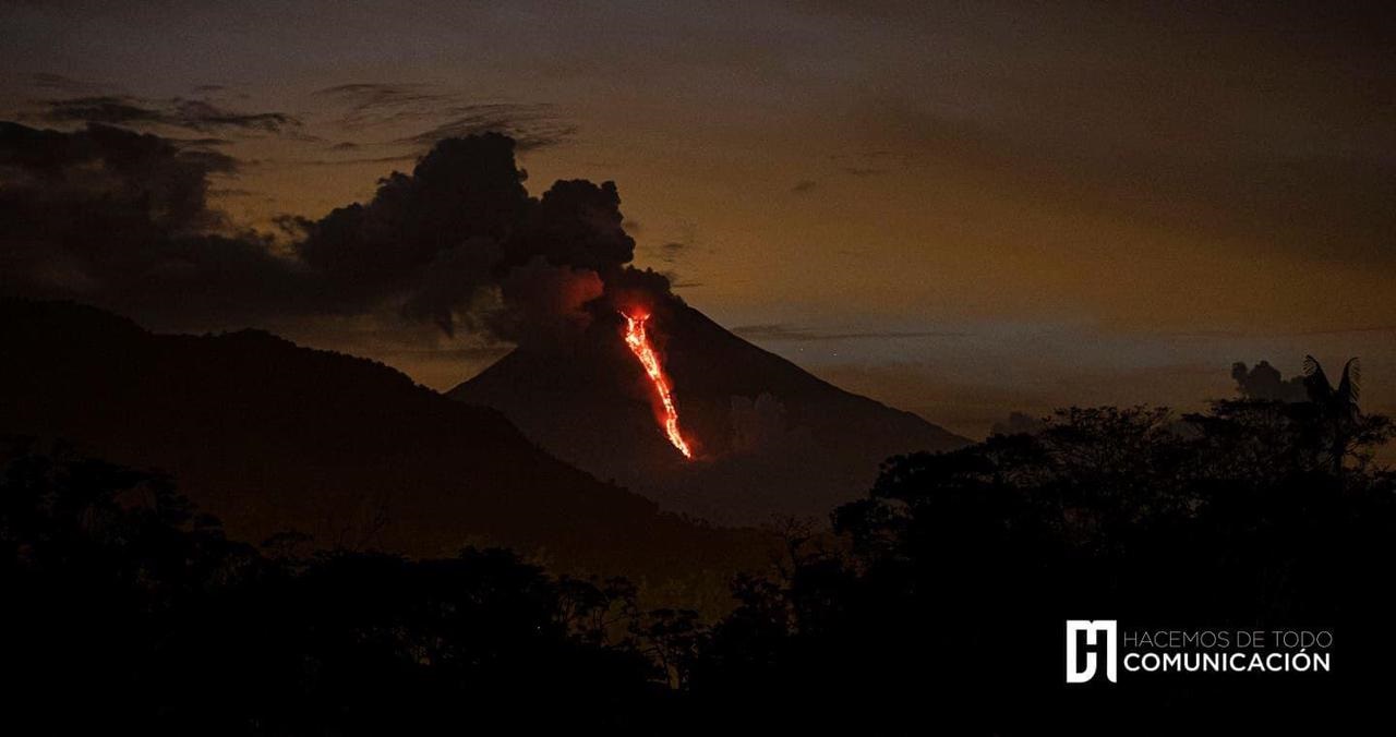
DAILY STATE REPORT OF SANGAY VOLCANO , Saturday, December 14, 2024 .
Information Geophysical Institute – EPN.
Surface Activity Level: Moderate , Surface Trend: No change
Internal Activity Level: Moderate , Internal Trend: No change
Seismicity: From December 13, 2024, 11:00 a.m. to December 14, 2024, 11:00 a.m.:
Seismicity:
Below is the count of seismic events recorded at the reference station
Explosion (EXP): 55
Precipitation / Lahars:
The presence of rain in the area of the volcano or in the surroundings, which could generate mud and debris flows, has not been recorded by the surveillance cameras. **In the event of heavy rain, it could remobilize the accumulated materials, generating mud and debris flows that would descend the sides of the volcano and flow into adjacent rivers.
Emissions / Ash Column:
In the last 24 hours, no gas and ash emissions have been observed by the surveillance camera system or the GOES-16 satellite system. For its part, the Washington VAAC agency has not published any activity reports for this volcano either.
Gas:
The Mounts satellite system reported 12 tons of sulfur dioxide (SO2) measured yesterday at 13:40 TL.
Observation:
Since yesterday afternoon at the closing of this report, the volcano remains completely cloudy.
Alert level: yellow
Source : IGEPN
Photo : IG-EPN / CM communication.
Chile , Lascar :
Seismology
The seismological activity of the period was characterized by the recording of:
19 VT-type seismic events, associated with rock fracturing (Volcano-Tectonic). The most energetic earthquake had a Local Magnitude (ML) value equal to 2.4, located 1.2 km to the East-Southeast of the volcanic edifice, at a depth of 1.9 km from the crater.
114 LP-type seismic events, associated with fluid dynamics within the volcanic system (Long Period). The size of the largest earthquake evaluated from the Reduced Displacement (DR) parameter was equal to 9 cm2.
2 TR-type seismic events, associated with the dynamics maintained over time of fluids within the volcanic system (TRemor). The size of the largest earthquake evaluated from the Reduced Displacement (DR) parameter was equal to 2 cm2.
Fluid Geochemistry
The sulfur dioxide (SO2) emissions data obtained by the Differential Optical Absorption Spectroscopy (DOAS) equipment, corresponding to the Emú station, located 6 km in the East-Southeast (ESE) direction of the active crater, presented an average value of 163 ± 22/d, with a maximum daily value of 244 t/d on November 27, related to the high wind speed in the area.
No anomalies were reported in sulfur dioxide (SO2) emissions into the atmosphere in the area near the volcano, according to data published by the Tropopheric Monitoring Instrument (TROPOMI) and the Ozone Monitoring Instrument (OMI) Sulphur Dioxide Group.
Thermal anomalies by satellites
During the period, no thermal alerts were recorded in the area associated with the volcanic system, according to the analytical processing of Sentinel 2-L2A satellite images, in combination with false-color bands.
Geodesy
According to the data provided by 2 GNSS stations that measure the deformation of the volcano, small-scale displacements can be observed, which would indicate that there is no evidence of change in the behavior of the internal system of the volcano. The vertical displacement rates do not exceed 0.80 cm/month.
Surveillance cameras
The images provided by the fixed camera, installed near the volcano, recorded regular degassing columns, with a maximum height of 700 meters on November 15.
The activity remained at levels considered low, suggesting stability of the volcanic system. The volcanic technical alert is maintained at:
GREEN TECHNICAL ALERT: Active volcano with stable behavior – There is no immediate risk
Observation:
Given the behavior of this volcanic system observed over the last ten years, sudden, small explosions without precursors affecting the immediate surroundings of the active crater cannot be ruled out. However, in the context of its base level, this type of event has not been frequent, which is why it is considered to have a low probability of occurrence. The hazards associated with this minor activity consist of the ejection of ballistic pyroclasts, the emission of ash and volcanic gases.
Source : Sernageomin
Photo : 80 jours voyages / Sylvain Chermette. ( 2022)
Colombia , Galeras :
San Juan de Pasto, December 10, 2024, 5:00 p.m.
Regarding the monitoring of the activity of the Galeras volcano, the Colombian Geological Survey (SGC), an entity attached to the Ministry of Mines and Energy, reports that:
During the week of December 3 to 9, 2024, the activity of the volcano showed an increase in seismicity. Compared to the previous week, the main variations in the monitored parameters were:
• A significant increase was recorded both in the frequency of earthquakes and in the seismic energy released.
• Fracture seismicity predominated within the volcanic system. During this period, the increase in seismic activity was mainly manifested in this type of seismicity, tripling the levels observed in the previous week. Seismic events related to fluid dynamics maintained the levels recorded in recent weeks.
• Earthquakes related to fracturing processes were located scattered in various sectors of the Galeras Volcanic Complex influence zone, with maximum distances of 11 km, depths less than 9 km from the summit (4,200 m above sea level) and with a maximum magnitude of 1.5. A group of superficial earthquakes located northwest of the active cone, at a maximum distance of 1.0 km and depths of up to 2.0 km, with magnitudes less than 0.1, and other events located southwest of the active cone at distances between 2 and 3 km, with depths close to 4 km (above the summit) and a maximum magnitude of 1.3, can be distinguished. • Small emissions of white gases were observed from the fumarole fields of Las Chavas to the West and El Paisita to the North of the active cone, with weak columns and variable dispersion due to wind action.
• The other volcanic monitoring parameters showed stability.
Based on the above, the SGC recommends closely monitoring the evolution through the weekly bulletins and other information published through our official channels, as well as the instructions of local and departmental authorities and the National Disaster Risk Management Unit (UNGRD).
Volcanic activity remains in yellow alert status: active volcano with changes in the behavior of the base level of the monitored parameters and other manifestations.
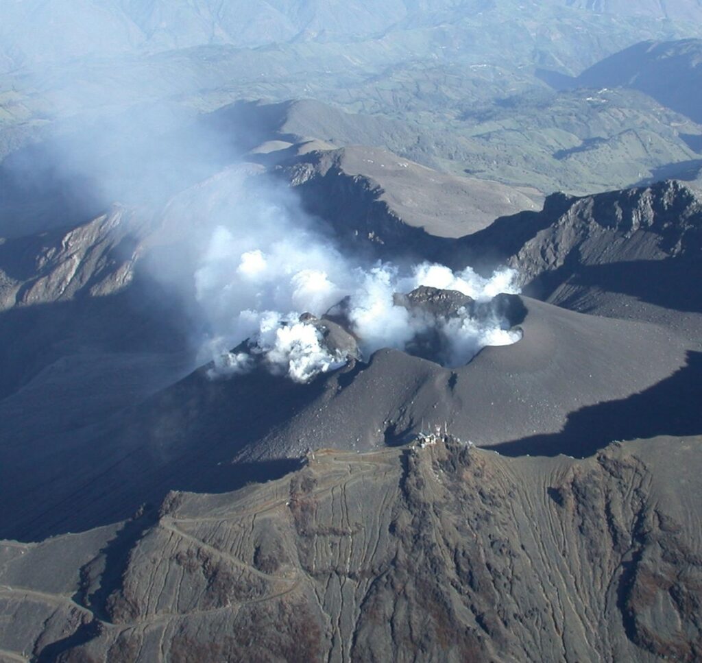
Source et photo : SGC
Costa Rica , Rincon de la Vieja / Poas :
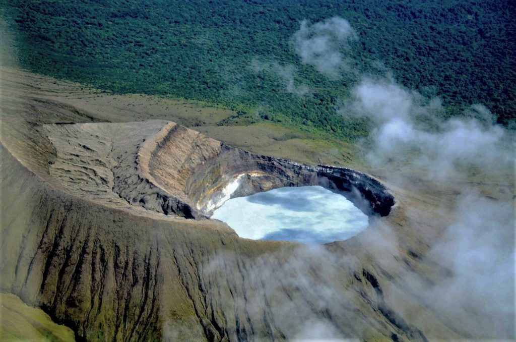
Rincón de la Vieja Volcano
Latitude: 10.83°N;
Longitude: 85.34°W;
Altitude: 1916 m .
Current Activity Level: Warning
Eruptive activity remained low this week with the occurrence of five low-energy exhalations. This eruptive manifestation is rich in water vapor, gases, and volcanic aerosols. Tremor decreased significantly from December 3, but returned to normal levels on December 7. The occurrence of long-period « tornillos » signals continues. The dominant frequency of « tornillos » shows a slight increasing trend since September 2024. In recent days, geodetic stations have detected a slight extension and uplift of the volcano base. The MultiGas station recorded gas ratios of 5.8 ± 0.30 for CO2/SO2 and 0.03 ± 0.01 for H2S/SO2. Over the past week, the average SO2 flux was 491 ± 243 t/d. The last SO2 detection by the TROPOMI Sentinel-5P satellite sensor was on October 19, 2024. Between late October and early November 2024, the waters of the Santuarium thermal spring located 4 km north of the active Rincón crater, are less rich in sulfuric and chlorinated magmatic components compared to the waters collected between 2019 and 2023. This difference is consistent with the fact that during the period 2019-2023, several energetic eruptions occurred with eruptive plumes between 2.5 km and up to 4 km high and ejection of hot rocks and fluids.
Poas Volcano
Latitude: 10.20°N;
Longitude: 84.23°W;
Altitude: 2687 m
Current activity level: Warning
The low-amplitude background tremor persists. Frequent low-frequency, low-amplitude LP (long-period) seismic events are recorded, but to a lesser extent than in previous weeks.
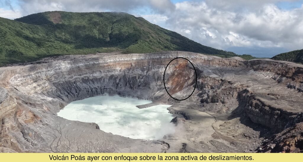
On December 4, a seismic acoustic signal was recorded, most likely related to rock fall from the northeastern wall of the active crater. The scar and deposit of this event were observed as early as December 5 on the Mirador surveillance camera images. Geodetic observations do not detect any significant deformation. The MultiGas station recorded weekly averages of 0.8 ± 0.2 for SO2/CO2 and 0.02 ± 0.03 for H2S/SO2, values similar to the previous week. During the past week, an average flow of 281 ± 105 t/d of SO2 was measured. The last detection of SO2 in the atmosphere by the TROPOMI Sentinel-5P satellite sensor was on November 28. The level of the hyperacid lake has remained stable this week. Its temperature remains above 40°C according to remote measurements. The recent chemistry of the hyperacid lake indicates a decrease in the supply of magmatic gases from the depths to the lake, which is a small window of the large underground hydrothermal system of the Poás.
Source : Ovsicori
Photos : Federico Chavarría-Kopper – Ovsicori , Ovsicori.

