December 09 , 2024.
Indonesia , Dukono :
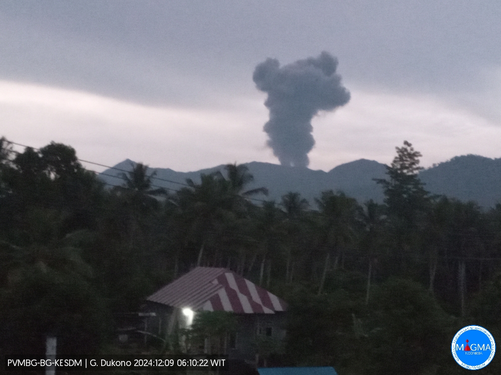
An eruption of Mount Dukono occurred on Monday, 9 December 2024 at 06:04 WIT with the height of the ash column observed at ±1000 m above the summit (±2087 m above sea level). The ash column was observed to be grey to black in colour with a thick intensity, oriented towards the northwest. This eruption was recorded on a seismograph with a maximum amplitude of 20 mm and a duration of 63.98 seconds.
Seismicity Observation:
17 eruption/explosion earthquakes with an amplitude of 4 to 34 mm and a seismic duration of 46.45 to 406.29 seconds.
2 deep tectonic earthquakes with an amplitude of 7-27 mm, and earthquake duration 72.74-112.34 seconds.
1 Continuous Tremor with an amplitude of 3 to 7 mm, dominant value of 4 mm.
Recommendation
(1) People around Mt. Dukono and visitors/tourists are advised not to do any activities, climb or approach the Malupang Warirang Crater within a radius of 3 km.
(2) Since eruptions with volcanic ash occur periodically and the distribution of ash follows the direction and speed of the wind, so the landing area of the ash is not fixed, people around Mount Dukono are advised to always carry masks/nose and mouth covers to use when needed to avoid the threat of volcanic ash on the respiratory system.
Source et photo : Magma Indonésie.
Chile , Laguna del Maule :
Seismology
The seismological activity of the period was characterized by the recording of:
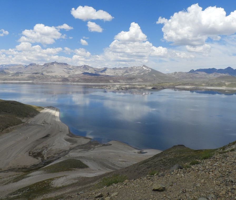
1945 VT type seismic events, associated with rock fracturing (Volcano-Tectonic). The most energetic earthquake had a Local Magnitude (ML) value equal to 2.7, located 6.1 km south-southwest of the center of the lagoon, at a depth of 6.8 km.
1 LP type seismic event, associated with fluid dynamics within the volcanic system (Long Period). The size of the earthquake evaluated from the Reduced Displacement (DR) parameter was equal to 1.6 cm2.
Fluid Geochemistry
No anomalies have been reported in sulfur dioxide (SO2) emissions to the atmosphere in the area near the volcanic complex, according to data published by the Tropopheric Monitoring Instrument (TROPOMI) and Ozone Monitoring Instrument (OMI) Sulfur Dioxide Group.
Satellite thermal anomalies
During the period, no thermal alerts were recorded in the area associated with the volcanic complex, according to the analytical processing of Sentinel 2-L2A satellite images, in combination with false-color bands.
Geodesy
From the geodetic data obtained during the period, magnitudes and displacements similar to those observed historically are observed, these magnitudes being slightly lower than the historical average obtained for this complex; The maximum variation rate reaches 1.17 cm/month at the MAU2 station, located southwest of the center of the lagoon.
Surveillance cameras
The images provided by the fixed camera, installed near the complex, did not record degassing columns or variations related to surface activity.
The activity remained at levels considered low, suggesting stability of the volcanic system. The volcanic technical alert is maintained at:
GREEN TECHNICAL ALERT: Active volcano with stable behavior – There is no immediate risk
Observation:
The area concerned is considered to be that located within a radius of 2 km around the passive CO2 degassing zone.
Source et photo : Sernageomin
Colombia , Nevado del Ruiz :
Manizales, December 3, 2024, 5:30 p.m.
From the monitoring of the activity of the Nevado del Ruiz volcano, the Colombian Geological Survey (SGC), an entity attached to the Ministry of Mines and Energy, reports that:
In the week between November 26 and December 2, 2024, the volcano continued with unstable behavior. Compared to the previous week, the main variations in the monitored parameters were:
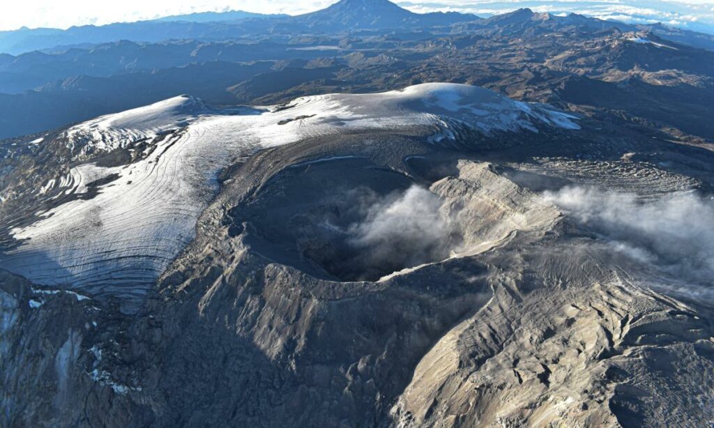
– Increase in seismicity related to fluid dynamics inside volcanic conduits associated with long-period signals and continuous ash emission. This increase began to be observed last Friday, November 29, in the morning and continues until the date of issue of this bulletin. The energy levels of this seismicity have been mainly low to sometimes moderate. Regarding the seismic signals associated with the pulsatile emission of ash, these have decreased in the number of earthquakes recorded and have maintained similar values in the seismic energy released. Thanks to the cameras (conventional or thermographic) used to monitor the volcano and the reports of the managers of the Los Nevados National Natural Park (PNNN), the SGC personnel in field work and the inhabitants of the volcanic influence area, it was possible to achieve the confirmation of the continuous emission of ash recorded in recent days, as well as the pulsatile emissions of ash and the changes in temperature of the emitted material, associated with some of the recorded events.
– Seismic activity associated with the fracturing of rocks inside the volcanic edifice maintained similar levels in the number of earthquakes recorded and increased in the seismic energy released. The earthquakes were located in the Arenas crater and on the different flanks of the volcano, mainly at distances less than 6 km from the crater and up to 12 km from it.
The depths of the events varied between less than 1 km and 7 km from the summit of the volcano. The highest magnitude of the week was 2.1, corresponding to the earthquake recorded on November 28 at 22:45, located in the crater at a depth of 2 km.
– The emission of water vapor and gases, mainly sulfur dioxide (SO₂), into the atmosphere through the Arenas crater was variable although it was observed that the SO₂ degassing rates increased compared to the previous week. In the satellite monitoring carried out, in a complementary manner, to evaluate this parameter, significant SO2 releases into the atmosphere were highlighted.
– The height of the vertical gas column maintained values below 1000 m, measured above the volcanic summit. In dispersion, the height reached values between 2000 and 2400 m during some pulsatile ash emissions recorded in recent days. The direction of dispersion of the gas column showed a preferential trend towards the west side of the volcano (from North-Northwest to Southwest).
– When monitoring thermal anomalies at the bottom of the Arenas crater, from satellite monitoring platforms, some reports of low-energy thermal anomalies were obtained, despite the atmospheric conditions of high cloudiness that continue to prevail in the area.
Source et photo : Ingeominas.
Ecuador , El Reventador :
DAILY REPORT ON THE STATE OF THE REVENTADOR VOLCANO , Sunday, December 08, 2024.
Information Geophysical Institute – EPN.
Surface Activity Level: High , Surface Trend: No Change
Internal Activity Level: Moderate , Internal Trend: No Change
From December 07, 2024, 11:00h to December 08, 2024, 11:00h :
Seismicity:
The count of seismic events recorded at the station is detailed below.
Explosion (EXP) 13
Rainfall / Lahars:
Since yesterday afternoon until the publication of this report, thanks to the satellite and meteorological monitoring system, no rain has been recorded in the areas surrounding the volcano. **In the event of heavy rain, it could remobilize the accumulated materials, generating mud and debris flows that would descend the sides of the volcano and flow into adjacent rivers.
Emissions / Ash Column:
Since yesterday, due to unfavorable weather conditions, it has not been possible to observe gas and ash emissions through surveillance cameras and satellite images. However, the W-VAAC agency has published 1 report on a possible gas and ash emission at 700 m above the crater level in a West-Southwest direction, in the last 24 hours.
Other monitoring parameter:
In the last 24 hours, the FIRMS satellite system has detected 1 thermal anomaly.
Observation:
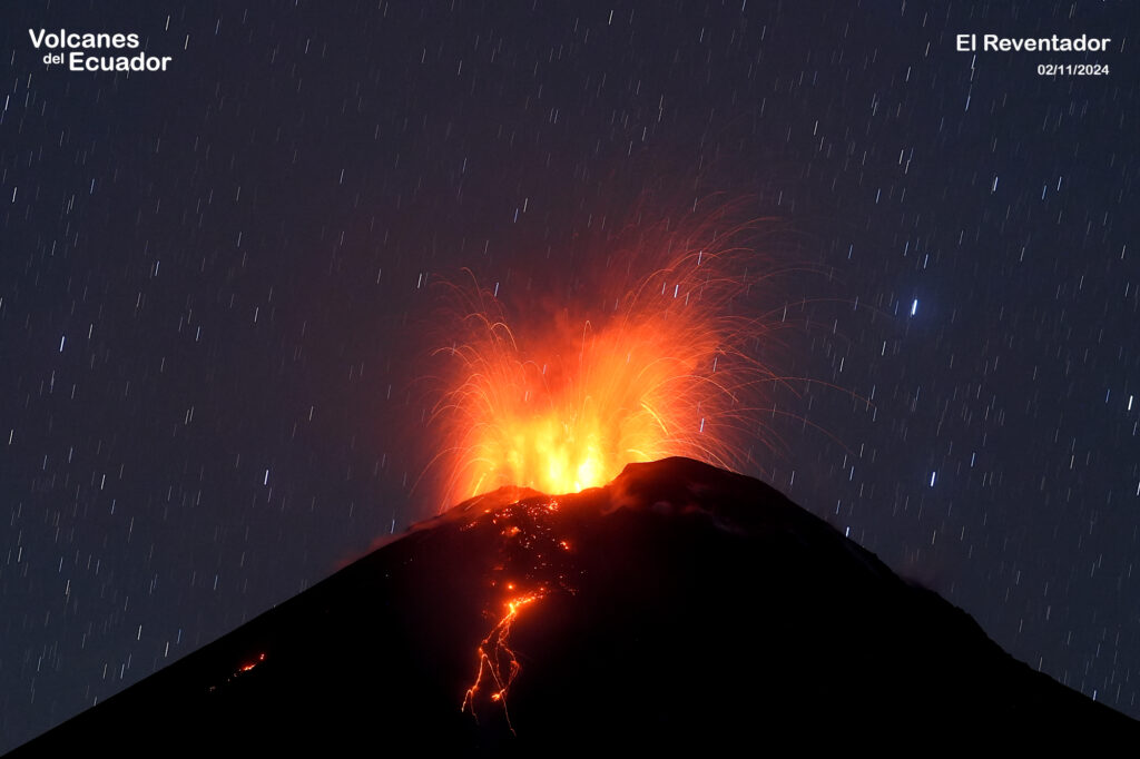
Since yesterday, thanks to the surveillance cameras, several episodes of descents of incandescent materials have been observed that reach between 300 and 800 m below the level of the crater. On the other hand, the volcano has remained cloudy most of the time.
Source : IGEPN
Photo : Benjamin Bernard , Volcanes del equateur , 2/11/2024
Costa Rica , Rincon de la Vieja / Poas :
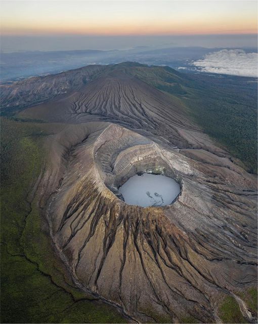
Rincón de la Vieja Volcano
Latitude: 10.83°N;
Longitude: 85.34°W;
Altitude: 1916 m
Current activity level: Warning
Eruptive activity remained low this week with only three low-energy exhalations. This eruptive manifestation is rich in water vapor, gases, and volcanic aerosols. Background tremor decreased significantly starting on December 3 and continues until the date of this report with sporadic occurrence of brief tremors. The occurrence of long-period « tornillo » signals continues. The dominant frequency of « tornillos » shows a similar trend to the previous week. In recent days, geodetic stations have detected a slight extension of the volcano base. The MultiGas station recorded gas ratios of ~3.1 for CO2/SO2 and ~0.1 for H2S/SO2, values within the normal range. Over the past week, the average SO2 flow rate was 407 ± 132 t/d. The last SO2 detection by the TROPOMI Sentinel-5P satellite sensor was on October 19, 2024.
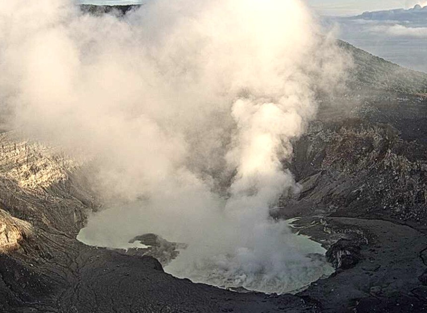
Poas Volcano
Latitude: 10.20°N;
Longitude: 84.23°W;
Altitude: 2687 m
Current activity level: Warning
Seismic tremor remains moderate to low amplitude with a slight decreasing trend this week. Frequent low-frequency, low-amplitude LP (long-period) seismic events are recorded, but to a lesser extent than in previous weeks. Since 29 November, no repetitive short-term tremor events (banded tremors) have been recorded. Occasional short-term tremors are recorded. Geodetic observations do not detect significant deformation. The MultiGas station recorded weekly averages of 0.7 ± 0.2 for SO2/CO2 and 0.01 ± 0.02 for H2S/SO2, similar to the previous week. During the past week, an average flow rate of 176 ± 52 t/d of SO2 was measured. The last detection of atmospheric SO2 by the TROPOMI Sentinel-5P satellite sensor was on 28 November. The level of the hyperacid lake rose by 1.2 m this week, particularly between December 2 and 5. It is at a level similar to October 2023.
Source : Ovsicori.
Photos : Soy Tico , Ovsicori .

