January 07 , 2022 .
Ecuador / Galapagos Islands / Isabella , Wolf :
Wolf volcano eruption – Isabela Island, Galapagos Archipelago
Summary
The Wolf Volcano is located in the northern part of Isabela Island in the Galapagos Archipelago, has a height of 1710 m above sea level and is the highest volcanoes of the islands.
On January 7, 2022, from 00:20 TL (23:20 TL of January 6, 2022 – Galapagos), during monitoring, the start of a new eruption of the Wolf volcano was highlighted. Satellite images show clear thermal anomalies and clouds of gas and ash with varying heights between 1900 and 3800 m elevation from 11:20 p.m. TL Galapagos on January 6, 2022 (12:20 a.m. TL Mainland). These clouds dispersed to the northeast and west. It is also identified that lava flows descend the southern and southeastern flanks of the volcano. There are no populations near or in the direction of the gas and ash clouds that could be affected by this activity.
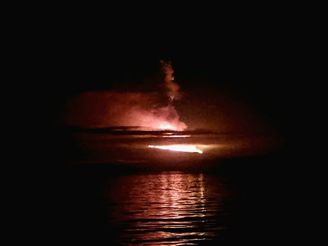
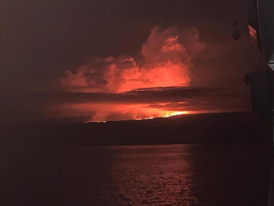
Figure 1. Eruption of the Wolf volcano – Galapagos Islands. In the photo, you can see the incandescence generated by the lava flows on the volcano.
General recommendations
Follow the recommendations of the Galápagos National Park and risk management authorities (SNGRE and GAD). IGEPN is keeping an eye on the new eruption of the Wolf volcano and will report on its evolution.
The interaction between hot lava flows and seawater can cause explosions, so approaching lava flows on entering the sea is not recommended.
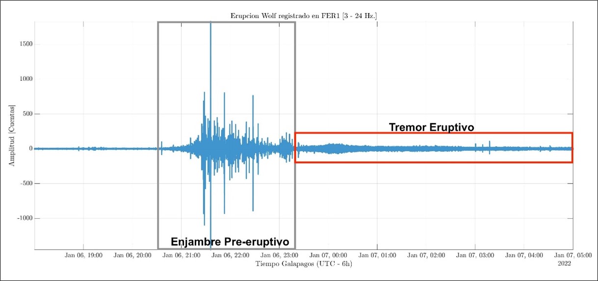
Figure 2. Above: Seismic recording at FER1 station in the Galapagos Islands. In the figure, you can see the pre-eruptive seismic swarm associated with the eruption, at approximately 9:00 p.m. TL Galapagos. The eruptive tremor occurs with low amplitude because the station is located on Fernandina Island. Below: Location of the magnitude 2.4 earthquake.
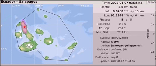
Seismic recording from the FER1 station, located in the Galapagos Islands, shows that starting at around 9:00 p.m. local time in the Galapagos, a seismic swarm occurred (Fig. 2, above). At 9:35 p.m., an earthquake of magnitude 2.4 was recorded, with an epicenter under the Wolf volcano (Fig. 2, above). As of 11:15 PM TL Galapagos, you can see a sign of tremor, probably associated with the onset of the eruption. All of these signals were of low amplitude because the FER1 station is located on Fernandina Island.
Satellite images
Thanks to satellite images (source: GOES16), at 5:20 am UTC on January 7 (TL Galapagos = UTC minus 6 hours) an emission column associated with the eruption has already been identified. The dispersion of the gas cloud and the low ash content predominate to the northeast and west of the volcano. According to alerts issued by the Washington VAAC, the transmitting columns reached varying heights between 1943 and 3,793 meters above sea level. It should be noted that there are no communities near the volcano or in the direction of the ash columns.
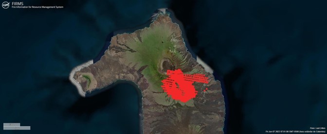
Graph 3. Thermal alerts provided by the FIRMS satellite system. The image shows the location of thermal alerts at the Wolf Volcano. We observe that these alerts accumulate on the southern and southeastern flanks of the volcano.
Likewise, the FIRMS satellite system shows several thermal alerts located on the southern and southeastern flanks of the volcano. These alerts are associated with the high temperatures generated by the lava flows descending from the cracks located on these flanks (Fig. 1 and Fig. 4).
Source : Instituto Geofísico Escuela Politécnica Nacional
Photo : Wilson Cabrera – Parc national des Galapagos. Leandro Vaca y Aura Banda .