November 9 , 2024.
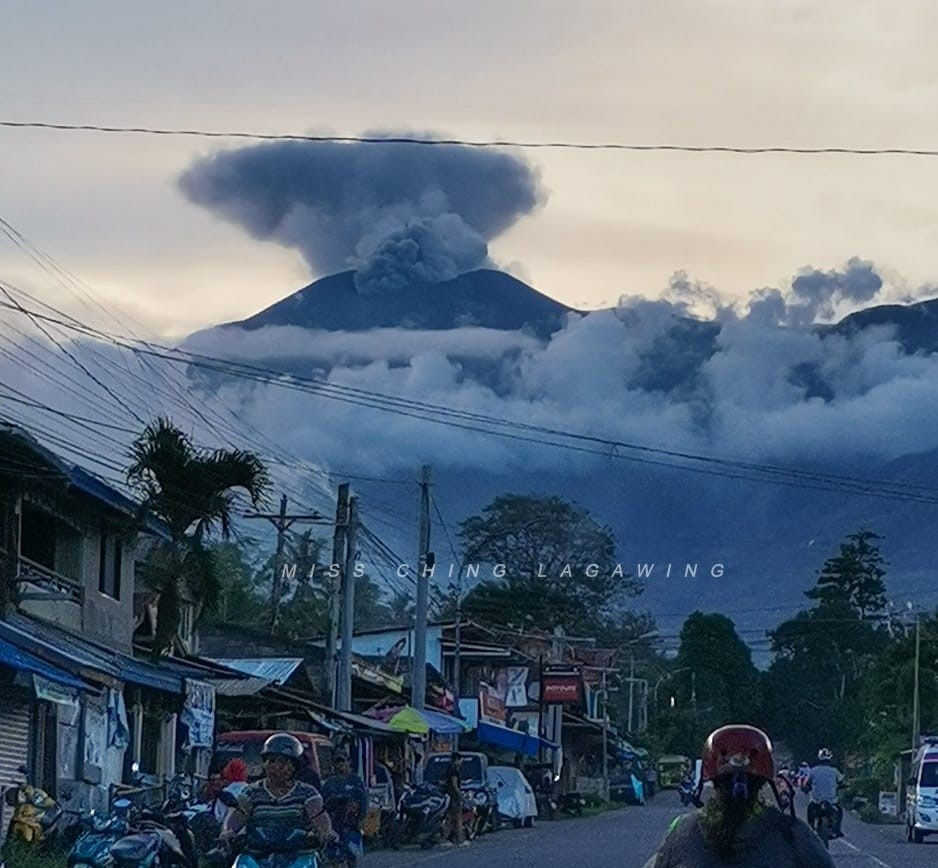
Philippines , Kanlaon :
KANLAON VOLCANO ADVISORY , 09 November 2024 , 10:30 AM
Notice of increased volcanic ash emission events at Kanlaon Volcano.
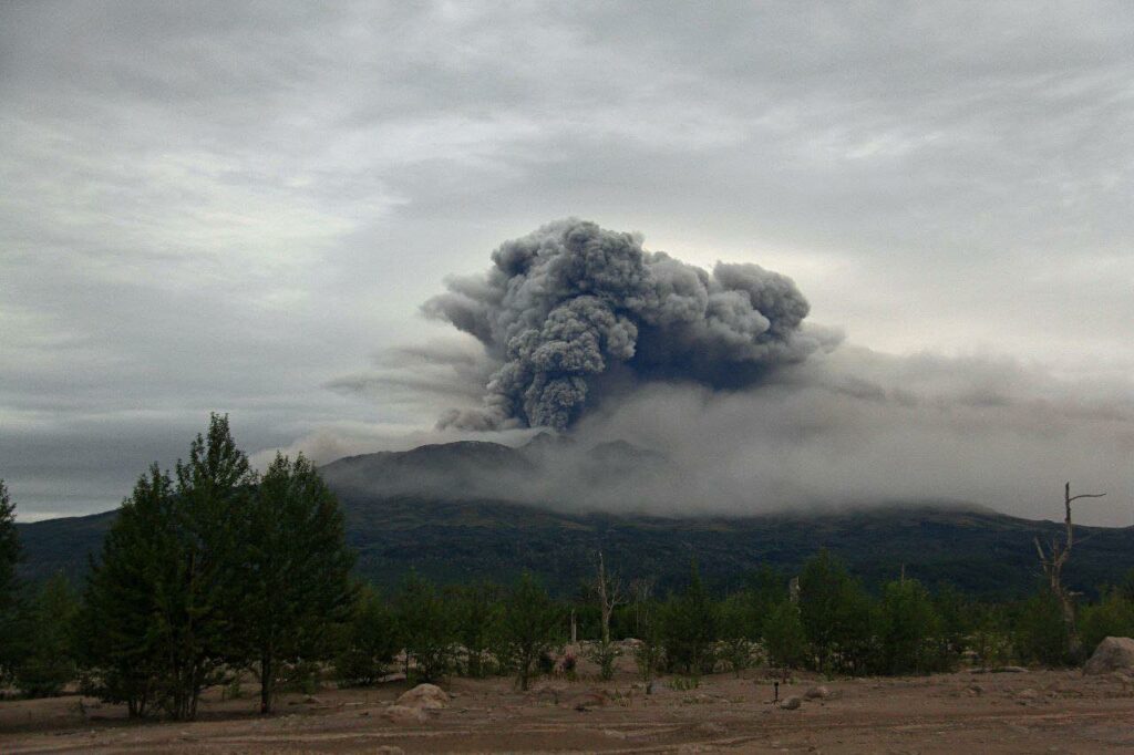
Since 19 October 2024, continuous degassing with occasional weak ash emission has been occurring from the summit crater of Kanlaon Volcano. Visual monitors of the Kanlaon Volcano Network (KVN) have recorded twenty-eight (28) ash emission episodes that lasted four minutes to one hour and eighteen minutes and generated grayish plumes that rose 300 to 800 meters above the summit before drifting to the general west. Ash emission has been generally “quiet” and occured without seismic or infrasound signals. The latest episode occurred this morning between 05:46 AM to 07:02 AM and persisted for one hour and sixteen minutes based on visual observations. The event generated light-gray plumes that rose 750 meters above the crater before drifting southwest. Traces of ash were reported in Sitio Bais, Brgy. Yubo, La Carlota City and Brgy. Sag-ang, La Castellana. Sulfurous fumes were also experienced in Brgy. Yubo and Brgy. Sag-ang. In addition, microscopic examination of ash samples from the 19 October and 2 and 5 November 2024 events revealed an ash composition of mainly pulverized old rock within the edifice and not of material from new magma. Volcanic SO2 emission from the summit crater of Kanlaon based on campaign Flyspec measurements yesterday, 08 November 2024, averaged 4,701 tonnes/day. Kanlaon has been persistently degassing high concentrations of volcanic SO2 with a current average rate of 4,299 tonnes/day since the 3 June 2024 eruption.
The public is reminded that Alert Level 2 (increasing unrest) prevails over Kanlaon, but that current activity at the summit crater may lead to eruptive unrest and an increase in the Alert Level. The public is strongly advised to be ready and vigilant, and to avoid entry into the four (4) kilometer-radius Permanent Danger Zone (PDZ) to minimize risks from volcanic hazards such as pyroclastic density currents, ballistic projectiles, rockfall and others. In case of ash fall events that may affect communities downwind of Kanlaon’s crater, people should cover their nose and mouth with a damp, clean cloth or dust mask. Civil aviation authorities must also advise pilots to avoid flying close to the volcano’s summit as ash and ballistic fragments from sudden eruption can be hazardous to aircraft. Communities living beside river systems on the southern and western slopes, especially those that have already experienced lahars and muddy streamflows, are advised to take precautionary measures when heavy rainfall over the volcano has been forecast or has begun.
DOST-PHIVOLCS maintains close monitoring of Kanlaon Volcano and any new development will be immediately communicated to all concerned stakeholders.
Source : Phivolcs
Photo : Miss Ching Lagawing
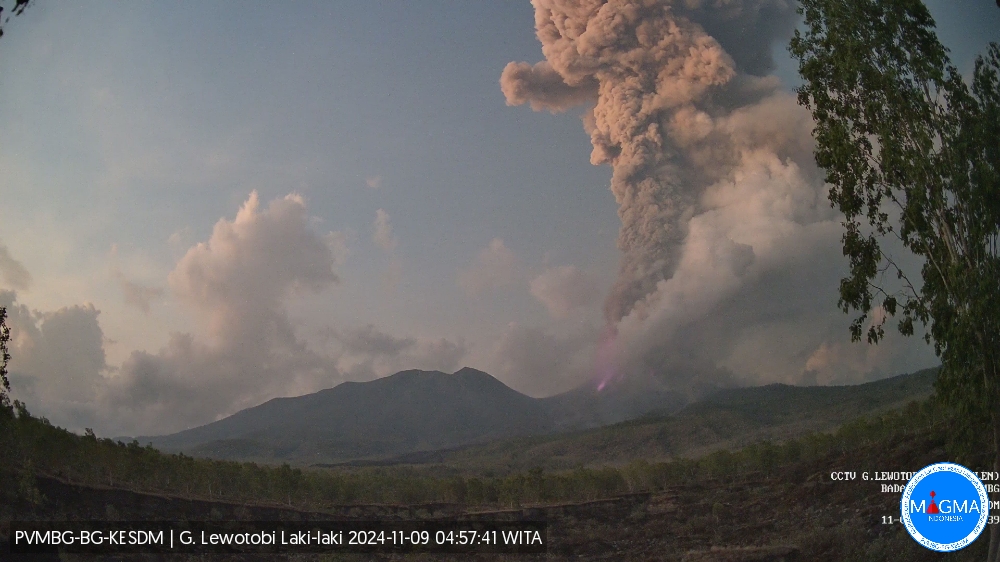
Indonesia , Lewotobi Laki-laki :
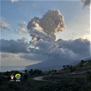
An eruption of Lewotobi Laki-laki occurred on Saturday, 9 November 2024 at 08:50 WITA with the height of the ash column observed at ± 6000 m above the summit (± 7584 m above sea level). The ash column was observed to be grey in colour with a thick intensity, oriented towards the northwest. At the time of writing this report, the eruption was still ongoing.
VOLCANO OBSERVATORY NOTICE FOR AVIATION – VONA
Issued : November 09 , 2024
Volcano : Lewotobi Laki-laki (264180)
Current Aviation Colour Code : RED
Previous Aviation Colour Code : red
Source : Lewotobi Laki-laki Volcano Observatory
Notice Number : 2024LWK740
Volcano Location : S 08 deg 32 min 20 sec E 122 deg 46 min 06 sec
Area : East Nusa Tenggara, Indonesia
Summit Elevation : 5069 FT (1584 M)
Volcanic Activity Summary :
Eruption with volcanic ash cloud at 00h50 UTC (08h50 local).
Volcanic Cloud Height :
Best estimate of ash-cloud top is around 24269 FT (7584 M) above sea level or 19200 FT (6000 M) above summit. May be higher than what can be observed clearly. Source of height data: ground observer.
Other Volcanic Cloud Information :
Ash cloud moving to northwest. Volcanic ash is observed to be gray. The intensity of volcanic ash is observed to be thick.
Remarks :
Eruption recorded on seismogram with maximum amplitude 47.3 mm and maximum duration 291 second
Source et photo : Magma Indonésie .
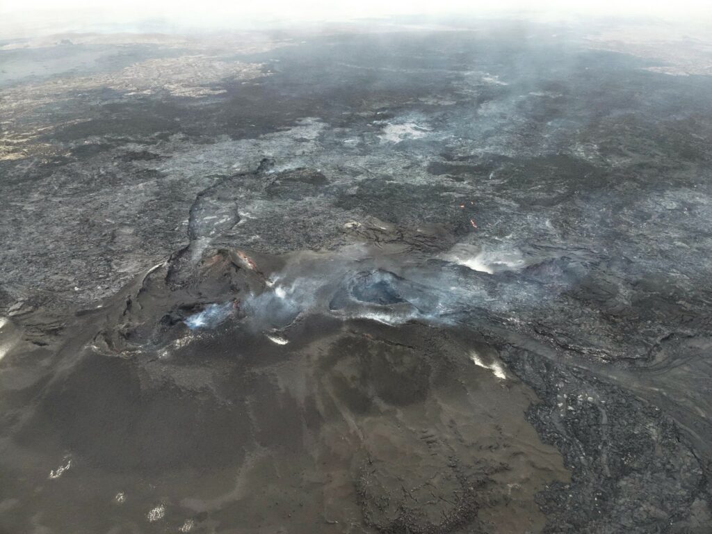
Iceland , Reykjanes Peninsula:
Little seismic activity observed in Sundhnúks crater series since Monday
Land uplift and magma accumulation at Svartsengi continues
Updated 8 November at 14:00
Low seismic activity in Sundhnúks crater series following earthquake on the night of Monday 4 November
The total volume of magma beneath Svartsengi is now about 80% of what accumulated before its eruption on 22 August.
The number of webcams has been increased to better monitor eruptions and lava flows
On the night of Monday 4 November, a short earthquake was recorded in the Sundhnúks crater series. Since then, seismic activity has been low and only five small earthquakes have been recorded after the eruption. However, it is likely that the strong winds of the last few days have affected the ability of the seismic system to detect even the smallest earthquakes in the region.
Land uplift and magma accumulation at Svartsengi continues. The total volume of magma beneath Svartsengi is now about 80% of what was collected before the eruption on 22 August. If the rate of magma accumulation remains unchanged, the volume of magma beneath Svartsengi will be comparable to that which was stored when the last magma flow occurred and the eruption began. However, the Norwegian Meteorological Agency estimates that more must now accumulate beneath Svartsengi to trigger the next magma flow.
Increased number of webcams to monitor transition zone
The Norwegian Meteorological Agency has installed two new webcams. The new cameras are located at the northern and southern ends of the transition zone, at Litla-Skógfell in the north and Húsafjall in the south. Two additional webcams are planned to be installed in the near future. This is done to be able to better monitor possible eruption openings and lava flows in the event of an eruption, but the total length of the area in the Sundhnúks crater series where volcanic fissures are likely to open is about 9 km.
Source : Vedur is
Photo : Ljósmynd: Almannavarnir/Björn Oddsson ,
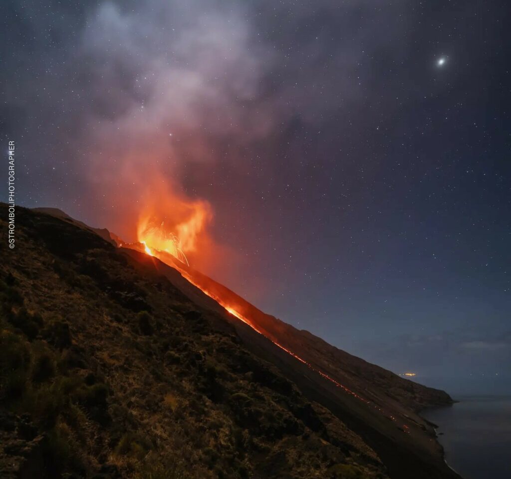
Italy , Stromboli :
Statement on the activity of Stromboli, 08 November 2024, 09:15 (08:15 UTC)
The National Institute of Geophysics and Volcanology, Osservatorio Etneo, communicates that thanks to the analysis of the images of the surveillance cameras, it has been observed that the activity of projections coming from the area of the North crater, reported in the press release of 6 November at 19:26 local time, continues – with variable frequency and intensity. The splashes feed a modest overflow of lava whose front reaches the upper part of the Sciara del Fuoco and causes the rolling of incandescent materials along it and sometimes up to the coast.
Since yesterday afternoon, a gradual increase in volcanic tremor has been observed, which is still ongoing.
Signals from GNSS and inclinometric deformation monitoring networks show no significant variation over the last 12 hours.
Further updates will be communicated shortly.
Source : INGV.
Photo : Stromboli stati d’animo / Sebastiano Cannavo ( 11/10/2024)
Kamchatka , Sheveluch :
VOLCANO OBSERVATORY NOTICE FOR AVIATION (VONA)
Issued: November 09 , 2024
Volcano: Sheveluch (CAVW #300270)
Current aviation colour code: ORANGE
Previous aviation colour code: orange
Source: KVERT
Notice Number: 2024-97
Volcano Location: N 56 deg 38 min E 161 deg 18 min
Area: Kamchatka, Russia
Summit Elevation: 3283 m (10768.24 ft), the dome elevation ~2500 m (8200 ft)
Volcanic Activity Summary:
Strong explosions of Sheveluch volcano continues (Karan lava dome). An ash plume extended about 70 km to the east from the volcano.
An explosive-extrusive eruption of the volcano continues. Ash explosions up to 15 km (49,200 ft) a.s.l. could occur at any time. Ongoing activity could affect international and low-flying aircraft.
Volcanic cloud height:
4500-5000 m (14760-16400 ft) AMSL Time and method of ash plume/cloud height determination: 20241109/0430Z – ARCTICA-M1
Other volcanic cloud information:
Distance of ash plume/cloud of the volcano: 70 km (43 mi)
Direction of drift of ash plume/cloud of the volcano: E / azimuth 101 deg
Time and method of ash plume/cloud determination: 20241109/0430Z – ARCTICA-M1
Source : Kvert
Photo : Viktor Frolov , Institut de volcanologie et de sismologie DVO RAN, @IViS_DVO_RAN ( 08/2024)

