October 12 , 2024.
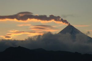
Chile , Puyehue – Cordon Caulle :
Seismology
The seismological activity of the period was characterized by the recording of:
30 VT-type seismic events, associated with rock fracturing (Volcano-Tectonic). The most energetic earthquake had a Local Magnitude (ML) value equal to 1.4, located 5.1 km to the South-Southeast, at a depth of 12.6 km in reference to the 2011 crater.
2 LP-type seismic events, associated with fluid dynamics within the volcanic system (Long Period). The size of the largest earthquake evaluated from the Reduced Displacement (DR) parameter was equal to 3 cm2.
Fluid Geochemistry
No anomalies were reported in sulfur dioxide (SO2) emissions into the atmosphere in the area near the volcanic complex, according to data published by the Tropospheric Monitoring Instrument (TROPOMI) and the Ozone Monitoring Instrument (OMI) Sulphur Dioxide Group.
Thermal anomalies by satellites
During the period, no thermal alerts were recorded in the area associated with the volcanic complex, according to the analytical processing of Sentinel 2-L2A satellite images, in combination with false-color bands.
Geodesy
Geodetic observations, based on 2 operational GNSS stations installed in the studied volcanic area, show continuity in the deformation process, observing in particular:
– Horizontal and vertical displacement rates, with amplitudes equivalent to the previous month, reaching an average vertical speed of 1.38 cm/month for the station closest to the maximum deformation zone previously determined by InSAR.
– The distance between the two stations shows a tendency to lengthen at a constant speed, calculating a variation rate of 0.9 cm/month, which is also associated with the inflationary process recorded by OVDAS since 2017.
Based on the trends and directions of movements in the current period, continuity in the inflationary process is observed, indicating a constant change in pressure and/or volume within the volcanic complex.
Surveillance cameras
The images provided by the surveillance cameras, installed near the volcanic complex, did not record degassing columns or variations related to surface activity.
Satellite geomorphological analysis
A zone of active degassing remains in the laccolith area, adjacent to the emission center of the 2011 eruption, according to the Planet Scope images of September 26, which show this area without snow cover, added to other smaller sectors, which have the same characteristics and are associated with thermal springs. These are also detected by the LandSat 8-9 thermal sensors, which corroborate the fact that these areas have higher temperatures than the surrounding areas.
Monitoring parameters related to activity in the volcanic complex, such as seismicity and geodesic changes, remain at values similar to previous periods. These characteristics allow to deduce the continuity of a volcanic system above its base threshold.
The volcanic technical alert is maintained at:
YELLOW TECHNICAL ALERT: Changes in the behavior of volcanic activity
Source : Sernageomin
Photo : Sernageomin / ANB. ( 5/2024)
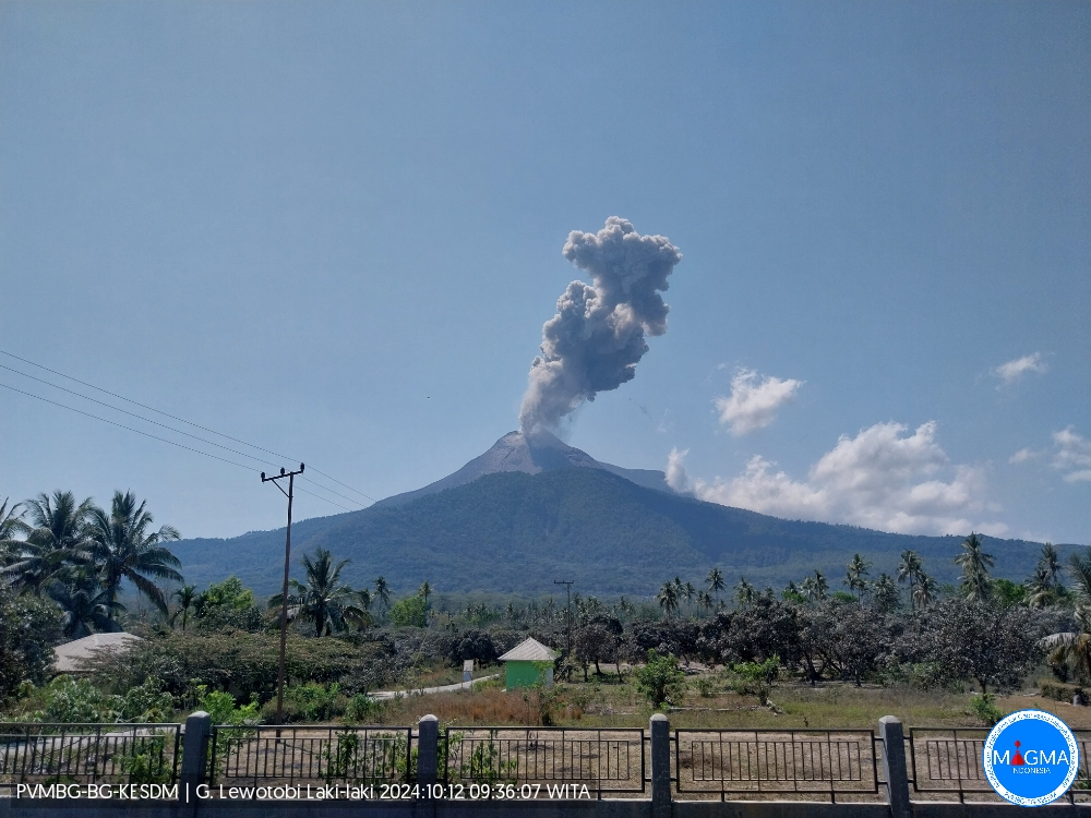
Indonesia , Lewotobi Laki-laki :
An eruption of Lewotobi Laki-laki occurred on Saturday, October 12, 2024 at 09:32 WITA with the height of the ash column observed at ± 900 m above the summit (± 2484 m above sea level). The ash column was observed to be gray in color with a thick intensity, oriented towards the southwest. This eruption was recorded on a seismograph with a maximum amplitude of 8.8 mm and a duration of 274 seconds.
VOLCANO OBSERVATORY NOTICE FOR AVIATION – VONA
Issued : October 12 , 2024
Volcano : Lewotobi Laki-laki (264180)
Current Aviation Colour Code : ORANGE
Previous Aviation Colour Code : orange
Source : Lewotobi Laki-laki Volcano Observatory
Notice Number : 2024LWK621
Volcano Location : S 08 deg 32 min 20 sec E 122 deg 46 min 06 sec
Area : East Nusa Tenggara, Indonesia
Summit Elevation : 5069 FT (1584 M)
Volcanic Activity Summary :
Eruption with volcanic ash cloud at 01h32 UTC (09h32 local).
Volcanic Cloud Height :
Best estimate of ash-cloud top is around 7949 FT (2484 M) above sea level or 2880 FT (900 M) above summit. May be higher than what can be observed clearly. Source of height data: ground observer.
Other Volcanic Cloud Information :
Ash cloud moving to southwest. Volcanic ash is observed to be gray. The intensity of volcanic ash is observed to be thick.
Remarks :
Eruption recorded on seismogram with maximum amplitude 8.8 mm and maximum duration 279 second.
Source et photo : Magma Indonésie.
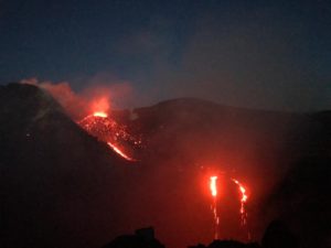
Colombia , Puracé – Los Coconucos volcanic chain :
Popayán, October 8, 2024, 3:30 p.m. .
From the monitoring of the activity of the Puracé volcano – Los Coconucos volcanic chain, the Colombian Geological Survey (SGC), an entity attached to the Ministry of Mines and Energy, reports that:
During the week of October 1 to 7, seismic activity continued to register a significant number of events. The seismicity associated with fluid dynamics inside the volcano presented energy levels similar to those observed the previous week and was located under the building of the Puracé volcano, at depths of less than 1 km. In particular, the tremor-type activity presented a period of predominance between October 1 and 2.
Seismicity related to rock fracturing (type VT) did not show notable amplitudes and was mainly concentrated near the crater of the Puraé volcano, as well as under the Piocollo volcano, with depths up to 3 km.
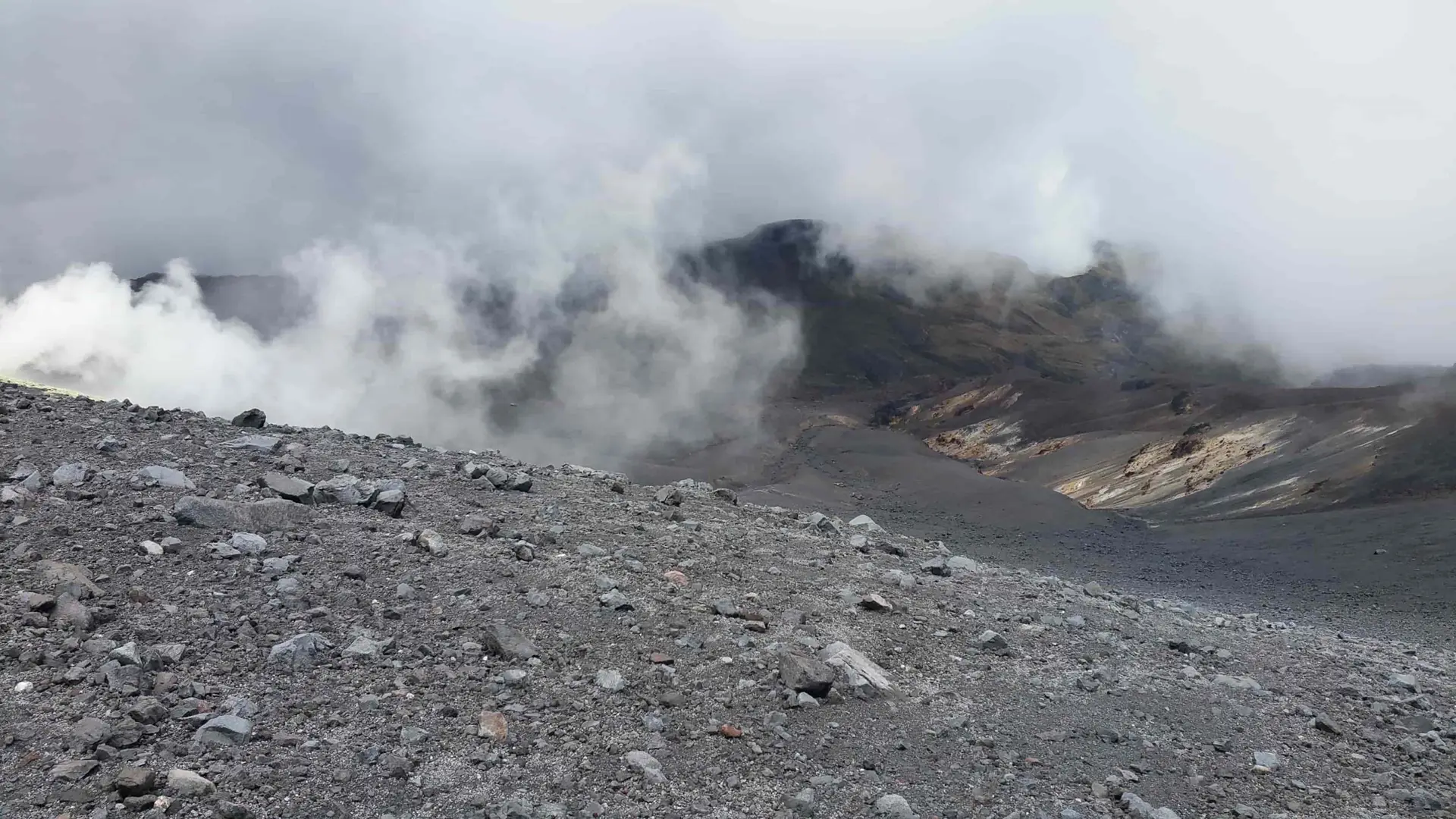
In addition, the slow deformation process that began in April 2022 on the Puracé volcano continued to be recorded. On the other hand, the monitoring of volcanic gases, electromagnetic fields and acoustic sensors did not show significant variations. Regarding the images captured by the installed cameras, it was observed that high degassing was maintained in the lateral fumarole and in the crater.
Based on the above, the SGC recommends carefully monitoring the evolution of volcanic activity through weekly bulletins and other information published in the
official channels, as well as complying with the instructions of local and departmental authorities and the National Disaster Risk Management Unit (UNGRD).
The state of alert for volcanic activity remains in yellow alert: active volcano with changes in the behavior of the base level of the monitored parameters and other manifestations.
Source : SGC
Photo : Angel on travel ( 5/2024)
Costa Rica , Rincon de la Vieja / Poas :
Rincón de la Vieja Volcano
Latitude: 10.83°N;
Longitude: 85.34°W;
Altitude: 1916 m
Current activity level: Warning
This week, 4 expirations and one eruption were recorded. This activity is rich in water vapor, aerosols and volcanic gases. None of these generated lahars or ash descent. The most energetic eruption this week occurred on October 10 at 06:32. The background tremor remains weak and stable. Sometimes, a variation in the dominant frequency of the tremor, of the slip type, is observed. Sporadic volcano-tectonic earthquakes of low magnitude are recorded near the summit, associated with rock breakage. The appearance of long-period signals and « tornillos » type signals continues. The dominant trend of « tornillos » has started to decrease during this week. When there is visibility, the degassing of the crater is quite regular and constant. In recent weeks, a slight contraction and subsidence of the base of the volcanic edifice as well as a slight elevation of the summit station have been detected. The MultiGas station recorded low gas concentrations this week due to the wind direction. Likewise the NOVAC station regarding SO2 fluxes. An accumulation of SO2 in the atmosphere is observed without any possible measurement by the Sentinel-5P satellite on October 5, 7 and 8.
Poas Volcano
Latitude: 10.20°N;
Longitude: 84.23°W;
Altitude: 2687 m
Current activity level: Warning.
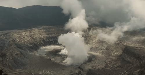
Moderate amplitude seismic tremor remains very stable. Almost no acoustic tremor is recorded. Low-frequency, low-amplitude LP-type seismic events are recorded. Short tremors have been recorded, but in fewer numbers than last week. Geodetic observations do not detect any significant deformation. The MultiGas station recorded low gas concentrations this week due to the wind direction, the SO2/CO2 ratio continues to decrease. The NOVAC station also did not record any representative SO2 flux. The last detection of the SO2 plume in the atmosphere by the Sentinel-5P satellite dates back to September 7. The lake level continues to rise, during the week it increased by about 0.2 m.
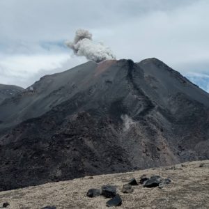
Source : Ovsicori
Photos : Ovsicori ( 3/2023) , ( 10/2024).
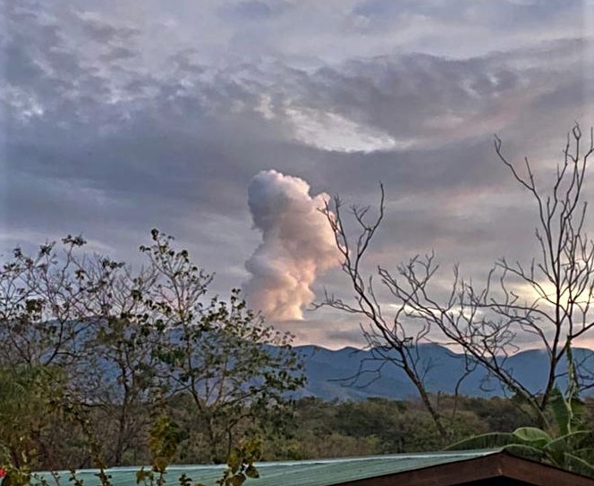
Mexico , Popocatepetl :
October 11, 11:00 (October 11, 17:00 GMT)
Activity of the last 24 hours
27 exhalations were detected, accompanied by water vapor, volcanic gases and sometimes light amounts of ash. In addition, 63 minutes of high-frequency and very low-amplitude tremor segments were recorded.
Yesterday, the National Center for Communication and Civil Protection Operations (CENACOM) reported a light ash fall in the municipality of Hueyapan, state of Morelos.
Since the morning and at the time of this report, there is visibility in the direction of the volcano. During the last hours, continuous emissions of volcanic gases and sometimes ash have been observed, in a South-Southwest direction.
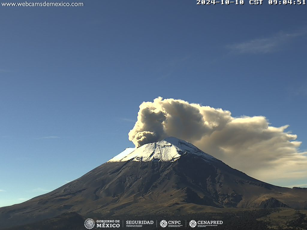
The Popocatépetl volcanic fire alert is in yellow phase 2.
The scenarios predicted for this phase are:
Some small to moderate explosions
Occurrence of tremors of varying amplitude
Light to moderate ash rains in the surrounding towns and in some more distant towns
Ejection of incandescent fragments within the 12-kilometer exclusion radius
The occurrence of lahars can be expected to descend into the ravines, due to the accumulation of ash on the slopes and its interaction with the rains expected in the coming weeks.
Possibility of pyroclastic flows not reaching the populations.
Source : Cenapred .