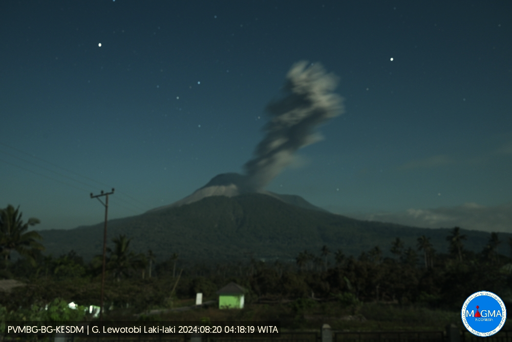
August 20 , 2024.
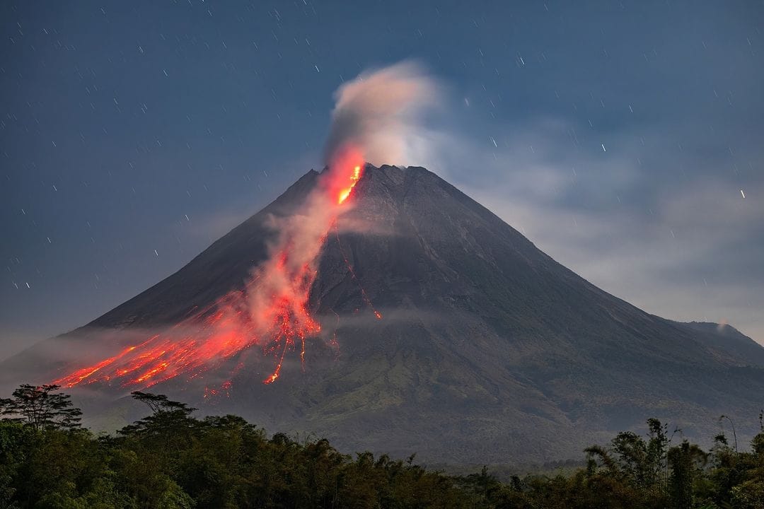
Indonesia , Lewotobi Laki-laki :
An eruption of Mount Lewotobi Laki-Laki occurred on Tuesday, 20 August 2024, at 04:14 WITA with the height of the ash column observed at ±500 m above the summit (±2084 m above sea level). The ash column was observed to be gray with moderate intensity, oriented to the southwest. This eruption was recorded on a seismograph with a maximum amplitude of 5.9 mm and a duration of 258 seconds.
VOLCANO OBSERVATORY NOTICE FOR AVIATION – VONA
Issued : August 19 , 2024
Volcano : Lewotobi Laki-laki (264180)
Current Aviation Colour Code : ORANGE
Previous Aviation Colour Code : orange
Source : Lewotobi Laki-laki Volcano Observatory
Notice Number : 2024LWK386
Volcano Location : S 08 deg 32 min 20 sec E 122 deg 46 min 06 sec
Area : East Nusa Tenggara, Indonesia
Summit Elevation : 5069 FT (1584 M)
Volcanic Activity Summary :
Eruption with volcanic ash cloud at 20h14 UTC (04h14 local).
Volcanic Cloud Height :
Best estimate of ash-cloud top is around 6669 FT (2084 M) above sea level or 1600 FT (500 M) above summit. May be higher than what can be observed clearly. Source of height data: ground observer.
Other Volcanic Cloud Information :
Ash cloud moving to southwest. Volcanic ash is observed to be gray. The intensity of volcanic ash is observed to be medium.
Remarks :
Eruption recorded on seismogram with maximum amplitude 5.9 mm and maximum duration 258 second.
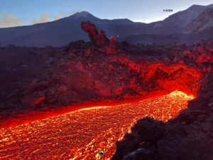
Source et photo : Magma Indonésie.
Chile , Laguna del Maule :
Special Report on Volcanic Activity (REAV), Maule Regions, Laguna del Maule Volcanic Complex, August 19, 2024, 05:45 local time (Continental Chile)
The National Geology and Mining Service of Chile (Sernageomin) announces the following PRELIMINARY information, obtained through the monitoring equipment of the National Volcanic Monitoring Network (RNVV), processed and analyzed at the Southern Andean Volcano Observatory (Ovdas):
On Monday, August 19 at 04:46 (08:46 UTC), the monitoring stations installed near the Laguna del Maule volcanic complex recorded a volcano-tectonic seismic swarm (associated with rock fracturing). At the time of issuing this report, there are more than 110 classified events.
The characteristics of the largest earthquake after its analysis are as follows:
TIME OF ORIGIN: 04:46 local time (08:46 UTC)
LATITUDE: 36.087° S
LONGITUDE: 70.482° West
DEPTH: 7.3 km
LOCAL MAGNITUDE: 3.0 (ML)
Observation:
In parallel with the event of greater magnitude, an increase in the volcano-tectonic activity of lower energy is recorded, which, at the time of issuing this report, continues to be observed in lower energy.
The volcanic technical alert is maintained at level GREEN.
Source et photo : Sernageomin
Photo : OAVV
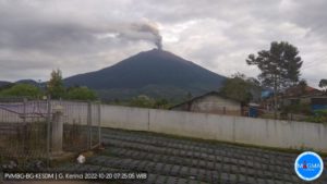
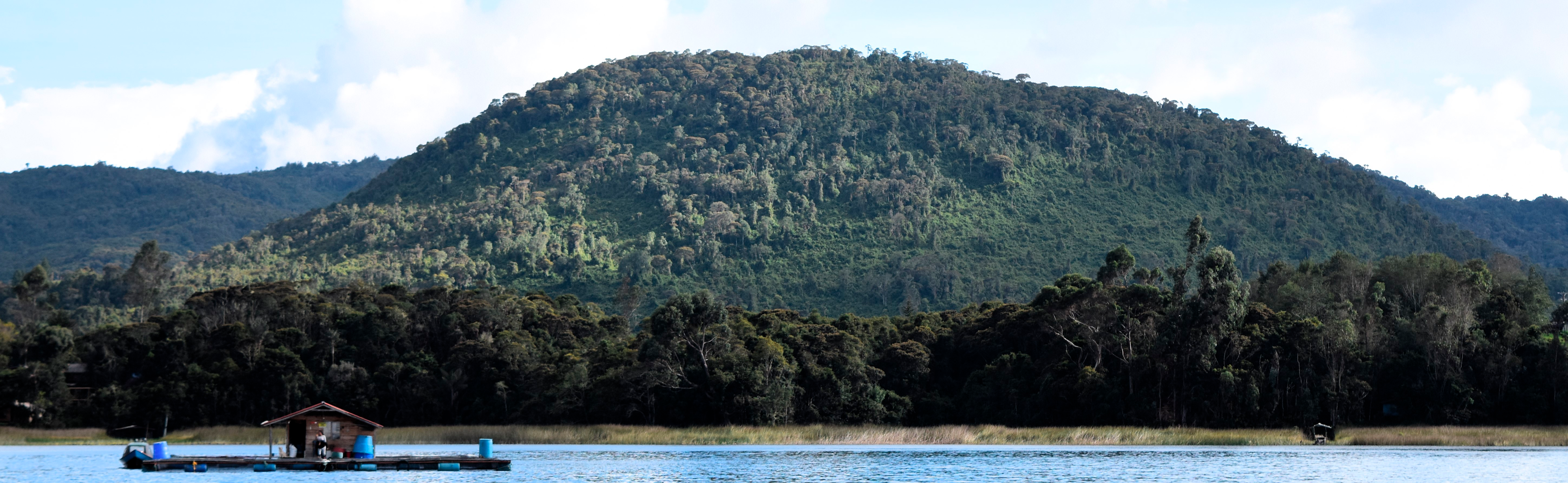
Colombia , Champ volcanique de Guamuez – Sibundoy :
Guamuez – Sibundoy Volcanic Field , Activity reported from August 15 to 17, 2024.
Since Thursday, August 15 and until the time of publication of this bulletin, seismic activity associated with the fracturing of rocks within the crust has been recorded in the area of La Cocha Lagoon (Nariño department). In this same sector there are some volcanoes that make up the Guamuez – Sibundoy volcanic field.
These volcanoes have different characteristics from volcanoes such as Nevado del Ruiz, Galeras, Nevado del Huila or Puracé. They are characterized by the fact that they only erupt once and other volcanoes form in the same area, thus forming a volcanic field, unlike the other types of volcanoes mentioned, where the magma normally comes out of the same place (crater) and many eruptions can occur several times.
In addition, in this sector there are also important geological faults that can interact with the presence of volcanoes.
In total, during the period evaluated, 439 earthquakes occurred in this sector of the volcanic field. Among them, seven events with a magnitude greater than or equal to 2.0 stand out, and the event that occurred today, August 17, 2024 at 8:21 a.m. with a magnitude of 3.4, located 14 km southwest of the city of Santiago (Putumayo), and reported as being felt in the area surrounding the La Cocha lagoon, in the municipality of Santiago and in the city of Pasto.
It is important to mention that since there has been an instrumental record, seismicity has occurred in this same sector (2011), but not in the number of earthquakes recorded in recent days. There is also a record of historical seismicity with earthquakes of considerable magnitude in the region of the volcanic field, such as the earthquake of 1834, with an estimated magnitude of 6.7.
Based on the above, the SGC recommends to closely monitor the evolution of this activity through the information published through our official channels.
The activity in the volcanic field remains in a state of GREEN alert: at rest
Source et photo : SGC
Indonesia , Merapi :
MOUNT MERAPI ACTIVITY REPORT, August 09-15, 2024
Published on August 16, 2024
OBSERVATION RESULT
Visual
The weather around Mount Merapi is generally clear in the morning and night, while it is foggy from noon to evening. White smoke, thin to thick, low to moderate pressure and 150 m high was observed from Mount Merapi Babadan observation post on August 13, 2024 at 05:25 WIB. This week, 1 hot avalanche cloud descended towards the southwest (upstream of the Bebeng River) with a maximum sliding distance of 1,000 m. Lava avalanches were observed 289 times upstream of Bebeng River with a maximum distance of 1,900 m, 1 time upstream of Boyong River with a maximum distance of 1,000 m, and 1 time upstream of Batang River with a maximum distance of 1,500 m. The sound of avalanches was heard 14 times from Kaliurang station with low to moderate intensity. It was observed that the morphology of the southwest dome had changed due to dome growth activities and lava avalanches. The highest hot spot was observed at 243 °C, which was lower than the previous measurement temperature. For the morphology of the middle dome, a slight morphological change was observed but it was not significant. The highest hot spot was observed at 218.6 °C, which was relatively the same as the previous measurement temperature. Based on the analysis of aerial photos, the volume of the South-West dome was measured at 2,671,500 m3 and that of the central dome at 2,366,900 m3.
Seismicity
This week, the seismicity of Mount Merapi recorded
1 hot cloud avalanche (HCA) earthquake,
11 shallow volcanic earthquakes (VTB),
40 multi-phase (MP) earthquakes,
6 low-frequency (LF) earthquakes,
936 avalanche (RF) earthquakes,
13 tectonic earthquakes (TT).
The intensity of earthquakes this week is higher than last week.
Deformation
The deformation of Mount Merapi monitored by EDM this week shows an average shortening rate of 0.2 cm/day, lower than last week.
Rainfall and lahars
This week, there was no rain at the Mount Merapi observation post and no additional flow or lava was reported in the rivers that originate on Merapi.
Conclusion
Based on the results of visual and instrumental observations, it was concluded that:
The volcanic activity of Mount Merapi is still quite high in the form of effusive eruptive activity.
The activity status is set at the « SIAGA » level.
Source : BPPTG
Photo : Merapi news FB ( 26/07/2024).
Guatemala , Fuego :
Altitude: 3,763 meters.
Atmospheric conditions: Clear.
Wind: East.
Precipitation: 42.0 mm.
Activity:
At night and early in the morning, explosions were observed, weak, moderate and some strong, at intervals of 6 to 10 per hour, with ash columns between 4,500 and 4,800 meters above sea level (14,763 – 15,748 feet) moving towards the West, Southwest, for about 30 km. Ash falls are reported in the villages of Panimaché, Morelia, Santa Sofía, Yucales, El Porvenir, Yepocápa, with a probability of spreading to Santa Lucia Cotz and others in this area.
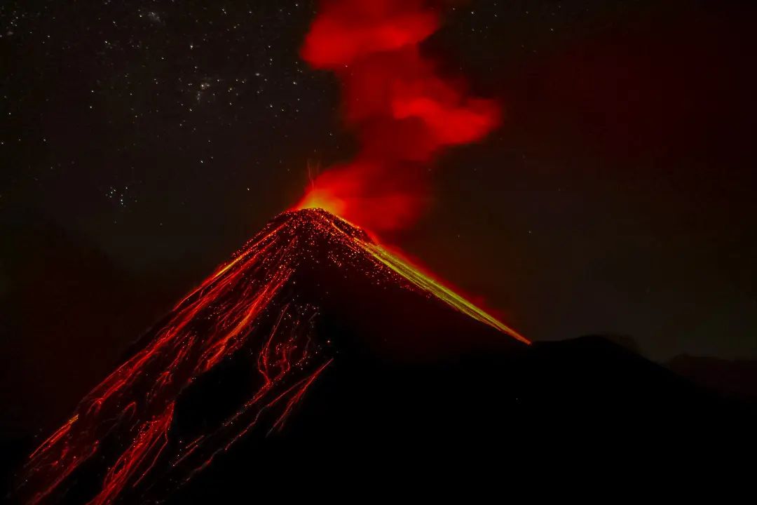
Moderate and strong explosions generate degassing sounds similar to those of aircraft turbines and train locomotives for up to 2 minutes. Strong explosions can eject ballistic elements onto the plateau, making it dangerous to climb and/or stay there. Take into account that in the afternoon and at night, moderate to heavy rains are generated in the volcanic area, so lahars may continue to be generated. It is recommended to take precautions when passing vehicles over rivers and ravines around the volcano.
Source : Insivumeh
Photo : Desnivel Tour