July 20 2024 .
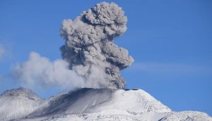
Alaska , Shishaldin :
Low-level unrest continues at Shishaldin Volcano. Occasional small volcanic earthquakes, seismic tremor, and periods of infrasound were detected. Web camera images of the volcano show a persistent weak steam plume at the summit. Sulfur dioxide emissions were seen in satellite data on two days. Such activity has characterized the post-eruption period of unrest over the past several months.
Minor rock falls associated with collapse events from the unstable ground in and near the summit crater may generate small clouds of fine-grained dust that dissipate quickly near the summit. No significant eruptive activity has occurred since November 2023.
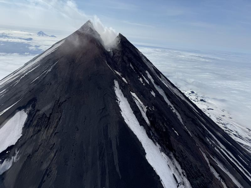
Shishaldin east flanc. Pogromni (Westdahl) in the background.
This week, an AVO field crew performed repairs to the monitoring network and installed a new webcam, which can be viewed here: https://avo.alaska.edu/webcam/view/1401
Local seismic and infrasound sensors, web cameras, and a geodetic network are used to monitor Shishaldin Volcano. In addition to the local monitoring network, AVO uses nearby geophysical networks, regional infrasound and lighting data, and satellite images to monitor the volcano.
Source : AVO
Photo : Boyce, Ellie Jul 18th, 2024.
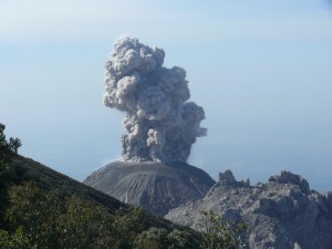
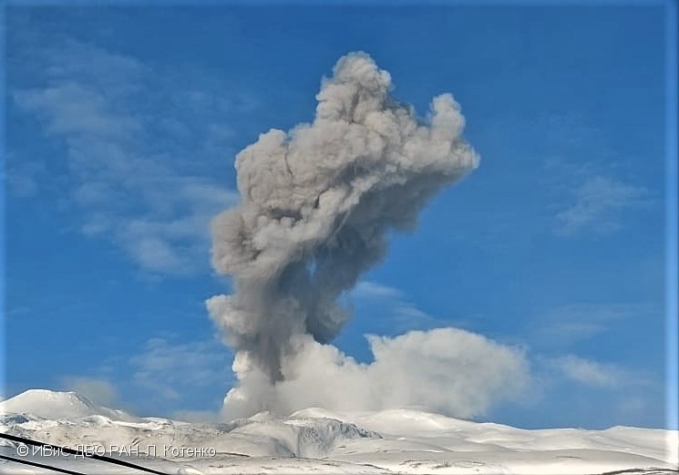
Russia / Kuril Islands , Ebeko :
VOLCANO OBSERVATORY NOTICE FOR AVIATION (VONA)
Issued: July 20 , 2024
Volcano: Ebeko (CAVW #290380)
Current aviation colour code: ORANGE
Previous aviation colour code: orange
Source: KVERT
Notice Number: 2024-40
Volcano Location: N 50 deg 41 min E 156 deg 0 min
Area: Northern Kuriles, Russia
Summit Elevation: 1156 m (3791.68 ft)
Volcanic Activity Summary:
A moderate explosive eruption of the volcano continues. According to visual data from Severo-Kurilsk, an explosion sent ash up to 2.5 km a.s.l., and an ash cloud drifted to the east of the volcano.
A moderate explosive eruption of the volcano continues. Ash explosions up to 6 km (19,700 ft) a.s.l. could occur at any time. Ongoing activity could affect low-flying aircraft and airport of Severo-Kurilsk.
Volcanic cloud height:
2000-2500 m (6560-8200 ft) AMSL Time and method of ash plume/cloud height determination: 20240720/0420Z – Visual data
Other volcanic cloud information:
Distance of ash plume/cloud of the volcano: 5 km (3 mi)
Direction of drift of ash plume/cloud of the volcano: E
Time and method of ash plume/cloud determination: 20240720/0430Z – Visual data
Source : Kvert
Photo : L. Kotenko, IVS FEB RAS ( archive , mars 2023 )
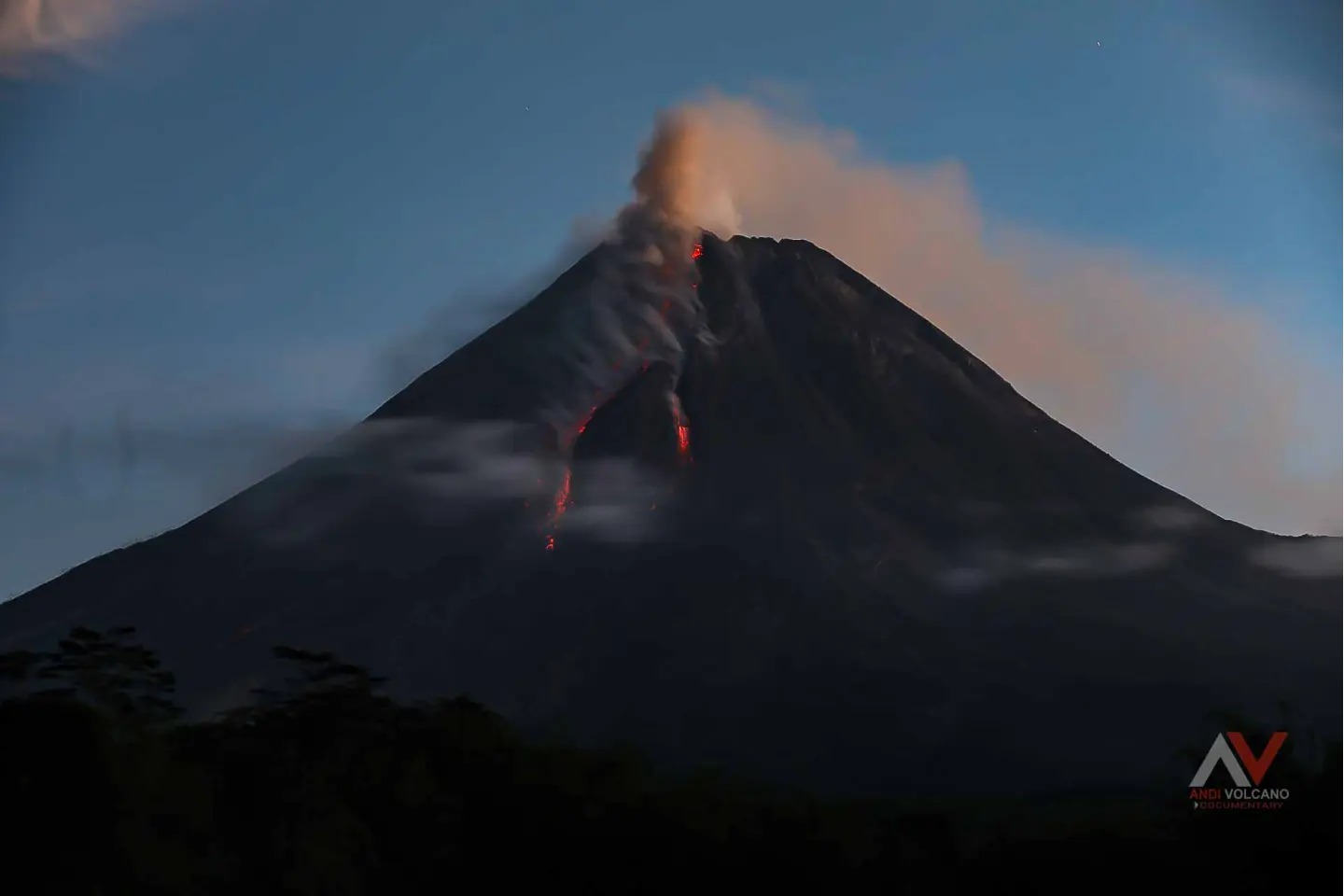
Indonesia , Merapi :
MOUNT MERAPI ACTIVITY REPORT July 12 – 18, 2024. Published on July 19, 2024.
OBSERVATION RESULT
Visual
The weather around Mount Merapi is generally clear in the morning and night, while it is foggy from noon to evening. White smoke, thin to thick, low to moderate pressure and 200 m high was observed from the observation post of Mount Merapi Babadan on July 12, 2024 at 1:43 p.m. WIB. This week, lava avalanches were observed 177 times upstream of the Bebeng River up to a maximum of 2,000 m and once upstream of the Bebeng River up to 1,100 m. The sound of avalanches was heard 13 times from Kaliurang and Babadan posts with low to moderate intensity.
It was observed that the morphology of the southwest dome had changed due to dome growth activities and lava avalanches. The highest hot spot was observed at 244.9°C, which was higher than the previous measurement temperature. For the morphology of the medial dome, no significant changes were observed. The highest hot spot was observed at 218.5°C, lower than the previous measurement temperature. Based on the analysis of aerial photos, the volume of the southwest dome was measured at 2,516,600 m3 and that of the central dome at 2,360,700 m3.
Seismicity
This week, the seismicity of Mount Merapi recorded:
16 shallow volcanic earthquakes (VTB),
67 multi-phase (MP) earthquakes,
4 low frequency (LF) earthquakes,
575 avalanche earthquakes (RF),
7 tectonic earthquakes (TT).
The intensity of earthquakes this week is lower than last week.
Deformation
The deformation of Mount Merapi monitored by EDM this week shows an average shortening rate of 0.4 cm/day, lower than last week.
Rain and lahars
This week there was no rain at the Mount Merapi lookout and no additional flow or lava was reported in the rivers originating on Mount Merapi.
Conclusion
Based on the results of visual and instrumental observations, it was concluded that:
Volcanic activity at Mount Merapi is still quite high in the form of effusive eruptive activity.
The activity status is set to the “SIAGA” level.
Source : BPPTKG
Photo : Andi Volcanist .
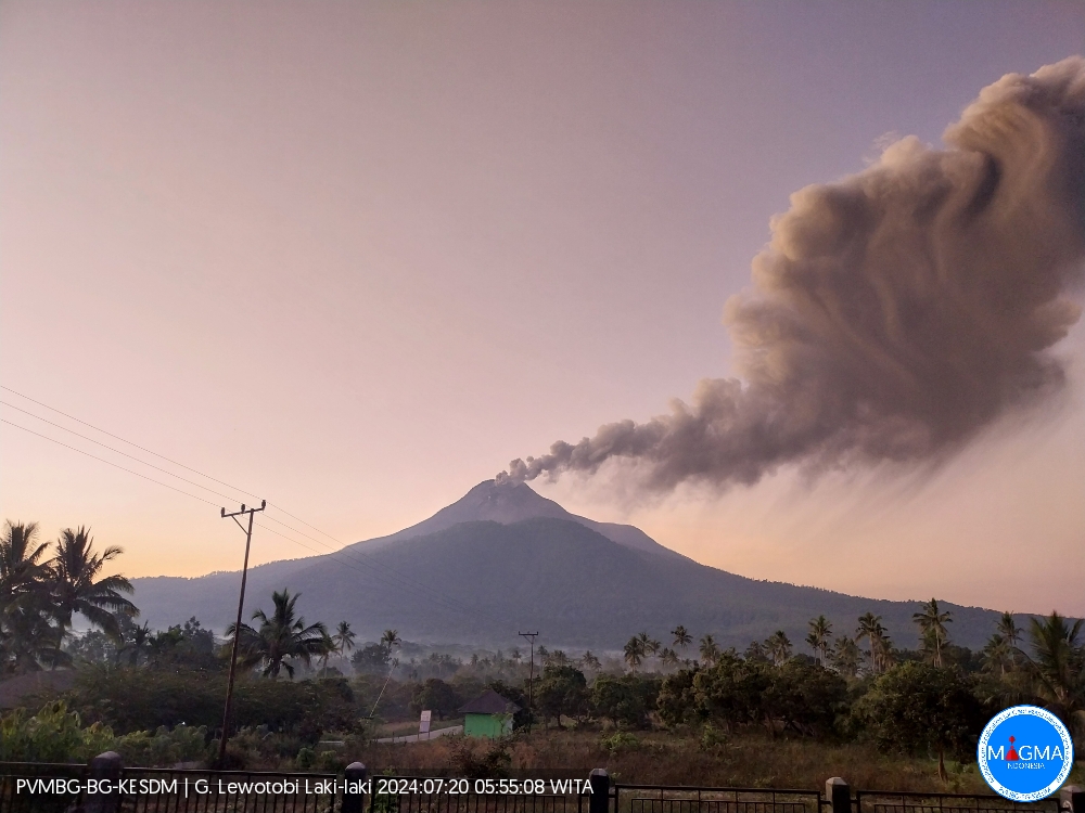
Indonesia , Lewotobi Laki-laki :
The eruption of Mount Lewotobi Laki-laki occurred on Saturday July 20, 2024 at 05:46 WITA with the height of the ash column observed at ± 300 m above the summit (± 1884 m above the level of the sea). The ash column was observed to be gray with thick intensity, oriented towards the South-West and West. At the time of writing, the eruption was still ongoing.
SEISMICITY OBSERVATIONS
1 emission earthquake with an amplitude of 3.7 mm and duration of the earthquake of 63 seconds.
1 Low frequency earthquake with an amplitude of 5.1 mm and an earthquake duration of 53 seconds.
1 Shallow volcanic earthquake with an amplitude of 2.9 mm and an earthquake duration of 7 seconds.
1 Deep volcanic earthquake with an amplitude of 5.9 mm, and an earthquake duration of 8 seconds.
1 Distant tectonic earthquake with an amplitude of 2.9 mm, and duration of the earthquake of 65 seconds.
RECOMMENDATION
1. Communities around Lewotobi Laki-laki and visitors/tourists do not carry out any activities within a radius of 3 km from the eruption center of Lewotobi Laki-laki and Lewotobi Perempuan and 4 km in the North-North direction -West and South-South-East of the eruption center.
2. The public should remain calm and follow the instructions of the regional government and not believe rumors whose origin is unclear.
Source et photo : Magma Indonésie.
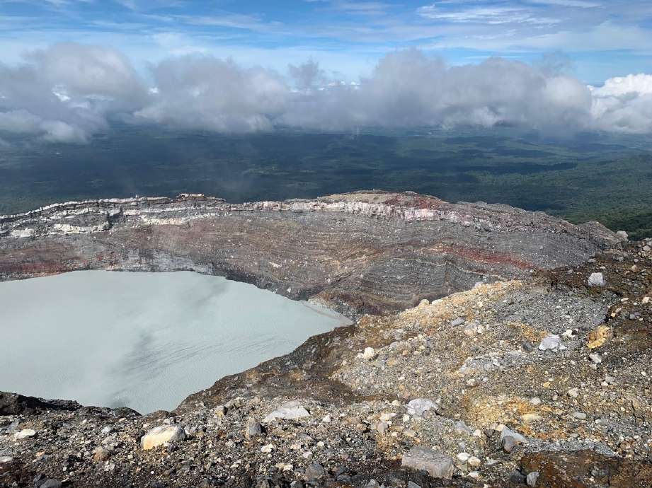
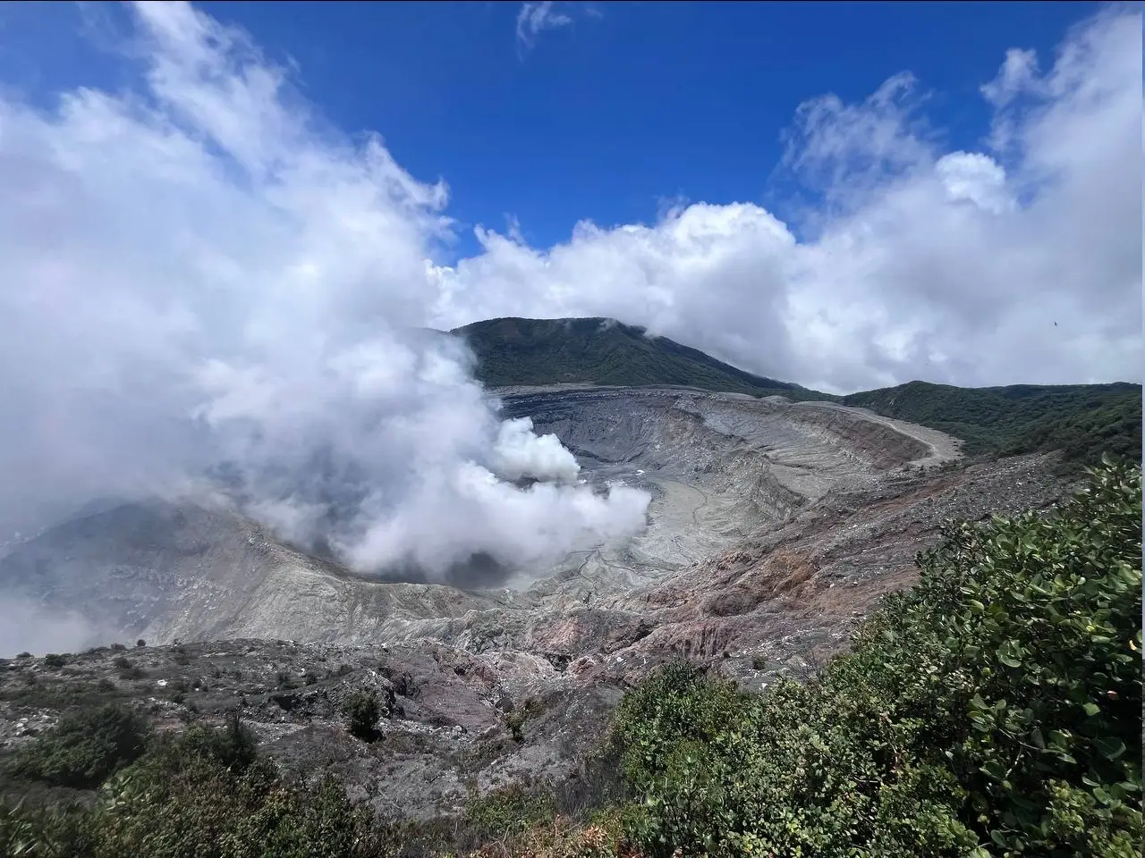
Costa Rica , Rincon de la Vieja / Poas :
Rincón de la Vieja Volcano
Latitude: 10.83°N;
Longitude: 85.34°W;
Altitude: 1916 m
Current activity level: Caution
Possible manifestations:
Eruptions or explosions, ash emissions, pyroclastic flows, lahars, substantial increase in the amplitude of seismic events, intensification of degassing.
This week three small exhalations rich in water vapor, aerosols and volcanic gases were recorded. The tremor remains variable in amplitude and frequency between 1 and 9.5 Hz. A slight increase in the amplitude of the tremor is identified from July 18. The sporadic appearance of long-period signals such as Tornillos and LPs persists. In recent weeks, the extension of the base of the volcano is not significant and stability of the summit is observed. The Sentinel-5P satellite has not detected the SO2 plume in the atmosphere since June 29.
Poas Volcano
Latitude: 10.20°N;
Longitude: 84.23°W;
Altitude: 2687 m
Current activity level: Warning
Possible manifestations:
Small eruptions, bubbling or geyser, significant gas emission, temperature rise (incandescence), seismic swarms or volcanic tremor, slight inflation-extension of the volcanic edifice.
The seismic tremor remains. On July 17, a temporary increase in tremor amplitude was observed. Almost no acoustic tremor is recorded. Frequent low-frequency, low-amplitude seismic events are recorded. Since last week, July 10-14, a decrease in the number of LP events has been observed. The number then gradually increased until reaching previous levels (~100/day). Since July 11, short tremor sequences with regular time between events, sometimes with a harmonic spectrum. In recent weeks, a contraction of the crater continues to be observed with subsidence to the north of the crater but without significant vertical movement towards the south. It is no longer possible to measure the quantity of SO2 in the atmosphere emitted by the Poás volcano since June 20. The water level around the Boca A fumarole remained stable this week. The water level in Mouth C continues to be very variable and has increased by several meters in a week to reach its highest level since its reappearance, similar to early July.
Source : Ovsicori
Photos : Juan Carlos López del ICE.( 2019) , RSN / Dr. Paulo Ruiz ( mai 2024).