July 19 , 2024.
Indonesia , Ibu :
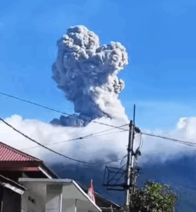
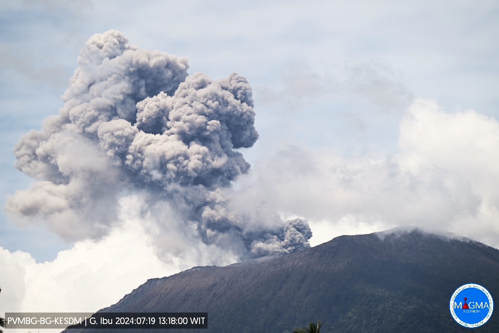
An eruption of Mount Ibu occurred on Friday July 19, 2024 at 1:16 p.m. WIT with the height of the ash column observed at ±1,000 m above the summit (±2,325 m above the level of the sea). The ash column was observed to be gray in color with thick intensity, oriented towards the North-East. This eruption was recorded on a seismograph with a maximum amplitude of 28 mm and a duration of 143 seconds.
SEISMICITY OBSERVATIONS:
16 eruption earthquakes with an amplitude of 8 to 28 mm and a seismic duration of 43 to 83 seconds.
11 emission earthquakes with an amplitude of 2 to 13 mm and earthquake duration of 14 to 61 seconds.
4 harmonic tremors with an amplitude of 2 to 5 mm and an earthquake duration of 46 to 153 seconds.
129 Shallow volcanic earthquakes with an amplitude of 2 to 9 mm and an earthquake duration of 4 to 14 seconds.
4 deep volcanic earthquakes with an amplitude of 2 to 28 mm, and an earthquake duration of 7 to 21 seconds.
RECOMMENDATION
Communities around Mount Ibu and visitors/tourists are advised not to carry out activities within a radius of 4 km, with a sectoral extension of 5 km towards the crater opening in the northern part of the active crater of Mount Ibu. Ibu.
In the event of ash falling, people who practice activities outside the home are advised to wear nasal, oral (mask) and eye (glasses) protection.
Source et photo : Magma Indonésie .
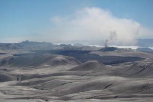
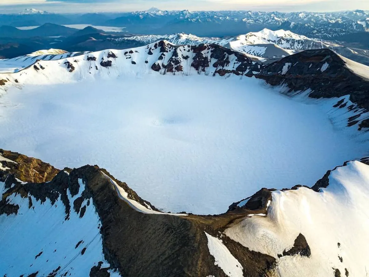
Chile , Puyehue – Cordon Caulle :
Seismology
The seismological activity of the period was characterized by the recording of:
94 seismic events of type VT, associated with the fracturing of rocks (Volcano-Tectonics). The most energetic earthquake had a Local Magnitude (ML) value equal to 2.0, located 4.6 km to the South-South-West, at a depth of 4.8 km from the 2011 emission center .
5 LP type seismic events, associated with fluid dynamics inside the volcanic system (Long Period). The size of the largest earthquake evaluated from the Reduced Displacement (RD) parameter was equal to 8 cm2.
Fluid Geochemistry
No anomalies have been reported in emissions of sulfur dioxide (SO2) into the atmosphere in the area near the volcanic complex, according to data published by the Tropopheric Monitoring Instrument (TROPOMI) and the Ozone Monitoring Instrument (OMI) Sulfur Dioxide Group.
Thermal anomalies by satellites
During the period, no thermal alerts were recorded in the area associated with the volcanic complex, according to the analytical processing of Sentinel 2-L2A satellite images, in combination of false color bands. They also did not record thermal anomalies from data processed by the observation of volcanic activity in the mid-infrared (MIROVA).
Geodesy
Geodetic observations, based on 4 GNSS stations installed on the volcanic system, indicate that the inflationary process previously reported in the central sector of the Cordón Caulle graben continues, although it has decreased in magnitude compared to last year; Concretely for this last fortnight, we observe:
– Vertical displacement rates of between 0.2 and 1.0 cm/month, considered moderate, increasing compared to the previous fortnight.
– Horizontal displacements maintain their trends with slight variations in magnitude and distribution, with displacement rates less than or equal to 1.0 cm/month.
– The increase in the distance between GNSS stations decreases this fortnight, presenting an increase rate of 0.8 cm/month.
Surveillance cameras
No surface activity from volcanic activity is identified from surveillance cameras installed around the volcanic complex.
Satellite geomorphological analysis
No morphological changes associated with volcanic activity are identified from Planet Scope, Sentinel 2 L2A and LandSat 8 satellite images. Most of the days evaluated include images completely covered by cloudiness without the possibility of observing the surface.
During the period evaluated, volcanic seismicity of lower energy and low recurrence was observed, preferably located near the emission center of the year 2011 and to the South of it. The volcanic deformation process remains active, although at lower rates than those observed during the previous fortnights. These conditions allow us to suggest that, although there is a decrease in the monitoring parameters, they are still above what is considered their basic threshold, therefore, the volcanic technical alert is maintained at:
YELLOW TECHNICAL ALERT: Changes in the behavior of volcanic activity.
Source : Sernageomin
Photo : Sernageomin / ANB. ( 05/2024 ?)
Colombia , Puracé :
Popayan, July 16, 2024, 2:30 p.m.
Weekly activity bulletin: Puracé Volcano – Los Coconucos volcanic chain
From the monitoring of the activity of the PURACE VOLCANO – LOS COCONUCOS VOLCANIC RANGE, the COLOMBIAN GEOLOGICAL SERVICE (SGC), an entity attached to the MINISTRY OF MINES AND ENERGY, reports that:
During the week between July 9 and 15, 2024, a decrease continued to be observed in both the number of events recorded and the seismic energy released, which is consistent with the behavior of recent weeks. The seismicity associated with the fracturing of rocks (type VT) was located under the Puracé volcano, as well as under the Piocollo and Curiquinga volcanoes, at depths between 1 and 3 km, while the seismicity linked to the movement of fluids was located in the crater sector of the Puracé volcano at depths less than 1 km. All of these events maintained low magnitudes.
The slow deformation process that began in April 2022 on the Puracé volcano continues to be recorded. In contrast, monitoring of volcanic gases, electromagnetic fields and acoustic sensors shows stability. As for the images captured by the installed cameras, it is evident that the degassing of the volcanic system continues.
The decrease in volcanic monitoring parameters recorded in recent weeks has motivated the Colombian Geological Service to change the alert status of the Puracé volcano – Los Coconucos volcanic chain to YELLOW.
The SGC calls on people who visit the Puracé National Natural Park not to approach the upper part of the Puracé and Curiquinga volcanoes, given that the increase in gas emissions into the atmosphere can cause damage to health.
The alert status for volcanic activity remains at: YELLOW ALERT: ACTIVE VOLCANO WITH CHANGES IN THE BEHAVIOR OF THE BASE LEVEL OF MONITORED PARAMETERS AND OTHER MANIFESTATIONS.
Source et photo : SGC
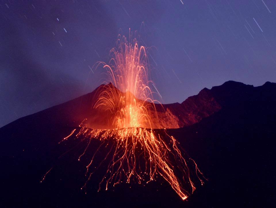
Japan , Sakurajima :
Japan Meteorological Agency (JMA) reported ongoing eruptive activity at Minamidake Crater (Aira Caldera’s Sakurajima volcano) during 8-15 July. Nighttime crater incandescence was visible. An explosion at 2123 on 10 July produced an ash plume that rose 2.3 km above the crater rim and drifted E, and also ejected large blocks up to 1.1 km from the vent. An explosion at 1819 on 14 July produced an ash plume that rose 4.5 km above the crater rim and drifted NE, with large blocks ejected up to 1.4 km from the vent. The Alert Level remained at 3 (on a 5-level scale), and the public was warned to stay 1 km away from both craters.
The Aira caldera in the northern half of Kagoshima Bay contains the post-caldera Sakurajima volcano, one of Japan’s most active. Eruption of the voluminous Ito pyroclastic flow accompanied formation of the 17 x 23 km caldera about 22,000 years ago. The smaller Wakamiko caldera was formed during the early Holocene in the NE corner of the caldera, along with several post-caldera cones. The construction of Sakurajima began about 13,000 years ago on the southern rim and built an island that was joined to the Osumi Peninsula during the major explosive and effusive eruption of 1914. Activity at the Kitadake summit cone ended about 4,850 years ago, after which eruptions took place at Minamidake. Frequent eruptions since the 8th century have deposited ash on the city of Kagoshima, located across Kagoshima Bay only 8 km from the summit. The largest recorded eruption took place during 1471-76.
Sources : Agence météorologique japonaise (JMA) , GVP.
Photo : K. Arima ( archive 2017)
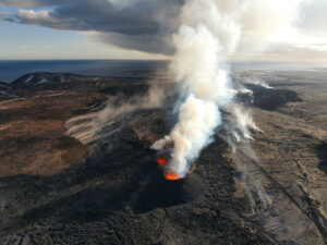
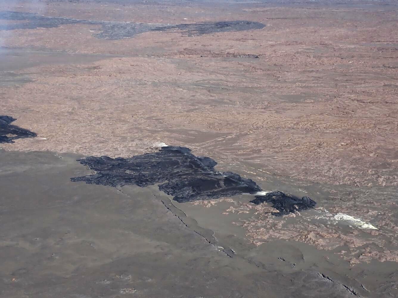
Hawaii , Kilauea :
Thursday, July 18, 2024, 8:40 AM HST (Thursday, July 18, 2024, 18:40 UTC)
19°25’16 » N 155°17’13 » W,
Summit Elevation 4091 ft (1247 m)
Current Volcano Alert Level: ADVISORY
Current Aviation Color Code: YELLOW
Activity Summary:
No significant change; Kīlauea volcano is not erupting. Earthquake activity beneath the summit has increased slightly while earthquake activity beneath the upper East Rift Zone decreased over the past 24 hours. Gradual inflation of the summit and upper rift zones continues. Substantial increases in seismicity and/or deformation could result in a new eruptive episode, but presently there are no signs of imminent eruption.
Summit and Upper Rift Zone Observations:
Over the past 24 hours, there were approximately 37 earthquakes detected beneath Kīlauea’s summit and 79 earthquakes detected beneath the upper East Rift Zone, mostly at depths of 0–2 km (0.0–1.2 mi) beneath the ground surface. A slight increase in earthquake counts was observed beneath the summit and a decrease was observed beneath the upper East Rift Zone compared to the previous day (during which there were 30 events detected beneath the summit, and 97 events detected beneath the upper East Rift Zone). All earthquake counts are well below the counts recorded during the June 27–July 1 upper East Rift Zone swarm. All events were smaller than M3 earthquakes in the summit and upper east rift zone regions. Tiltmeters in Kīlauea summit region (instruments SDH, southwest of the summit, and UWE, northwest of the summit) show gradual inflationary ground deformation rates over the past day. GPS instruments around the summit region continue to show longer-term, gradual inflation since the end of the June 3, 2024, eruption. The most recent measurement of the summit’s SO2 emission rate was approximately 100 tonnes per day on July 17, 2024.
Middle and Lower Rift Zone Observations:
Rates of seismicity and ground deformation beneath the middle and lower East Rift Zone and lower Southwest Rift Zone remain low. Recent eruptive activity and ongoing unrest have been restricted to the summit and upper rift zone regions. Measurements from continuous gas monitoring stations downwind of Puʻuʻōʻō in the middle East Rift Zone—the site of 1983–2018 eruptive activity—remain below detection limits for SO2, indicating that SO2 emissions from Puʻuʻōʻō are negligible.
Source : HVO
Photo : USGS / A.R. Nalesnik ( 14 Juin 2024. )