September 13 , 2022.
Iceland , Grimsey Island :
Over 7000 earthquakes have been detected since activity started at Grímsey. The largest earthquake detected was a M4.9 on the 8th of September at 04:01. The largest earthquakes have been felt widely in the north of Iceland. The last large seismic swarm in this area was in February 2018.
Department of Civil Protection and Emergency Management have announced an Uncertainty level for the ongoing seismic activity north of Iceland on September 9. 2022.
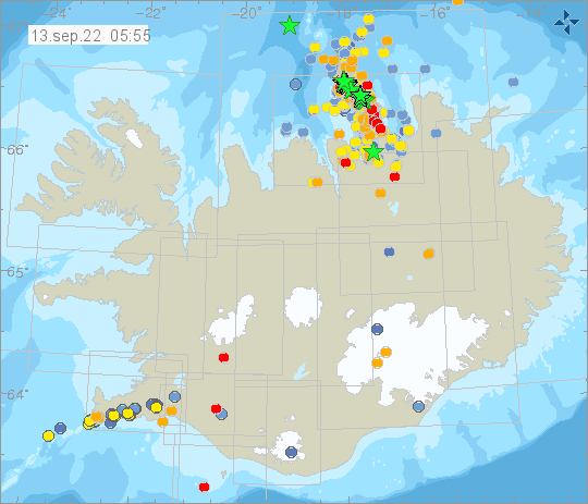
Uncertainty level of civil protection due to earthquake swarms off North Iceland.
In consultation with the Sheriff’s Office, the National Commissioner of police has declared the level of uncertainty of civil protection due to earthquake swarms off The North.
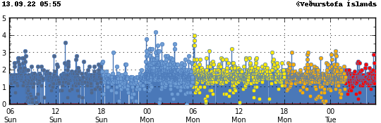
An earthquake swarm is underway east of Grímsey island and around 2,600 earthquakes have been detected since a magnitude 4.9 quake struck yesterday 8 September. The area in question is a known earthquake zone and a similar swarm was underway in the area in 2018.
The level of uncertainty of civil protection means that increased monitoring of a scenario that at a later stage could lead to a threat to people’s health and safety, environment or urban areas. Declaring a level of uncertainty is part of procedures in the civil protection structure to ensure formal communication and disclosure between responders.
The Civil Protection Department of the National Commissioner of Police and the Sheriff’s Office are urging people living in known earthquake zones to take appropriate measures for earthquakes.
Source : Vedur is.
Photos : Vedur is.
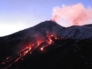
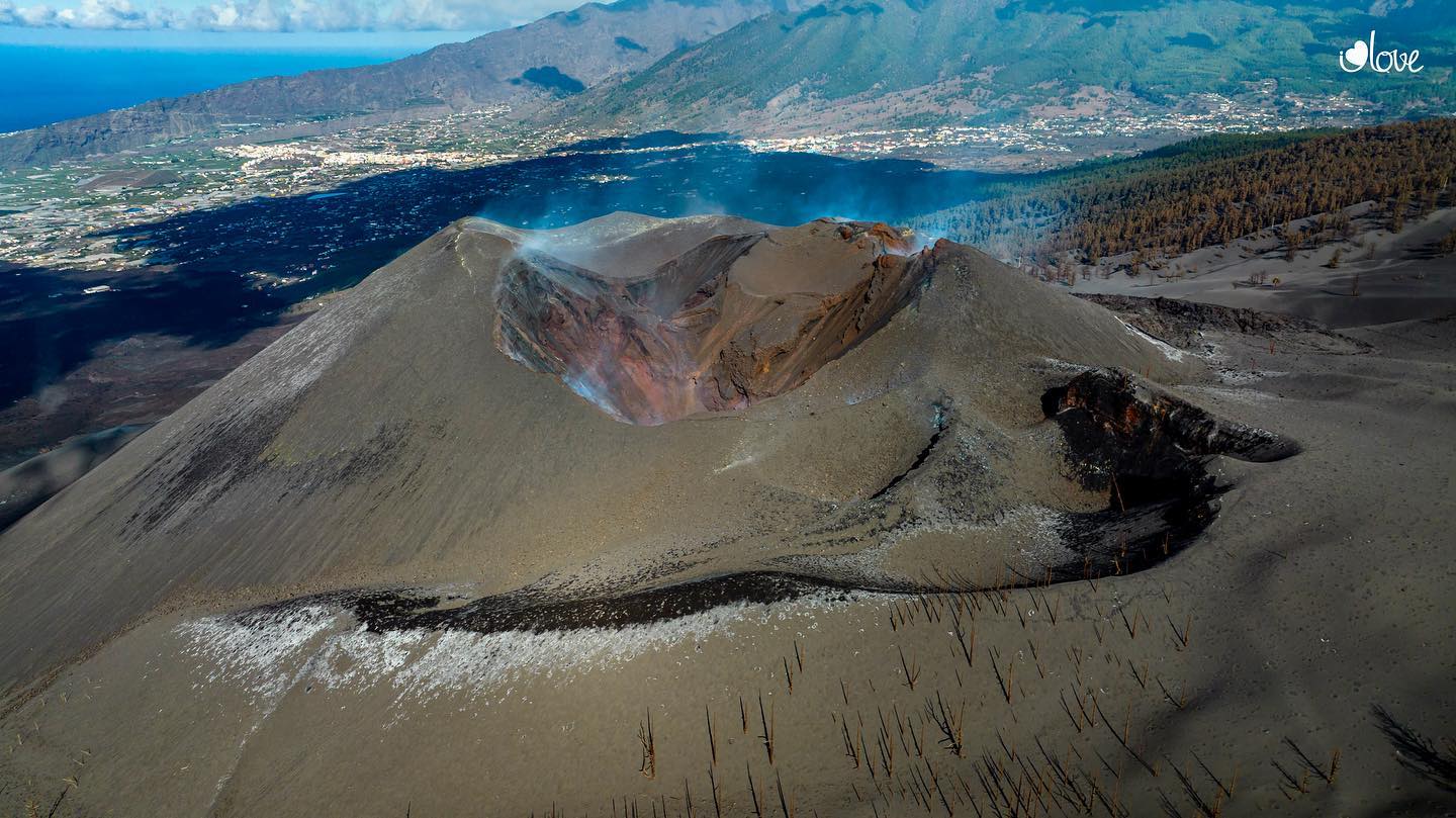
La Palma , Cumbre Vieja :
The update report of the volcanic activity of Cumbre Vieja, dated September 9 and published this Sunday, indicates that « since December 13, the post-eruptive phase continues, in which certain volcanic dangers persist, without being able to exclude future reactivations”, according to the Cabildo de La Palma.
“There is no presence of volcanic tremors in the seismic signals. Surface seismicity and intermediate depth continue to be located. Seismicity related to the movement of volcanic fluids continues. There are no significant surface deformations of the terrain related to magmatic activity,” the report explains.
The document points out that the high temperatures and the instabilities of the terrain on the volcanic cone are maintained, as well as in the lava flows, « thus persisting in their dangerousness ». « An instrumental monitoring network is currently operational to continuously record CO2 (carbon dioxide) concentrations in the ambient air, inside and outside buildings, in the population centers of Puerto Naos and The Bombilla, which currently integrates more than 20 sensors of different types,” he adds.
« The daily average of the CO2 concentration in the ambient outdoor air recorded by the stations located in La Bombilla presents a wide range of values, ranging from less than 5,000 ppm (parts per million) to values greater than 200,000 ppm. “, he details.
« In the areas of Puerto Naos and La Bombilla, as long as the CO2 levels are not within the exposure limits that are considered usual for the general population, by a principle of precaution, prudence and prevention, it it is advisable to keep the area « out of access », allowing access only for the performance of the work activity, following the protocols established by the Occupational Risk Services », he emphasizes.
Source : Eldiario es.
Photo : i love the world
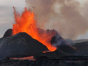
Peru , Sabancaya :
Analysis period: from September 05, 2022 to September 11, 2022, Arequipa, September 12, 2022.
Alert level: ORANGE
The Geophysical Institute of Peru (IGP) reports that the eruptive activity of the Sabancaya volcano remains at moderate levels, that is to say with the recording of an average of 44 daily explosions, with columns of ash and of gas up to 2.9 km altitude above the summit of the volcano and their subsequent dispersion. Therefore, for the following days, no significant change is expected in eruptive activity.
The IGP recorded and analyzed the occurrence of 347 earthquakes of volcanic origin, associated with the circulation of magmatic fluids inside the Sabancaya volcano. An average of 44 explosions was recorded daily, in addition to recording Volcano-Tectonic (VT) type events associated with rock fracturing inside the Sabancaya volcano.
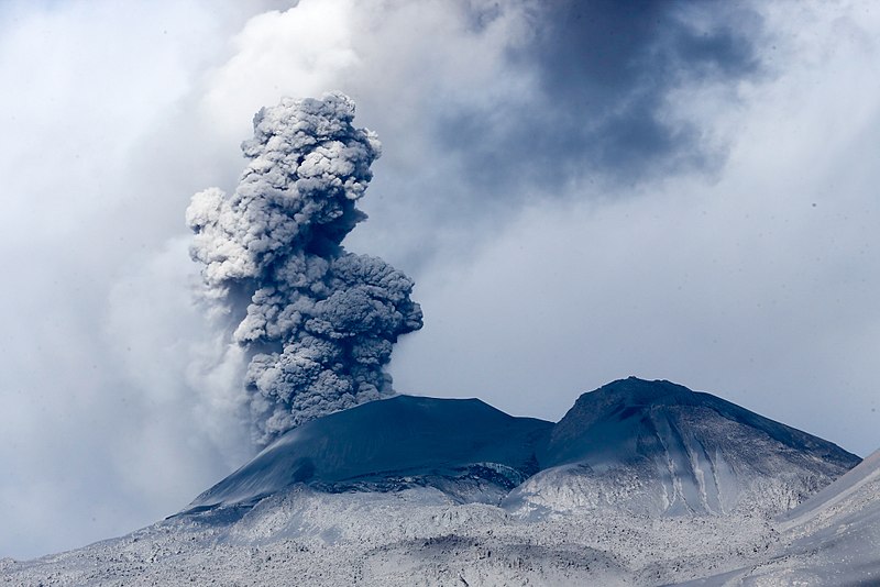
Monitoring the deformation of the volcanic structure using GNSS techniques (processed with fast orbits) does not show any significant anomalies. However, in general, an inflation process was observed in the northern sector (surroundings of the Hualca Hualca volcano). Visual surveillance identified columns of gas and ash up to 2.9 km above the summit of the volcano, which were dispersed towards the eastern, southeast and northeast sectors of Sabancaya. . Satellite recordings have identified the presence of 10 thermal anomalies, with a maximum value of 28 MW, associated with the presence of a lava body on the surface of the volcano’s crater.
RECOMMENDATIONS
• Keep the volcanic alert level orange.
• Do not approach within a radius of less than 12 km from the crater.
Source : Cenvul
Photo : Galeria del Ministerio de Defensa del Perú.
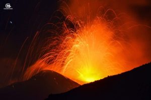
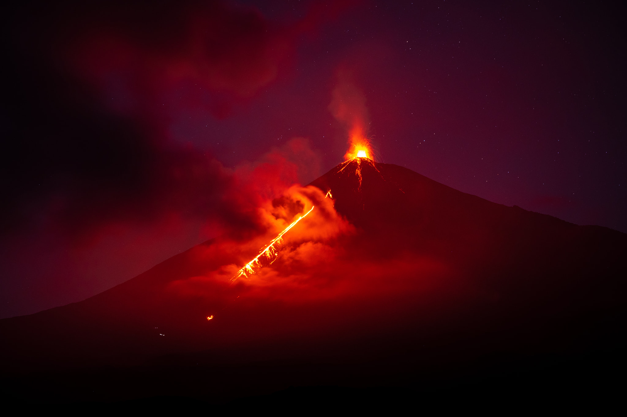
Guatemala , Fuego :
LAHAR IN THE CENIZA RAVINE, TRIBUTARY TO THE ACHIGUATE RIVER
The rains and precipitation accumulated in the last hours in the area of the volcanic complex are currently generating a lahar in the ravine of Ceniza, a tributary of the Achíguate River, with weak to moderate characteristics, but with the probability of increasing in the next few minutes in due to persistent rains in the area. The lahar descends fine and hot volcanic materials, in addition to carrying branches and tree trunks, as well as blocks from 30 cm to 1.5 meters in diameter. The rains of the past few days have kept the volcanic deposits saturated with humidity, so that lahars will continue to be generated in the afternoon and evening.
The possibility that weak to moderate lahars are generated in one of the other ravines around the volcano is not excluded.
Activity:
Short periods of degassing are recorded, as well as 7 to 12 weak and moderate explosions per hour which generate ash columns of 4,400 to 4,700 m (14,435 to 15,419 ft) dispersing towards the West and the North- West. Some strong explosions generate abundant ash. Due to the explosive activity, low to moderate rumblings are also generated with a weak shock wave which vibrates the roofs and windows of houses around the volcano. In addition, weak to moderate avalanches are recorded in the upper part of all the ravines. The greatest contribution of material generated by these avalanches occurs in the Seca and Ceniza ravines, extending to the edge of the vegetation. Due to the direction of the wind, fine ash falls can be generated in the communities to the west and northwest of the volcanic edifice, such as Quisaché, El Socorro and Acatenango.
Source : Insivumeh.
Photo : Diego Rizzo (archive) .
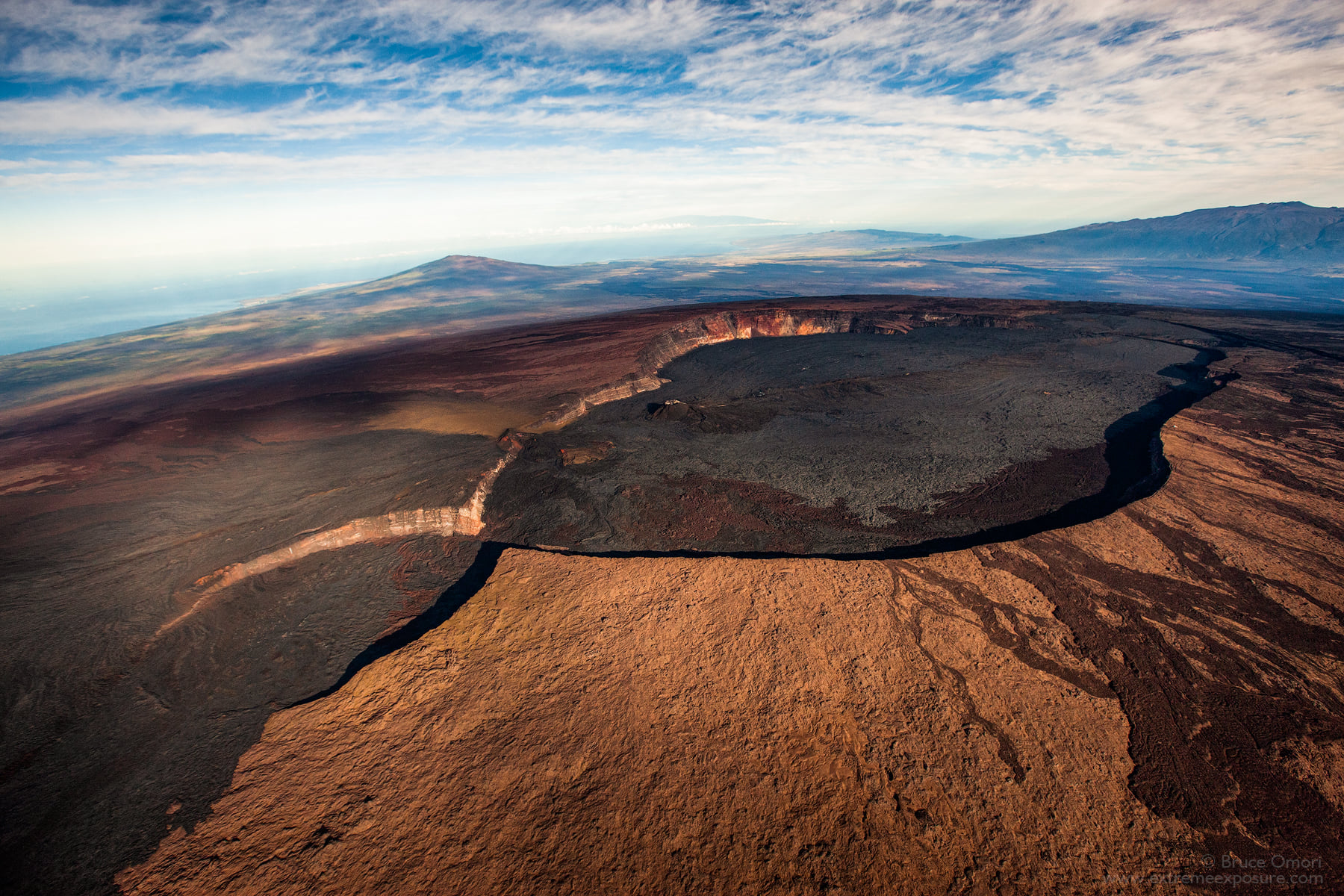
Hawaii , Mauna Loa :
19°28’30 » N 155°36’29 » W,
Summit Elevation 13681 ft (4170 m)
Current Volcano Alert Level: ADVISORY
Current Aviation Color Code: YELLOW
Activity Summary:
Mauna Loa Volcano is not erupting. Rates of seismicity remain slightly elevated above long-term background levels. Other Mauna Loa monitoring data streams—ground deformation, gas concentrations, visual appearance in webcams—show no significant changes.
Observations:
During the past week, HVO seismometers recorded approximately 124 small-magnitude (below M3.0) earthquakes below the summit and upper-elevation flanks of Mauna Loa.The majority of these earthquakes occurred at shallow depths less than 15 kilometers (9 miles) below sea level.
Global Positioning System (GPS) measurements show low rates of deformation in the volcano’s summit region continuing through the past week.
Concentrations of sulfur dioxide (SO2), hydrogen sulfide (H2S), and carbon dioxide (CO2), as well as fumarole temperatures, remain stable at both the summit and at Sulphur Cone on the upper Southwest Rift Zone.
Webcam views have shown no changes to the volcanic landscape on Mauna Loa over the past week.
Source : HVO.
Photo : Bruce Omori.