June 25 , 2024.
Iceland : Reykjanes Peninsula :
The eruption which began on May 29 is over. Updated risk assessment
Updated June 24 at 2:00 p.m.
The eruption is over. The eruption lasted 24 days.
The fifth eruption of the Sundhnúks crater series since December 2023
Land uplift is stable, but slower than between recent eruptions
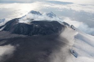
The eruption that began on the Sundhnúks crater series on May 29 has ended, no activity has been observed in the crater since June 22. The eruption lasted 24 days and was the fifth eruption of the Sundhnúks crater series since December 2023. Additionally, the lava bed that formed is the largest in terms of volume and area.
Although no lava flows from the crater, there is still considerable movement in the lava bed north of Sýlingarfell as there is still liquid lava beneath the solidified surface. Over the past two days there has been activity in the lava tubes running through the Sýlingarfell defense wall as well as in the lava bed to the north of the defense wall. We can continue to expect movements to be noticed in the lava bed in the coming days, as it takes a long time for this process to stop.
About ten days after the eruption, Svartsengi’s land uplift began to be measured again, indicating that magma accumulation there continues. Land mass has remained stable since then, but is now slower than it was between the last events. The National Weather Service continues to monitor the area and measurements over the coming days and weeks will help interpret the potential evolution of earthquakes.
As magma accumulation continues beneath Svartsengi, repeated magma flows and eruptions are likely. At present, it is difficult to predict when the next event will occur or when magma accumulation will stop.
Updated hazard assessment
The National Weather Service has released an updated risk assessment. The end of the last eruption brought about changes in several areas. The risk is considered lower in all areas where lava flows and gas contamination are less likely. VÍ experts measured the gas emission from the crater on Friday June 21, and it was measured very low, around 1 kg/s.
Source : IMO
Photo : Ragnar Visage ( archive).
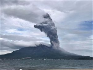
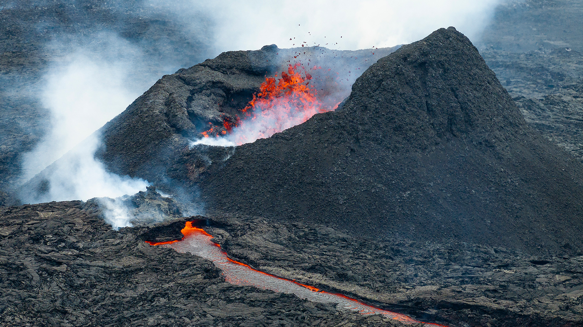
Italy , Stromboli :
Press release on the activity of Stromboli, June 24, 2024, 10:41 (08:41 UTC)
The National Institute of Geophysics and Volcanology, Osservatorio Etneo, communicates that, during the night, the lava overflow on the Sciara del Fuoco has gradually dried up and the small lava flows generated yesterday have stopped and are cooling. However, modest spattering activity persists at vents in the northern crater area of the crater terrace, while in the southern crater area explosions occur at intervals of approximately 5 to 10 minutes.
Compared to the previous release, the average amplitude of the volcanic tremor showed oscillations between high and very high levels; it currently remains at a high level. The signals from the GNSS (HF) and inclinometer deformation monitoring networks do not show significant changes compared to the last press release.
Further updates will be communicated shortly.
Source et photo : INGV
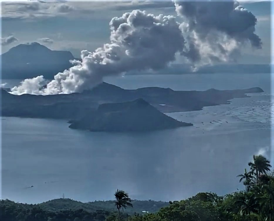
Philippines , Taal :
TAAL VOLCANO ADVISORY , 25 June 2024 , 01:15 AM
Weak phreatic activity at Taal Volcano.
Weak phreatic or steam-driven eruption at the Taal Main Crater occurred on the evening of 24 June 2024, between 9:30 PM and 09:32 PM based on visual, seismic and infrasound records of the Taal Volcano Network (TVN). The event produced steam-laden plumes that rose 600 meters above the Main Crater before drifting west based on IP and thermal camera monitors. Sulfur dioxide (SO2) emissions averaged 4,641 tonnes/day on 20 June 2024. Nonetheless, average SO2 emissions since January this year remain high at 7,967 tonnes/day. Weak phreatic activity is likely driven by the continued emission of hot volcanic gases at the Taal Main Crater and could be succeeded by similar events. The background levels of volcanic earthquake activity and ground deformation detected at Taal indicate that unrest is unlikely to progress into magmatic eruption.
DOST-PHIVOLCS reminds the public that Alert Level 1 prevails over Taal Volcano, which means that it is still in abnormal condition and should not be interpreted to have ceased unrest nor ceased the threat of eruptive activity. At Alert Level 1, sudden steam-driven or phreatic explosions, volcanic earthquakes, minor ashfall and lethal accumulations or expulsions of volcanic gas can occur and threaten areas within the Taal Volcano Island (TVI). Furthermore, degassing of high concentrations of volcanic SO2 continues to pose the threat of potential long-term health impacts to communities around Taal Caldera that are frequently exposed to volcanic gas. DOST-PHIVOLCS strongly recommends that entry into TVI, Taal’s Permanent Danger Zone or PDZ, especially the vicinities of the Main Crater and the Daang Kastila fissure, must remain strictly prohibited. Local government units are advised to continuously monitor and assess preparedness of their communities and undertake appropriate response measures to mitigate hazards that could be posed by long-term degassing and related phreatic activity. Civil aviation authorities must advise pilots to avoid flying close to the volcano as airborne ash and ballistic fragments from sudden explosions and wind-remobilized ash may pose hazards to aircrafts.
DOST-PHIVOLCS is closely monitoring Taal Volcano’s activity and any new significant development will be immediately communicated to all stakeholders.
Source : Phivolcs
Photo : Kyle Aranza ( Archive)
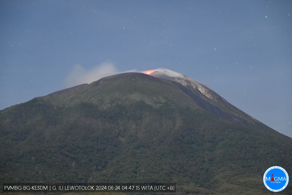
Indonesia , Ili Lewotolok :
Decrease in the activity level of the Ili Lewotolok volcano from level III (SIAGA) to level II (WASPADA) on June 23, 2024 at 4:00 p.m. WITA.
In general, the seismicity of Mount Ili Lewotolok shows a decline, with emission earthquakes still dominating the seismicity record. A decrease in activity was also observed from deformation data indicating deflation that resulted in stress/pressure changes on the volcano.
The evolution of the activities of G. Ili Lewotolok from June 1 to 22, 2024 is as follows:
Visual observation:
Period 1 – June 7, 2024: Observation of white-gray smoke from the crater of light to thick intensity, between 25 and 500 meters high above the summit. An eruption occurred, but visually the height of the eruption was 100 meters from the summit and the eruption column was gray.
Period 8 – June 15, 2024: Observation of white-gray smoke from the crater of light to thick intensity, between 25 and 600 meters high above the summit. An eruption occurred, visually the height of the eruption varied between 100 and 300 meters from the summit and the eruption column was white to gray.
Period 16 – June 22, 2024: Observation of white-gray smoke from the crater of light to thick intensity, between 25 and 400 meters high above the summit. An eruption occurred, but the height and color of the eruptive column were not visually observed.
Instrumental observation
Seismicity
Period 1 – June 7, 2024: 7 eruption earthquakes were recorded, 2,463 emission earthquakes, 11 superficial volcanic earthquakes, 3 deep volcanic earthquakes, 2 local tectonic earthquakes and 4 distant tectonic earthquakes. Continuous tremor recorded with an amplitude of 2.3 to 19.4 mm (dominant value 10 mm).
Period 8 – June 15, 2024: 18 eruption earthquakes were recorded, 2,170 emission earthquakes, 2 superficial volcanic earthquakes, 5 deep volcanic earthquakes, 4 local tectonic earthquakes and 4 distant tectonic earthquakes. Continuous tremor recorded with an amplitude of 1.2 to 6.3 mm (dominant value 4 mm).
Period from June 16 to 22, 2024: 4 eruption earthquakes were recorded, 1,522 emission earthquakes, 1 harmonic tremor, 1 hybrid earthquake, 18 deep volcanic earthquakes, 3 local tectonic earthquakes and 2 distant tectonic earthquakes. Continuous tremor recorded with an amplitude of 1.9 to 3.7 mm (Dominant value 1.9 mm).
Deformation
Deformation measurement data by EDM (Electronic Distance Measurement) during the period June 1 to 22, 2024 show oblique distance fluctuations with an increasing trend at the two measurement points LWT1 and at LWT2 during the period from June 16 to 22, 2024.
Based on the latest instrumental monitoring data of Mount Ili Lewotolok, the volcanic activity of Mount Ili Lewotolok shows a decline, so the activity level of Mount Ili Lewotolok has been lowered from level III (SIAGA) to level II (WASPADA) from June 23, 2024 at 4:00 p.m. WITA.
Source et photo : PVMBG
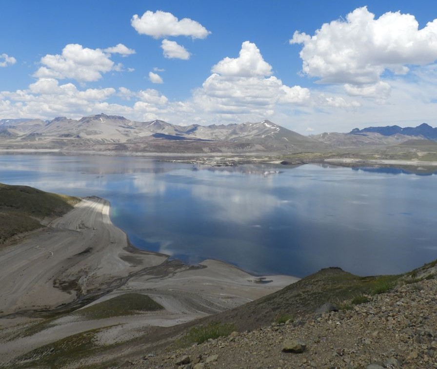
Chile , Laguna del Maule :
Seismology
The seismological activity of the period was characterized by the recording of:
603 seismic events of type VT, associated with the fracturing of rocks (Volcano-Tectonics). The most energetic earthquake had a Local Magnitude (ML) value equal to 2.3, located 3.7 km West-South-West of the center of the lagoon, at a depth of 5.6 km.
7 LP type seismic events, associated with fluid dynamics inside the volcanic system (Long Period type). The size of the largest earthquake evaluated from the Reduced Displacement (RD) parameter was equal to 5.9 cm2.
Fluid geochemistry
No anomalies have been reported in the emissions of sulfur dioxide (SO2) into the atmosphere in the area near the volcanic complex, according to data published by the Tropospheric Monitoring Instrument (TROPOMI) and the Ozone Monitoring Instrument (OMI) Sulfur Dioxide Group.
Thermal anomalies by satellites
During the period, no thermal alerts were recorded in the area associated with the volcanic complex, according to the analytical processing of Sentinel 2-L2A satellite images, in combination of false color bands.
Geodesy
The geodetic activity of the period was characterized by:
– Slight decrease and stabilization of deformation rates, both horizontal and vertical, compared to the previous period, similar to the historical rates observed in the complex.
– Line lengths, distance between GNSS stations, are also stable compared to the previous period, and reach values similar to those historically recorded in this system.
Therefore, based on the geodetic data obtained during the period, a stabilization of the station movement rate is observed compared to the previous period, which implies rates close to those historically observed in the complex. The maximum rate of change reaches 1.64 cm/month at station MAU2, near the center of the lagoon.
Surveillance cameras
The images provided by the surveillance camera, installed near the volcanic complex, did not record degassing columns or variations linked to surface activity.
Satellite geomorphological analysis
No morphological variation is identified on the Planet Scope and Sentinel 2 L2A images attributable to volcanic activity.
During the fortnight, the VT seismicity record remains, with low magnitudes. Locations continue to be recorded mainly in active sources located to the South-West and South-East of the center of the lagoon. The volcanic deformation process remains active with rates similar to those observed historically. The above indicates that the volcanic system is still recording activity with levels considered above its base threshold. In this way, the technical alert is maintained in:
YELLOW TECHNICAL ALERT: Changes in the behavior of volcanic activity
Source et photo : Sernageomin