June 18 , 2024.
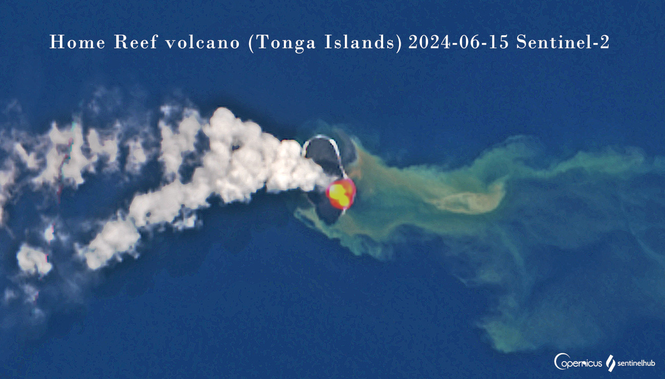
Tonga Archipelago , Home Reef :
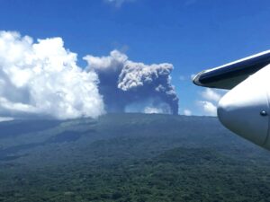
A volcanic hazard alert issued by Tonga Geological Services tonight, warns all mariners to sail no closer than 4km from the Home Reef Volcano, which has exhibited ongoing volcanic activity this afternoon.
“In the last 24 hours Home Reef Volcano has exhibited ongoing volcanic activity with a total of seven volcanic thermal anomalies recorded in the last 24hrs , compared to three events in the prior 24 hours. The latest events were recorded at 1421 hours this afternoon, Monday June 17.
“A strong anomaly in the latest Sentinel – 2 satellite imagery from 15 June 2024, suggests a new batch of magma rising in the volcano’s feeder pipe. The advancing lava flow is enlarging the island to the east, and the volcano’s shape appears to be more rounded now.
The volcanic activity poses low risk to the Vava’u and Ha’apai Communities. However all Mariners are advised to sail beyond 4km from Home Reef until further notice. A hazard map is attached to guide all mariners sailing near Home Reef.
Home Reef is located 25 km southwest of Late Island, 22 km northeast of Lateiki (Metis Shoal) and 75 km northwest of Mo’unga’one Island at Latitude & Longitude 18.992°S & 174.775°W . Monitoring of the eruption is ongoing daily on the status of the eruption.
The alert was the first for this event, issued by the Volcano Watch Team Tonga Geological Services, Natural Resources Division Ministry of Lands, Survey, Planning and Natural Resource
Home Reef, an underwater volcano midway between Metis Shoal and Late Island in the central islands of Tonga, was first reported as active in the mid-19th century, when an ephemeral island formed. In 1984, an eruption produced a 12 km high eruptive plume, large quantities of floating pumice, and an ephemeral island measuring 500 x 1,500 m, with cliffs 30 to 50 m high that surrounded a crater filled with ‘water. In 2006, an island-forming eruption produced vast rafts of dacitic pumice that drifted to Australia. Another island was built during a September-October 2022 eruption.
Source : Matangitonga . to , GVP.
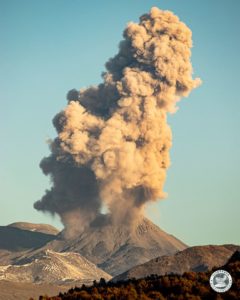
Italy / Sicily , Etna :
VOLCANO OBSERVATORY NOTICE FOR AVIATION (VONA)
Issued: June 17 , 2024
Volcano: Etna 211060
Current Color Code: ORANGE
Previous Color Code: yellow
Source: Etna Volcano Observatory
Notice Number: 2024/0014/03N01
Volcano Location: 3744N 01500E
Area: Italy
Summit Elevation: 3300 m
Volcanic Activity Summary:
MILD EXPLOSIVE ACTIVITY IS OBSERVED AT SUMMIT CRATERS
Volcanic cloud height:
NO ASH CLOUD IS PRODUCED
Other volcanic cloud information: N/A
Remarks:
THE PHENOMENON IS OBSERVED BY VISIBLE AND THERMAL SURVEILLANCE CAMERAS AND BY INGV’S PERSONNEL ON THE FIELD
Source : INGV
Photo : Guide Erna Nord-Compania Guide Etna. ( capture d’écran)
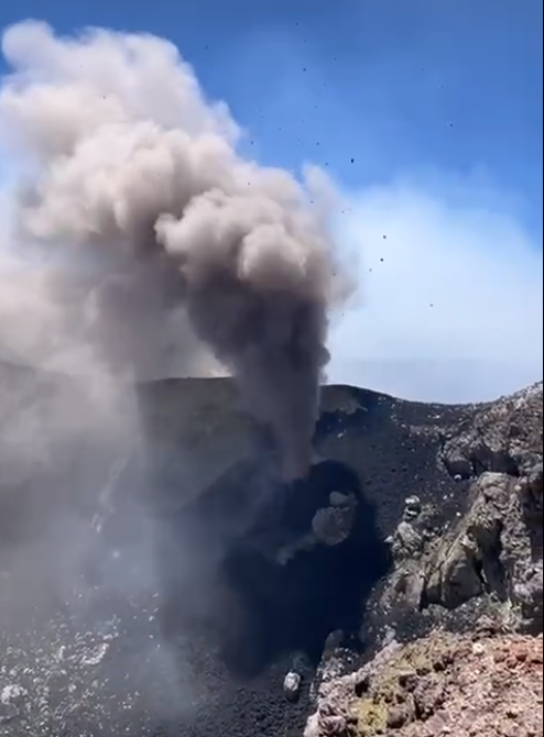
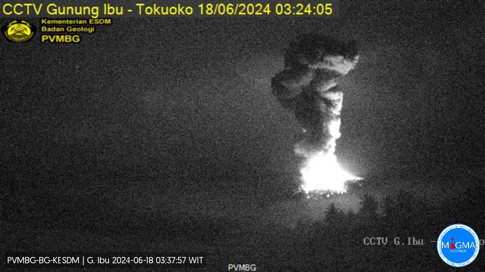
Indonesia , Ibu :
An eruption of Mount Ibu occurred on Tuesday 18 June 2024 at 03:21 WIT with the height of the ash column observed at ±3,000 m above the summit (±4,325 m above sea level) . The ash column was observed to be gray to black in color with thick intensity, oriented towards the North and Northeast. This eruption was recorded on a seismograph with a maximum amplitude of 28 mm and a duration of 199 seconds.
Observation of seismicity:
3 emission earthquakes with an amplitude of 2 to 4 mm and duration of the earthquake of 25 to 45 seconds.
81 shallow volcanic earthquakes with an amplitude of 2 to 24 mm and a seismic duration of 4 to 16 seconds.
44 deep volcanic earthquakes with an amplitude of 2 to 28 mm, and an earthquake duration of 5 to 16 seconds.
1 Distant tectonic earthquake with an amplitude of 4 mm, and an earthquake duration of 86 seconds.
RECOMMENDATION
1. Communities around Mount Ibu and visitors/tourists should not carry out activities within a radius of 4 km and a sectoral extension of 7 km towards the crater opening in the northern part of the active Mount Ibu crater.
2. In the event of ash falling, people who carry out activities outside the house are advised to protect their nose, mouth (mask) and eyes (glasses).
Source et photo : Magma Indonésie
Chile , Planchon Peteroa :
Seismology
The seismological activity of the period was characterized by the recording of:
82 seismic events of type VT, associated with the fracturing of rocks (Volcano-Tectonics). The most energetic earthquake had a Local Magnitude (ML) value equal to 2.4, located 7.0 km north-northeast of the volcanic edifice, at a depth of 1.9 km from the crater .
16 LP type seismic events, associated with fluid dynamics inside the volcanic system (Long Period). The size of the largest earthquake evaluated from the Reduced Displacement (RD) parameter was equal to 2 cm2.
Fluid geochemistry
No anomalies have been reported in emissions of sulfur dioxide (SO2) into the atmosphere in the area near the volcanic complex, according to data released by the Tropopheric Monitoring Instrument (TROPOMI) and Ozone Monitoring Instrument (OMI) Dioxide Group of sulfur.
Thermal anomalies by satellites
During the period, no thermal alerts were recorded in the area associated with the volcanic complex, according to the analytical processing of Sentinel 2-L2A satellite images, in combination of false color bands.
Surveillance cameras
The images provided by the fixed camera, installed near the volcanic complex, did not record degassing columns or variations linked to surface activity.
Activity remained at levels considered low, suggesting stability of the volcanic complex. The technical volcanic alert is maintained in:
GREEN TECHNICAL ALERT: Active volcano with stable behavior – There is no immediate risk
Observation:
The area contained within a radius of 800 m around the center of the craters is considered a potential volcanic danger zone.
Source et photo : Sernageomin
Alaska , Great Sitkin :
The slow eruption of lava in the summit crater of Great Sitkin Volcano continues as observed in satellite radar data through June 15. A few small earthquakes were detected beneath the volcano over the past day. Satellite observations were obscured by clouds over the past day.

Great Sitkin Volcano on September 3, 2023, during helicopter approach for sampling efforts by AVO geologists. Image is looking west at the east margin of the summit flow field.
The current lava flow eruption began in July 2021. No explosive events have occurred since a single event in May 2021.
Local seismic and infrasound sensors and web cameras are used to monitor Great Sitkin along with regional infrasound and lightning networks and satellite data.
Source : AVO
Photo : Loewen, Matt