June 15 , 2024 .
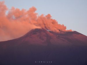
Iceland : Reykjanes Peninsula :
Considerable pollution measured from the eruption
The lava field formed in this eruption is the largest of the five lava flows that have formed in the eruptions at Sundhnúkur.
Updated 13. June at 16:30 UTC
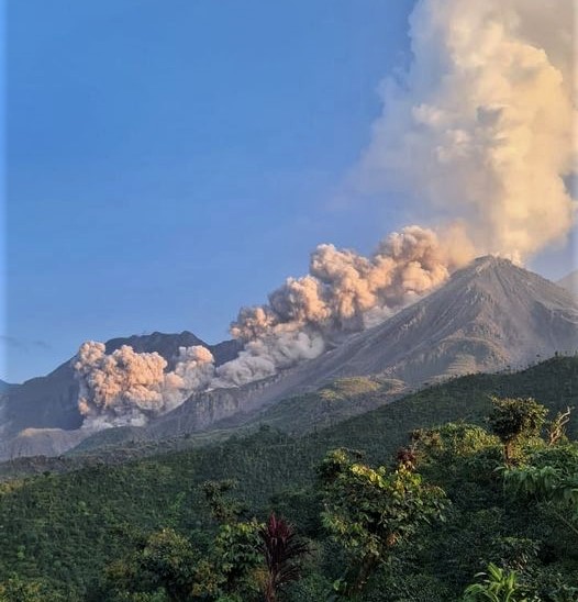
The eruption has lasted for 15 days. One crater remains active
The lava field in this eruption has reached 9.2 km2 and a volume of about 41 million m3, making it the largest since December 2023
The lava pond remains rather stable, but lava flows from it into the active lava stream north of Sýlingarfell
Gas pollution is likely to continue in the coming days.
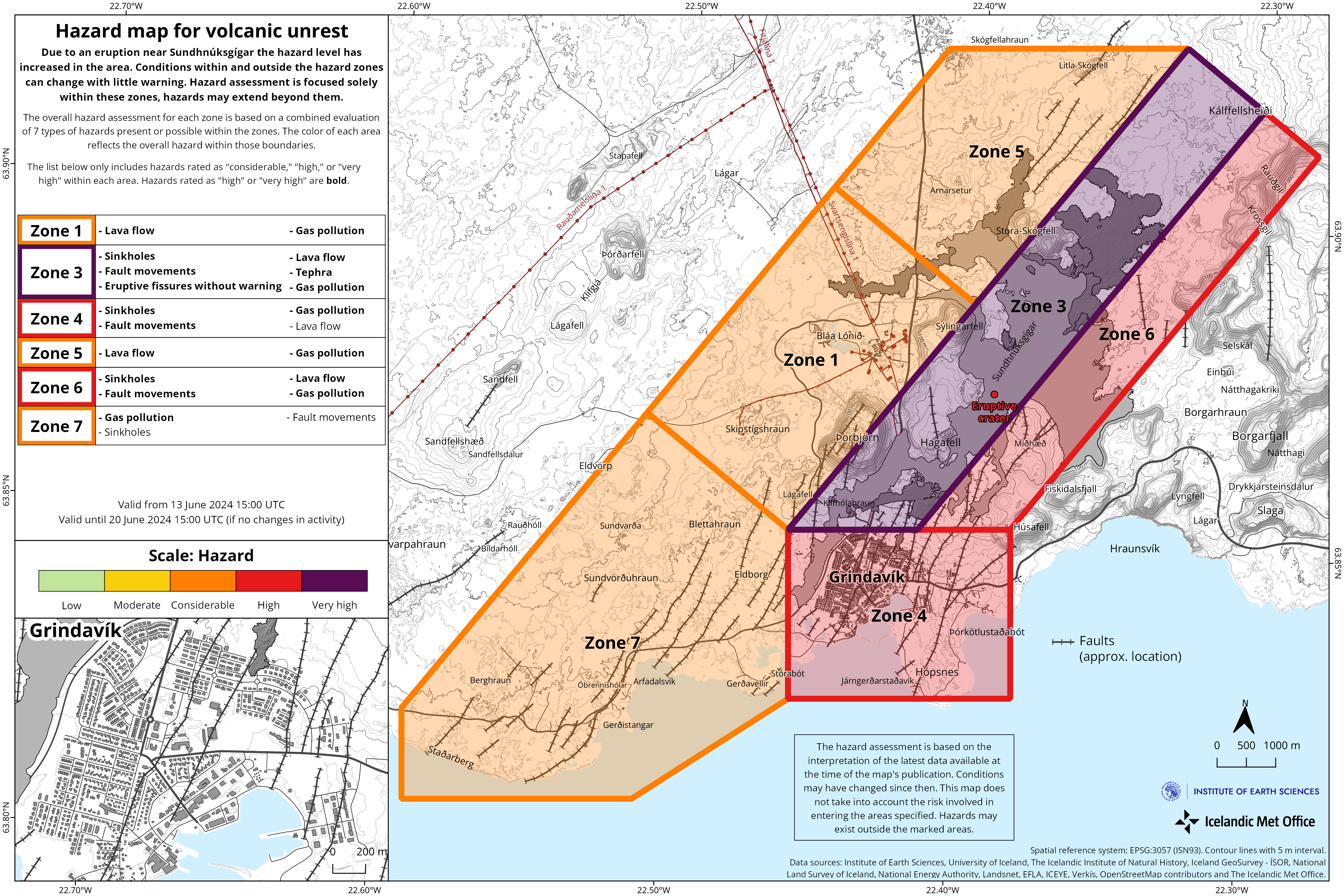
Hazard assessment updated – few changes
The volcanic eruption that started on 29 May is still ongoing and has therefore lasted for 15 days. It has been fairly stable for the past few days and only one crater is still active, as it has been since June 4th. Very little seismic activity has been detected in the area.
The main lava flow continues to be from the crater towards mt. Sýlingarfell and along the mountain on its northern side. A lava pond is still present at Sýlingarfell, but lava flows from the pond into the active lava stream north of Sýlingarfell. That stream is in a similar channel as the lava that inundated Grindavík road last Saturday. The lava flow front near Grindavík road is moving very slowly but thickening.
The photogrammetry team of the Icelandic Institute of Natural History (IINH) and the National Land Survey of Iceland (NLSI) has processed data collected by experts from Efla, Verkís and Svarmi during a drone flight over the eruption site on 10 June. The data show that the lava flow field has reached 9.2 km2 and a volume of about 41 million m3. This makes the lava field formed in this eruption the largest of the five eruptions that have occurred in the Sundhnúkur crater row area since December 2023, both in terms of area and volume. For comparison, the lava field formed in the eruption that started on 16 March and lasted until 9 May was about 6.2 km2 in area and 35 million m3.
Based on this data, the average flow of lava from the eruption during the period 3-10 June is estimated at 10 m3/s. Between the afternoon of 29 May – 3 June, the lava flow was estimated at 27 m3/s, so the vigor of the activity has decreased somewhat between these two measurements.
GPS measurements indicate that land uplift in Svartsengi continues and that the location of the magma accumulation zone beneath Svartsengi is unchanged. This can suggest that the magma flow from depth continues and is greater than the flow out of the crater on the surface, causing magma to accumulate beneath Svartsengi. There are no clear signs of a reduction in magma flow. The activity is closely monitored, and scientists continue to interpret any developments
Substantial gas pollution in the last days
Gas pollution from the eruption has been quite high yesterday and today. Gas meters located close to the Blue Lagoon and at Hafnir detect considerable gas pollution. Easterly winds last night blew the gas to the west and the highest concentration of SO2 was measured over 8000 µg/m3. Gas pollution can be expected to persist for the next few days. Easterly winds continue today and the gas will then travel to the west over the Svartsengi area and onwards over the western part of the Reykjanes peninsula. Tomorrow, the wind direction vary and the gas will dispersed widely over the peninsula, but as the day goes on winds will turn to northerly directions and gas will blow south over Grindavík.
The hazard assessment has been updated in light of the developments in the eruption and weather- and gas distribution forecasts. The assessment is mostly unchanged, aside from zone 5 where the hazard due to lava flow has increased. There is still a very high hazard in zone 3, the Sundhnúkur crater row, where the eruption started. There is also a high hazard (red) in zone 4 (Grindavík) and zone 6. In zones 1,5 and 7 there is a considerable hazard (orange). The hazard map is valid until 20 June, barring any development.
Source : IMO
Photos : mbl.is/Kristinn Magnússon , IMO.
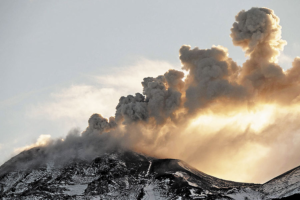
Indonesia , Lewotobi Laki-laki :
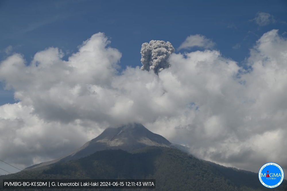
An eruption of Mount Lewotobi Laki occurred on Saturday June 15, 2024 at 12:02 WITA with the height of the ash column observed at ±900 m above the summit (±2484 m above sea level). The ash column was observed to be gray with thick intensity, oriented towards the South-West and West. This eruption was recorded on a seismograph with a maximum amplitude of 47.3 mm and a duration of 196 seconds.
VOLCANO OBSERVATORY NOTICE FOR AVIATION – VONA
Issued : June 15 , 2024
Volcano : Lewotobi Laki-laki (264180)
Current Aviation Colour Code : ORANGE
Previous Aviation Colour Code : orange
Source : Lewotobi Laki-laki Volcano Observatory
Notice Number : 2024LWK069
Volcano Location : S 08 deg 32 min 20 sec E 122 deg 46 min 06 sec
Area : East Nusa Tenggara, Indonesia
Summit Elevation : 5069 FT (1584 M)
Volcanic Activity Summary :
Eruption with volcanic ash cloud at 04h02 UTC (12h02 local).
Volcanic Cloud Height :
Best estimate of ash-cloud top is around 7949 FT (2484 M) above sea level or 2880 FT (900 M) above summit. May be higher than what can be observed clearly. Source of height data: ground observer.
Other Volcanic Cloud Information :
Ash cloud moving from southwest to west. Volcanic ash is observed to be gray. The intensity of volcanic ash is observed to be thick.
Remarks :
Eruption recorded on seismogram with maximum amplitude 47.3 mm and maximum duration 196 second.
Source et photo : Magma Indonésie.
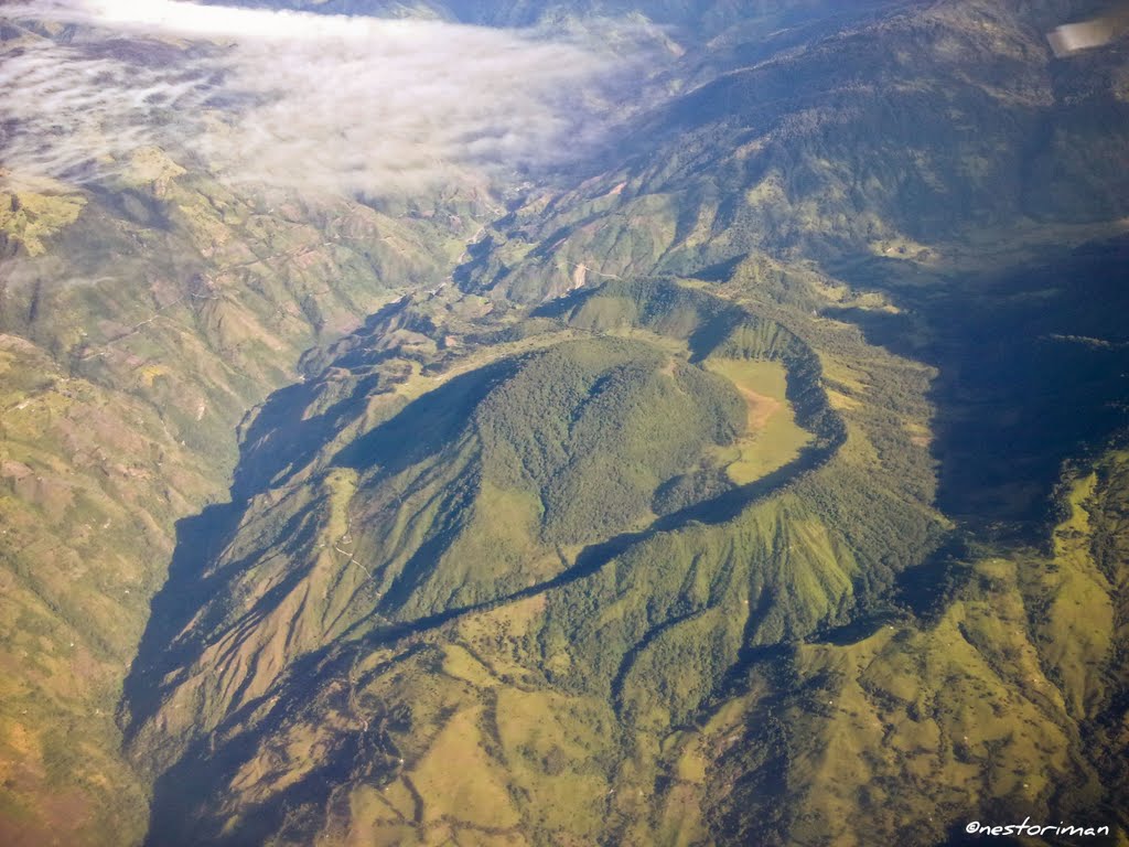
Colombia , Cerro Machin :
Weekly Activity Bulletin: Cerro Machín Volcano
Regarding the monitoring of the activity of the CERRO MACHÍN VOLCANO, the COLOMBIAN GEOLOGICAL SERVICE (SGC), an entity attached to the MINISTRY OF MINES AND ENERGY, reports that:
For the week of June 4 to 10, 2024, the recording of seismicity associated with the fracturing of rocks inside the volcanic edifice continued. In general, this activity has maintained similar levels in the number of recorded earthquakes and in the seismic energy released compared to the previous week, however since 10:30 a.m. today there has been a slight increase. The earthquakes were located on the southwest and south flanks of the main dome, at distances less than 2 km from the main dome.
The depths of the earthquakes varied between 2 and 6 km from the summit of the volcano. The maximum magnitudes up to the time of the bulletin’s release were 1.3 and 1.2, corresponding to the earthquakes recorded today at 10:44 a.m. and 11:08 a.m. respectively. The two earthquakes were located 1 km west-southwest of the main dome, at a depth of 3 km.
The other parameters measured and used for the diagnosis of volcanic activity did not present significant changes during the period evaluated.
The alert status for volcanic activity remains at: YELLOW ALERT: Active volcano with changes in the behavior of the base level of monitored parameters and other manifestations.
Source : SGC
Photo : Nestoriman
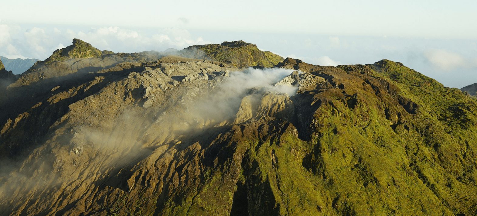
La Guadeloupe , La Soufrière :
Monthly bulletin, Paris Institute of Globe Physics / Guadeloupe Volcanological and Seismological Observatory.
May 2024, Soufrière Volcano:
• Seismicity:
762 volcano-tectonic earthquakes (VT), including 3 swarms of 314, 179, and 119 earthquakes were detected in the volcano sector. All earthquakes have a negative magnitude and are located less than 1 km deep under the Soufrière dome. The energy released (1.5 MJ) is up compared to the previous month (1.0 MJ)
• Deformation:
since the beginning of 2024, GNSS stations have recorded a slowdown in the opening of the top of the dome
• Gases and fluids
– after significant fluctuations in 2023, the temperature (95.1 to 95.3 °C) and pH (3.32) of the Napoléon Nord fumarole returned to normal values
– the temperature of Lake Tarissan is 99.6°C. Its pH (+0.01) is slightly decreasing.
– The composition of deep gases (non-condensable) does not show any major change which could reflect a rise of magma.
Based on the observations summarized in this bulletin, and in accordance with the provisions planned by the authorities, the volcanic alert level (table in the appendix) remains:
Vigilance: Yellow
Regional telluric activity
• 178 earthquakes were recorded on regional fault networks, including 56 in the Saintes sector
• The largest earthquake (Md= 5.4 ± 0.3) occurred on May 8 at 10:43 (local time). The epicenter was located 36 km north-northwest of Anse-Bertrand, at a depth of 17 km. This shock was widely felt in Guadeloupe.
Source et photo : IPGP
Guatemala , Santiaguito :
Weather conditions: partly cloudy
Wind: from the West
Precipitation: 73.0 mm.
Activity:
The Santiaguito Volcano Observatory OVSAN reports abundant degassing on the crater dispersing towards the East and South-East, weak to moderate explosions are recorded expelling columns of gas and ash which reach up to 900 meters high above the crater which disperse towards the South-East, the East and in a North-East direction. At night and early in the morning, incandescence was observed in the Caliente Dome crater and in the upper part of the lava flow in a West-Southwest direction.
Weak, moderate and some strong block avalanches are recorded on the lava flow, on the southern flank and on the southeastern flank. The volcano maintains high activity due to the extrusion of lava blocks in the Caliente Dome in a west, southwest direction and the unstable nature of the material in the crater. There is therefore a probability of moderate to strong pyroclastic flows. one should not stay near or in river beds near the slopes of the volcano. In the afternoon and evening, the heavy rains forecast could cause lahars in different ravines of the volcano.
Source : Insivumeh
Photo : Edgar Cabrera / CONRED