May 13 , 2024.
Indonesia , Ibu :
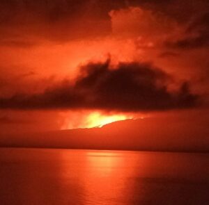
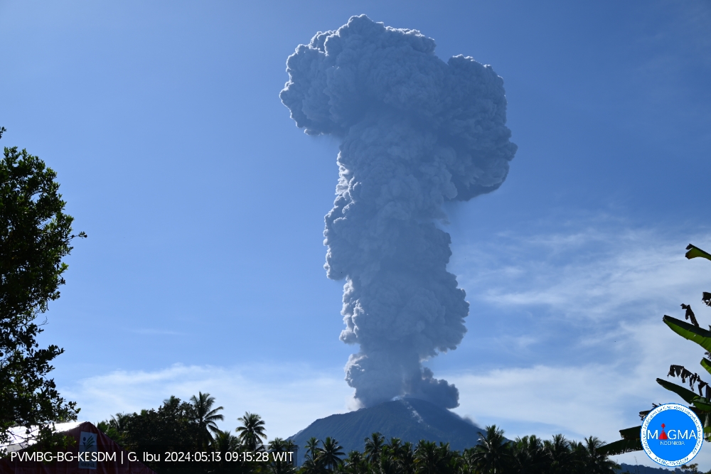
An eruption of Mount Ibu occurred on Monday 13 May 2024 at 09:12 WIT with the height of the ash column observed at ±5,000 m above the summit (±6,325 m above sea level) . The ash column was observed to be gray to black in color with thick intensity, oriented towards the West. At the time of writing, the eruption was still ongoing.
VOLCANO OBSERVATORY NOTICE FOR AVIATION – VONA
Issued : May 13 , 2024
Volcano : Ibu (268030)
Current Aviation Colour Code : RED
Previous Aviation Colour Code : orange
Source : Ibu Volcano Observatory
Notice Number : 2024IBU006
Volcano Location : N 01 deg 29 min 17 sec E 127 deg 37 min 48 sec
Area : North Maluku, Indonesia
Summit Elevation : 4240 FT (1325 M)
Volcanic Activity Summary :
Eruption with volcanic ash cloud at 00h12 UTC (09h12 local).
Volcanic Cloud Height :
Best estimate of ash-cloud top is around 20240 FT (6325 M) above sea level or 16000 FT (5000 M) above summit. May be higher than what can be observed clearly. Source of height data: ground observer.
Other Volcanic Cloud Information :
Ash cloud moving to west. Volcanic ash is observed to be gray. The intensity of volcanic ash is observed to be thick.
Remarks :
Eruption and ash emission is continuing. Eruption recorded on seismogram with maximum amplitude 28 mm.
Source et photo : Magma Indonésie
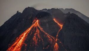
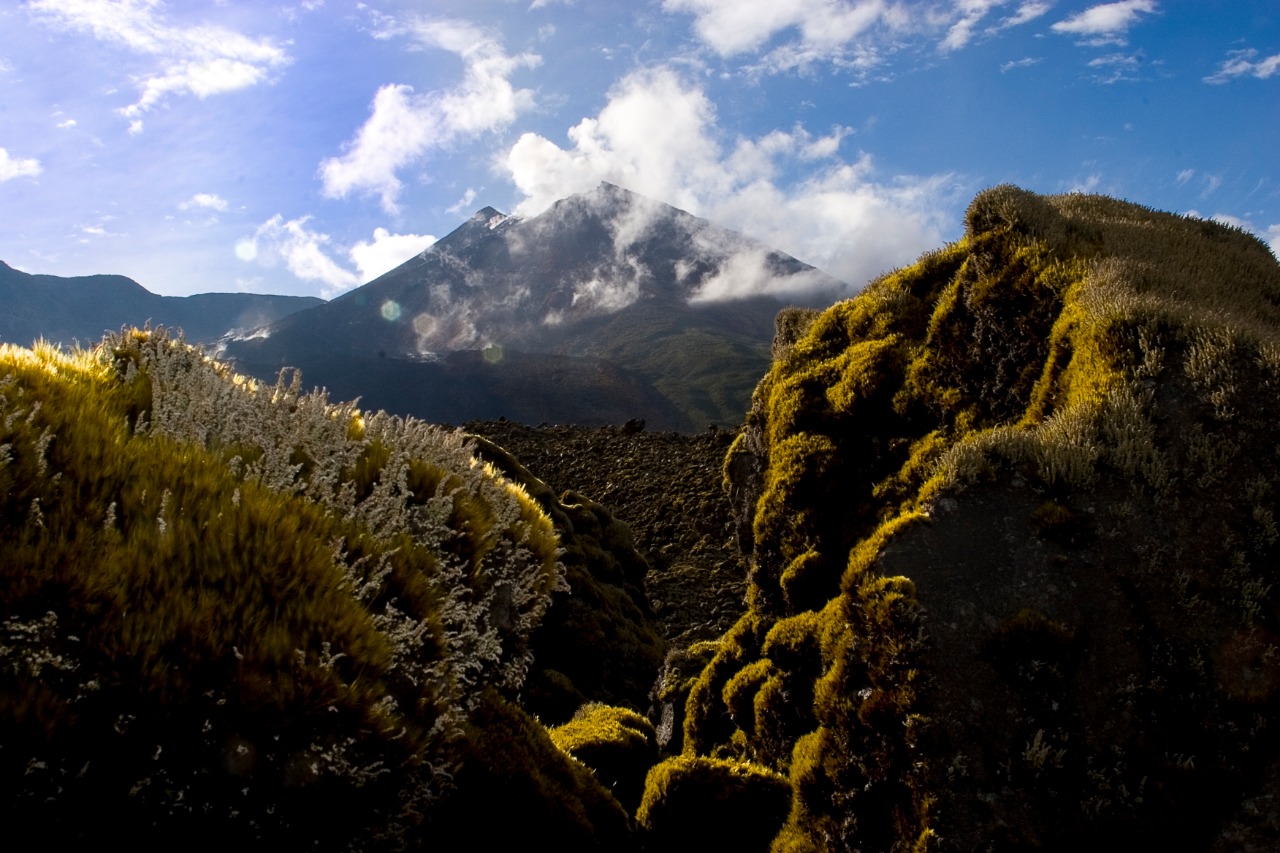
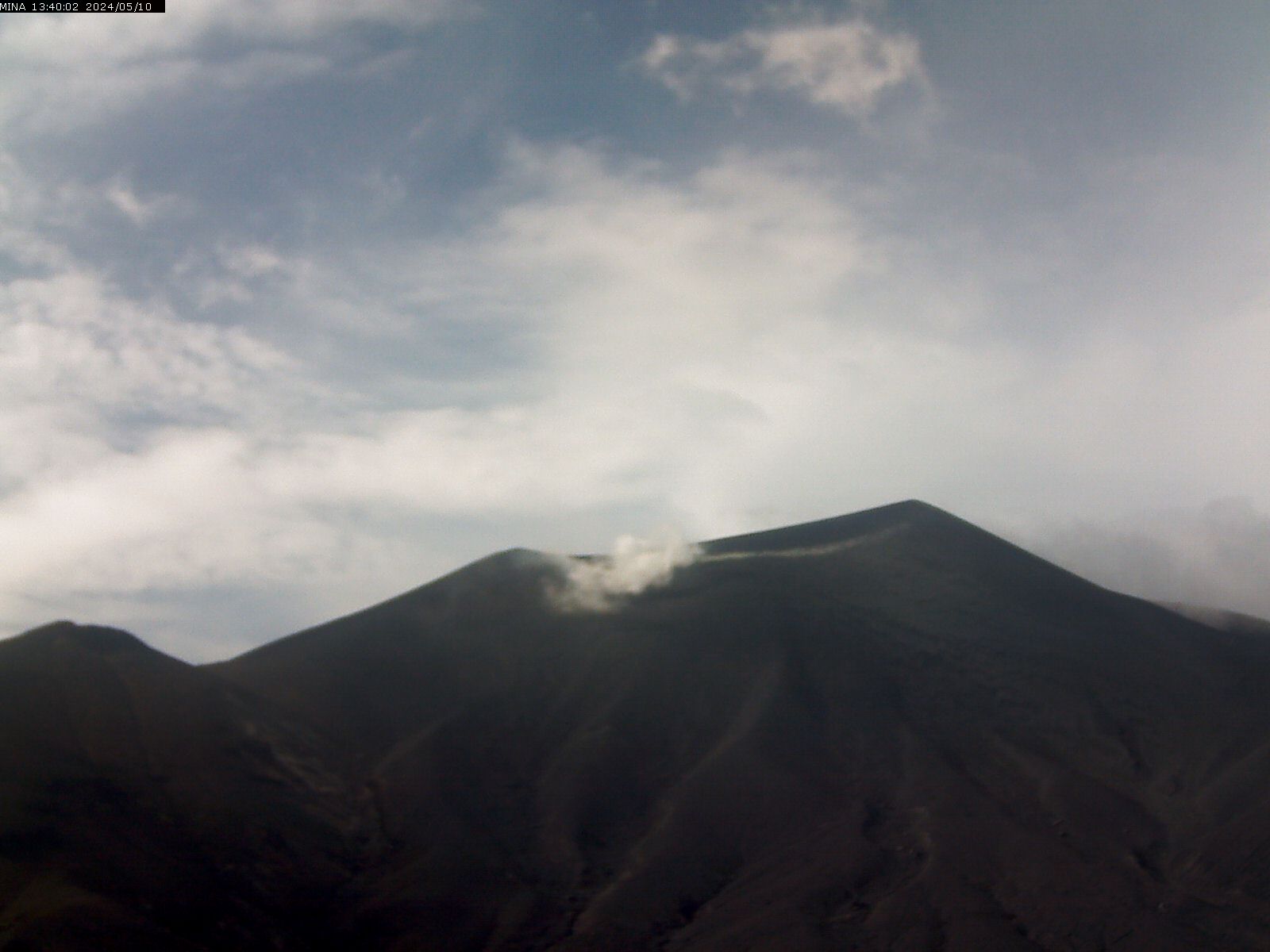
Ecuador , Reventador :
DAILY REPORT ON THE STATE OF REVENTADOR VOLCANO, Sunday May 12, 2024.
Information Geophysical Institute – EPN.
Surface activity level: High, Surface trend: No changes
Internal activity level: Moderate, Internal trend: No changes
Seismicity: From May 11, 2024, 11:00 a.m. to May 12, 2024, 11:00 a.m.:
Seismicity:
Below is the count of seismic events recorded at the reference station
Explosion (EXP) 59
Long Period (LP) 10
Transmitting Tremor (TREMI) 8
Harmonic Tremor (TRARM) 4
Precipitation/Lahars:
No rain was recorded in the volcano area. **In the event of heavy rains, these could remobilize the accumulated materials, generating mud and debris flows which would descend the sides of the volcano and flow into adjacent rivers.
Emissions/ash column:
Over the last 24 hours, thanks to the surveillance camera system, several gas and ash emissions have been recorded with heights between 200 and 700 meters above the level of the crater in the North-West and West directions. In connection with these emissions, the Washington VAAC issued 5 reports with heights between 800 and 1,100 meters above the level of the crater, oriented towards the Northwest and West-Northwest.
Other monitoring parameters:
The MIROVA-VIIRS satellite system recorded 2 thermal anomalies and the FIRMS satellite system recorded 12 thermal anomalies, over the last 24 hours.
Observation:
During the night yesterday and early today, several episodes of incandescence and descent of incandescent material along the flanks of the volcano were recorded, up to 600 meters below the level of the crater. As of closing this report, the volcano remains partly cloudy.
Alert level: Orange
Source : IGEPN.
Photo : volcan reventador FB.
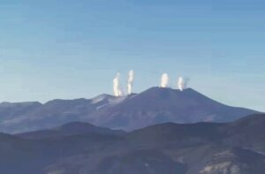
Colombia , Puracé :
Popayan, May 12, 2024, 3:00 p.m.
Regarding the monitoring of the activity of the PURACE VOLCANO – LOS COCONUCOS VOLCANIC RANGE, the COLOMBIAN GEOLOGICAL SERVICE (SGC), an entity attached to the MINISTRY OF MINES AND ENERGY, reports that:
From yesterday until the time of publication of this bulletin, the seismic activity associated with fracture processes, as well as that linked to the movement of fluids, maintained a behavior similar to that observed in previous days. Fracture earthquakes continue to be located under the crater of the Puracé volcano and its eastern flank, up to 4 km deep. The maximum magnitude calculated was 0.8 ML, corresponding to an earthquake recorded today at 00:57. Seismicity linked to the movement of fluids continues to be concentrated in the crater sector and on its northern flank, at depths less than 2.0 km.
Due to the action of the winds in the upper part of the volcano it was not possible to measure the height of the gas column, however, in the images obtained this morning it was possible to see the degassing processes at the inside the crater as on the lateral fumarole, with white emissions which dispersed depending on the wind regime in the area. Ground deformation processes and the concentrations of carbon dioxide (CO2) and sulfur dioxide (SO2) gases maintain the observed trend, with values that remain above the known baselines for this volcano.
The SGC confirms that the alert state of the PURACE VOLCANO continues at ORANGE: volcano with significant changes in the monitored parameters.
Source et photo : SGC
Hawaii , Kilauea :
Sunday, May 12, 2024, 9:04 AM HST (Sunday, May 12, 2024, 19:04 UTC)
19°25’16 » N 155°17’13 » W,
Summit Elevation 4091 ft (1247 m)
Current Volcano Alert Level: ADVISORY
Current Aviation Color Code: YELLOW
Activity Summary:
Kīlauea volcano is not erupting. Unrest continues beneath the upper East Rift Zone and the summit caldera south of Halemaʻumaʻu.
Summit and Upper East Rift Zone Observations:
Earthquake counts remain slightly above background levels, but overall seismicity is reduced from several days ago. Over the past day, most earthquakes have clustered below the upper East Rift Zone. Earthquake depths have averaged 2–4 km (1.2–3.1 miles) beneath the surface, and magnitudes have been mostly below M2.0.
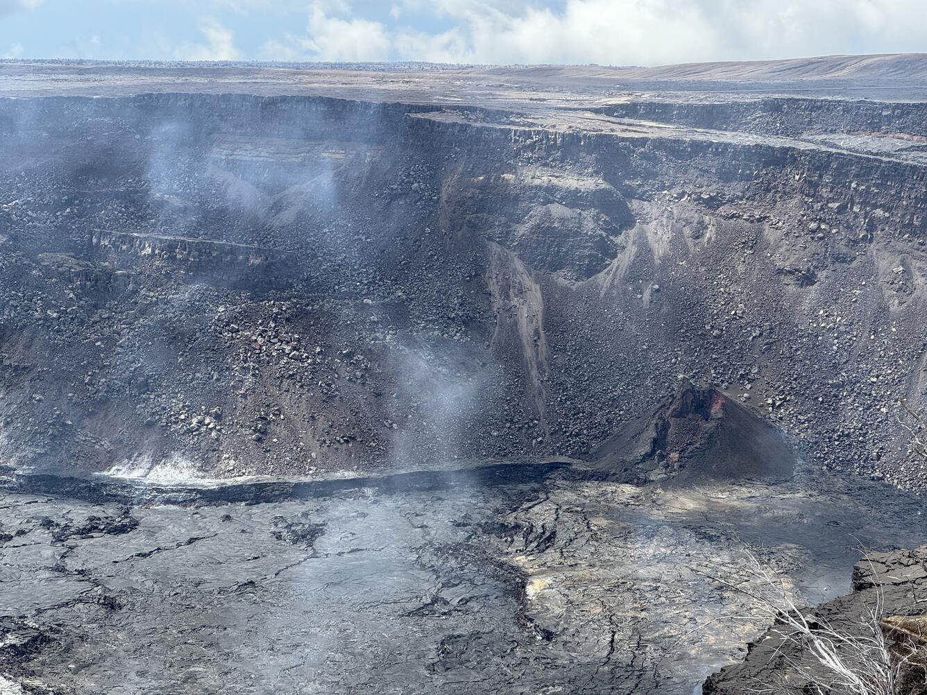
Ground deformation continues beneath Halemaʻumaʻu, though at reduced rates over the past day. The Uēkahuna tiltmeter northwest of the summit has shown slight inflationary tilt over the past day. Over the same period, the Sand Hill tiltmeter southwest of the summit has been flat, showing no significant inflation or deflation in the south caldera region.
Sulfur dioxide (SO2) gas emission rates remain low. An SO2 emission rate of approximately 62 tonnes per day was recorded on May 2.
Rift Zone Observations:
Elevated seismic activity in the East Rift Zone is confined to the upper portion of the rift zone, with no significant earthquakes occurring past Pauahi Crater. At this time, seismicity in Kīlauea’s Southwest Rift Zone remains relatively low outside of the summit region. Measurements from continuous gas monitoring stations downwind of Puʻuʻōʻō in the middle East Rift Zone—the site of 1983–2018 eruptive activity—remain below detection limits for SO2, indicating that SO2 emissions from Puʻuʻōʻō are negligible.
Analysis:
Magma has been pressurizing the system beneath Halemaʻumaʻu and the south caldera region, activating seismicity along faults in the upper East Rift Zone. At this time, it is not possible to say whether this increase in activity will lead to an intrusion or eruption in the near future, or simply continue as seismic unrest at depth. Changes in the character and location of unrest can occur quickly, as can the potential for eruption.
Source : HVO
Photo : USGS / M. Patrick
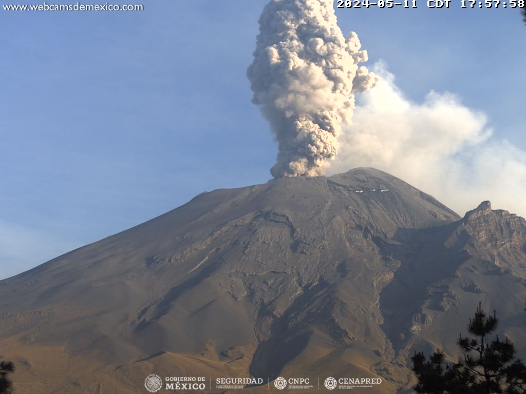
Mexico , Popocatepetl :
May 12, 11:00 a.m. (May 12, 5:00 p.m. GMT)
Activity from the last 24 hours
12 exhalations were detected, accompanied by water vapor, volcanic gases and slight amounts of ash. Additionally, 257 minutes of tremor were identified. Additionally, two volcano-tectonic earthquakes were recorded today at 00:26 and 00:36 local time, with magnitudes of 1.5 and 1.6, respectively.
During the morning and at the time of this report, a slight emission of water vapor and volcanic gases is observed, heading towards the West (W).
The volcanic warning fire of the Popocatépetl volcano is in yellow phase 2.
The scenarios planned for this phase are:
A few small to moderate explosions
Appearance of tremors of variable amplitude
Light to moderate ash rain in surrounding towns and some more distant towns
Ejection of incandescent fragments within the exclusion radius of 12 kilometers
The occurrence of lahars can be expected to move down the ravines, due to the accumulation of ash on the slopes and its interaction with the rains expected in the coming weeks.
Possibility of pyroclastic flows not reaching populations
Source et photo : Cenapred