May 05 , 2024.
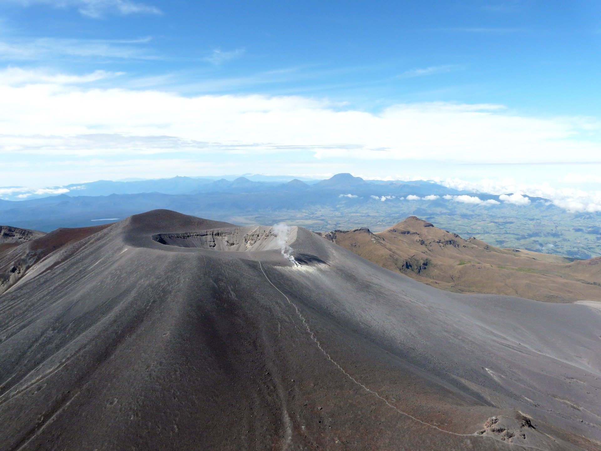
Colombia , Puracé :
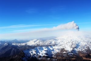
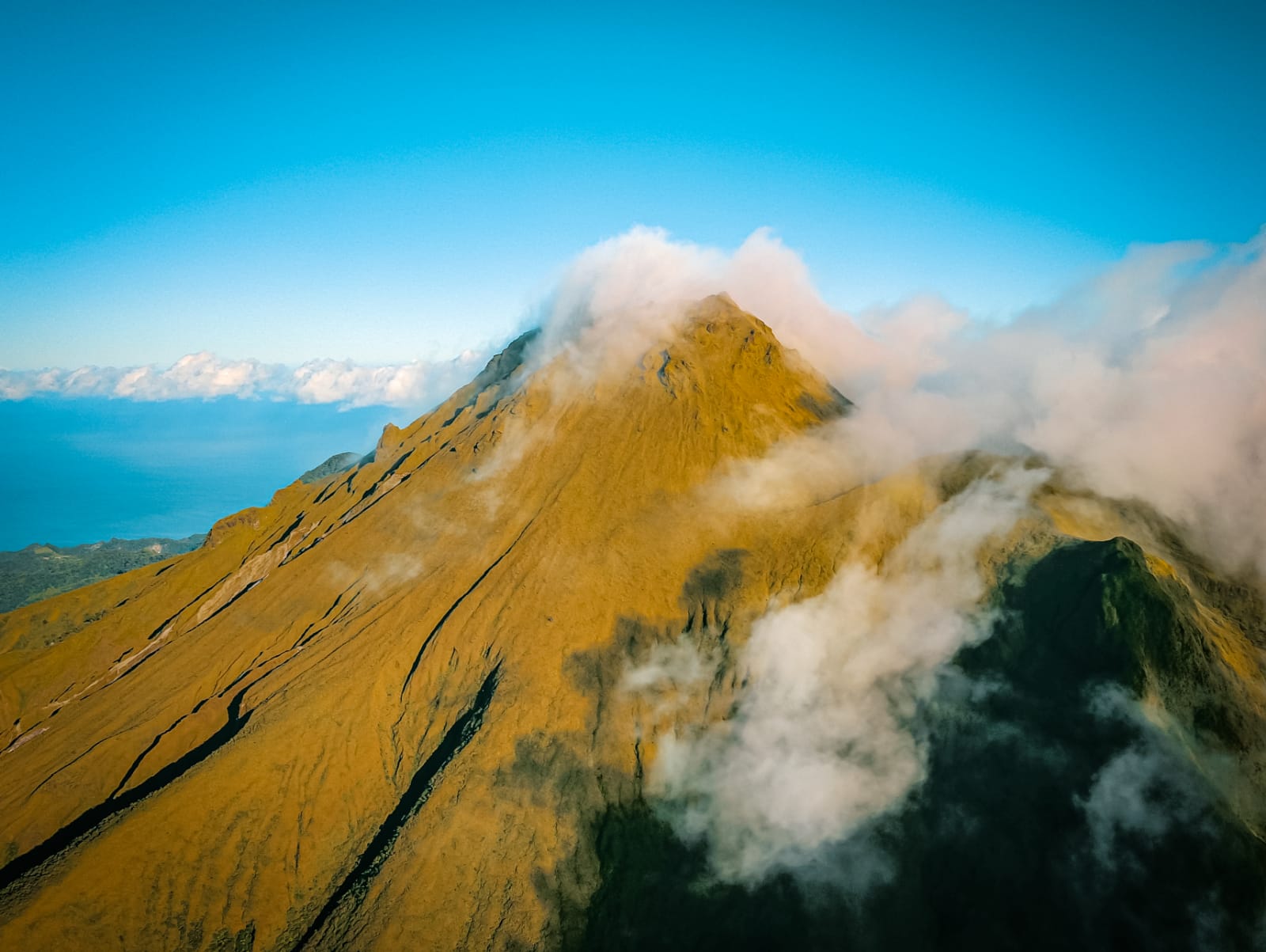
Popayan, May 4, 2024, 2:45 p.m.
From the monitoring of the activity of the PURACE VOLCANO – LOS COCONUCOS VOLCANIC CHAIN, the COLOMBIAN GEOLOGICAL SERVICE (SGC), an entity attached to the MINISTRY OF MINES AND ENERGY, reports that:
Since the declaration of the state of ORANGE alert, until the moment of publication of this bulletin, the seismic activity of fracture and fluid movement shows a behavior similar to that which was recorded in previous days, in terms number of events and energy released. Earthquakes associated with rock fracturing were located mainly under the crater of the Puracé volcano and on its eastern flank, at depths between 0.8 and 4 km. The maximum magnitude was 1.6 ML, corresponding to an earthquake recorded today at 10:50 a.m. Seismicity linked to the movement of fluids was concentrated in the crater sector and on its northern flank, at depths less than 0.8 km.
Additionally, earthquakes associated with the rise, settling, or movement of magma have been recorded, which may occur in the form of a dome or protrusion that may or may not rise to the surface.
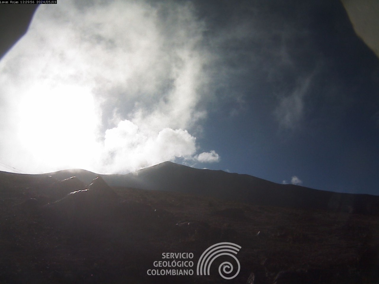
The maximum height of the gas column observed between yesterday and today was approximately 1,400 m, measured from the summit of the volcano, with a direction of dispersion towards the West. Ground deformation processes and concentrations of carbon dioxide (CO2) and sulfur dioxide (SO2) gases continue to show values above known reference values for this volcano.
The SGC confirms that the alert state of the PURACE VOLCANO continues at ORANGE: volcano with significant changes in the monitored parameters. Although it is possible that seismic activity levels, as well as degassing levels, decrease or oscillate, in the sense of increasing on some days and decreasing on others, this does not imply that the volcano has returned to its normal activity levels. . To return to a minor alert state (yellow), a reasonable period of time is required during which all monitored parameters are evaluated and trends that may indicate greater stability are determined. During this time, in the event of an acceleration of processes suggesting an imminent eruption or if the eruption itself occurs, the alert status level will change to Red.
We recommend that the community remain calm and follow all instructions from the National Disaster Risk Management Unit (UNGRD), as well as local authorities. Also pay attention to the information provided by the Colombian Geological Service on the evolution of the state of the volcano.
Source et photos : SGC
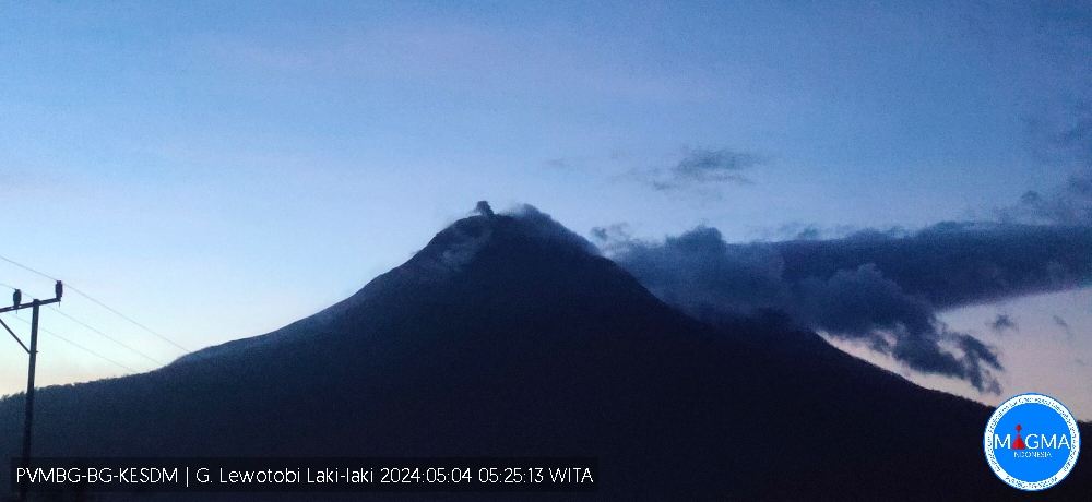
Indonesi , Lewotobi Laki-laki :
An eruption of Mount Lewotobi Laki Laki occurred on Sunday May 5, 2024 at 00:13 WITA with the height of the ash column observed at ±200 m above the summit (±1784 m above sea level) . The ash column was observed to be white to gray in color with medium to thick intensity, oriented towards the North. This eruption was recorded on a seismograph with a maximum amplitude of 47.3 mm and a duration of 145 seconds.
Observation of seismicity:
3 eruption earthquakes with an amplitude of 7.4 to 29.6 mm and duration of the earthquake from 72 to 146 seconds.
3 emission earthquakes with an amplitude of 10.5 to 29.6 mm and duration of the earthquake from 30 to 45 seconds.
1 Low frequency earthquake with an amplitude of 7.4 mm and an earthquake duration of 50 seconds.
1 hybrid/multiphase earthquake with an amplitude of 7.4 mm, and an earthquake duration of 18 seconds.
13 Shallow volcanic earthquakes with an amplitude of 3.7 to 10.5 mm and an earthquake duration of 7 to 14 seconds.
2 deep volcanic earthquakes with an amplitude of 10.5 to 14.8 mm, and an earthquake duration of 9 to 13 seconds.
4 distant tectonic earthquakes with an amplitude of 10.5 to 47.3 mm, and earthquake duration 35 to 140 seconds.
1 flood vibration earthquake with an amplitude of 47.3 mm and an earthquake duration of 3198 seconds.
RECOMMENDATION
1. Communities around Mount Lewotobi Laki Laki and visitors/tourists do not carry out any activities within a radius of 2 km from the center of the eruption and in a sector of 3 km in the North-North-East direction and 5 km in the direction of the North-East sector.
2. The public should remain calm and follow the instructions of the regional government and not believe rumors whose origin is unclear.
Source et photo : magma Indonésie
Hawaii , Kilauea :
Saturday, May 4, 2024, 10:40 AM HST (Saturday, May 4, 2024, 20:40 UTC)
19°25’16 » N 155°17’13 » W,
Summit Elevation 4091 ft (1247 m)
Current Volcano Alert Level: ADVISORY
Current Aviation Color Code: YELLOW
Activity Summary:
Kīlauea volcano is not erupting. Seismicity has decreased significantly beneath the upper East Rift Zone, as has inflation in the caldera south of Halemaʻumaʻu.
Summit and upper East Rift Zone Observations: Activity has slowed significantly in the past 24 hours. Earthquake counts have decreased significantly with approximately 75 earthquakes in this area in the past 24 hours and 7 in the past 8 hrs. Earthquake locations remain focused primarily from the southeast side of Kaluapele (Kīlauea caldera) beneath Keanakākoʻi crater extending to the intersection with Hilina Pali Road. Earthquake depths remain unchanged, averaging 2-3 km (1.2-1.9 miles) beneath the surface, and magnitudes have not exceeded M2.0 in the past 24 hours. There have been no earthquakes in the caldera south of Halemaʻumaʻu over this same period.
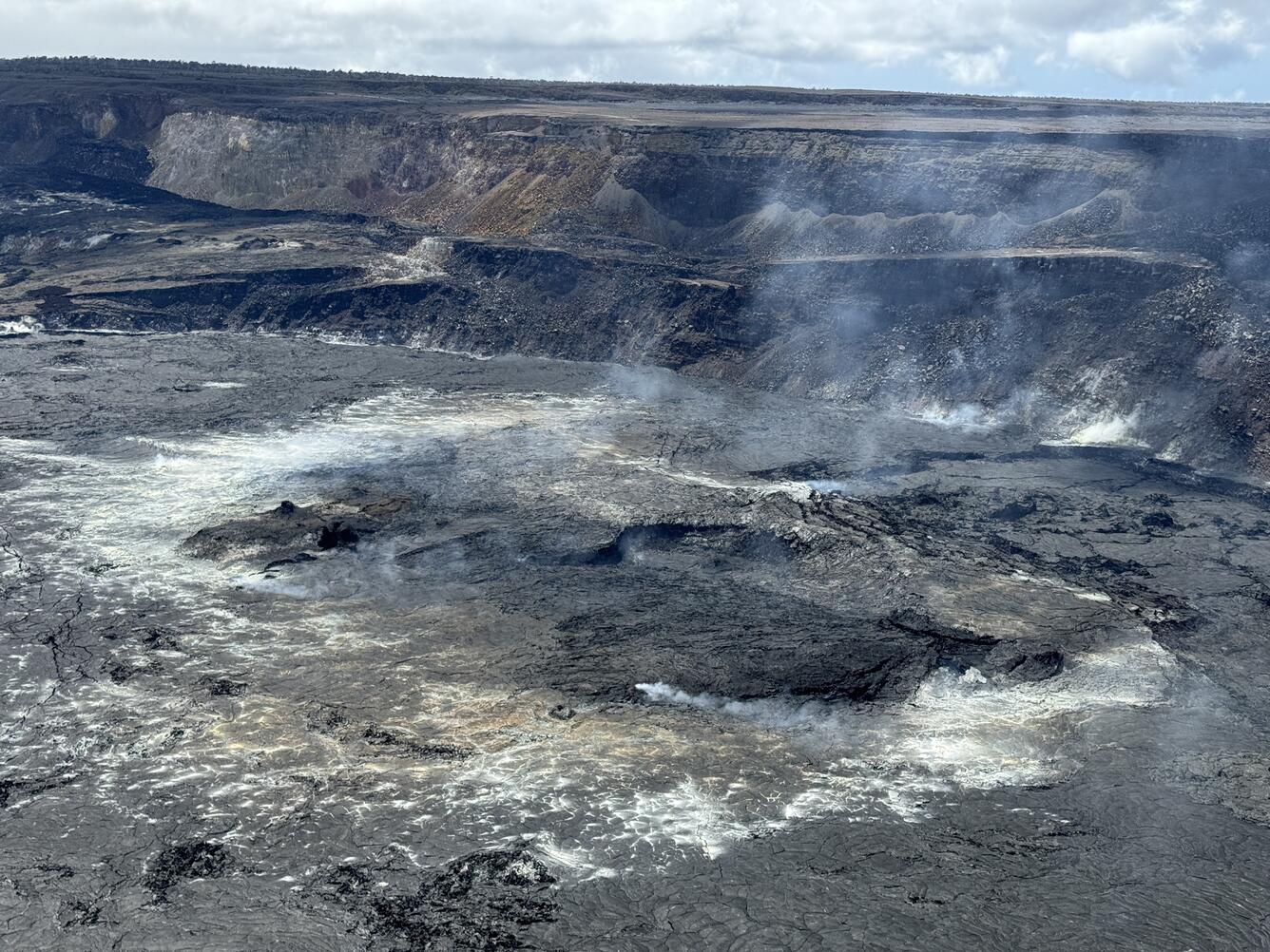
Despite a significant increase in small earthquakes at the summit and upper East Rift Zone in recent days, activity at the surface was quiet On May 1, 2024. This photo shows the floor of Halema‘uma‘u, at the summit of Kīlauea, which last erupted in September 2023. Weak outgassing plumes originated from several spots on the crater floor, and this has been typical during quiet periods.
Ground deformation has effectively ceased beneath Halemaʻumaʻu and the south side of Kalaupele and Keanakākoʻi crater. The Uēkahuna tiltmeter has recorded little change in the past 24 hours, after recording a deflationary signal as part of a local deflation-inflation (DI) event beneath Halemaʻumaʻu. The Sandhill tiltmeter has also recorded little change over the same period.
Sulfur dioxide (SO2) gas emission rates remain low. An SO2 emission rate of approximately 62 tonnes per day was recorded on May 2nd.
Rift Zone Observations:
All seismic activity on the East Rift Zone is confined to the upper East Rift Zone, with no significant earthquakes occurring past the Pauahi Crater. At this time, seismicity south of Kaluapele and in Kīlauea’s Southwest Rift Zone remains low overall.
Source : HVO
Photo : USGS M. Patrick.
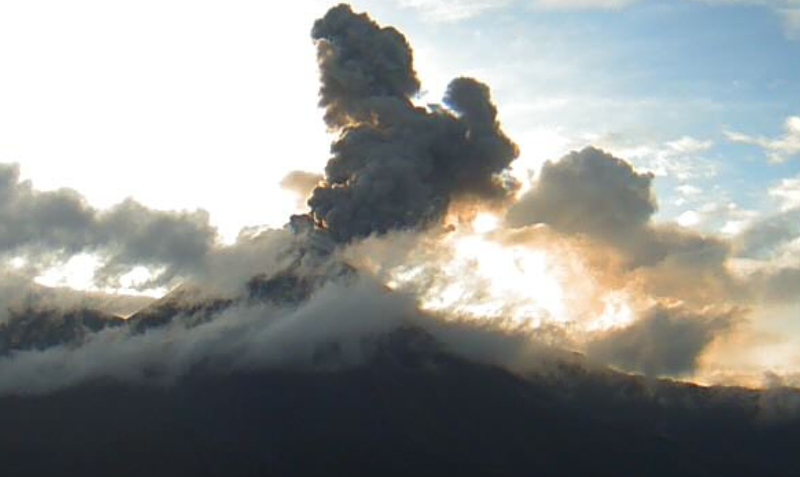
Ecuador , Reventador :
DAILY REPORT ON THE STATE OF THE REVENTADOR VOLCANO, Saturday May 4, 2024.
Information Geophysical Institute – EPN.
Surface activity level: Moderate, Surface trend: Ascending
Internal activity level: Moderate, Internal trend: No changes
Seismicity: From May 3, 2024, 11:00 a.m. to May 4, 2024, 11:00 a.m.:
Below is the count of seismic events recorded at the reference station
Explosion (EXP) 65
Long Period (LP) 13
Transmitting Tremor (TREMI) 9
Harmonic Tremor (TRARM) 5
Precipitation/Lahars:
No rain was recorded in the volcano area. **In the event of heavy rains, these could remobilize the accumulated materials, generating mud and debris flows which would descend the sides of the volcano and flow into adjacent rivers.
Emissions/ash column:
Over the last 24 hours, thanks to the surveillance camera system, several emissions of gas and ash have been recorded with heights between 500 and 700 meters above the level of the crater and directed towards the West. In connection with this activity, the Washington VAAC has published two emissions reports, with heights of 800 meters above the crater level in the West and South-West directions.
Other monitoring parameters:
The MIROVA-VIIRS satellite system recorded 1 thermal anomaly in the last 24 hours.
Observation:
During the night of yesterday and early today, thanks to the camera system, an incandescence was observed at the level of the crater with material falling on the flanks of the volcano up to 400 meters below the level of the crater. On the other hand, yesterday afternoon, a pyroclastic flow was recorded which descended the southeast flank of the volcano to 800 meters below the level of the crater. As of closing this report, the volcano remains completely cloudy.
Alert level: Yellow.
Source : IGEPN.
Photo : Archive IGEPN
La Martinique , Montagne Pelée :
Weekly report, Paris Institute of Globe Physics / Martinique Volcanological and Seismological Observatory
Activity on Montagne Pelée, Saint-Pierre, May 3, 2024 at 2:00 p.m. local time (GMT-4)
Volcanic activity is stable this week with 13 earthquakes of volcanic origin observed.
Between April 26, 2024 at 4:00 p.m. (UT) and May 3, 2024 at 4:00 p.m. (UT), the OVSM recorded 13 low-energy volcano-tectonic earthquakes. These earthquakes were clearly identified as originating from one of the well-known seismically active zones at Montagne Pelée, located between 1.0 and 1.4 km depth below the summit of the volcano.
Surface seismicity of the volcano-tectonic type is associated with micro-fracturing in the volcanic edifice linked to the global reactivation of the volcano observed since the end of 2018.
No earthquake was felt by the population.
The previous week, the OVSM had recorded 15 earthquakes of volcanic origin. As of May 3, 2024 and during the last 4 weeks, the OVSM has therefore observed a total of 39 volcanic earthquakes, or an average of 9 to 10 earthquakes per week.
During phases of volcanic reactivation of volcanoes similar to Montagne Pelée, it is usual to observe seismic activity varying in intensity and frequency.
For more details on observations and interpretations of volcanic activity over the longer term, refer to the OVSM monthly bulletins.
The alert level is currently YELLOW: vigilance.
Source : Direction de l’OVSM-IPGP.
Photo : rci.fm