April 29 , 2024.
Indonesia , Ibu / Lewotobi Laki Laki :
Ibu Volcano:
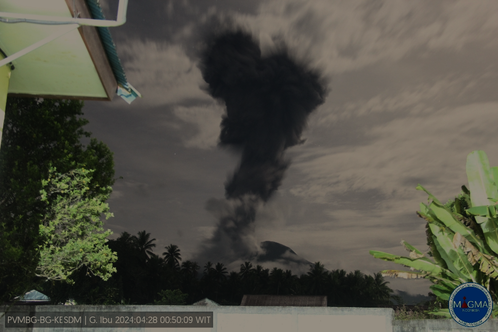
An eruption of Mount Ibu occurred on Sunday, April 28, 2024 at 00:37 WIT with the height of the ash column observed at ±3,500 m above the summit (±4,825 m above sea level) . The ash column was observed to be gray to black in color with thick intensity, oriented towards the West. This eruption was recorded on a seismograph with a maximum amplitude of 28 mm and a duration of 206 seconds.
Observation of seismicity:
8 eruption/explosion earthquakes with an amplitude of 24 to 28 mm and a seismic duration of 38 to 206 seconds.
2 avalanche earthquakes with an amplitude of 2 to 12 mm and a duration of 33 to 34 seconds.
43 emission earthquakes with an amplitude of 2 to 28 mm and earthquake duration of 26 to 54 seconds.
6 harmonic tremors with an amplitude of 2 to 8 mm and an earthquake duration of 54 to 245 seconds.
1 Tornillo type earthquake with an amplitude of 2 mm and an earthquake duration of 18 seconds.
451 Shallow volcanic earthquakes with an amplitude of 2 to 24 mm and an earthquake duration of 5 to 14 seconds.
8 deep volcanic earthquakes with an amplitude of 2 to 8 mm, and an earthquake duration of 5 to 7 seconds.
22 distant tectonic earthquakes with an amplitude of 3 to 28 mm, and the duration of the earthquake was 56 to 228 seconds.
RECOMMENDATION
1. Communities around Mount Ibu and visitors/tourists should not carry out activities within a radius of 2.0 km, with a sectoral extension of 3.5 km towards the crater opening in the northern part of the crater active Mount Ibu.
Lewotobi Laki Laki Volcano:
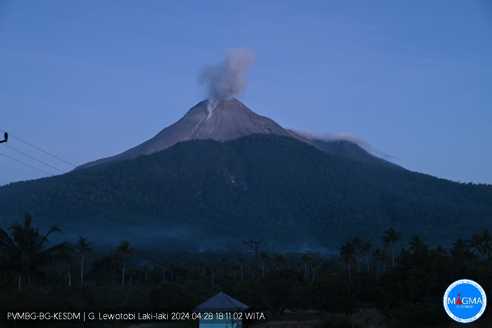
An eruption of Mount Lewotobi Laki Laki occurred on Sunday, April 28, 2024 at 6:08 p.m. WITA with the height of the ash column observed at ± 300 m above the summit (± 1884 m above sea level) . The ash column was observed to be white to gray in color with light to moderate intensity, oriented towards the South-West. This eruption was recorded on a seismograph with a maximum amplitude of 14.8 mm and a duration of 290 seconds.
Observation of seismicity:
2 eruption/explosion earthquakes with an amplitude of 14.8 to 37 mm and an earthquake duration of 248 to 311 seconds.
1 emission earthquake with an amplitude of 20.7 mm and duration of the earthquake of 72 seconds.
3 low-frequency earthquakes with an amplitude of 5.9 to 14.8 mm and an earthquake duration of 12 to 28 seconds.
3 hybrid/multi-phase earthquakes with an amplitude of 7.4 mm, and an earthquake duration of 18 to 22 seconds.
16 shallow volcanic earthquakes with an amplitude of 4.4 to 14.8 mm and a duration of 7 to 12 seconds.
2 deep volcanic earthquakes with an amplitude of 7.4 to 10.5 mm, and an earthquake duration of 9 to 14 seconds.
3 distant tectonic earthquakes with an amplitude of 10.5 to 47.3 mm, and an earthquake duration of 72 to 407 seconds.
RECOMMENDATION
1. Communities around Mount Lewotobi Laki Laki and visitors/tourists do not carry out any activities within a radius of 2 km from the center of the eruption of Mount Lewotobi Laki Laki and within a sector of 3 km in the North-North direction -East and 5 km in the direction of the North-East Sector.
Source et photos : Magma Indonésie
Colombia , Galeras :
Weekly activity bulletin: Galeras Volcano
Regarding the monitoring of the activity of the GALERAS VOLCANO, the MINISTRY OF MINES AND ENERGY, through the COLOMBIAN GEOLOGICAL SERVICE (SGC), reports that:
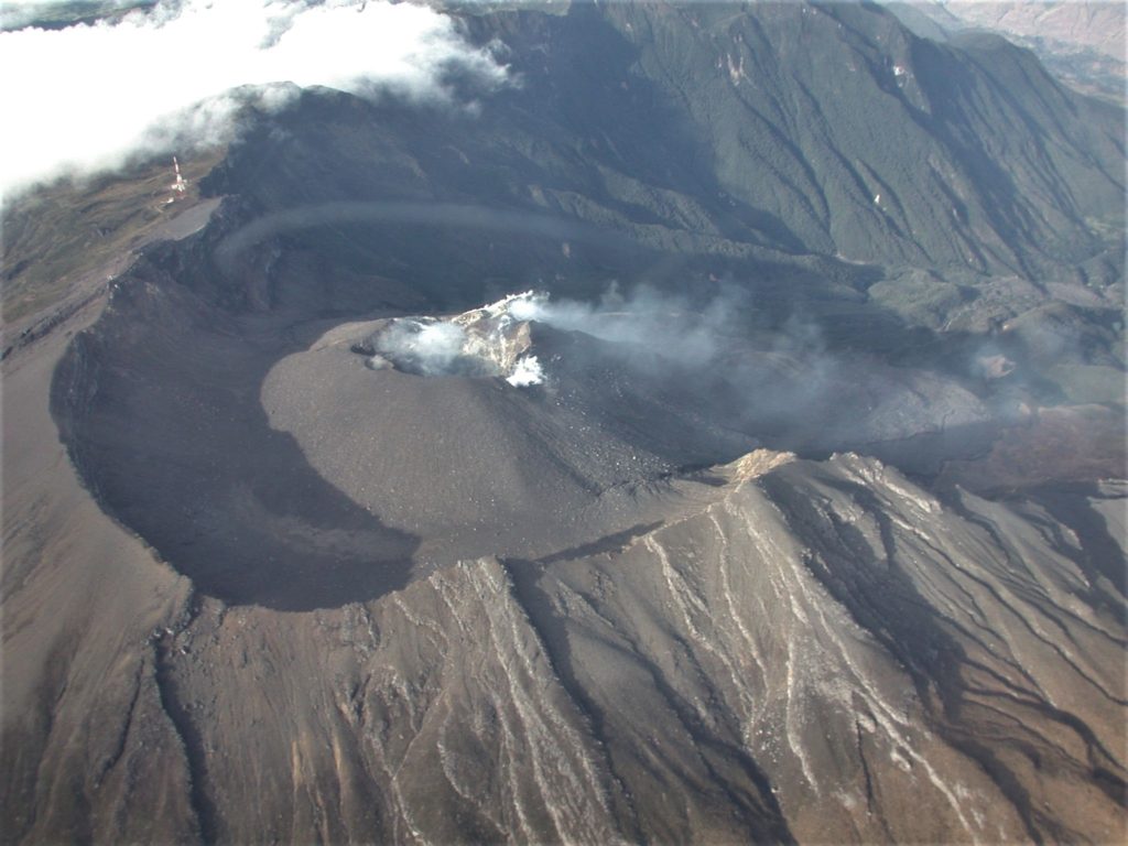
For the period from April 16 to 22, 2024, and compared to what was recorded the previous week, a slight increase was observed in the number of events with a decrease in seismic energy released. The seismic activity of the volcano showed a predominance of events associated with rock fracture, followed by seismicity linked to fluid transit. The fracture earthquakes were located in a scattered manner in the volcanic region, at distances less than 15 km and at depths between 1.0 and 12 km from its summit (4,200 m above sea level) and with a maximum magnitude of 1.3.
Gas emissions have been recorded from the fumarole fields of Las Chavas, to the West; and El Paisita, to the north of the active cone, with white gas columns of low height and variable dispersion due to wind action.
Other volcanic monitoring areas showed stability in their recordings.
Volcanic activity remains in a YELLOW ALERT state: Active volcano with changes in the behavior of the base level of monitored parameters and other manifestations.
Source et photo: SGC
Ecuador , Reventador :
DAILY REPORT ON THE STATE OF THE REVENTADOR VOLCANO, Sunday April 28, 2024.
Information Geophysical Institute – EPN.
Surface activity level: Moderate, Surface trend: No changes
Internal activity level: Moderate, Internal trend: No changes
Seismicity: From April 27, 2024, 11:00 a.m. to April 28, 2024, 11:00 a.m.:
Seismicity:
Due to transmission problems, it was not possible to count volcanic events over the past 24 hours.
Precipitation/Lahars:
Since yesterday, it has not been possible to monitor the volcano using surveillance cameras, however, satellite images and weather forecast services have shown a slight presence of rain in the volcano area without these having generated mud and debris flows. **In the event of heavy rains, these could remobilize the accumulated materials, generating mud and debris flows which would descend the sides of the volcano and flow into adjacent rivers.
Emissions/ash column:
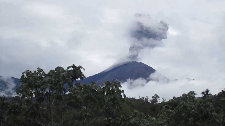
Yesterday, in the morning and afternoon, the W-VAAC issued 3 reports of gas and ash emission episodes at 800 m altitude above the level of the crater in a southwest direction , West and North-West.
Other monitoring parameters:
Over the past 24 hours, the FIRMS satellite system has recorded 2 thermal anomalies.
Observation:
Since yesterday, the volcano has remained cloudy most of the time, both in satellite images and weather forecast services.
Alert level: Yellow.
Source : IGEPN.
Photo : Archive IGEPN
La Martinique , Montagne Pelée :
Weekly report, Paris Institute of Globe Physics, Martinique Volcanological and Seismological Observatory,
Saint-Pierre, April 26, 2024 at 1:00 p.m. local time (GMT-4)
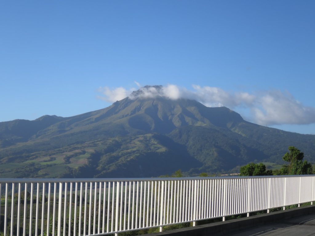
Volcanic activity increased slightly this week with 15 earthquakes of volcanic origin observed.
Between April 19, 2024 at 4:00 p.m. (UT) and April 26, 2024 at 4:00 p.m. (UT), the OVSM recorded 15 low-energy volcano-tectonic earthquakes. These earthquakes were clearly identified as originating from one of the well-known seismically active zones at Montagne Pelée, located between 1.0 and 1.4 km depth below the summit of the volcano.
Surface seismicity of the volcano-tectonic type is associated with micro-fracturing in the volcanic edifice linked to the global reactivation of the volcano observed since the end of 2018.
No earthquake was felt by the population.
The previous week, the OVSM had recorded 3 earthquakes of volcanic origin. As of April 26, 2024 and during the last 4 weeks, the OVSM has therefore observed a total of 52 volcanic earthquakes, or an average of 13 earthquakes per week.
During phases of volcanic reactivation of volcanoes similar to Montagne Pelée, it is usual to observe seismic activity varying in intensity and frequency.
For more details on observations and interpretations of volcanic activity over the longer term, refer to the OVSM monthly bulletins.
The alert level is currently YELLOW: vigilance.
Source : Direction de l’OVSM-IPGP.
Photo : Observatoire.
Mexico , Popocatepetl :
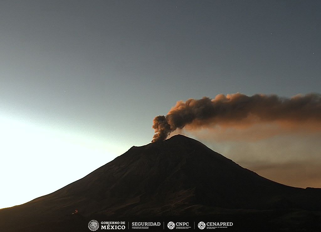
April 28, 11:00 a.m. (April 28, 5:00 p.m. GMT). Activity from the last 24 hours:
44 low-intensity exhalations were detected, accompanied by water vapor, other volcanic gases and sometimes light amounts of ash.
Additionally, 148 minutes of very low amplitude high frequency tremors were recorded.
During this morning and at the time of this report, the volcano is observed with an emission of water vapor and other gases directed towards the East-North-East.
The Popocatépetl volcanic warning fire is in yellow phase 2.
The scenarios planned for this phase are:
A few small to moderate explosions
Appearance of tremors of variable amplitude
Light to moderate ash rain in surrounding towns and some more distant towns
Ejection of incandescent fragments within the exclusion radius of 12 kilometers
The occurrence of lahars can be expected to descend into the ravines, due to the accumulation of ash on the slopes and their interaction with the rains expected in the coming weeks.
Possibility of pyroclastic flows not reaching populations.
Sources : Cenapred.
Photo : Cenapred ( archive).

