Iceland : Reykjanes Peninsula :
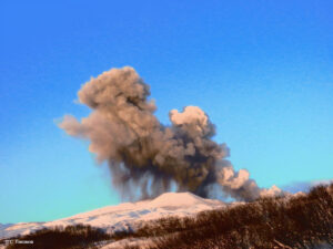
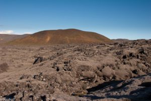
The Svartsengi eruption remains constant. The uprising has continued at a similar pace since early April.
Updated April 14 at 5:15 p.m.
The risk assessment is valid until April 16, all things being equal
There is always a risk of gas pollution. Residents in the area are advised to monitor air quality.
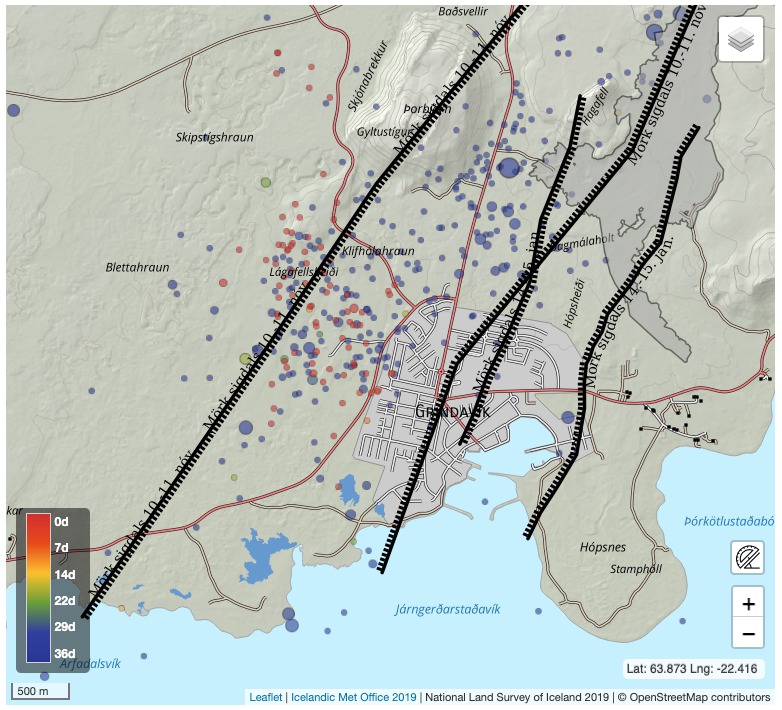
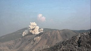
Numerous small earthquakes (less than magnitude 1) have been recorded northwest of Grindavík over the past few hours. (See preview images above.) The activity is primarily localized in the graben that formed on November 10 and is likely due to the effects of the Svartsengi eruption, which is causing voltage changes in the region.
Today’s seismic activity is similar to the activity measured in this area last mid-March. The seismic activity is therefore not a sign of a change in the activity of the volcano, which remained fairly stable during the weekend. Seismic activity northwest of Grindavík is also not a sign that magma is moving beneath this area.
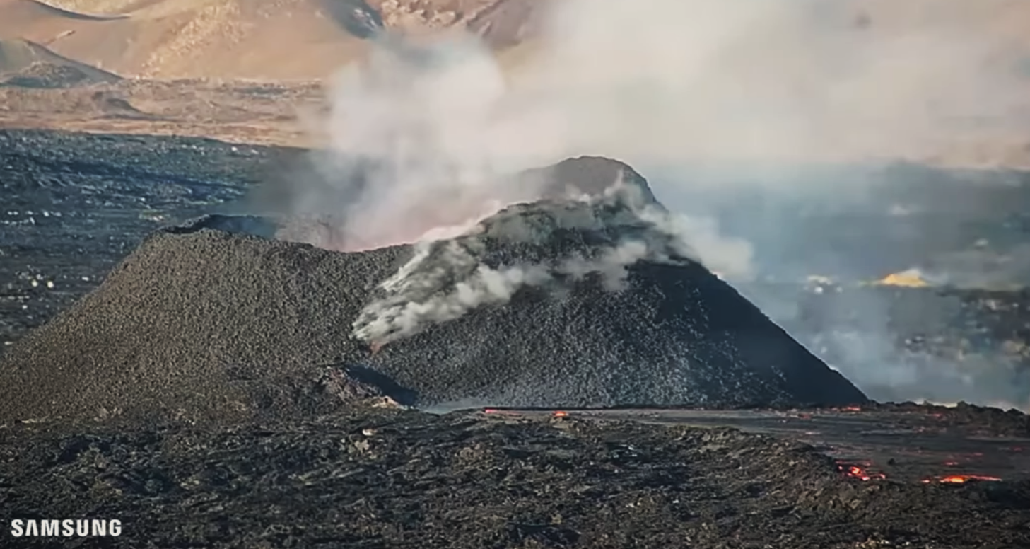
At the time of writing this article, seismicity has only subsided to the northwest of Grindavík. Large earthquakes are unlikely to accompany this currently measured activity.
If a magma was looking for something other than the path it traveled in the Sundhnúks crater series, e.g. to the west towards Eldvörp or south of Þorbirn, a possible eruption in this area would be preceded by very intense earthquakes and deformations which would be clearly visible on measuring instruments and satellite images. There is no sign of this at this stage.
24-hour monitoring from the National Weather Service continues to monitor the area and eruption centers.
Source : Vedur
Photos : IMO , Capture d’écran mblis
Italy , Campi Flegrei :
Campi flegrei – update on the seismic swarm from April 14, 2024, 10:59
A seismic swarm has been underway in the Campi Flegrei area since 9:35 a.m. (local time) on April 14, 2024. At 10:59 a.m., 45 earthquakes of magnitude Md ≥ 0.0 and maximum magnitude Md = 3.7 ± 0.3 were previously detected.
The image shows the locations of larger events.
Updates will follow depending on the evolution of the phenomenon.
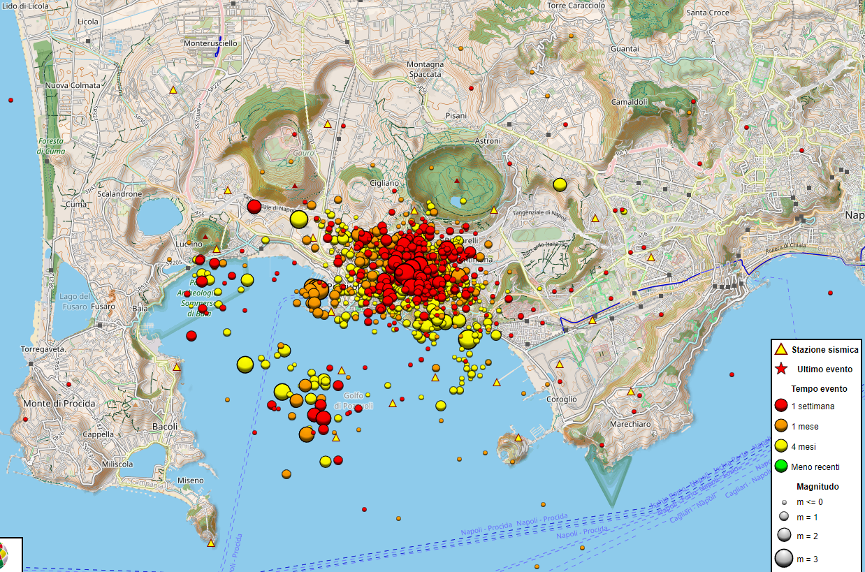
Campi flegrei – update on the seismic swarm from April 14, 2024, 1:55 p.m.
A seismic swarm has been underway in the Campi Flegrei area since 9:35 a.m. (local time) on April 14, 2024. At the time of publication of this press release (1:55 p.m.), 75 earthquakes of magnitude Md ≥ 0.0 and maximum magnitude Md = 3.7 ± 0.3 had been previously detected.
The image shows the locations of larger events.
Updates will follow depending on the evolution of the phenomenon.
Campi flegrei – end of the seismic swarm on April 14, 2024, 8:57 p.m.
The INGV Observatorio Vesuviano reports the conclusion of the seismic swarm which began at 9:35 a.m. (local time) on April 14, 2024 and consisted of several dozen earthquakes, 70 of which were preliminary located with a magnitude Md ≥ 0, 0 and with a maximum magnitude Md = 3.7 ± 0.3 located in the Campi Flegrei area.
In the photo the places of events of a larger scale.
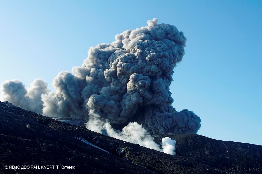
Russie / Iles Kouriles , Ebeko :
VOLCANO OBSERVATORY NOTICE FOR AVIATION (VONA)
Issued: April 15 , 2024
Volcano: Ebeko (CAVW #290380)
Current aviation colour code: ORANGE
Previous aviation colour code: orange
Source: KVERT
Notice Number: 2024-21
Volcano Location: N 50 deg 41 min E 156 deg 0 min
Area: Northern Kuriles, Russia
Summit Elevation: 1156 m (3791.68 ft)
Volcanic Activity Summary:
A moderate explosive eruption of the volcano continues. According to visual data from Severo-Kurilsk, explosion sent ash up to 4 km a.s.l., and ash cloud drifted to the south-east of the volcano.
A moderate explosive eruption of the volcano continues. Ash explosions up to 6 km (19,700 ft) a.s.l. could occur at any time. Ongoing activity could affect low-flying aircraft and airport of Severo-Kurilsk
Volcanic cloud height:
3500-4000 m (11480-13120 ft) AMSL Time and method of ash plume/cloud height determination: 20240415/0324Z – Visual data
Other volcanic cloud information:
Distance of ash plume/cloud of the volcano: 5 km (3 mi)
Direction of drift of ash plume/cloud of the volcano: SE
Time and method of ash plume/cloud determination: 20240415/0324Z – Visual data
Start time of explosion and how determined: 20240415/0324Z – Visual data
Source : Kvert
Photo : T Totenko , ivs feb ras , kvert
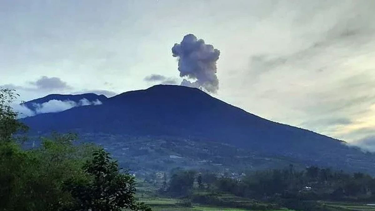
Indonesia , Marapi :
VOLCANO OBSERVATORY NOTICE FOR AVIATION – VONA
Issued : April 14 , 2024
Volcano : Marapi (261140)
Current Aviation Colour Code : ORANGE
Previous Aviation Colour Code : orange
Source : Marapi Volcano Observatory
Notice Number : 2024MAR045
Volcano Location : S 0 deg 22 min 52 sec E 100 deg 28 min 23 sec
Area : West Sumatra, Indonesia
Summit Elevation : 9251 FT (2891 M)
Volcanic Activity Summary :
Eruption at 10h39 UTC (17h39 local).
Volcanic Cloud Height :
Ash-cloud is not observed.
Other Volcanic Cloud Information :
Ash-cloud is not observed.
Remarks :
Eruption recorded on seismogram with maximum amplitude 11 mm and maximum duration 27 second. Tremor recorded on seismogram with maximum amplitude 1.5 mm.
Observation of seismicity:
2 emission earthquakes with an amplitude of 1.6 to 2.8 mm and duration of the earthquake from 214 to 241 seconds.
1 Tornillo type earthquake with an amplitude of 1.7 mm and an earthquake duration of 11 seconds.
2 local tectonic earthquakes with an amplitude of 3.2 to 4.8 mm, and an earthquake duration of 12 to 34 seconds.
1 Continuous tremor with an amplitude of 0.5 to 1.5 mm, dominant value of 0.5 mm.
RECOMMENDATION
1. Communities around Mount Marapi and climbers/visitors/tourists should not enter and conduct activities within a 4.5 km radius of the eruption center (Verbeek crater) of Mount Marapi.
2. Communities living around the valleys/streams/river banks that originate at the top of Mount Marapi should always be aware of the potential threat of lahars that may occur, especially during the rainy season.
Source : Magma Indonésie
Photo : Between ( archive)
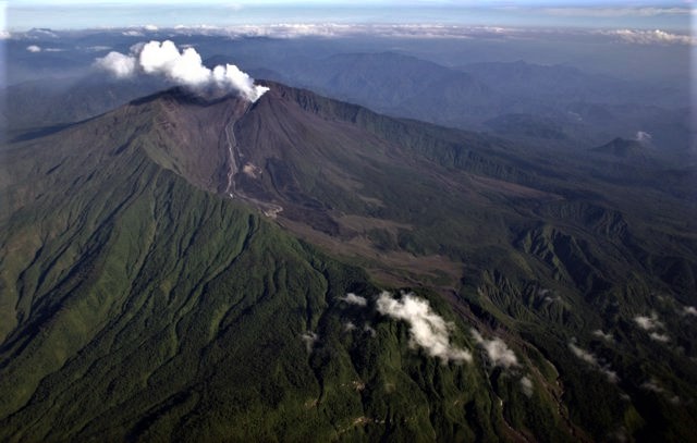
Ecuador , Reventador :
DAILY REPORT ON THE STATE OF THE REVENTADOR VOLCANO, Sunday April 14, 2024.
Information Geophysical Institute – EPN.
Surface activity level: Moderate, Surface trend: No changes
Internal activity level: Moderate, Internal trend: No changes
Seismicity: From April 13, 2024, 11:00 a.m. to April 14, 2024, 11:00 a.m.:
The following table shows the number of seismic events from the reference station over the last 24 hours.
Explosion (EXP) 48
Long Period (LP) 6
Transmitting tremor (TREMI) 6
Tremor harmonic (TRARM): 5
Precipitation/Lahars:
No rain was recorded in the volcano area. **Heavy rains could remobilize accumulated material and generate mud and debris flows that travel down the volcano’s flanks and flow into rivers downstream.
Emissions/ash column:
Since yesterday morning and afternoon at the time of writing this report, thanks to the surveillance camera system and the GOES-16 satellite system, several gas and ash emissions have been recorded with heights between 200 and 800 meters above the level of the crater, in southwest, west and west-southwest directions. In addition, the VAAC agency in Washington published 5 reports of gas and ash emissions with heights between 400 and 1,100 meters above the crater level in the southwest and west directions.
Other monitoring parameters:
The FIRMS satellite system recorded 6 thermal anomalies, the MIROVA-VIIRS satellite system recorded 2 thermal anomalies and the MIROVA-MODIS satellite system recorded 1 moderate thermal anomaly in the last 24 hours.
Observation:
Since yesterday afternoon, thanks to the surveillance camera system, the volcano has remained partially clear most of the time. Additionally, during the night and early morning, the descent of incandescent material could be observed up to 200 meters below the level of the crater. Currently the volcano is completely cloudy.
Alert level: Orange.
Source : IGEPN.
Photo : Patricio Ramon, 2005 (Instituto Geofisca, Escuela Politecnica Nacional).