April 01 , 2024.
Indonesia , Semeru :
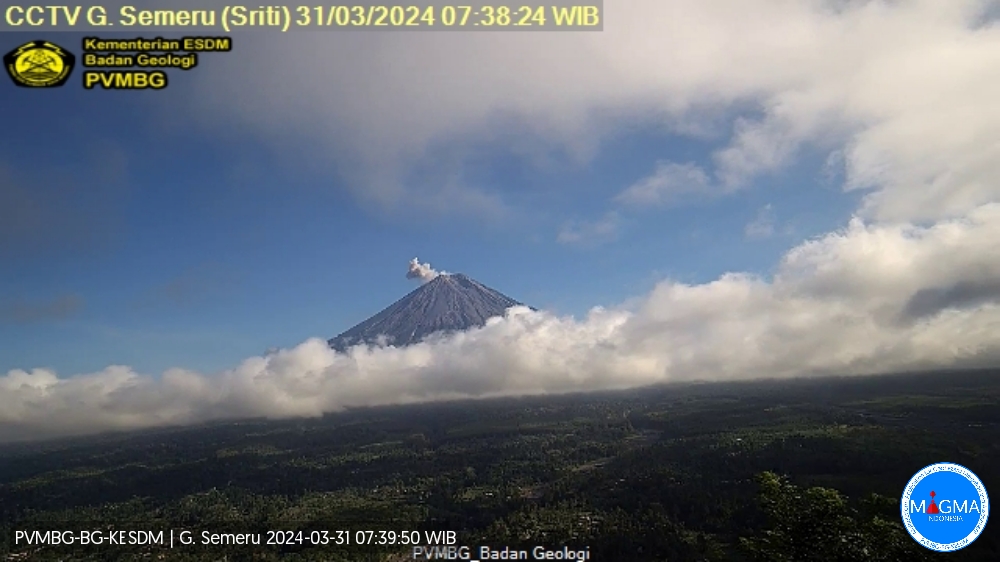
Mount Semeru exhibited an eruption on Sunday, March 31, 2024 at 07:37 WIB with the height of the ash column observed at ± 600 m above the summit (± 4276 m above sea level). The ash column was observed to be white to gray in color with thick intensity, oriented towards the West. This eruption was recorded on a seismograph with a maximum amplitude of 22 mm and a duration of 103 seconds.
VOLCANO OBSERVATORY NOTICE FOR AVIATION – VONA
Issued : March 31 , 2024
Volcano : Semeru (263300)
Current Aviation Colour Code : ORANGE
Previous Aviation Colour Code : orange
Source : Semeru Volcano Observatory
Notice Number : 2024SMR227
Volcano Location : S 08 deg 06 min 29 sec E 112 deg 55 min 12 sec
Area : East java, Indonesia
Summit Elevation : 11763 FT (3676 M)
Volcanic Activity Summary :
Eruption with volcanic ash cloud at 00h37 UTC (07h37 local).
Volcanic Cloud Height :
Best estimate of ash-cloud top is around 13683 FT (4276 M) above sea level or 1920 FT (600 M) above summit. May be higher than what can be observed clearly. Source of height data: ground observer.
Other Volcanic Cloud Information :
Ash cloud moving to west. Volcanic ash is observed to be white to gray. The intensity of volcanic ash is observed to be thick.
Remarks :
Eruption recorded on seismogram with maximum amplitude 22 mm and maximum duration 103 second.
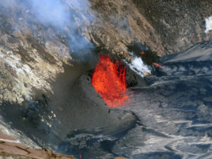
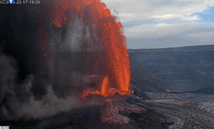
Source et photo : Magma Indonésie.
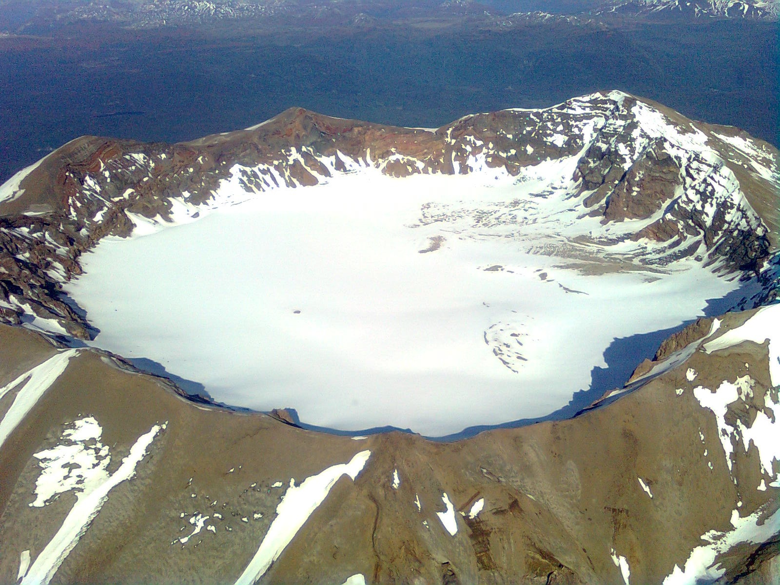
Chile , Puyehue – Cordon Caulle :
Special Report on Volcanic Activity (REAV), Los Lagos region, Puyehue-Cordon Caulle volcanic complex, March 31, 2024, 10:50 p.m. local time (mainland Chile).
The National Service of Geology and Mines of Chile (Sernageomin) publishes the following PRELIMINARY information, obtained using the monitoring equipment of the National Volcanic Monitoring Network (RNVV), processed and analyzed at the Southern Andean Volcanological Observatory ( Ovdas):
Yesterday, Sunday March 31, at 10:29 p.m. local time (Monday April 1, 1:29 a.m. UTC), monitoring stations installed near the Puyehue-Cordon Caulle volcanic complex recorded an earthquake associated with the fracturing of rocks (volcano-tectonic type).
The characteristics of earthquakes after their analysis are as follows:
ORIGINAL TIME: 10:29 p.m. local time (01:29 UTC)
LATITUDE: 40.556° S
LONGITUDE: 72.167°E
DEPTH: 5.6 km
LOCAL MAGNITUDE: 3.1 (ML)
OBSERVATIONS:
Following the occurrence of the event, other volcano-tectonic earthquakes of lower energy were recorded.
The technical volcanic alert remains at level Green.
Source et photo : Sernageomin
Colombia , Galeras :
Weekly activity bulletin: Galeras Volcano
Regarding the monitoring of the activity of the GALERAS VOLCANO, the MINISTRY OF MINES AND ENERGY, through the COLOMBIAN GEOLOGICAL SERVICE (SGC), reports that:
For the period from March 19 to 25, 2024, and compared to what was recorded the previous week, an increase in the number of events was observed, with a decrease in the seismic energy released. The seismic activity of the volcano showed a predominance of events associated with fluid transit, followed by seismicity linked to rock fracture. The fracture earthquakes were located in a scattered manner in the volcanic region, at distances between 0.5 and 15 km, with depths between 0.5 and 14 km from its summit (4,200 m above sea level). ) and magnitudes less than 0.7.
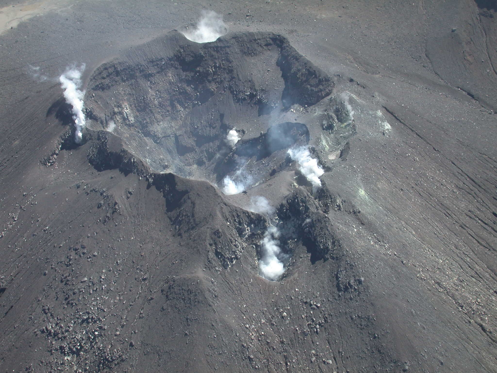
Small gas emissions were recorded, mainly from the fumarole fields of Las Chavas, to the west, and El Paisita, to the north of the active cone, with white gas columns, of low height and variable dispersion. due to the action of the winds.
Other volcanic monitoring areas showed stability in their recordings.
Volcanic activity remains in a YELLOW ALERT state: Active volcano with changes in the behavior of the base level of monitored parameters and other manifestations.
Source et photo : SGC
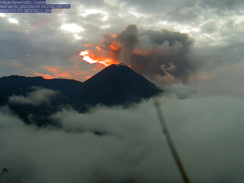
Ecuador , Reventador :
DAILY REPORT ON THE STATE OF THE REVENTADOR VOLCANO, Sunday March 31, 2024.
Information Geophysical Institute – EPN.
Surface activity level: Moderate, Surface trend: No changes
Internal activity level: Moderate, Internal trend: No changes
Seismicity: From March 30, 2024, 11:00 a.m. to March 31, 2024, 11:00 a.m.:
The following table shows the number of seismic events from the reference station in the last 24 hours.
Explosion (EXP) 67
Long Period (LP) 6
Transmitting tremor (TREMI) 7
Tremor harmonic (TRARM): 2
Precipitation/Lahars:
No rain was recorded in the volcano area. **Heavy rains could remobilize accumulated material and generate mud and debris flows that travel down the volcano’s flanks and flow into rivers downstream.
Emissions/ash column:
Since yesterday afternoon until the closing of this report, thanks to the network of surveillance cameras, several gas and ash emissions have been recorded with heights between 500 and 800 meters above the level of the crater with North-East and North-West directions. In connection with these emissions, the VAAC in Washington published four reports of emissions with heights between 800 and 1,300 meters above the level of the crater in a north and northwest direction.
Other monitoring parameters:
The FIRMS satellite system recorded 6 thermal anomalies for this volcano over the last 24 hours.
Observation:
During the night of yesterday and early today, thanks to the surveillance camera system, several episodes of incandescence and descent of incandescent materials along the flanks of the volcano were recorded up to 1000 meters below the level of the crater . As of closing this report, the volcano remains completely cloudy.
Alert level: Orange.
Source : IGEPN.
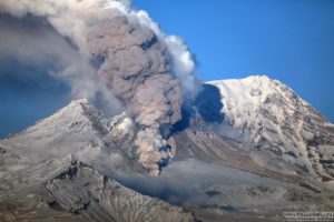
Photo : Archive IGEPN
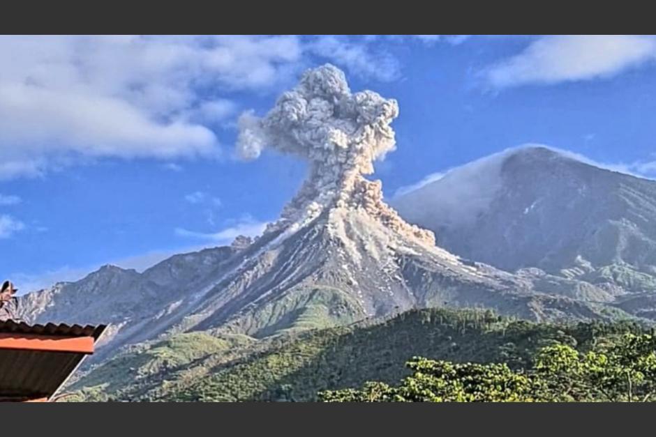
Guatemala , Santiaguito :
Weather conditions: Clear weather
Wind: North-East
Precipitation: 0.0 mm.
Activity:
The Santiaguito volcano observatory OVSAN reports moderate degassing above the crater. Weak to moderate explosions are recorded, expelling columns of gas and ash which disperse in a west and southwest direction. At night and early morning, constant incandescence was observed in the Caliente Dome crater and in the upper part of the lava flow in a West-Southwest direction. Constant avalanches of blocks, weak, moderate and some strong are recorded on the lava flow, on the South flank and on the South-East flank. The volcano maintains high activity due to the extrusion of blocky lava into the Caliente Dome in a west, southwest direction and the unstable nature of the material in the crater. There is a chance of moderate to strong pyroclastic flows, so do not stay near or in river beds near the slopes of the volcano.
The Municipality of Quetzaltenango, in collaboration with the National Coordinator for Disaster Reduction (CONRED), announced new restrictive measures for the rise of two volcanoes in Guatemala: the Santiaguito Volcano and the Santa María Volcano. This decision comes after assessing the risks these activities represent for the safety of people.
For Santiaguito Volcano, a total climbing ban was determined due to the dangerous conditions represented by its topography and volcanic activity. This measure aims to prevent accidents and guarantee the safety of mountaineering and adventure tourism enthusiasts.
Concerning the Santa María volcano, specific restrictions have been established to moderate the ascent to its summit. It is forbidden to spend the night at the summit and the times authorized to start the ascent are limited to the hours between 5 and 8 a.m.
Likewise, the descent must be carried out between 11 a.m. and 2 p.m. The main objective of these measures is to ensure the safety of visitors and to minimize the environmental impact of human activities in these natural environments.
Authorities stress the importance of not lighting campfires or using flammable materials during excursions. In addition, they urge practitioners of this sport and visitors in general to enjoy nature with responsibility and respect, recalling that the preservation of these natural spaces is essential for future generations.
Sources : Insivumeh , Republica.gt
Photo : Conred.