March 5 , 2024.
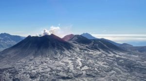
Ecuador / Galapagos Islands , Fernandina :
DAILY REPORT ON THE ACTIVITY OF THE FERNANDINA VOLCANO. Quito, Monday March 4, 2024.
From March 3, 2024 11:00:00 to March 4, 2024 11:00:00
Activity level:
Surface: High; Surface trend: No change
Internal: High ; Internal trend: No change
Emissions/ash column:
Since yesterday afternoon, a gas trail with little or no ash load has been recorded in a West-South-West direction.
Gas:
The Mounts satellite system recorded 46,457.4 tonnes of SO2 measured at 1:27 p.m. TL on March 3, 2024 (Galapagos time).
Other monitoring parameters:
The FIRMS, MIROVA-MODIS and MIROVA-VIIRS satellite systems respectively record hundreds of thermal anomalies, 4 extreme thermal anomalies and 2 very high, 1 high and 1 extreme thermal anomalies over the last 24 hours.
Observation:
Thanks to satellite images and maps produced by the staff of the Geophysical Institute, lava flows were observed in a South-South-East direction. It is important to note that Fernandina Island has no human settlements, so there is no risk to the population. However, if lava flows enter the sea, it is recommended to keep your distance as contact can generate small explosions and, therefore, the release of toxic gases. Likewise, it is recommended not to approach the eruption area, due to the risk of being affected by the products of this event or by possible secondary phenomena such as fires.
Source : IGEPN
Photo :Theofilos Toulkeridis
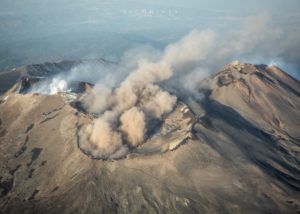
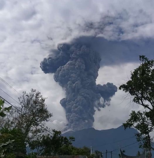
Indonesia , Marapi :
Mount Marapi erupted on Tuesday, March 5, 2024 at 08:53 WIB. The height of the eruptive column was not observed. The eruption was recorded on a seismograph with a maximum amplitude of 12.9 mm and a duration of 63 seconds.
SEISMICITY OBSERVATIONS:
5 eruption/explosion earthquakes with an amplitude of 7.5 to 17.6 mm and an earthquake duration of 46 to 87 seconds.
26 emission earthquakes with an amplitude of 1 to 12.4 mm and earthquake duration of 25 to 223 seconds.
1 Tornillo type earthquake with an amplitude of 1 mm and an earthquake duration of 12 seconds.
1 Low frequency earthquake with an amplitude of 1.7 mm and an earthquake duration of 14 seconds.
1 hybrid/multiphase earthquake with an amplitude of 3.4 mm, the earthquake lasted 17 seconds.
1 Shallow volcanic earthquake with an amplitude of 1 mm and an earthquake duration of 11 seconds.
1 Distant tectonic earthquake with an amplitude of 3.8 mm, and duration of the earthquake of 92 seconds.
1 Continuous tremor with an amplitude of 0.5 to 2.5 mm, dominant value of 1 mm.
RECOMMENDATION
1. Communities around Mount Marapi and climbers/visitors/tourists should not enter and conduct activities within a 4.5 km radius of the eruption center (Verbeek crater) of Mount Marapi.
2. Communities living around the valleys/streams/river banks that originate at the summit of Mount Marapi should always be aware of the potential threat of lahars that may occur, particularly during the rainy season.
Source : Magma Indonésie.
Photo : Wulkany Swiata ( archive).
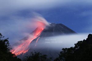
Chile , Villarica :
Special Report on Volcanic Activity (REAV), La Araucanía and Los Ríos regions, Villarrica volcano, March 3, 2024, 6:15 p.m. local time (mainland Chile)
The National Geology and Mining Service of Chile (Sernageomin) announces the following PRELIMINARY information, obtained through the monitoring equipment of the National Volcanic Monitoring Network (RNVV), processed and analyzed at the Southern Andean Volcano Observatory (Ovdas):
On Sunday March 3, 2024, at 5:59 p.m. local time (8:59 p.m. UTC), monitoring stations installed near the Villarrica volcano recorded a pulse of particulate materials.
The characteristics of this pulse after its analysis are as follows:
MAXIMUM HEIGHT OF THE COLUMN: 400 meters above the crater
DIRECTION OF SPREAD: North-East (NE)
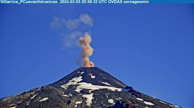
Observation :
No seismicity was recorded in relation to this activity.
The technical volcanic alert is maintained at YELLOW level.
Source et photo : Sernageomin
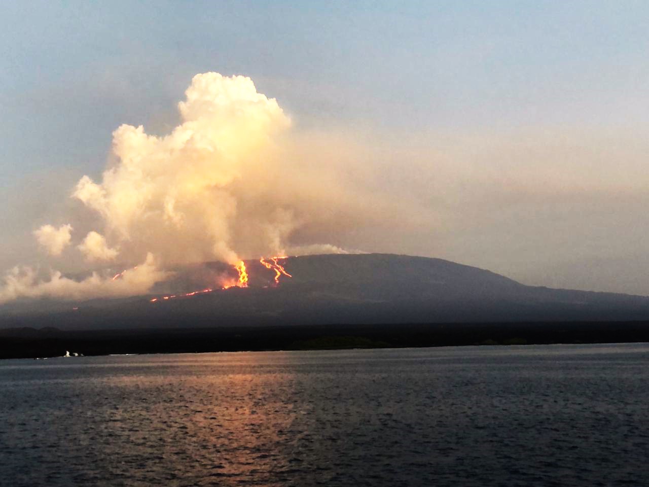
Colombia , Galeras :
Galeras Volcano Weekly Activity Bulletin
Regarding the monitoring of the activity of the GALERAS VOLCANO, the MINISTRY OF MINES AND ENERGY, through the COLOMBIAN GEOLOGICAL SERVICE (SGC), reports that:
For the period from February 20 to 26, 2024, low and fluctuating levels of seismic occurrence and energy were maintained, with values similar to those recorded in previous weeks.
In the internal processes of the volcano, the predominance of earthquakes associated with rock fracturing remained and, to a lesser extent, earthquakes associated with fluid movements were also recorded.

For the most part, the fracture earthquakes were located close to the volcanic edifice, at distances less than 5.6 km, with depths between 1 and 9.5 km from its summit (4,200 m d ‘altitude) ; some events were located at distances between 12 and 15.5 km north-northeast of the volcanic crater. The maximum magnitude was 1.2.
During the week, gas emissions were also recorded from the fumarole fields of Las Chavas, to the West, and El Paisita, to the North of the active cone, with columns of white gas, of very low height and with variable dispersion due to wind action.
Other volcanic monitoring areas showed stability in their recordings.
Volcanic activity remains on YELLOW ALERT Status: Active volcano with changes in baseline behavior of monitored parameters and other manifestations
Source : SGC
Photo : Capra
Costa Rica , Poas / Rincon de la Vieja :
Poas Volcano:
Latitude: 10.2
Longitude: -84,233
Altitude: 2,687 meters above sea level
Activity observed:
Low level eruptive activity continues in mouth A with frequent bubbling. A decrease in tremors was observed yesterday after 8 p.m. Gas flows generally remain stable and the SO2 concentration at the visitor viewpoint is below 1.6 ppm this morning. The geodetic stations show a slight contraction of the crater and the North station shows a slight uplift.
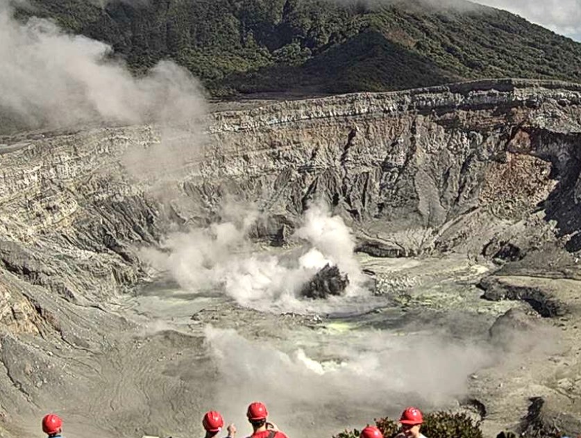
Environmental conditions:
Clear weather; Wind towards the South-West
Activity Level: Warning (2)
Rincón de la Vieja Volcano
Latitude: 10.83
Longitude:-85.324
Altitude: 1,916 meters above sea level
Activity observed:
An expiration was recorded at 8:32 a.m. Periods of low frequency tremors (0.6 to 2 Hz) with almost continuous high frequency tremors (2 to 6 Hz) are observed. The summit geodetic station shows subsidence with a slight movement towards the South-West.
Environmental conditions:
Clear weather; Wind towards the West
Activity Level: Caution (3)
Source et photo : Ovsicori.