February 23 , 2024.
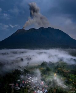
Alaska , Kanaga :
Seismicity was quiet at Kanaga Volcano over the past day. No activity was observed in cloudy satellite and webcam images.
A steam-driven explosion occurred at Kanaga on December 18, 2023 and since then, seismic activity at the volcano has been above background. This unrest may mean that the likelihood of explosive ash-producing activity has increased.
Local seismic and infrasound sensors and web cameras are used to monitor Kanaga. AVO also uses regional infrasound and lightning networks as well as satellite data.
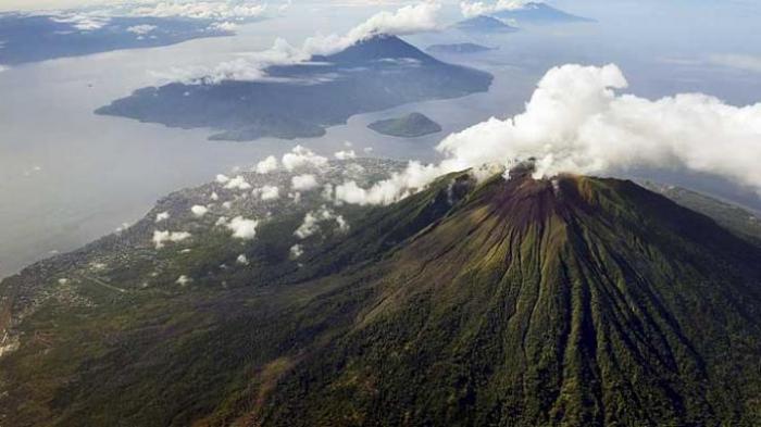
Symmetrical Kanaga stratovolcano is situated within the Kanaton caldera at the northern tip of Kanaga Island. The caldera rim forms a 760-m-high arcuate ridge south and east of Kanaga; a lake occupies part of the SE caldera floor. The volume of subaerial dacitic tuff is smaller than would typically be associated with caldera collapse, and deposits of a massive submarine debris avalanche associated with edifice collapse extend nearly 30 km to the NNW. Several fresh lava flows from historical or late prehistorical time descend the flanks of Kanaga, in some cases to the sea. Historical eruptions, most of which are poorly documented, have been recorded since 1763. Kanaga is also noted petrologically for ultramafic inclusions within an outcrop of alkaline basalt SW of the volcano. Fumarolic activity occurs in a circular, 200-m-wide, 60-m-deep summit crater and produces vapor plumes sometimes seen on clear days from Adak, 50 km to the east.
Source : AVO
Photo : Boyce, Ellie/ Alaska Volcano Observatory / University of Alaska Fairbanks, Geophysical Institute.
Indonesia , Gamalama :
VOLCANO OBSERVATORY NOTICE FOR AVIATION – VONA
Issued : February 23 , 2024
Volcano : Gamalama (268060)
Current Aviation Colour Code : YELLOW
Previous Aviation Colour Code : unassigned
Source : Gamalama Volcano Observatory
Notice Number : 2024GML001
Volcano Location : S 0 deg 48 min 00 sec E 127 deg 19 min 48 sec
Area : North Maluku, Indonesia
Summit Elevation : 5488 FT (1715 M)
Volcanic Activity Summary :
Increasing in volcanic activity.
Volcanic Cloud Height :
Best estimate of ash-cloud top is around 6768 FT (2115 M) above sea level or 1280 FT (400 M) above summit. May be higher than what can be observed clearly. Source of height data: ground observer.
Other Volcanic Cloud Information :
Ash cloud moving to west. Volcanic ash is observed to be white to gray. The intensity of volcanic ash is observed to be thick.
SEISMICITY OBSERVATIONS:
1 emission earthquake with an amplitude of 6 mm and duration of the earthquake of 20.19 seconds.
14 deep volcanic earthquakes with an amplitude of 4 to 12 mm, earthquake duration from 8.67 to 20.03 seconds.
6 local tectonic earthquakes with an amplitude of 4-42 mm, and earthquake duration 20.26-33.81 seconds.
10 deep tectonic earthquakes with an amplitude of 6-18 mm, earthquake duration 33.89-77.78 seconds.
Source : Magma Indonésie
Photo : KOMPAS/HERU SRI KUMORO
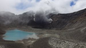
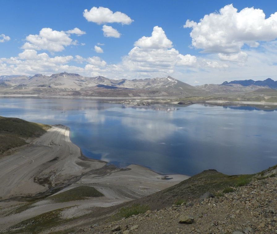
Chile , Laguna del Maule :
Seismology
The seismological activity of the period was characterized by the recording of:
818 seismic events of type VT, associated with rock fractures (Volcano-Tectonics). The most energetic earthquake had a Local Magnitude (ML) value equal to 3.6, located 3.6 km East-South-East of the center of the lagoon, at a depth of 7.6 km .
1 LP type seismic event, associated with fluid dynamics inside the volcanic system (Long Period). The size of the earthquake evaluated from the Reduced Displacement (RD) parameter was equal to 0.7 cm2.
1 TR type seismic event, associated with the dynamics maintained over time of fluids inside the volcanic system (TRemor). The size of the earthquake evaluated from the Reduced Displacement (RD) parameter was equal to 13 cm2.
Fluid geochemistry
No anomalies have been reported in emissions of sulfur dioxide (SO2) into the atmosphere in the area near the volcanic complex, according to data published by the Tropopheric Monitoring Instrument. (TROPOMI).
Geodesy
From the data obtained by 5 GNSS stations, we can observe that the inflationary process recorded since 2012 continues, in particular for this period we can note that:
– The distance between stations remained with stable trends, with no change during the period.
The maximum amplitudes of extension and shortening of these distances are approximately 1.0 cm/month, a lower value than in the previous period.
– The maximum vertical rise remains in the central sector of the lagoon, with a speed of 1.6 cm/month, recorded at station MAU2. Furthermore, there has been a change in trend, from rising to subsidence in the stations located to the South and South-East of the lagoon since the last days of December with a maximum magnitude of -1.1 cm/month. On the other hand, the subsidence trend continues in the stations located south of Laguna Fea, with vertical speeds reaching –0.8 cm/month.
– Through the use of the InSAR technique, from Sentinel 1A satellite images, signals associated with deformations of a magnitude and pattern similar to what has been observed in recent years and in accordance with GNSS data, with a maximum inflation zone near the center of the lagoon and with a subsidence zone to the east of Laguna fea.
Satellite geomorphological analysis
According to the analysis of PlanetScope Scene (3 m/px) and Sentinel 2 L2-A (10 m/px) satellite images in combination of true and false color bands, no morphological or
variations attributable to volcanic activity.
During the evaluated period, the appearance of VT and LP activity continues, remaining above its baseline threshold. Although VT seismicity has decreased in quantity, in recent months an increase in the maximum recorded local magnitude has been observed. Regarding deformation, displacement rates continue with values similar to those historically recorded, referring to inflation around the peninsula and the process of subsidence of lesser magnitude in the Barrancas region. Therefore, it is determined that the volcanic system continues with internal activity even higher than its basic threshold, the technical alert is maintained:
YELLOW TECHNICAL ALERT: Changes in the behavior of volcanic activity
Source : Sernageomin
Photo : Auteur inconnu
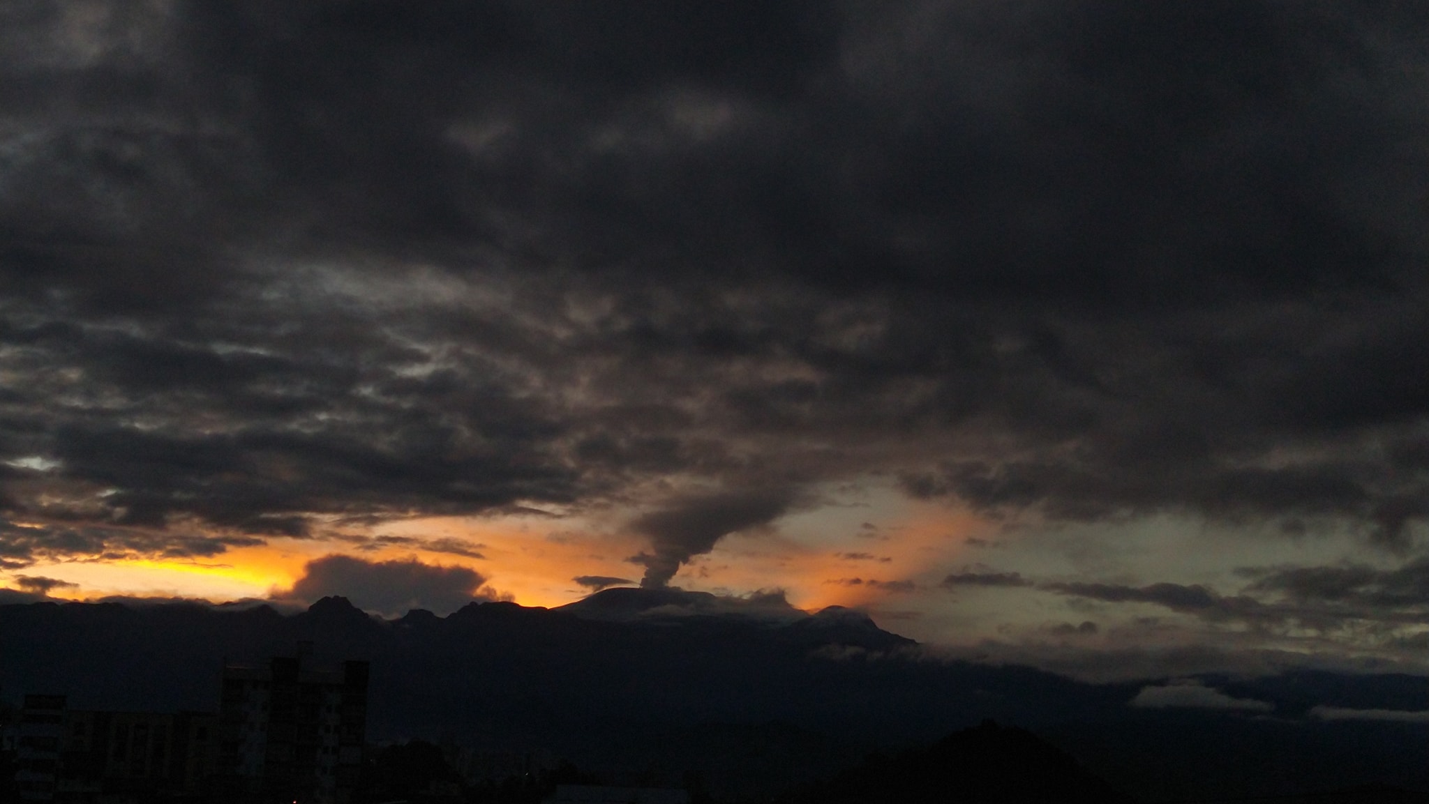
Colombia , Nevado del Ruiz :
Weekly bulletin on the activity of the Nevado del Ruiz volcano
From the monitoring of the activity of the NEVADO DEL RUIZ VOLCANO, the MINISTRY OF MINES AND ENERGY through the COLOMBIAN GEOLOGICAL SERVICE (SGC) reports that:
In the week of February 13-19, 2024, the volcano continued with unstable behavior. Compared to the previous week, the main variations in the parameters monitored were:
– Seismic activity associated with the fracturing of rocks within the volcanic edifice has increased in the number of earthquakes recorded and has maintained similar levels in seismic energy released. The earthquakes were located mainly in the Arenas crater and on the different flanks of the volcano, mainly at distances less than 7 km from the crater. The depths of the events varied between 1 and 8 km from the summit of the volcano. The highest magnitude of the week was 1.6, corresponding to the earthquake of February 18 at 3:18 p.m., located in the southeast sector of the crater, 2 km deep.
– Seismicity associated with fluid dynamics inside volcanic conduits has decreased in the number of earthquakes recorded and in the seismic energy released. The seismic signals had low to moderate energy levels and were primarily related to pulsatile emissions of ash and gas into the atmosphere. Using cameras used to monitor the volcano, several ash emissions and changes in relative temperature of the emitted material associated with some of these seismic signals were confirmed.
– When monitoring surface activity, from satellite monitoring platforms, several thermal anomalies were detected at the bottom of Arenas crater with energy levels varying between low and high. On February 15, the maximum value recorded since monitoring of this parameter (since 2007) was obtained with a value slightly higher than the maximum obtained on January 23, 2024.
The state of alert for volcanic activity remains at:
YELLOW ALERT: ACTIVE VOLCANO WITH CHANGES IN THE BEHAVIOR OF THE BASE LEVEL OF MONITORED PARAMETERS AND OTHER MANIFESTATIONS
Source : SGC
Photo : Julian Fernando Aranzazu Henao
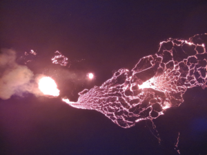
Guatemala , Fuego :
Weather conditions: Clear weather
Wind: northeast
Precipitation: 0.0 mm.
Activity:
The Fuego OVFGO volcano observatory reports weak degassing above the crater. Weak, moderate and a few strong explosions are recorded, which occur at a frequency of 6 to 11 per hour. These explosions generate columns of gas and gray ash at heights of 4,500 to 4,700 meters above sea level (14,763 to 15,420 feet), which travel 15 km to the southwest.
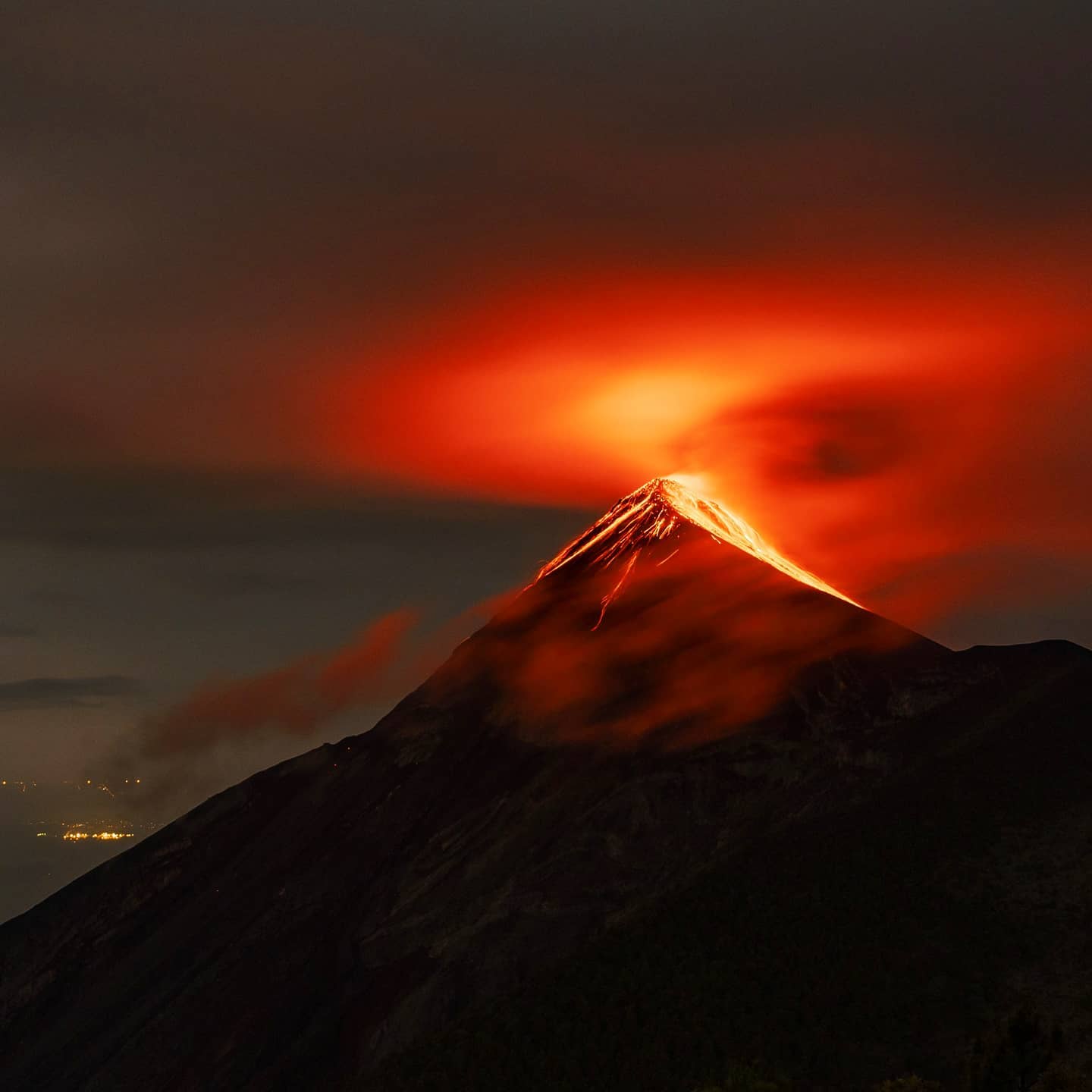
The explosions produce weak to moderate avalanches around the crater and towards the Seca, Ceniza, Las Lajas and Taniluyá ravines where some of the ejected material reached the vegetation. At night and early morning, an incandescent pulse was observed at heights of 200 to 300 meters above the crater. Low to moderate rumbling sounds with weak shock waves are also reported, sounds similar to those of a train locomotive are heard with one-minute intervals. Falling fine ash particles are reported in the communities of Panimache I and II, Morelia, Santa Sofía, los Yucales and other nearby communities southwest of the volcanic complex.
Source : Insivumeh.
Photo : Diego Rizzo .