December 12 , 2023.
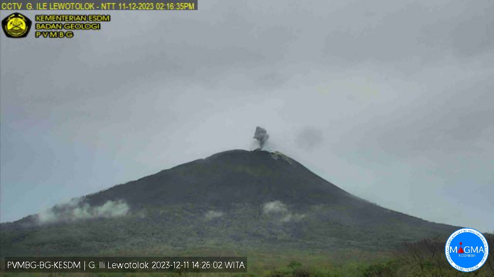
Indonesia , Ili Lewotolok :
Mount Ili Lewotolok erupted on Monday, December 11, 2023, at 2:14 p.m. WITA. The height of the eruptive column was observed to be ± 300 m above the peak (± 1,723 m above sea level). The ash column was observed to be gray with moderate intensity, oriented towards the East. The eruption was recorded on a seismograph with a maximum amplitude of 21.6 mm and a duration of 36 seconds.
VOLCANO OBSERVATORY NOTICE FOR AVIATION – VONA
Issued : December 11 , 2023
Volcano : Ili Lewotolok (264230)
Current Aviation Colour Code : ORANGE
Previous Aviation Colour Code : orange
Source : Ili Lewotolok Volcano Observatory
Notice Number : 2023LEW107
Volcano Location : S 08 deg 16 min 19 sec E 123 deg 30 min 18 sec
Area : East Nusa Tenggara, Indonesia
Summit Elevation : 4554 FT (1423 M)
Volcanic Activity Summary :
Eruption with volcanic ash cloud at 06h14 UTC (14h14 local).
Volcanic Cloud Height :
Best estimate of ash-cloud top is around 5514 FT (1723 M) above sea level or 960 FT (300 M) above summit. May be higher than what can be observed clearly. Source of height data: ground observer.
Other Volcanic Cloud Information :
Ash cloud moving to east. Volcanic ash is observed to be gray. The intensity of volcanic ash is observed to be medium.
Remarks :
Eruption recorded on seismogram with maximum amplitude 21.6 mm and maximum duration 36 second.
Source et photo : Magma Indonésie.
Peru , Sabancaya :
Analysis period: from December 4, 2023 to December 10, 2023, Arequipa, December 11, 2023.
Alert level: ORANGE
The Geophysical Institute of Peru (IGP) reports that the eruptive activity of the Sabancaya volcano remains at moderate levels, that is, with the recording of an average of 36 daily explosions, with columns of ash and of gas up to 2.9 km altitude above the summit of the volcano and their subsequent dispersion. Therefore, for the following days, no significant changes are expected regarding eruptive activity.
The IGP recorded and analyzed the occurrence of 169 earthquakes of volcanic origin, associated with the circulation of magmatic fluids inside the Sabancaya volcano. An average of 36 explosions were recorded daily, in addition to recording of Volcano-Tectonic (VT) type events associated with rock fracturing inside the Sabancaya volcano.
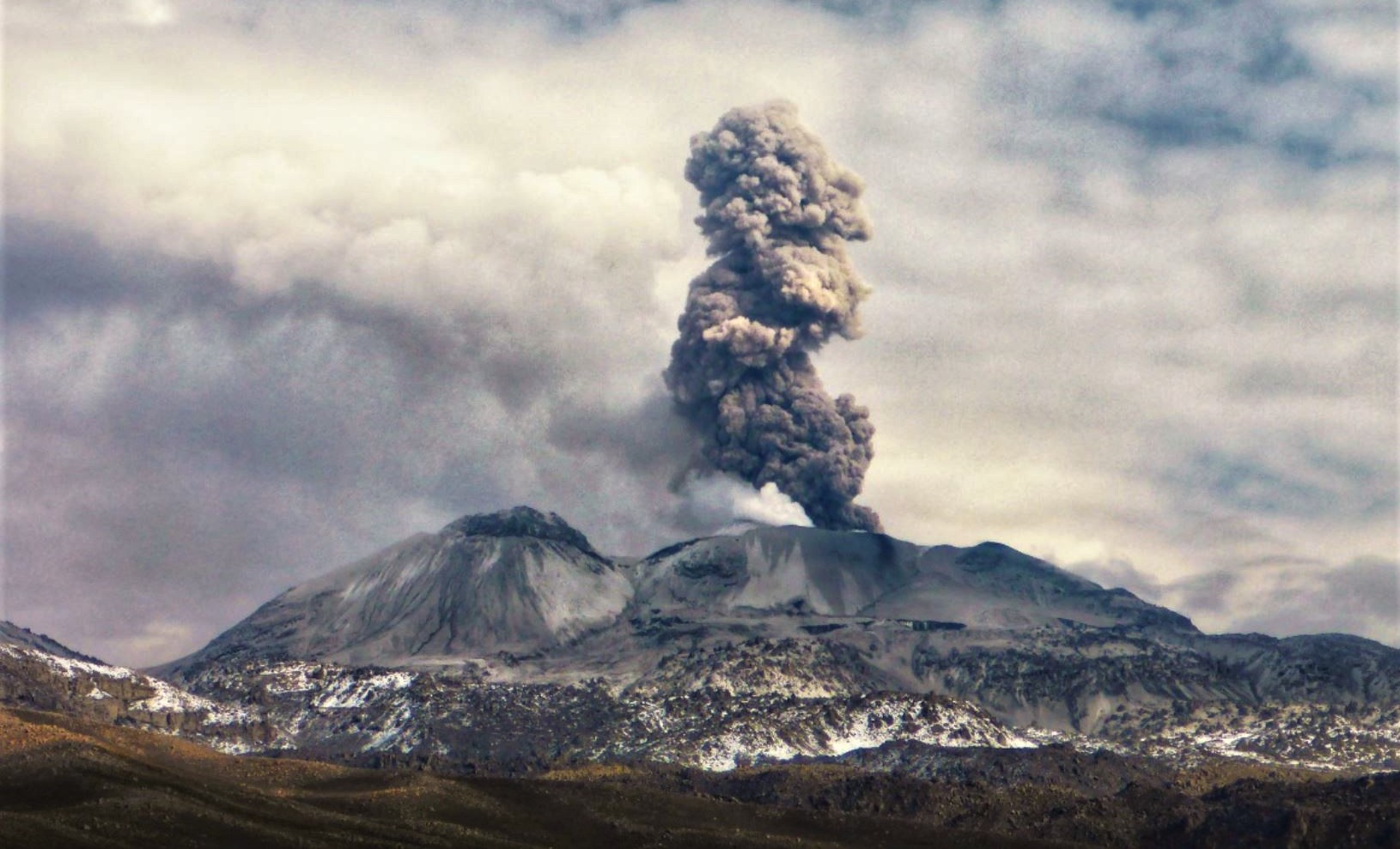
Monitoring the deformation of the volcanic structure using GNSS techniques (processed with fast orbits) does not present significant anomalies. However, in general, a slight inflation process was observed in the northern sector (around the Hualca Hualca volcano). Visual monitoring made it possible to identify columns of gas and ash up to 2.9 km above the volcano summit, which were dispersed towards the northwest and west sectors of Sabancaya. Satellite recordings identified the presence of 19 thermal anomalies, with a maximum value of 51 MW, associated with the presence of a lava body on the surface of the volcano crater.
RECOMMENDATIONS
• Keep the volcano alert level in orange.
• Do not approach within a radius of less than 12 km from the crater.
Source : Cenvul.
Photo : Andina.
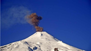
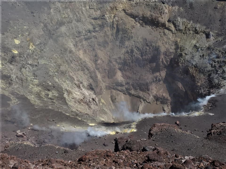
Chile , Lascar :
Seismology
The seismological activity of the period was characterized by the recording of:
65 seismic events of type VT, associated with the fracturing of rocks (Volcano-Tectonics). The most energetic earthquake had a Local Magnitude (ML) value equal to 0.0, located 2.0 km west-northwest of the volcanic edifice, at a depth of 2.8 km relative to to the crater.
142 LP type seismic events, associated with fluid dynamics inside the volcanic system (Long Period). The size of the largest earthquake evaluated from the Reduced Displacement (RD) parameter was equal to 13 cm2.
2 TR type seismic events, associated with the dynamics maintained over time of fluids inside the volcanic system (TRemor). The size of the largest earthquake evaluated from the Reduced Displacement (RD) parameter was equal to 6 cm2.
1 VLP type seismic event, associated with the dynamics of large volumes of fluids inside the volcanic system (Very Long VLP Period). The size of the earthquake (DR) was equal to 3 cm2.
Fluid geochemistry
The sulfur dioxide (SO2) emissions data obtained by the differential optical absorption spectroscopy (DOAS) equipment, corresponding to the Emú station, located 6 km in the East-South-East (ESE) direction from active crater, presented an average value of 464 ± 148 t/d, with a maximum daily value of 1,406 t/d on November 17. No anomalies have been reported in emissions of sulfur dioxide (SO2) into the atmosphere in the area near the volcano.
Satellite thermal anomalies
During the period, 3 thermal alerts were recorded in the area associated with the volcanic system, according to data processed by the Mid-Infrared Observation of Volcanic Activity (MIROVA), with a maximum power of 2.5 MW on the 16th. november.
Geodesy:
The geodetic activity of the period was characterized by:
– Low horizontal and vertical deformation rates of the station available on the volcano.
– The maximum horizontal deformation rate reaches –0.36 cm/month, while the vertical deformation rate shows a slight increase which reaches a maximum of 0.4 cm/month.
Surveillance cameras
The images provided by the fixed camera, installed near the volcano, recorded regular degassing, with a maximum column height of 1,000 meters on November 28.
Activity remained at levels considered low, suggesting stability of the volcanic system. The technical volcanic alert is maintained in:
GREEN TECHNICAL ALERT: Active volcano with stable behavior – There is no immediate risk.
Source : Sernageomin
Photo : Eric Jo
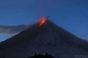
Hawaii , Kilauea :
Monday, December 11, 2023, 6:55 AM HST (Monday, December 11, 2023, 16:55 UTC)
19°25’16 » N 155°17’13 » W,
Summit Elevation 4091 ft (1247 m)
Current Volcano Alert Level: ADVISORY
Current Aviation Color Code: YELLOW
Activity Summary:
Kīlauea volcano is not erupting. Slightly elevated seismicity continues in the summit region, upper East Rift Zone, and Southwest Rift Zone. Unrest may continue to wax and wane with fluctuating input of magma to the area, and eruptive activity could occur in the near future with little or no warning. No unusual activity has been noted along the middle and lower sections of Kīlauea’s East Rift Zone.

Summit Observations:
Seismicity in Kīlauea’s summit region remains elevated, but the past couple days have seen a slight decline in earthquake rates. Most of the earthquakes have been focused in a cluster just southeast of Kaluapele, Kīlauea’s summit caldera.
The Uēkahuna summit tiltmeter—located northwest of the caldera—tracked a deflation-inflation event from midday Saturday through yesterday (Sunday) afternoon, then a quick onset of steady deflation early this morning. The Sand Hill tiltmeter—located southwest of the caldera—has tracked similar trends. Overall, the summit of Kīlauea remains at a high level of inflation; relative tilt is above the level reached prior to the most recent eruption in September 2023, and it is higher than at any time since the 2018 eruption.
Sulfur dioxide (SO2) gas emission rates remain low. Field measurements indicated an SO2 emission rate of approximately 70 tonnes per day on December 5, which was similar to measurements in October and November.
Source et photo : HVO.
Costa Rica , Poas :
Latitude: 10.2
Length: -84233
Altitude: 2,687 meters above sea level
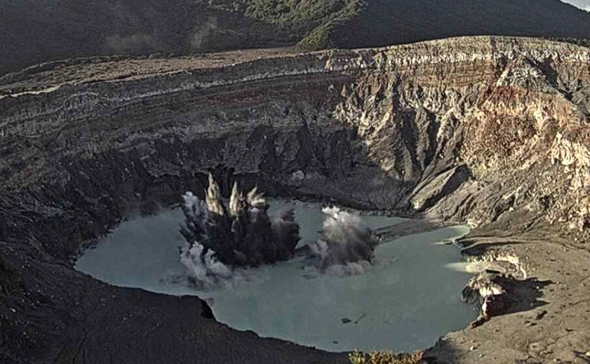
Activity observed:
7 small phreatic eruptions were recorded between 10:58 p.m. and 11:11 p.m. The volcano continues to record a continuous low frequency tremor of moderate amplitude. Gas ratios remain stable.
Environmental conditions:
The wind blows towards the South-West. The volcano was cloudy until midday.
Activity Level: Warning (2)
Source et photo : Ovsicori