December 11 , 2023.
Indonesia , Salak :
PRESS RELEASE ON THE LATEST ACTIVITIES OF THE SALAK VOLCANO
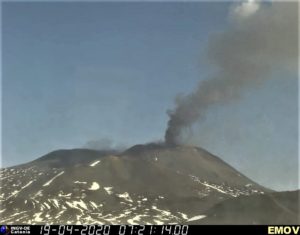
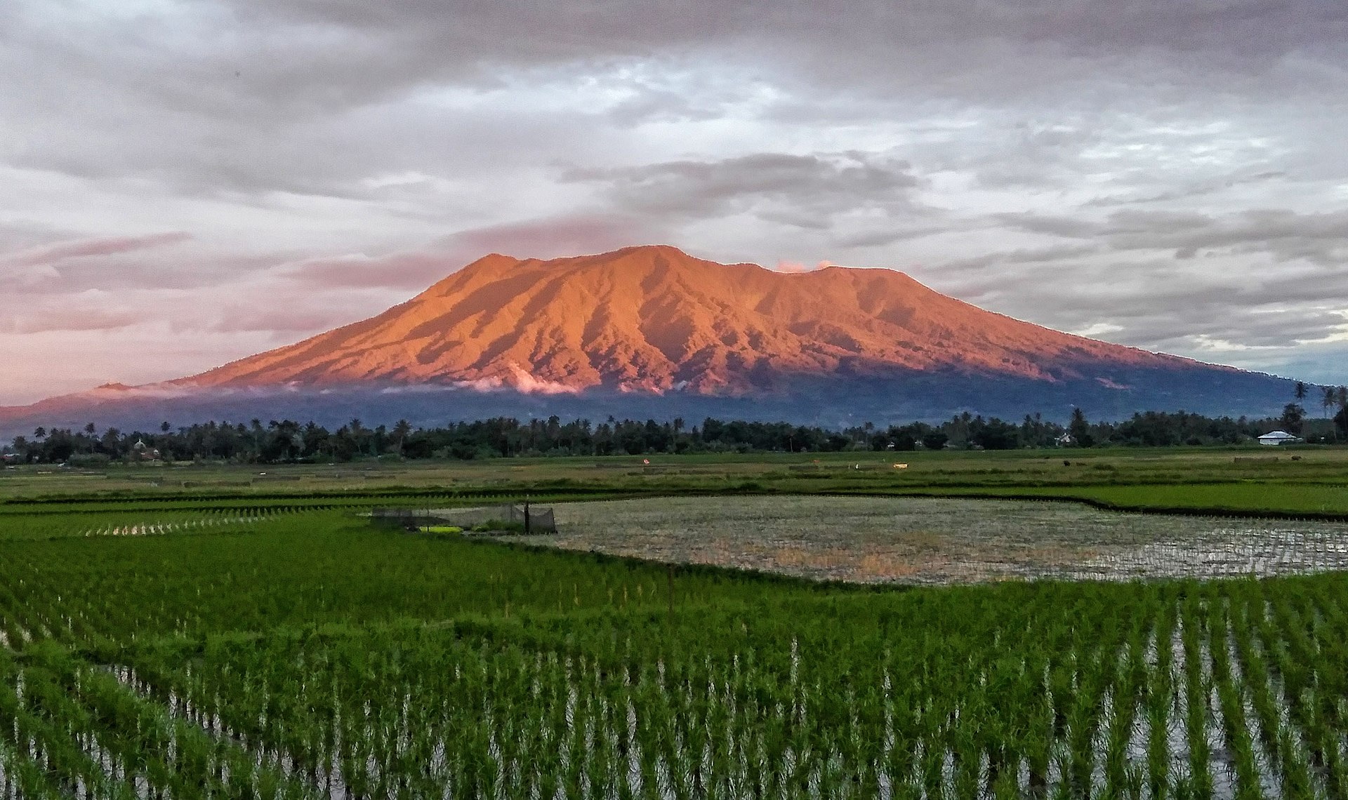
Salak Volcano is a type A stratovolcano with a height of ±2210 meters above sea level. Administratively, it is located in Bogor Regency and Sukabumi Regency, West Java Province. , and is monitored via the G. Salak Volcano Observation Post (PGA) in Benda Village, Cicurug District, Sukabumi Regency.
The last eruption of Mount Salak occurred in 1938 as a phreatic eruption from the Cikuluwung Putri crater. Since then, the latest activity has only been mudslides at Kawah Ratu and Kawah Hirup as well as passing through solfataras and fumaroles at Kawah Ratu.
The latest developments in the activities of the Salak volcano following the 4.0 magnitude earthquake in the southwest of the city of Bogor, Friday (12/8) early in the morning, are as follows:
Local tectonic earthquakes saw an increase in the number of earthquakes of more than 4 times per day on December 6, 2023 with 8 events. On December 7, 2023, there were 7 incidents and on December 8, 2023, there were 7 incidents.
Visual observations for the period December 1 to 9, 2023.
the volcano was clearly visible until it was covered in fog. No smoke from the crater was observed. The weather is sunny to rainy, the wind is light in the South. The air temperature is around 22-32°C.
Kawah-ratu solfataric zone.
Earthquake observations for the period December 1-9, 2023 are still dominated by distant tectonic earthquakes which were recorded 31 times and local tectonic earthquakes 22 times. Volcanic earthquakes indicating Mount Salak activity have not been recorded.
Even if seismicity tends to be normal, we must nevertheless be wary of phreatic eruptions, in the form of mudflows or steam explosions, which can occur suddenly, following the increase in local tectonic seismicity there a few days.
During the rainy season, the humidity level of the air around the crater will be higher, so the volcanic gases will be difficult to decompose, which will lead to an increase in the concentration of gases and may be life-threatening. .
Based on the above, the activity level of Salak Volcano has not seen an increase in volcanic activity and remains at Level I (normal) with the following recommendations:
At Level I (normal) activity levels, people and visitors/tourists do not enter craters within a 500 meter radius of active Mount Salak craters (Kawah Ratu, Kawah Hirup and Kawah Paeh), in especially during the rainy season, to avoid accumulations of gas, which is dangerous.
The Geological Agency will continue to coordinate with the National Disaster Management Agency (BNPB) / Regional Disaster Management Agency (BPBD) West Java Province / Disaster Management Agency (BPBD) Sukabumi Regency and Bogo Regency .
Source : PVMBG
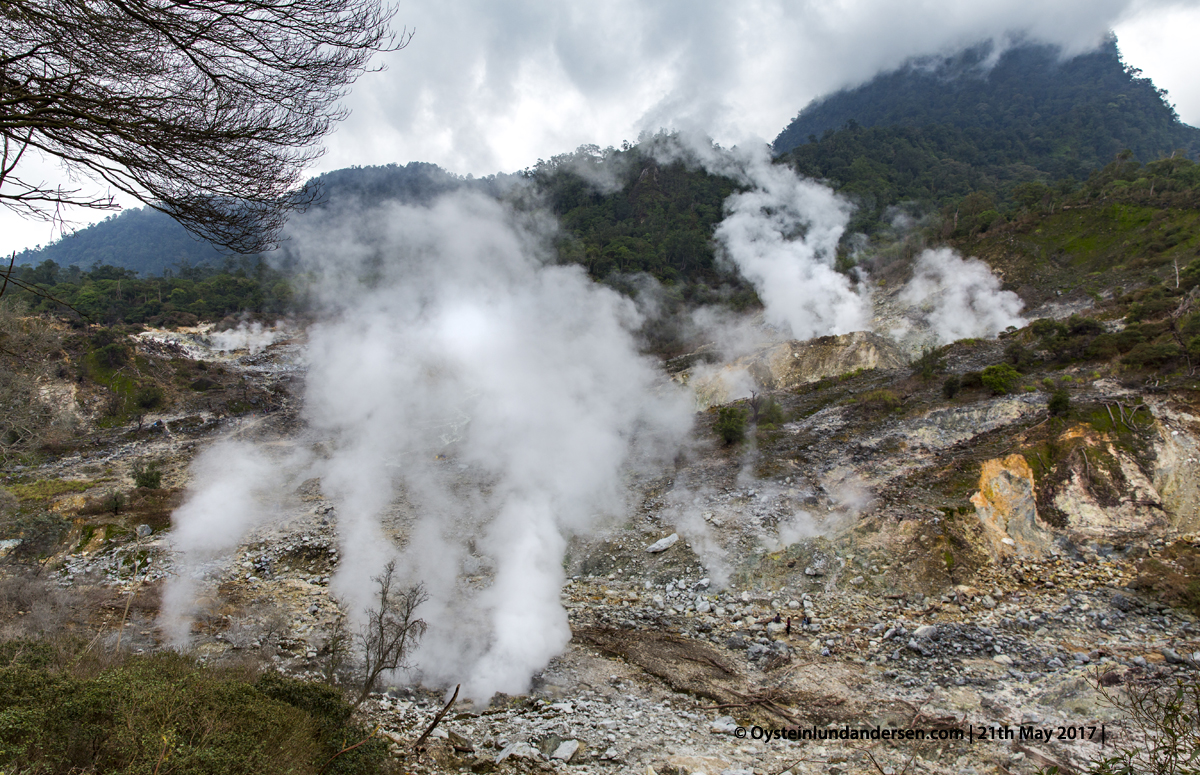
Photo : Oystein Lund Andersen ( 2017).
Indonesia , Marapi :
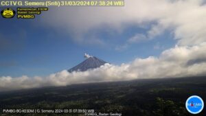
Mount Marapi erupted on Monday, December 11, 2023 at 08:50 WIB. The height of the eruptive column was observed to be ± 400 m above the peak (± 3,291 m above sea level). The ash column was observed to be gray with thick intensity, oriented towards the North. The eruption was recorded on a seismograph with a maximum amplitude of 30 mm and a duration of 50 seconds.
VOLCANO OBSERVATORY NOTICE FOR AVIATION – VONA
Issued : December 11 , 2023
Volcano : Marapi (261140)
Current Aviation Colour Code : ORANGE
Previous Aviation Colour Code : orange
Source : Marapi Volcano Observatory
Notice Number : 2023MAR038
Volcano Location : S 0 deg 22 min 52 sec E 100 deg 28 min 23 sec
Area : West Sumatra, Indonesia
Summit Elevation : 9251 FT (2891 M)
Volcanic Activity Summary :
Eruption with volcanic ash cloud at 01h50 UTC (08h50 local).
Volcanic Cloud Height :
Best estimate of ash-cloud top is around 10531 FT (3291 M) above sea level or 1280 FT (400 M) above summit. May be higher than what can be observed clearly. Source of height data: ground observer.
Other Volcanic Cloud Information :
Ash cloud moving to north. Volcanic ash is observed to be gray. The intensity of volcanic ash is observed to be thick.
Remarks :
Eruption recorded on seismogram with maximum amplitude 30 mm and maximum duration 50 second.
Source : Magma Indonésie.
Photo : Dody.bukittinggi
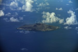
Chile , Hudson :
Seismology
The seismological activity of the period was characterized by the recording of:
453 seismic events of type VT, associated with the fracturing of rocks (Volcano-Tectonics). The most energetic earthquake had a Local Magnitude (ML) value equal to 2.4, located 6.7 km south-southeast of the volcanic edifice, at a depth of 4.8 km from the crater .
113 LP type seismic events, associated with fluid dynamics inside the volcanic system (Long Period). The size of the largest earthquake evaluated from the Reduced Displacement (RD) parameter was equal to 23 cm2.
2 TR type seismic events, associated with the dynamics maintained over time of fluids inside the volcanic system (TRemor). The size of the largest earthquake evaluated from the Reduced Displacement (RD) parameter was equal to 1 cm2.
30 HB type seismic events, associated with both rock fracturing and fluid dynamics within the volcanic system (Hybrid). The most energetic earthquake presented a Reduced Displacement (DR) value of 867 cm2 and a Local Magnitude (ML) value equal to 2.7, located 6.8 km to the East-South-East of the volcanic edifice, at a depth of 2.4 km from the crater, which was reported in REAV on November 6.
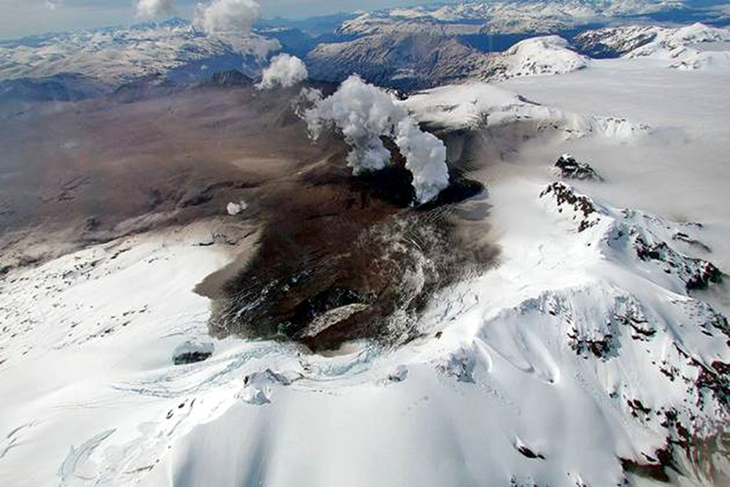
Thermal anomalies by satellites
During the period, no thermal alerts were recorded in the area associated with the volcanic system, according to data processed by the Mid-Infrared Observation of Volcanic Activity (MIROVA). In addition, no radiance anomalies were reported thanks to the analytical processing of Sentinel 2-L2A satellite images, in combination of false color bands.
Geodesy
From the data provided by 2 continuous GNSS stations, which allow the monitoring of the deformation of the volcanic edifice, we observe that the tendency of movement towards the South-East is maintained in the station closest to the caldera, at a rate of 0.3. cm/month. On the other hand, the vertical component has a low displacement rate of 0.2 cm/month.
Surveillance cameras
The images provided by the fixed camera, installed near the volcanic system, did not record degassing columns or variations linked to surface activity.
Activity remained at levels considered low, suggesting stability of the volcanic system. The technical volcanic alert is maintained in:
GREEN TECHNICAL ALERT: Active volcano with stable behavior – There is no immediate risk.
Source : Sernageomin
Photo : Patagonialink
Guatemala , Fuego :
Weather conditions: Clear weather
Wind: East
Precipitation: 0.0 mm.
Activity:
The Fuego Volcano Observatory, OVFGO, reports degassing above the crater. 2 to 5 weak and moderate explosions are recorded per hour. These explosions generate a column of gas and ash with a height of 4,500 to 4,700 meters above sea level (14,436 to 15,420 feet), dispersing over 12 km to the West and South -West.
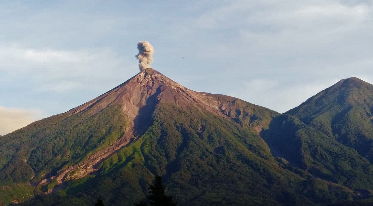
Low rumbling sounds with a weak shock wave are reported. Small and moderate avalanches are also reported around the crater and towards the Ceniza, Trinidad and Las Lajas ravines. At night and early in the morning, an incandescent pulse is observed 200 to 250 meters above the crater. Falling fine ash particles are reported in Panimache I and II, Morelia, El Porvenir, Santa Sofía, Finca Paloverde and other neighboring communities.
Source : Insivumeh.
Photo : Conred
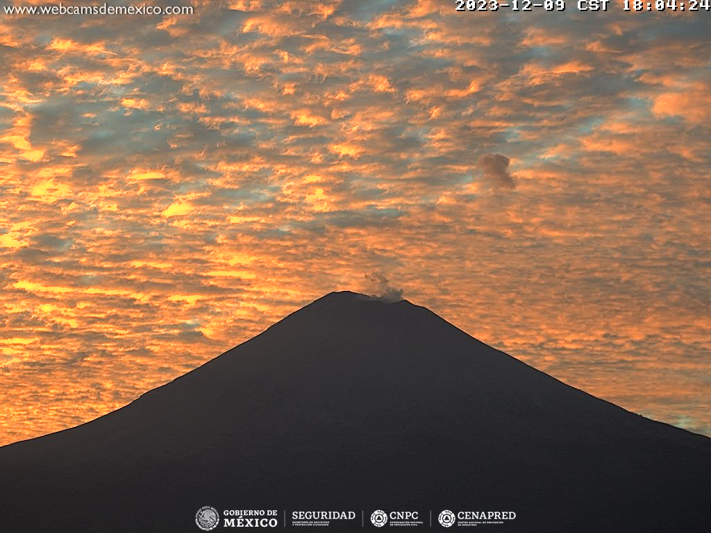
Mexico , Popocatepetl :
December 10, 11:00 a.m. (December 10, 5:00 p.m. GMT)
Activity from the last 24 hours
50 exhalations were detected, accompanied by water vapor, volcanic gases and ash, in addition to 241 minutes of tremor (4.01 h) of high frequency and low amplitude. Today at 3:35 a.m., a magnitude 1.6 volcano-tectonic (VT) earthquake was detected.
During the morning and at the time of this report, a continuous emission of water vapor, other volcanic gases and ash is observed, in an East-North-East (ENE) direction.
The Popocatépetl volcanic warning light is located in Yellow Phase 2.
The scenarios planned for this phase are:
A few smaller to moderate sized explosions
Appearance of tremors of variable amplitude
Light to moderate ash rain in surrounding towns and some more distant towns
Ejection of incandescent fragments within the Exclusion radius of 12 kilometers
Source : Cenapred