November 28 , 2023.
Iceland , Reykjanes Peninsula :
Activity still located primarily near Sýlingarfell and Hagafell. A short-lived seismic swarm started at around midnight, 170 earthquakes were detected, the largest was M3
Updated 27. November at 16:30 UTC
Seismic activity has been relatively stable for the past few days with a daily rate of about 500 earthquakes in the area of the magmatic dike. Most of the seismicity continues to be nearby Sýlingarfell and Hagafell. Around midnight a short-lived seismic swarm commenced in the vicinity of Sýlingarfell and lasted for roughly one hour. A total of 170 earthquakes were detected in the area at a depth of 3-5 km. The earthquakes were almost all very small with one M3.0.
Data from GPS stations and satellite images show that uplift continues in the area of Svartsengi and deformation is still ongoing along and around the dike. The elevated seismic activity which occurred around midnight isn´t associated with any changes to the ongoing deformation. Both seismic and deformation data suggest that magma continues to accumulate beneath Svartsengi and to flow into the middle portion of the dike which formed on 10 November. The seismic swarm that occurred this night might indicate increasing pressure within the dike.
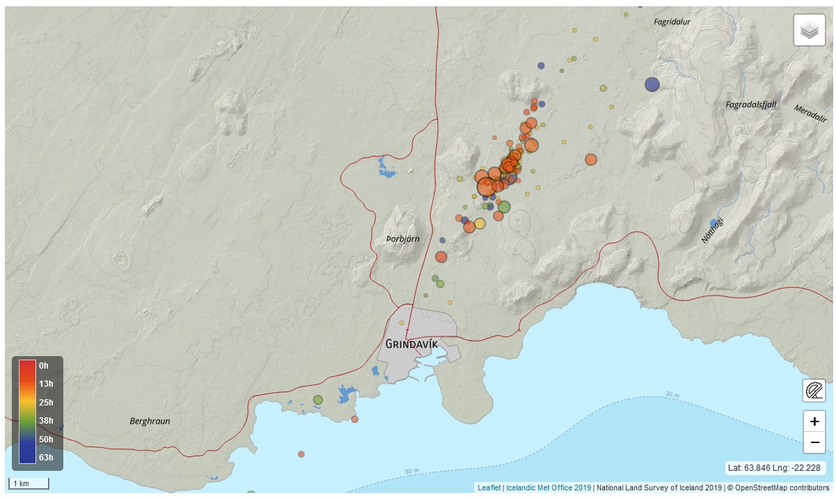
In light of the available data and the newest analysis, an eruption along the dike is still considered likely as long as the magma inflow continues. It is assessed that the area with the highest likelihood for an eruption is in the middle part of the dike between Hagafell and Sýlingarfell. The hazard map published by the IMO on 22 November remains valid.
Additional geodetical modelling has been performed to reconstruct the evolution of the dike which formed on 10 November. These newest results suggest that the dike at depth could be wider than initially assessed. The time needed to solidify the magma that intruded into the dike would be therefore estimated to be on the order of a few months.
Source et photo : IMO.
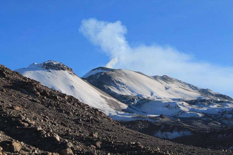
Peru , Sabancaya :
Analysis period: from November 20, 2023 to November 26, 2023, Arequipa, November 27, 2023.
Alert level: ORANGE
The Geophysical Institute of Peru (IGP) reports that the eruptive activity of the Sabancaya volcano remains at moderate levels, that is, with the recording of an average of 31 daily explosions, with columns of ash and of gas up to 2.9 km altitude above the summit of the volcano and their subsequent dispersion. Therefore, for the following days, no significant changes are expected regarding eruptive activity.
The IGP recorded and analyzed the occurrence of 130 earthquakes of volcanic origin, associated with the circulation of magmatic fluids inside the Sabancaya volcano. An average of 31 explosions were recorded daily, in addition to recording of Volcano-Tectonic (VT) type events associated with rock fracturing inside the Sabancaya volcano.
Monitoring the deformation of the volcanic structure using GNSS techniques (processed with fast orbits) does not present significant anomalies. However, in general, a slight inflation process was observed in the northern sector (around the Hualca Hualca volcano). Visual monitoring identified columns of gas and ash up to 2.9 km above the volcano summit, which were dispersed towards the northeast and southwest sectors of Sabancaya. Satellite recordings identified the presence of 13 thermal anomalies, with a maximum value of 10 MW, associated with the presence of a lava body on the surface of the volcano crater.
RECOMMENDATIONS
• Keep the volcano alert level in orange.
• Do not approach within a radius of less than 12 km from the crater.
Source : Cenvul.
Photo : Auteur inconnu ( archive)
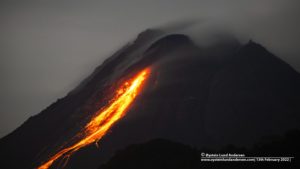
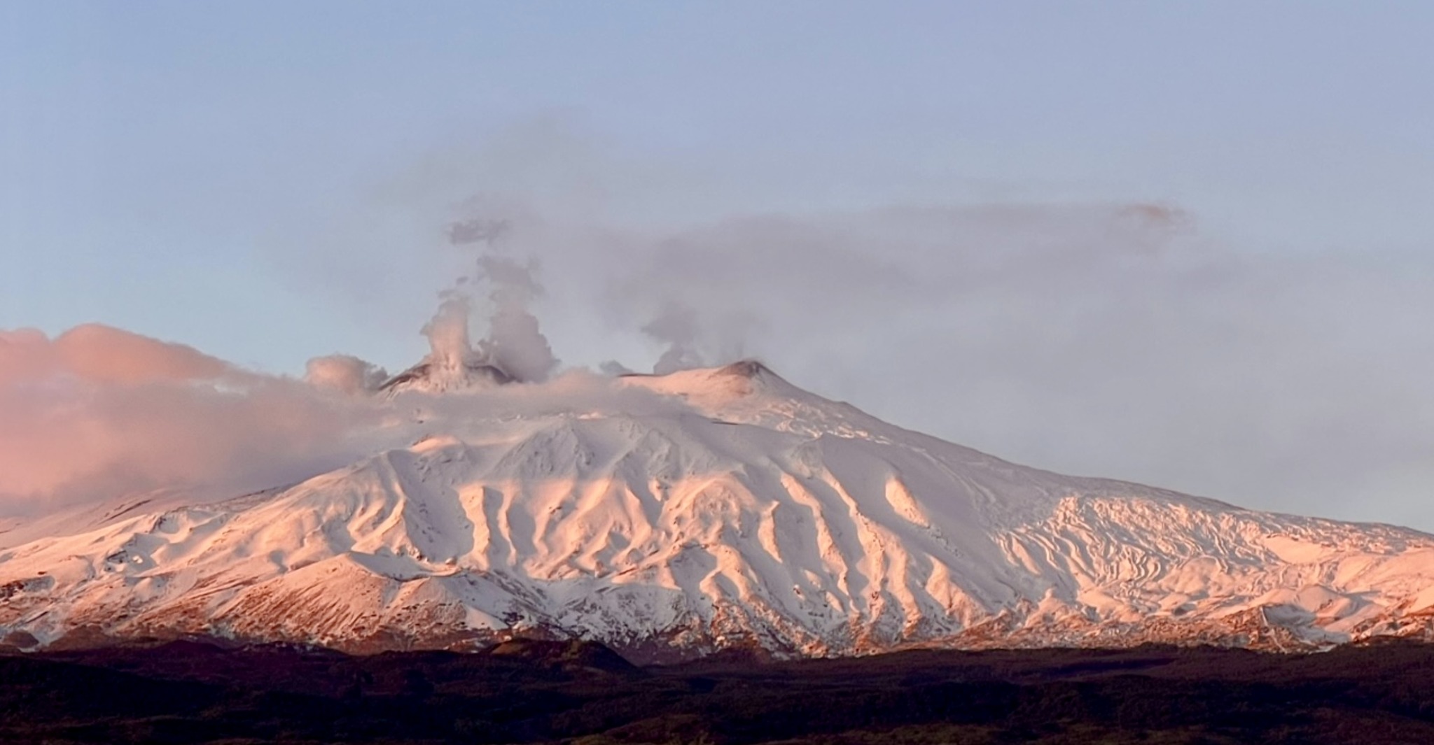
Italy / Sicily , Etna :
Press release on the activity of Etna, November 2, 2023, 10:50 p.m. (9:50 p.m. UTC).
The National Institute of Geophysics and Volcanology, Osservatorio Etneo, communicates that according to the analysis of images from surveillance cameras, we observe that Strombolian activity persists in the Southeast crater. The activity varying in intensity and frequency produces modest emissions of ash which disperse quickly in the atmosphere near the summit area.
The average amplitude of the volcanic tremor continues to show a variable trend over time, with rapid oscillations between medium and high values and sources localized in the Southeast crater area. Regarding infrasound activity, the presence of high intensity wind did not allow us to make a reliable estimate of the frequency of appearance of infrasound events and their location. However, according to the visualization of the seismograms, where it was possible to make an evaluation, the sources are located in the Bocca Nuova crater area and in the Southeast crater area.
Analysis of signals from the inclinometer network and extensometers does not show any significant deformation of the ground over the last few hours.
Further updates will be communicated shortly.
Source : INGV.
Photo : Guide Etna Nord – Compagnia Guide Etna
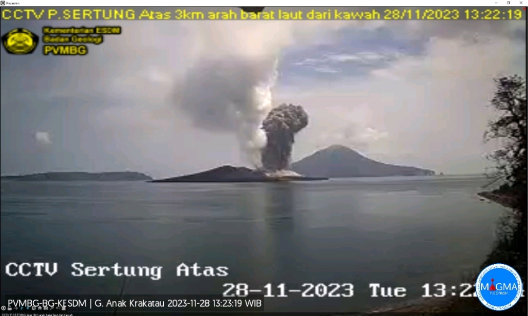
Indonesia , Anak Krakatau :
An eruption of Mount Anak Krakatau occurred on Tuesday, November 28, 2023 at 1:21 p.m. WIB. The height of the eruptive column was observed to be ±1,000 m above the peak (±1,157 m above sea level). The ash column was observed to be black with thick intensity, oriented towards the Northeast. The eruption was recorded on a seismograph with a maximum amplitude of 70 mm and a duration of 46 seconds.
VOLCANO OBSERVATORY NOTICE FOR AVIATION – VONA
Issued : November 28 , 2023
Volcano : Anak Krakatau (262000)
Current Aviation Colour Code : ORANGE
Previous Aviation Colour Code : orange
Source : Anak Krakatau Volcano Observatory
Notice Number : 2023KRA089
Volcano Location : S 06 deg 06 min 07 sec E 105 deg 25 min 23 sec
Area : Lampung, Indonesia
Summit Elevation : 502 FT (157 M)
Volcanic Activity Summary :
Eruption with volcanic ash cloud at 06h21 UTC (13h21 local).
Volcanic Cloud Height :
Best estimate of ash-cloud top is around 3702 FT (1157 M) above sea level or 3200 FT (1000 M) above summit. May be higher than what can be observed clearly. Source of height data: ground observer.
Other Volcanic Cloud Information :
Ash cloud moving to northeast. Volcanic ash is observed to be dark. The intensity of volcanic ash is observed to be thick.
Remarks :
Eruption recorded on seismogram with maximum amplitude 70 mm and maximum duration 46 second
Several intense eruptions took place today on the volcano at 02:04, 02:15, 03:51, 04:38 UTC, with altitudes between 957 m and 1657 m.
Source et photo : Magma Indonésie.
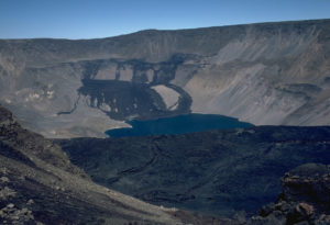
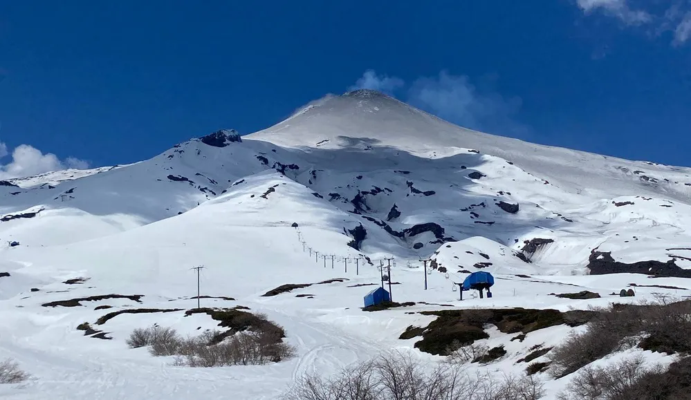
Chile , Villarica :
Special Report on Volcanic Activity (REAV), La Araucanía and Los Ríos regions, Villarrica volcano, November 27, 2023, 10:58 p.m. local time (mainland Chile)
The National Geology and Mining Service of Chile (Sernageomin) announces the following PRELIMINARY information, obtained through the monitoring equipment of the National Volcanic Monitoring Network (RNVV), processed and analyzed at the Southern Andean Volcano Observatory (Ovdas):
On Monday, November 27, 2023, at 10:38 p.m. local time (Tuesday, November 28, 1:38 a.m. UTC), monitoring stations installed near the Villarrica volcano recorded an earthquake associated with the fracturing of the rock (volcano-tectonic type).
The characteristics of the earthquake after its analysis are as follows:
ORIGINAL TIME: 10:38 p.m. local time (November 28, 2023, 01:38 UTC)
LATITUDE: 39.424°S
LONGITUDE: 71.892°E
DEPTH: 4.6 km
LOCAL MAGNITUDE: 3 (ML)
Observation :
During this day, an increase in volcano-tectonic activity was recorded, presenting local magnitude events of 1.7, 2.5 and 2.6 respectively, all with an epicenter similar to that previously described. Following the event, lower energy VT type earthquakes were recorded. No surface activity was observed, following cloudiness in the area.
At the time of issuing this report, the other seismic parameters did not show any variations.
The technical volcanic alert is maintained at YELLOW level.
Source : Sernageomin.
Photo : Auracaniadiario