November 15 , 2023.
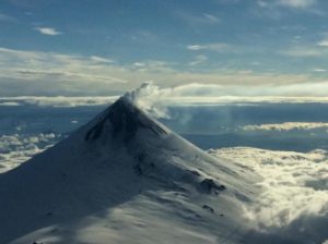
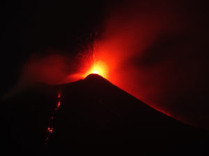
Italy , Stromboli :
WEEKLY BULLETIN, from November 6, 2023 to November 12, 2023. (issue date November 14, 2023)
SUMMARY STATEMENT OF ACTIVITY
In light of the monitoring data, it appears:
1) VOLCANOLOGICAL OBSERVATIONS: Normal Strombolian activity was observed during this period. The total hourly frequency fluctuated between average values (7-14 events/h). The intensity of the explosions varied from low to medium in the North Crater area and from low to high in the South-Central area.
2) SISMOLOGY: The monitored seismological parameters do not show significant variations.
3) GROUND DEFORMATIONS: The island’s ground deformation monitoring networks did not show significant variations during the period studied.
4) GEOCHEMISTRY: SO2 flux at medium level
CO2 flow in the Pizzo area: no update available.
CO2 flow at Scari: on average degassing values.
There is no update on the C/S ratio in the plume.
There is no update on the isotope ratio of dissolved helium in groundwater.
5) SATELLITE OBSERVATIONS: Thermal activity observed by satellite was generally weak.
VOLCANOLOGICAL OBSERVATIONS
In the observed period, the eruptive activity of Stromboli was characterized through the analysis of images recorded by the surveillance cameras of the INGV-OE at altitude 190m (SCT-SCV), of Pizzo and Punta dei Corvi . The explosive activity was mainly produced by 3 (three) eruptive vents located in the northern area of the crater and by 2 (two) vents located in the south central area.
Due to unfavorable weather conditions, visibility of the crater terrace was insufficient on November 12.
In the area of the North crater (N), with two vents located in sector N1 and one in sector N2, explosive activity of varying intensity from low (less than 80 m high) to medium (less than 150 m high). top) was observed. The products emitted in the eruption were mainly coarse materials (bombs and lapilli). The average frequency of explosions fluctuated between 4 and 7 events/h.
In the South-Central (CS) zone, sectors S1 and C did not show significant activity while sector S2 has two active vents which also showed simultaneous activity of varying intensity from low to high (more than 150 m height) emitting predominantly fine materials mixed with coarse materials. The average frequency of explosions oscillated between 3 and 8 events/h.
Source et photo : INGV.
Iceland , Reykjanes Péninsula :
The newly activated graben at Grindavík remains active. Increased monitoring in the vicinity of Grindavík. Unchanged likelihood of an eruption.
Updated 14. November at 12:40 UTC
Since midnight, 14 November, over 700 earthquakes have been located along the orientation of the magma intrusion, the largest of which was M 3.1 near to Hagafell. Last night, 13 November, stress-triggered seismicity occurred close to Kleifarvatn, with the largest earthquake registering M 3.8 at 21:09 UTC. Today, most earthquakes are occurring along the magma intrusion, with the majority being micro-earthquakes, commonly at focal depths of 3 to 5 km.
Deformation measurements, including high-resolution aerial observations, satellite radar imagery, and ground-based GPS observations reveal continued, ongoing ground movements due to the ongoing formation of the magma intrusion. These results are consistent with continued, albeit much lower magma inflow to the region of the intrusion.
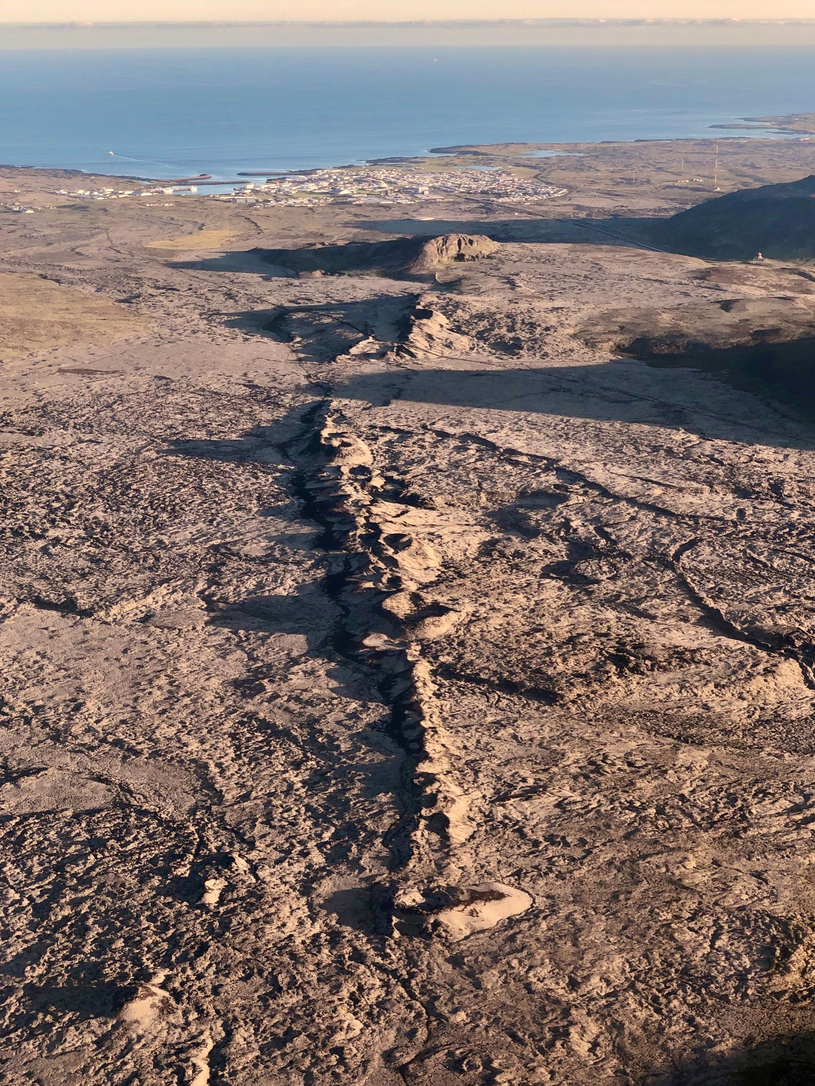
Sundhnúkar crater row lies southwest to Grindavík.
Between 12 and 13 November, the inflow is estimated at 75 m3 / s, and the average depth to the top of the magma intrusion is thought to be around 800 m. The inflow and depth estimates are derived from model-based calculations, and they are subject to uncertainty.
Throughout this period of volcanic unrest, the focus has been continuous monitoring of seismicity and ground deformation in the Grindavík – Svartsengi region. To further our monitoring capabilities, we have installed additional GPS stations in and around Grindavík. The latest measurements from these stations show that the graben-like formation is still forming and mechanically active. Furthermore, to increase our ability to warn of an eruption, we have installed ground-based SO2 detectors that overlook Grindavík and south of Sundhnúkur.
In summary, the likelihood of an eruption remains high. If an eruption occurs, the most likely location will be on the magma intrusion. Our latest hazard assessment does not indicate any other potential eruption sites.
Updated 14. November at 19:20 UTC
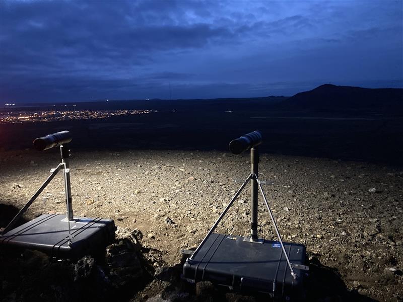
Earlier this week, IMO specialists installed two DOAS remote sensing instruments on Húsafell. These instruments can measure the presence and the amount of SO2 in the atmosphere. One of the DOAS instruments detected SO2 yesterday and today at the newly formed graben, located between Sundhnúkagígar and Grindavík. Because of the low amount of daylight, the measurements can be imprecise, and it took time to review the data and interpret it. In the last two days, eastern winds have been prevalent in the area, so it cannot be ruled out that recent strong seismicity has caused the release of SO2 from beneath Fagardalsfjall, as magma at that location has not solidified yet since the eruption in July 2023.
It is hard to estimate the depth from which the SO2 is being released as the process is influenced by magma pressure. However, it is thought that the magma needs to be in the upper hundred meters of the crust in order for SO2 to be released. This is one of the reasons why the DOAS instruments have been sited close to Grindavík.
DOAS (Differential Optical Absorption Spectrometer) is a tool that can detect sulfur dioxide in the atmosphere. The method relies on visible light, which travels through the atmosphere, hits a sensor in the measuring device, which is then analyzed for certain colors (wavelengths) that are missing from the spectrum. Sulfur dioxide absorbs certain wavelengths of light, which means that light hits the measuring instrument in a different way if SO2 is detected. The probe scans certain sectors of the sky, and it provides information on the concentration of sulfur dioxide within the area scanned. DOAS measurements need daylight to work, so operating such instruments in the wintertime in Iceland can be challenging.
Source : IMO
Photo : Siggi Anton , RUV, IMO .
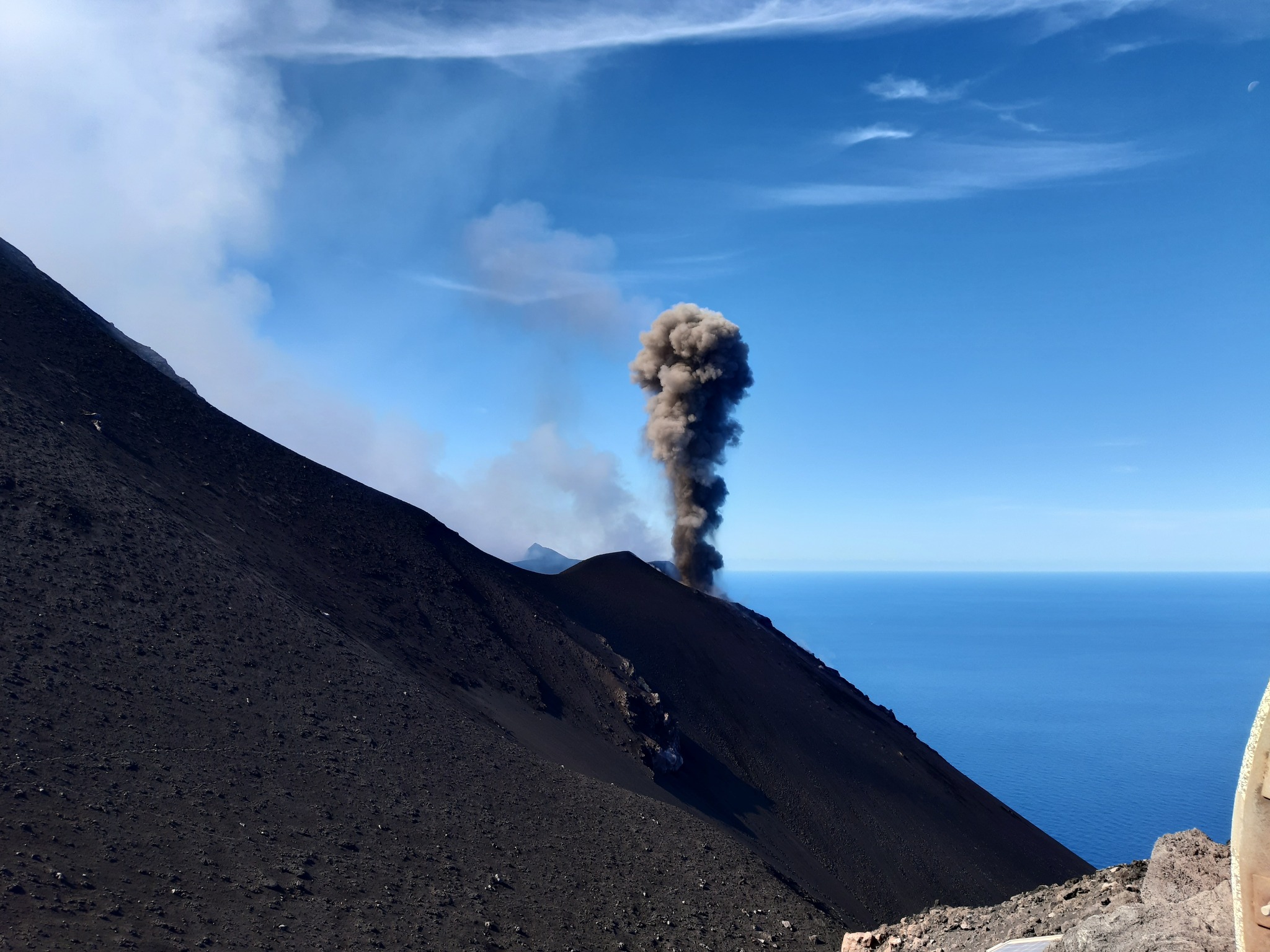
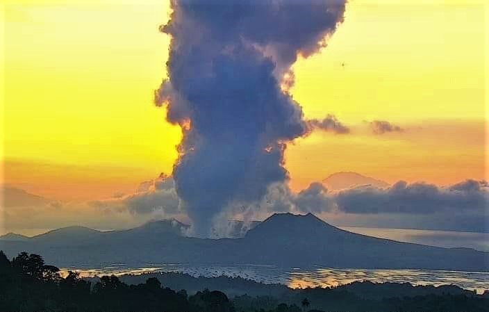
Philippines , Taal :
TAAL VOLCANO ADVISORY , 15 November 2023 , 02:00 PM .
This is a notice of elevated sulfur dioxide and continuous degassing activity from Taal Volcano.
A total of 11,695 tonnes/day of volcanic sulfur dioxide or SO2 gas emission from the Taal Main Crater was measured today, 15 November 2023. Visual monitors show continued pronounced upwelling of volcanic fluids in the Main Crater, generating short and weak- to moderate-volume degassing plumes. Strong winds drifted the plumes to the southwest. No volcanic smog or vog over Taal Caldera was observed by visual monitors throughout the day. However, a mild sulfur stench was observed in Banyaga, Agoncillo. Taal has been continuously degassing high concentrations of volcanic SO2 since March 2021; emissions since September 2023 have averaged 6,267 tonnes/day. Moderate seismicity has been recently exhibited by Taal; of the 686 volcanic earthquakes recorded since 1 September 2023, 629 were weak volcanic tremors associated with volcanic gas activity.
As a reminder, vog consists of fine droplets containing volcanic gas such as SO2 which is acidic and can cause irritation of the eyes, throat and respiratory tract with severities depending on the gas concentrations and durations of exposure.
DOST-PHIVOLCS reminds the public that Alert Level 1 prevails over Taal Volcano, which means that it is still in abnormal condition and should not be interpreted to have ceased unrest nor ceased the threat of eruptive activity. At Alert Level 1, sudden steam-driven or phreatic explosions, volcanic earthquakes, minor ashfall and lethal accumulations or expulsions of volcanic gas can occur and threaten areas within TVI. DOST-PHIVOLCS strongly recommends that entry into TVI, Taal’s Permanent Danger Zone or PDZ, especially the vicinities of the Main Crater and the Daang Kastila fissure, must remain strictly prohibited. Local government units are advised to continuously monitor and assess volcanic SO2 and vog exposure of, and potential impacts on, their communities and undertake appropriate response measures to mitigate these hazards.
Source : Phivolcs
Photo : Webcam ( archive)
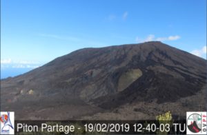
Colombia , Purace / Los Coconucos Volcanic Range :
Weekly activity bulletin of the Puracé volcano – Los Coconucos Volcanic Range
From the monitoring of the activity of the PURACE VOLCANO – LOS COCONUCOS VOLCANIC CHAIN, the MINISTRY OF MINES AND ENERGY through the COLOMBIAN GEOLOGICAL SERVICE (SGC) reports:
During the week of November 7-13, 2023, seismic activity showed a similar trend to that observed the previous week, maintaining values above the baseline.
of seismic activity, both in energy released and in number of events recorded. Seismic events linked to the movement of fluids in volcanic conduits predominated, located mainly under the crater of the Puracé volcano. The ML 2.8 magnitude fracture event of November 8 at 7:58 p.m. stands out, located 1.3 km east of the crater of the Puracé volcano, 4 km deep.
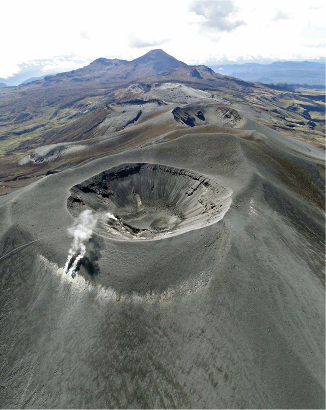
On the other hand, localized deformations continued to be recorded between the Puracé and Cuiriquinga volcanoes. In addition, stable values were recorded in the flow of sulfur dioxide (SO2) and high values in the concentration of carbon dioxide (CO2) persist, compared to what was recorded in the first half of 2023.
The images obtained using the installed cameras show the degassing of the volcanic system.
The other parameters measured and used for the diagnosis of volcanic activity showed no notable changes during the period evaluated.
The alert status for volcanic activity remains at: YELLOW ALERT: ACTIVE VOLCANO WITH CHANGES IN THE BEHAVIOR OF THE BASE LEVEL OF MONITORED PARAMETERS AND OTHER MANIFESTATIONS.
Source et photo : SGC
Hawaii , Kilauea :
Tuesday, November 14, 2023, 8:57 AM HST (Tuesday, November 14, 2023, 18:57 UTC)
19°25’16 » N 155°17’13 » W,
Summit Elevation 4091 ft (1247 m)
Current Volcano Alert Level: ADVISORY
Current Aviation Color Code: YELLOW
Activity Summary:
Kīlauea volcano is not erupting. The unrest associated with the intrusion that began in early October southwest of Kīlauea’s summit continues. An earthquake swarm located immediately south of Kīlauea’s caldera which began Friday November 10th persists with moderate levels of seismicity and HVO continues to monitor this activity. Unrest may continue to wax and wane with changes to the input of magma into the area and eruptive activity could occur in the near future with little or no warning. No unusual activity has been noted along Kīlauea’s East Rift Zone.
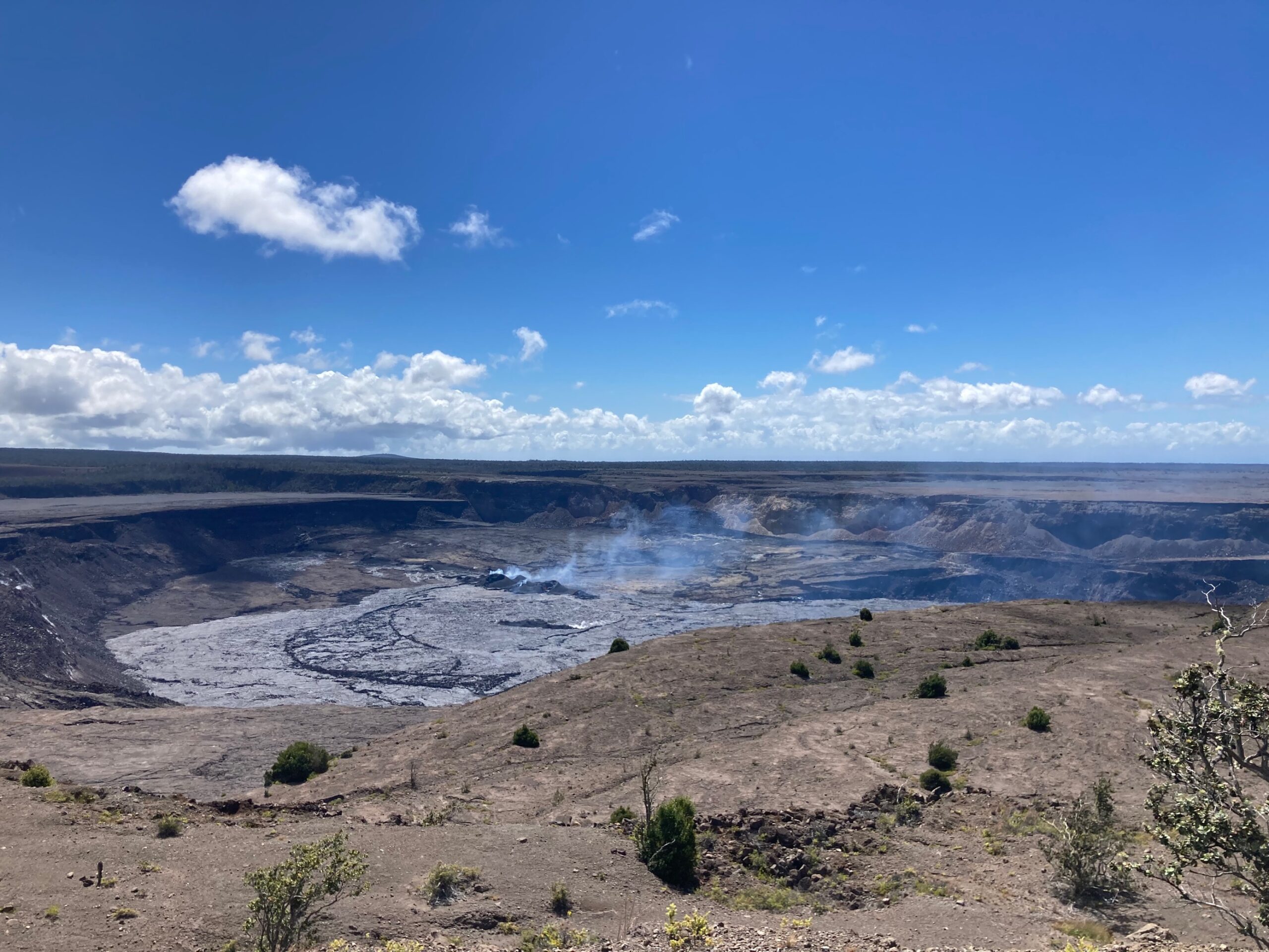
Summit Observations:
Unrest around the summit area of Kīlauea has persisted at low seismic rates over the past 24 hours. Moderate levels of seismicity continue after a swarm started on Friday November 10th. Current activity has occurred immediately south of Halemaʻumaʻu mostly within Kīlauea’s caldera and extending along the southwest rift zone. HVO continues to monitor this activity.
The Uēkahuna summit tiltmeter, located northwest of the caldera, has been unchanged over the past 24 hours. The Sand Hill tiltmeter, located southwest of the caldera, has resumed longer term trends over past 24 hours suggesting inflation of a source south of Halemaʻumaʻu. Overall, the summit of Kīlauea remains at a high level of inflation, above the level reached prior to the most recent eruption in September 2023.
Sulfur dioxide (SO2) emission rates remain low and were measured at a rate of about 100 tonnes per day on October 19, 2023.
There is currently no sign of an imminent eruption, but eruptive activity is possible in the coming weeks or months. Increased inflation and earthquake activity (heightened unrest) are expected to precede an eruption. The onsets of previous summit eruptions have been marked by strong swarms of earthquakes caused by the emplacement of a dike 1-2 hours before eruptions.
Source : HVO
Photo : USGS/ M. Patrick. ( archive)