October 07 , 2023.
Italy , Stromboli :
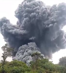
Press release on Stromboli activity, October 6, 2023, 6:48 p.m. (4:48 p.m. UTC).
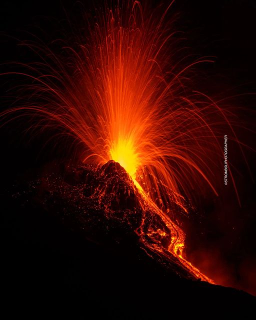
The National Institute of Geophysics and Volcanology, Osservatorio Etneo, communicates that the analysis of images from the network of surveillance cameras made it possible to observe that the overflow of lava from the North crater area reported on 6/10 at 2.12 UTC n is more powered and cools. Strombolian activity coming from the mouths of the northern zone of the crater persists, while the splashes have decreased in intensity. Strombolian activity is also observed in the south-central zone of the crater.
From a seismic point of view, today the average amplitude of the volcanic tremor has almost always remained confined in the range of average values, reaching high values only occasionally and for short moments. Even now, the tremor amplitude presents average values. No significant changes were reported in the frequency of occurrence and amplitude of explosion earthquakes.
The deformation data from the inclinometer and GNSS networks do not show significant variations.
Press release on Stromboli activity, October 7, 2023, 06:27 (04:27 UTC).
The National Institute of Geophysics and Volcanology, Osservatorio Etneo, communicates that from around 03:00 UTC, images from video surveillance cameras show an intensification of projections coming from the northern area of the crater. From around 03:10 UTC, this activity feeds a lava overflow which, for the moment, remains confined to the upper part of the Sciara del Fuoco. Strombolian activity continues from the Center-South crater area.
From a seismic point of view, the average tremor amplitude presents high values. No significant changes were reported in the frequency of occurrence and amplitude of explosion earthquakes.
The deformation data from the inclinometer and GNSS networks do not show significant variations.
Further updates will be communicated shortly
Source : INGV.
Photo : Stromboli stati d’animo / Sebastiano Cannavo.
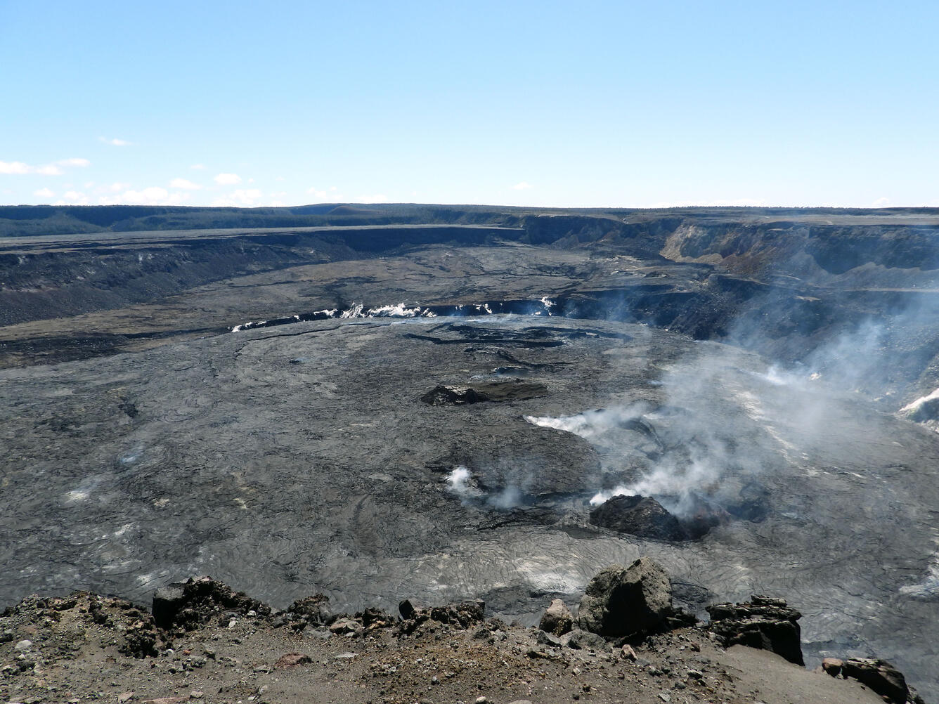
Hawaii , Kilauea :
Friday, October 6, 2023, 9:04 a.m. HST (Friday, October 6, 2023, 7:04 p.m. UTC)
19°25’16 » N 155°17’13 » W,
Summit elevation: 4091 feet (1247 m)
Current volcanic alert level: NOTICE
Current aviation color code: YELLOW
Summary of activity:
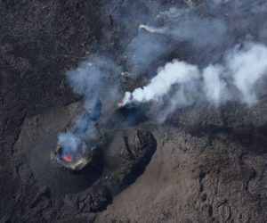
The Kīlauea volcano is not erupting. The area just south of Kīlauea’s summit is currently showing signs of high unrest. No unusual activity was noted along the eastern rift zone or the southwest rift zone of Kīlauea.
Summit Observations:
The inflationary tilt continues at a slightly slower rate in the area just south of the summit caldera. Inflation at Kīlauea’s summit remains near its highest level in more than 5 years and has almost returned to the level seen just before the last eruption on September 10. Seismicity beneath the Kīlauea summit region, which began on October 4, has increased with approximately 320 earthquakes occurring in the past 24 hours. Most earthquakes originate from the ongoing seismic swarm in a region south of the caldera at depths of about 2.5 to 3.5 km (1.5 to 2 mi) below the surface. The trend in seismic activity is parallel, but slightly to the south, to that of the vents of the December 1974 eruption. From 3 a.m. to 6 a.m. this morning, October 6, strong seismicity was recorded at the northeastern end of this trend at the southern limit of the caldera. Seismicity in the area decreased around 6 a.m., but still remains high. Sulfur dioxide (SO2) emission rates remain low and were measured at a rate of around 150 tonnes per day on September 25.
Rift Zone Observations:
No unusual activity was noted along the eastern rift zone or the southwest rift zone; constant rates of ground deformation and seismicity continue along both. Measurements from continuous gas monitoring stations downwind of Pu’u’ō’ō in the Southeast Rift Zone – the site of eruptive activity from 1983 to 2018 – remain below detection limits for SO2 , indicating that SO2 emissions from Pu’u’ō’ō are negligible.
Source : HVO.
Photo : USGS / K. Mulliken.( archive)
Indonesia , Merapi :
Report on the activity of Mount Merapi from September 29, 2023 to October 5, Published on October 7, 2023.
OBSERVATION RESULTS
Visual
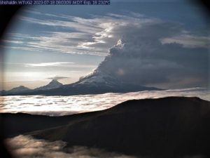
The weather around Mount Merapi is generally sunny in the morning and afternoon, while the evening is foggy. White smoke, fine to thick, low to medium pressure and 150 m high was observed from the observation post of Mount Merapi in Badaban on September 29, 2023 at 5:30 a.m.
This week, lava avalanches were observed 177 times towards the South and South-West, including 21 times upstream of the Boyong River up to 1600 m, 155 times upstream of the Bebeng River up to a maximum of 2000 m and 1 time upstream of the Senowo river up to a maximum of 700 m. The sound of avalanches was heard 24 times from the Babadan post with low to moderate intensity.
The morphology of the South-West dome has undergone changes observed by drone aerial photos on September 28, 2023 and analysis of thermal photos of the summit on September 27, 2023, showed the addition of material in the lava dome. The southwest dome morphology observed a slight increase in dome height as well as changes due to lava avalanche activity. During this time, no significant changes were observed for the central dome. Based on the analysis of aerial photos from September 28, 2023, the volume of the southwest dome was measured at 3,097,700 cubic meters and that of the central dome at 2,358,500 cubic meters.

Seismicity
This week, the seismicity of Mount Merapi showed:
15 shallow volcanic earthquakes (VTB),
2431 multi-phase (MP) earthquakes,
3 low frequency (LF) earthquakes,
1014 avalanche earthquakes (RF)
8 tectonic earthquakes (TT).
The intensity of seismicity this week is lower than last week, but the number of earthquakes is still quite high.
Deformation
The deformation of Mount Merapi that was monitored using EDM this week showed a shortening of steepening distance by 0.4 cm/day.
Rain and lahars:
There was no rain this week at Pengamatan’s Mount Merapi lookout post. There have been no reports of additional flows or lahars from rivers flowing down from Mount Merapi.
Conclusion
Based on the results of visual and instrumental observations, it is concluded that:
-Mount Merapi’s volcanic activity is still quite high in the form of effusive eruption activity. The activity status is defined at the “SIAGA” level.
The current danger potential is in the form of lava avalanches and hot clouds in the South-South-West sector including the Boyong river for a maximum of 5 km, the Bedog, Krasak, Bebeng rivers for a maximum of 7 km. In the South-East sector, it includes the Woro river for a maximum of 3 km and the Gendol river for 5 km. While the ejection of volcanic material in the event of an explosive eruption can reach a radius of 3 km from the summit.
Source : BPPTKG
Photo : Yohannes Tyas Galih Jati / volcanodiscovery ( archive).
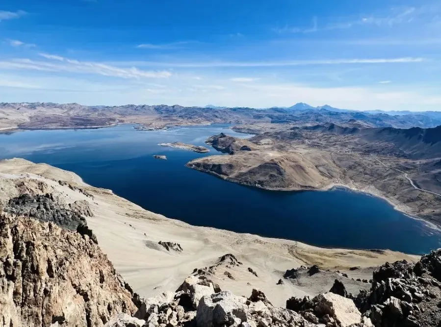
Chile , Laguna del Maule :
Special Report on Volcanic Activity (REAV), Maule region, Laguna del Maule volcanic complex, October 05, 2023, 2:12 p.m. local time (mainland Chile)
The National Geology and Mining Service of Chile (Sernageomin) announces the following PRELIMINARY information, obtained through the monitoring equipment of the National Volcanic Monitoring Network (RNVV), processed and analyzed at the Andes del Sud Volcanological Observatory ( Ovdas):
On Friday, October 6, 2023 at 1:52 p.m. local time (4:52 p.m. UTC), monitoring stations installed near the Laguna del Maule volcanic complex recorded an earthquake, associated with both rock fracturing and fluid dynamics at inside the volcanic system (hybrid type).
The characteristics of the largest magnitude earthquake recorded so far after its analysis are as follows:
ORIGINAL TIME: 1:52 p.m. local time (4:52 p.m. UTC)
LATITUDE: 36.166° S
LONGITUDE: 70.428°E
DEPTH: 3.6 km
LOCAL MAGNITUDE: 3.1
REDUCED DISPLAY: 200 cm2
Comments:
Following the main event, 3 lower energy events were recorded.
The technical volcanic alert remains at the Yellow level.
Source : Sernageomin.
Photo : OAVV
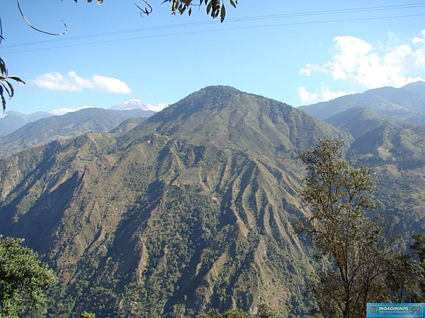
Colombia , Cerro Machin :
Weekly activity bulletin from the Cerro Machín volcano
From the monitoring of the activity of the CERRO MACHÍN VOLCANO, the MINISTRY OF MINES AND ENERGY through the COLOMBIAN GEOLOGICAL SERVICE (SGC) reports that:
Over the past week, the recording of seismic activity associated with the fracturing of rocks inside the volcanic edifice has continued. Compared to the previous week, this activity, although now at low levels, has increased in the number of earthquakes recorded and seismic energy released. The day with the highest number of earthquakes recorded was Monday, October 2. The earthquakes were of low energy (magnitudes less than 1) and were mainly located in the main dome and on the southwest flank of the volcano (up to 2 km from the dome), at depths between 3 and 4 km. .
Last weekend a report was received from a resident of the volcanic area indicating that in the sector of La Primavera (Finca La Florida) there was a spontaneous emanation of water with bubbling. Since February, a change in soil and vegetation temperature began to be observed at this location, which was inspected on February 18 and monitored on two other occasions (March 7 and June 23) by the SGC. Next week, SGC personnel will be on site and inspecting this change to confirm the origin of the bubbling, whether due to water temperature or gases.
The other parameters measured and used for the diagnosis of volcanic activity did not present significant changes during the period evaluated.
The alert status for volcanic activity remains at: YELLOW ALERT: ACTIVE VOLCANO WITH CHANGES IN THE BEHAVIOR OF THE BASE LEVEL OF MONITORED PARAMETERS.
Source : SGC
Photo : Ingeominas.