April 06 , 2023.
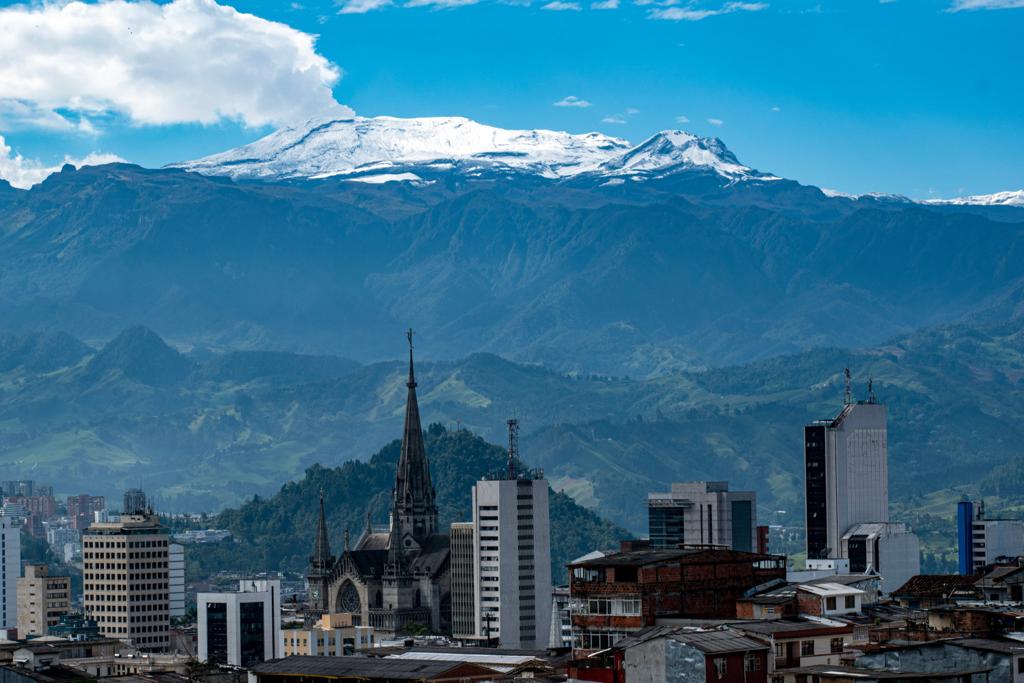
Colombia , Nevado del Ruiz :
Manizales, April 5, 2023 10:30 a.m.
Regarding the monitoring of the activity of the NEVADO DEL RUIZ VOLCANO, the MINISTRY OF MINES AND ENERGY through the COLOMBIAN GEOLOGICAL SERVICE (SGC) informs that:
The recording of rock fracturing seismicity continues inside the volcanic edifice. Yesterday April 4, 5,200 events were recorded, reaching a maximum magnitude of 3.1 ML corresponding to the 11:24 p.m. earthquake. During the first hours of today, April 5, more than 2,600 earthquakes were recorded. The occurrence of seven earthquakes with a magnitude greater than 2.0 ML stands out, the maximum magnitude reached was 3.9 ML, corresponding to the 02:16 earthquake. This magnitude is also the highest magnitude for this seismic source since instrumental monitoring has been carried out since 1985 in this sector of the volcano. Seismicity remains localized in the southwest sector of the volcanic edifice at a distance from the crater between 2.0 and 4.0 km.
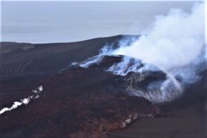
In addition, the seismic activity related to the movement of fluids inside the volcanic conduits, associated with confirmed ash emissions, continues to be recorded. Yesterday, degassing
slightly reduced compared to the previous day. The maximum height of the column of gas and / or ash observed yesterday was 1500 m measured from the summit of the volcano and the direction of dispersion of the column oscillated between the North-West and the South-West of the volcano. In addition, in the early morning of today, several thermal anomalies were observed in the crater from available satellite observations.
It is important to emphasize that the activity of the volcano at LEVEL ORANGE can fluctuate and sometimes decrease compared to previous days, without this meaning that it has returned to a level of lower activity. To change the level and return to the yellow level, a prudential time is required where trends and patterns can be observed that allow us to deduce the possible decrease in activity, which is why it is warned that the level of activity of the Nevado del Ruiz volcano will remain at the ORANGE LEVEL for several weeks. Meanwhile, if there is an acceleration of processes suggesting an impending eruption or the eruption itself occurring, the activity level will turn red.
The community is recommended to remain calm and follow all instructions from the National Disaster Risk Management Unit (UNGRD) and local authorities, as well as to be attentive to the information provided by the Colombian Geological Service on the evolution of the state of the volcano.
The COLOMBIAN GEOLOGICAL SERVICE will continue to be attentive to the evolution of the volcanic phenomenon and will provide timely information on any changes that may occur.
The level of activity of the volcano remains at the ORANGE LEVEL of activity or (II): PROBABLE ERUPTION IN TERM OF DAYS OR WEEKS
Servicio Geológico Colombiano’s (SGC) reported that thermal anomalies, persistent in Arenas Crater at Nevado del Ruiz since October 2022, were low-to-moderate in intensity. Seismicity increased significantly on 24 March, characterized by rock-fracturing earthquakes mainly located 2-5 km SW of Arenas crater at depths of 2-4 km. On 28 March there were 6,500 of these events, the highest daily count since 2010. The number of daily events continued to increase and on 29 March the seismic network recorded 11,000 earthquakes, the highest daily count since seismic monitoring began in 1985; on 30 March there were 11,600 earthquakes. The maximum magnitudes per day were also increasing, with a M 2.6 on 24 March, a M 2.7 on 29 March, and a M 3.1 on 30 March. The earthquake locations migrated towards Arenas Crater, though the depths remained within the same range. The Alert Level was raised to Orange, Level II (the second highest level on a four-level scale) on 30 March. In addition to the swarm, seismic signals indicating fluid movement continued to be recorded and some were associated with ash emissions; the tallest plume on 30 March rose 1.8 km above the summit and drifted NW and SW.
The number of earthquakes on 31 March totaled 8,800 with a maximum magnitude of 2.6 event at 12h36. The number of signals indicating fluid movement increased during 31 March-1 April and were likely associated with ash emissions. Gas-and-ash plumes rose as high as 1.3 km above the summit and drifted SW and SE. A total of 10,400 earthquakes were recorded on 1 April with the largest event, a M 3.1, recorded at 10h40. On 2 April a total of 5,400 earthquakes were recorded and the largest event (M 2.3) occurred at 11h22 and was located 4.3 km SW of the crater. Ash-and-gas emissions persisted and rose to 1.2 km above the summit and drifted SW and NW. Ashfall was reported in Brisas y de Potosí by Parque Nacional Natural Los Nevados officials. The Gestión del Riesgo de Desastres (UNGRD) reported that there were 57,000 people living in 22 municipalities in the departments of Tolima, Caldas, Risaralda, Valle del Cauca, Quindío, and Cundinamarca who could be impacted by Nevado del Ruiz. Preparations and coordination for a possible evacuation of residents were centered on areas in high-risk zones including the municipalities of Villamaría in the department of Caldas, Casabianca, Herveo, Murillo, and Villahermosa in Tolima, and the sector of the Gualí River in the municipality of Guaduas, Cundinamarca.
Source : SGC , GVP.
Photos : SGC.
Vanuatu , Ambae :
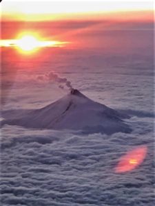
On 30 March the Vanuatu Meteorology and Geo-Hazards Department (VMGD) reported that the cone in Ambae’s Lake Voui continued to produce emissions consisting of steam, volcanic gases, and possibly occasional ash that drifted downwind. Volcanic earthquakes were recorded by the seismic network. According to the Wellington VAAC a low-level ash plume rose to an altitude of 2.4 km based on satellite imagery on 5 April. The Alert Level remained at 2 (on a scale of 0-5) and the public was warned to stay outside of the Danger Zone, defined as a 2-km radius around the active vents in Lake Voui, and away from drainages during heavy rains. Source: Vanuatu Meteorology and Geo-Hazards Department (VMGD), Wellington VAAC.
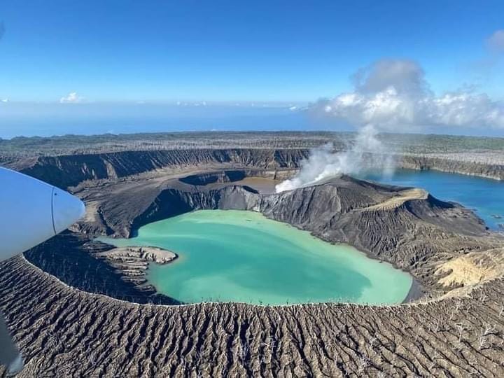
The island of Ambae, also known as Aoba, is a massive 2,500 km3 basaltic shield that is the most voluminous volcano of the New Hebrides archipelago. A pronounced NE-SW-trending rift zone dotted with scoria cones gives the 16 x 38 km island an elongated form. A broad pyroclastic cone containing three crater lakes (Manaro Ngoru, Voui, and Manaro Lakua) is located at the summit within the youngest of at least two nested calderas, the largest of which is 6 km in diameter. That large central edifice is also called Manaro Voui or Lombenben volcano. Post-caldera explosive eruptions formed the summit craters about 360 years ago. A tuff cone was constructed within Lake Voui (or Vui) about 60 years later. The latest known flank eruption, about 300 years ago, destroyed the population of the Nduindui area near the western coast.
Sources : GVP. Département de la météorologie et des géorisques de Vanuatu (VMGD), VAAC de Wellington.
Photo : air taxi vanuatu
Kamchatka , Bezymianny :
VOLCANO OBSERVATORY NOTICE FOR AVIATION (VONA)
Issued: April 05 , 2023
Volcano: Bezymianny (CAVW #300250)
Current aviation colour code: ORANGE
Previous aviation colour code: orange
Source: KVERT
Notice Number: 2023-45
Volcano Location: N 55 deg 58 min E 160 deg 35 min
Area: Kamchatka, Russia
Summit Elevation: 2882 m (9452.96 ft)
Volcanic Activity Summary:
An elevated activity of the volcano continues. Probably, a new block of lava is squeezed out on the lava dome, it’s accompanied by the avalanches. Satellite data by KVERT showed an ash plume extended about 140 km to the east from the volcano.
An extrusive-effusive eruption of the volcano continues. Ash explosions up to 10-15 km (32,800-49,200 ft) a.s.l. could occur during next several days. Ongoing activity could affect international and low-flying aircraft.
Volcanic cloud height:
3500-3800 m (11480-12464 ft) AMSL Time and method of ash plume/cloud height determination: 20230405/2128Z – NOAA-19 4m5
Other volcanic cloud information:
Distance of ash plume/cloud of the volcano: 140 km (87 mi)
Direction of drift of ash plume/cloud of the volcano: E / azimuth 90 deg
Time and method of ash plume/cloud determination: 20230405/2128Z – NOAA-19 4m5
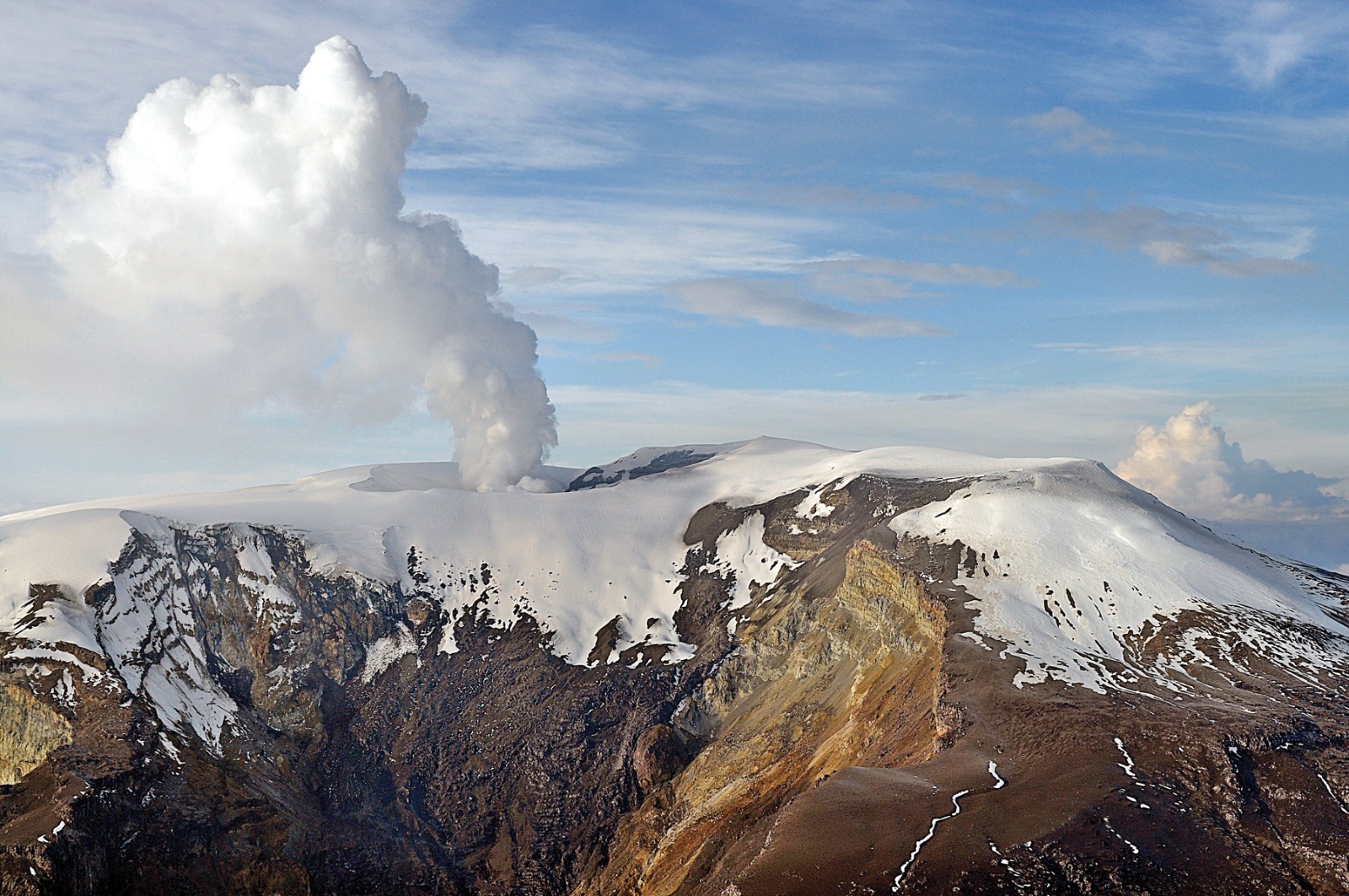
KVERT reported that a thermal anomaly over Bezymianny persisted in satellite images at least through 31 March, local time. On 2 April an ash plume rose 4.3 km (14,000 ft) a.s.l. and drifted SE according to the Tokyo VAAC. The Aviation Color Code remained at as raised to Orange (the second highest level on a four-color scale).
Sources : Kvert. GVP.
Photo : A. Sokorenko, IVS FEB RAS
Japan , Asamayama :
JMA reported that inflation on Asamayama’s W flank persisted during 29 March-4 April, and the number of shallow volcanic earthquakes continued to increase. There were 95 events on 29 March, 91 on 30 March, 94 on 31 March, 77 on 1 April, 68 on 2 April, 104 on 3 April, and 149 on 4 April. Sulfur dioxide measurements were 1,600 tons per day on 29 March, which had increased compared to the previous measurement of 100 tons per day on 17 March. On 3 April the sulfur dioxide concentration was 1,000 tons per day. The Alert Level remained at a 2 (on a scale of 1-5) and warned the public to be aware of large volcanic blocks and pyroclastic flows within 2 km of the crater.
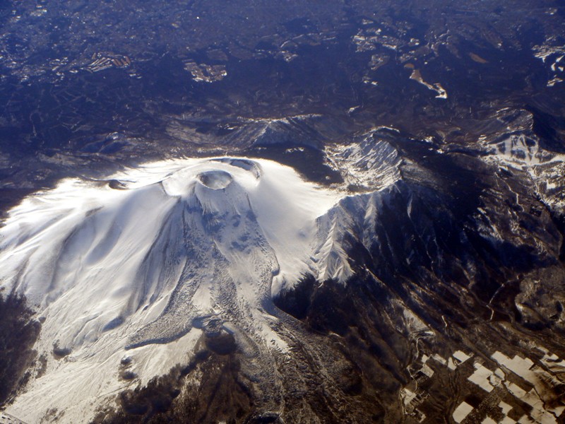
Asamayama, the most active volcano in Honshu, overlooks the seaside resort of Karuizawa, 140 km northwest of Tokyo. The volcano is located at the junction of the Izu-Marianas and Nord_Est Japan volcanic arcs. The modern Maekake cone forms the summit and is located east of the remnant of an ancient andesitic volcano, Kurofuyama, which was destroyed by a Late Pleistocene landslide about 20,000 years before present (BP) . The growth of a dacitic shield volcano was accompanied by sandstone pyroclastic flows, the largest of which occurred around 14,000-11,000 BP, and the growth of the Ko-Asamayama lava dome on the eastern flank. Maekake, capped by the pyroclastic cone of Kamayama that forms the present summit, is probably only a few thousand years old and has observed activity dating back to at least the 11th century CE. Maekake has had several major Plinian eruptions, the last two of which occurred in 1108 (Asamayama’s largest Holocene eruption) and 1783 CE.
Sources : Agence météorologique japonaise (JMA), GVP
Photo : Wikipedia.
Alaska , Semisopochnoi :
51°55’44 » N 179°35’52 » E,
Summit Elevation 2625 ft (800 m)
Current Volcano Alert Level: WATCH
Current Aviation Color Code: ORANGE
Several small explosions were detected at Semisopochnoi over the past 24 hours. Seismicity remained slighly elevated. An over 250 mile (400 km) long, low altitude water vapor plume was evident over the past day and is likily related to volcanic emissions but does not appear to contain volcanic ash.
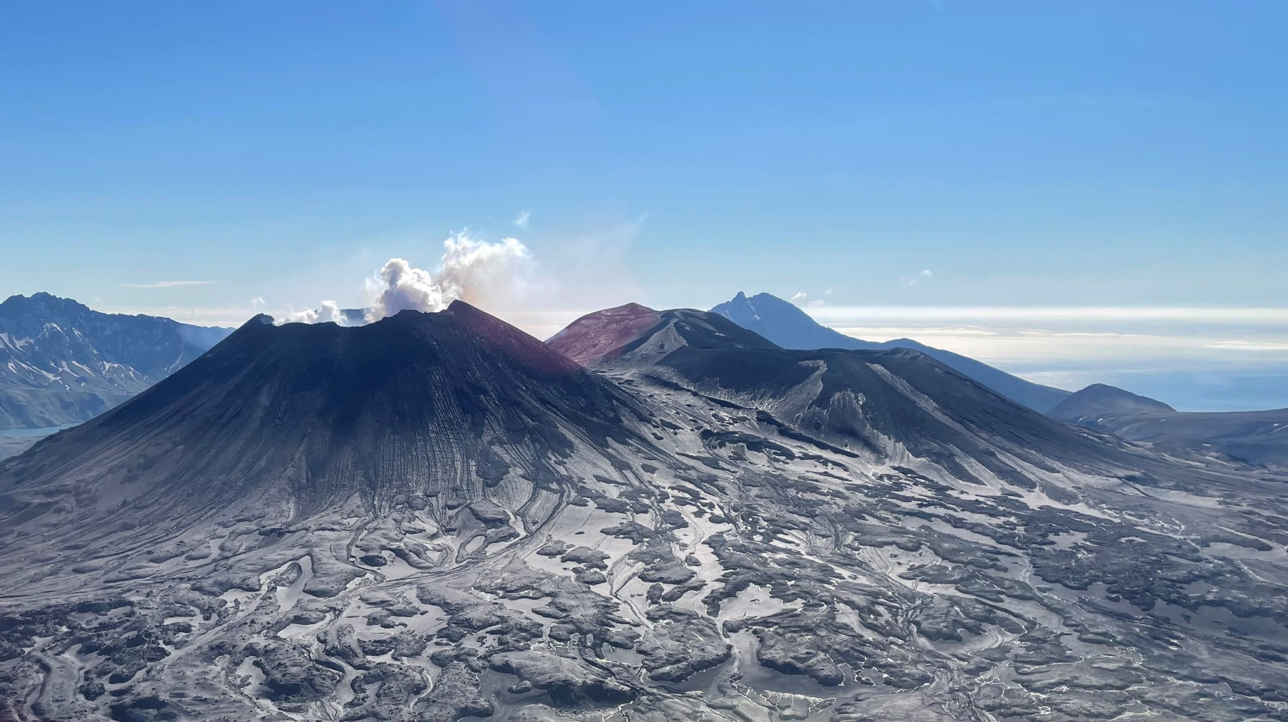
Small eruptions producing minor ash deposits within the vicinity of the active north crater of Mount Young and ash clouds usually under 10,000 ft (3 km) above sea level have characterized the recent periods of activity. Additional ash-producing events could occur again with little warning.
Semisopochnoi volcano is monitored by local seismic and infrasound sensors, satellite data, webcams, and regional infrasound and lightning networks.
Source : AVO.
Photo : Lerner, Allan