February 17 , 2023.
Hawaii , Kilauea :
Wednesday, February 15, 2023, 8:32 AM HST (Wednesday, February 15, 2023, 18:32 UTC)
19°25’16 » N 155°17’13 » W,
Summit Elevation 4091 ft (1247 m)
Current Volcano Alert Level: WATCH
Current Aviation Color Code: ORANGE
Activity Summary:
The summit eruption of Kīlauea Volcano, within Halemaʻumaʻu crater, continued over the past 24 hours. All recent eruptive activity has been confined to the crater. No significant changes have been observed at the summit or in either rift zone.
Halemaʻumaʻu crater Lava Lake Observations:
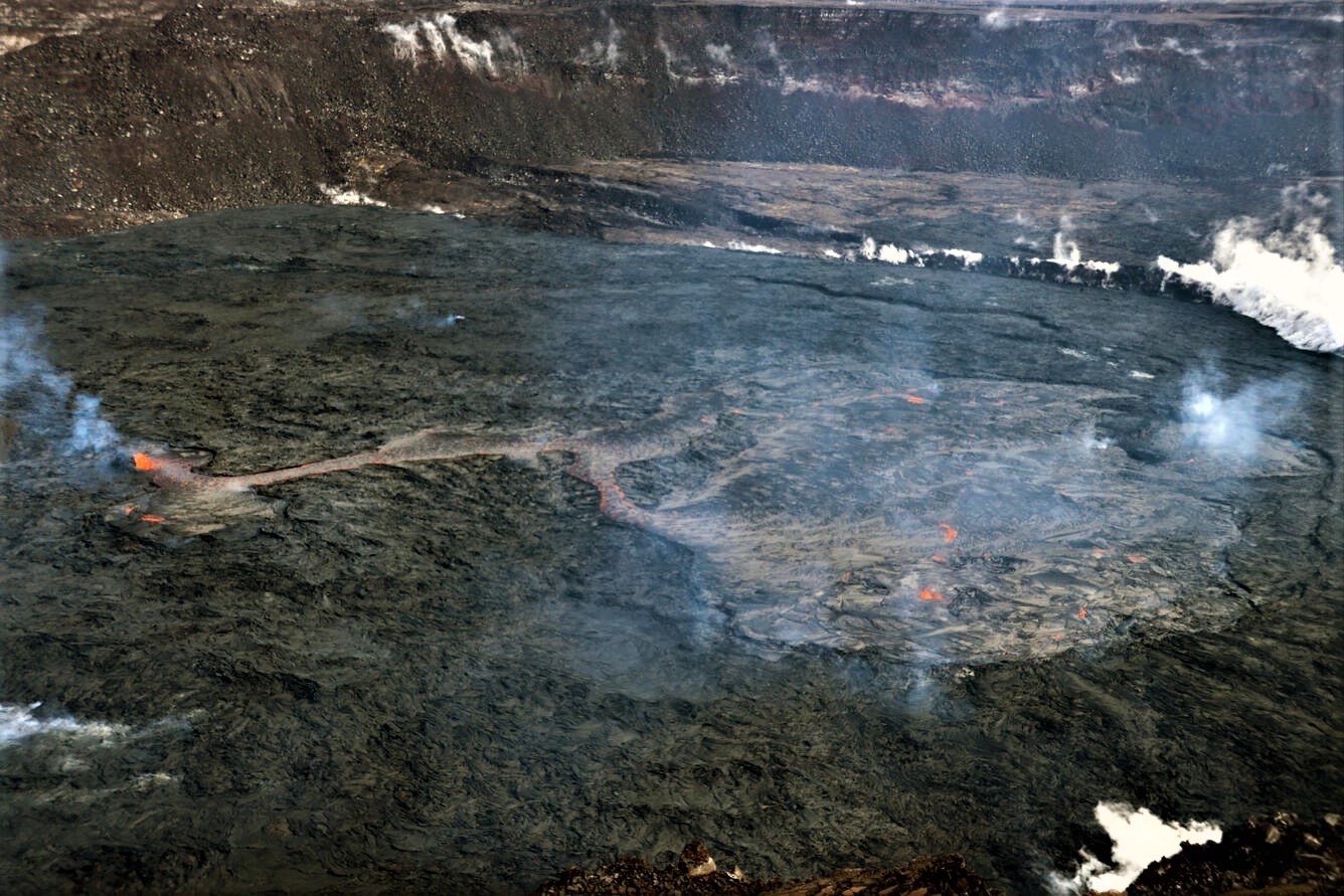
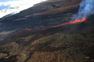
Eruption of lava in three locations of Halemaʻumaʻu crater floor continued over the past 24 hours. The eastern lake remains active and remains about 25 acres in size with the small southern lava fountain still being active. The smaller lava pond in the central portion of the crater floor also has an active small lava fountain with nearly continuous expansive overflows over the last day, and channels from the small central lava pond flow to the eastern lake. The western lake in the basin of the 2021–2022 lava lake remains active.
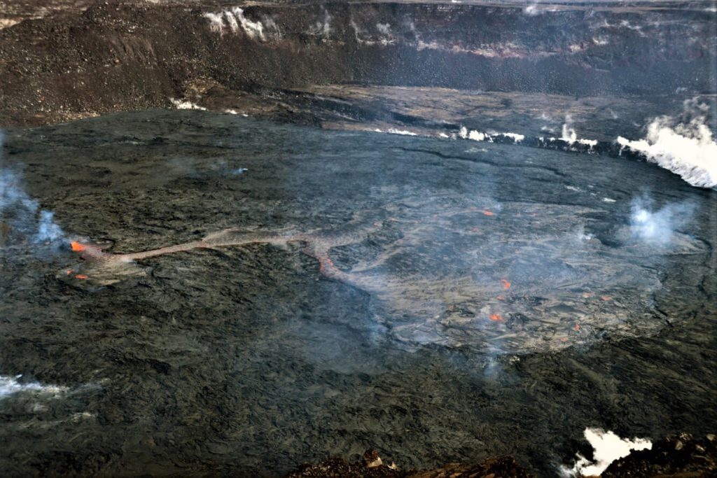
The eruption in Halema‘uma‘u, at the summit of Kīlauea, continues. Over the past week, the main source of lava effusion has shifted from the large eastern lake (right side of image) towards the smaller lake in the center of the crater (left side of image). This central vent has supplied lava towards the east that has poured into the eastern lake basin. The small fountain within the eastern lake has also shown renewed vigor in recent days.
Summit Observations:
Summit tiltmeters remain mostly flat (no deflationary or inflationary trends) over the past 24 hours. Volcanic tremor remains above background levels. A sulfur dioxide (SO2) emission rate of approximately 2,000 tonnes per day (t/d) was measured on February 13, 2023.
Rift Zone Observations:
No unusual activity has been noted along the East Rift Zone or Southwest Rift Zone; steady rates of ground deformation and seismicity continue along both. Measurements from continuous gas monitoring stations downwind of Puʻuʻōʻō in the middle East Rift Zone have been below detection limits for SO2, indicating that SO2 emissions from Puʻuʻōʻō are negligible.
Source : HVO.
Photo : USGS/ M. Patrick.
Ecuador , Cotopaxi :
Information on the activity of the Cotopaxi volcano, Quito, Thursday February 16, 2023.
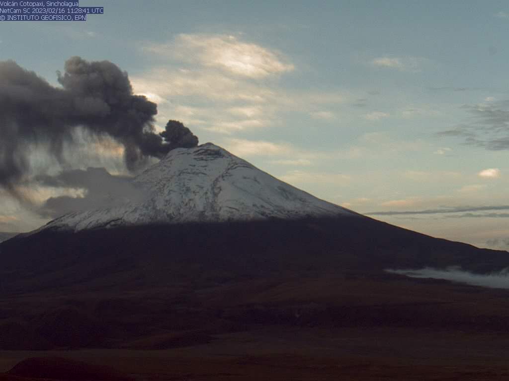
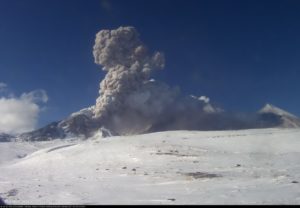
From 06:00 TL, through the surveillance cameras of the Cotopaxi volcano, a column of ash is observed which reaches 1 km above the summit and heads east. The cloud has a moderate ash content and could generate ash fall in areas east of the volcano. This phenomenon is more and more frequent during the current eruptive period. It is recommended to take the appropriate measures and to obtain information from official sources.
The IG-EPN continues to monitor the event and will inform in a timely manner if any changes in the monitoring parameters are detected.
Camera Sincholagua. Gas and ash emission. 02/16/2023 06:28 TL.
The Geophysical Institute is monitoring and any news will be reported.
IG reported that the eruption at Cotopaxi continued during 7-14 February, characterized by daily or almost daily emissions of gas, steam, and ash; inclement weather conditions occasionally prevented views. Gas-and-ash emissions rose as high as 2 km above the crater rim and drifted NW, W, and E during 7-10 February. Minor ashfall was reported in the parish of Tambillo (32 km NNW), Mejia region, on 10 February. Steam-and-gas emissions rose to 1 km and drifted W and SW on 11 February. Gas-and-ash plumes rose around 500 m on 12 February and drifted SW. Minor amounts of ash fell in El Chasqui (17 km W), Mulaló (19 km SW), and San Juan de Pastocalle (20 km WSW). During 13-14 February several steam-and-ash emissions rose as high as 1 km and drifted W and SW. Minor ashfall was reported in Mulaló, San Agustín (11 km W), Ticatilín (15 km WSW), San Ramón (17 km SW), Control Caspi (20 km WSW), and in Pastocalle (22 km W). Servicio Nacional de Gestión de Riesgos y Emergencias (SNGRE) maintained the Alert Level at Yellow (the second lowest level on a four-color scale).
Sources et photo : IGEPN. GVP
Japan , Suwanosejima :
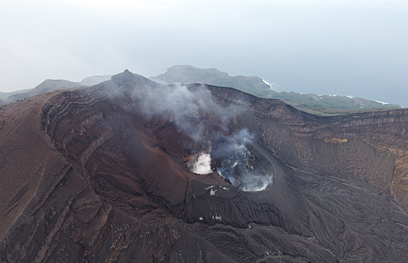
JMA reported that the eruption at Suwanosejima’s Ontake Crater continued during 6-13 February with a total of 10 explosions recorded by the seismic network. The explosions produced eruption plumes that rose as high as 1.5 km above the crater rim and ejected large blocks as far as 400 m from the vent. Crater incandescence was observed nightly. Occasional ashfall was reported in Toshima village (3.5 km SSW). The Alert Level remained at 2 (on a 5-level scale) and residents were warned to stay 1 km away from the crater.
The 8-km-long island of Suwanosejima in the northern Ryukyu Islands consists of an andesitic stratovolcano with two historically active summit craters. The summit is truncated by a large breached crater extending to the sea on the east flank that was formed by edifice collapse. One of Japan’s most frequently active volcanoes, it was in a state of intermittent Strombolian activity from Otake, the NE summit crater, between 1949 and 1996, after which periods of inactivity lengthened. The largest recorded eruption took place in 1813-14, when thick scoria deposits blanketed residential areas, and the SW crater produced two lava flows that reached the western coast. At the end of the eruption the summit of Otake collapsed, forming a large debris avalanche and creating the open Sakuchi caldera, which extends to the eastern coast. The island remained uninhabited for about 70 years after the 1813-1814 eruption. Lava flows reached the eastern coast of the island in 1884. Only about 50 people live on the island.
Source : GVP.
Photo : Auteur inconnu.
Italy , Stromboli :
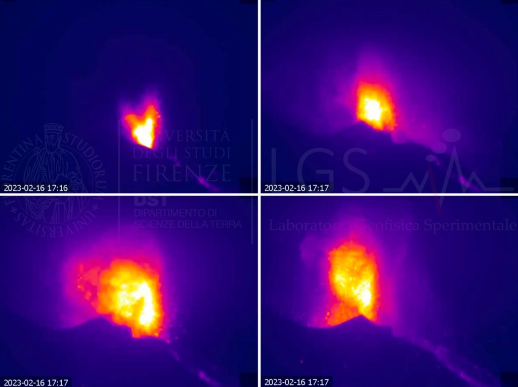
Press release on the activity of STROMBOLI, February 16, 202, 18:19 (17:19 UTC).
The National Institute of Geophysics and Volcanology, Osservatorio Etneo, announces that monitoring networks recorded a strong explosion at 6:18 p.m. (17:18 UTC).
Further updates will be communicated soon.
Press release on the activity of STROMBOLI, February 16, 202, 18:46 (17:46 UTC).
The National Institute of Geophysics and Volcanology, Osservatorio Etneo, communicates that from 17:17 UTC, from the images of the video surveillance network, an explosion of an intensity greater than the normal Strombolian activity was observed, followed by another explosion of lesser intensity. During the last 24 hours, the average amplitude of the volcanic tremor has not shown significant variations and remains in the range of medium-low values. Data from the geodetic monitoring networks of the island of Stromboli show no significant variation over the past 12 hours.
Further updates will be communicated soon.
At 17:16 UTC today (18:16 local time), the monitoring network of the Laboratory of Experimental Geophysics LGS – Department of Earth Sciences DSTUNIFI University of Florence UNIFI an above-normal explosive event, associated with a seismic signal in the maximum VLP band of 2.5×10⁻⁵ m (moving) and a ground deformation of about 1 micro-radiation (recorded with a THK tiltmeter) of about 0.13 mrad.
The event generated a sequence of three explosions with a maximum infrasonic pressure of 30 Pa located in the South Center crater sector.
From the surveillance cameras (ROC) the material emitted flowed into the Sciara del Fuoco and towards the Pizzo.
Sources : INGV. LGS.
Photo : LGS
Chile , Lascar :
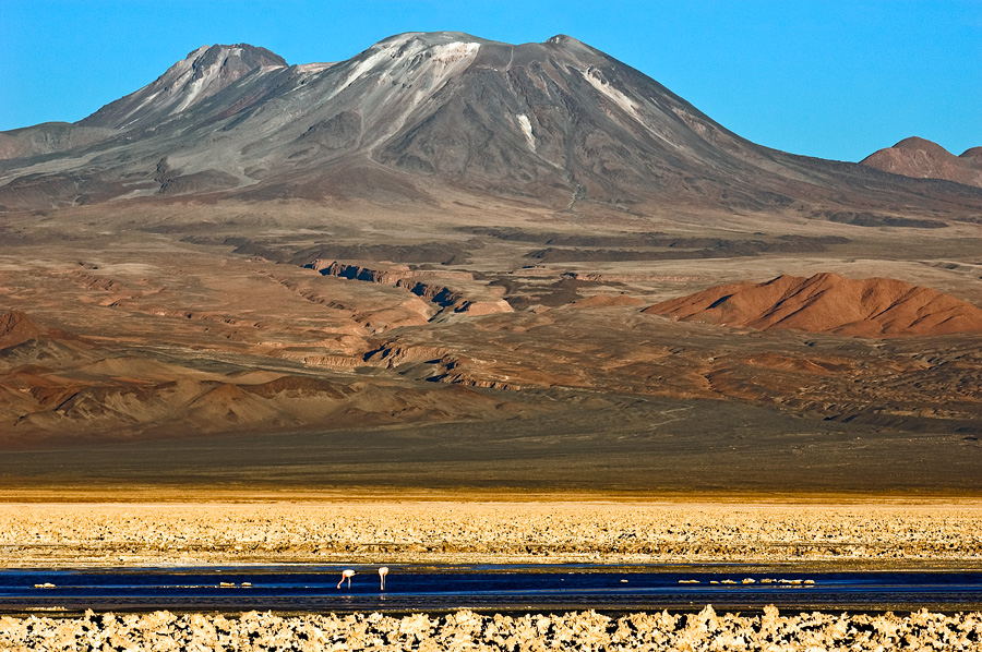
Volcanic Activity Report (RAV), Volcanological Observatory of the Southern Andes – Ovdas.
Seismic activity:
Over the past 24 hours, the seismic record continues to show volcano-tectonic type activity (VT, associated with rock material rupture processes), as well as earthquakes associated with fluid movements, both of Long Period (LP) and Tornillos (TO) type. .
Observations:
The source of the highest energy volcano-tectonic event was located 0.5 km west-northwest, with a depth of 1.5 km, from the active crater.
A low intensity whitish degassing is observed.
Other Notes:
From 2 GNSS stations, which measure surface deformation, insignificant position variations have been observed in recent days. The distance between the stations presents variations of less than 1 cm, remaining at the annual average value. Horizontal displacements show rates of less than 0.25 cm/month. On the other hand, the vertical displacements are weak, observing a beginning of negative trend vertically for the QUEB station, north of the crater, at a rate of 0.3 cm / month.
No new satellite thermal anomaly was detected (date of last image: February 16 (3)).
No new SO2 satellite anomaly was detected (date of last image: February 15 (4)).
The average SO2 flux was 96 t/d on February 13 and 26 t/d on February 14, measured with DOAS equipment.
Source : Sernageomin.
Photo : Gerard Prins
Colombia , Cerro Machin :
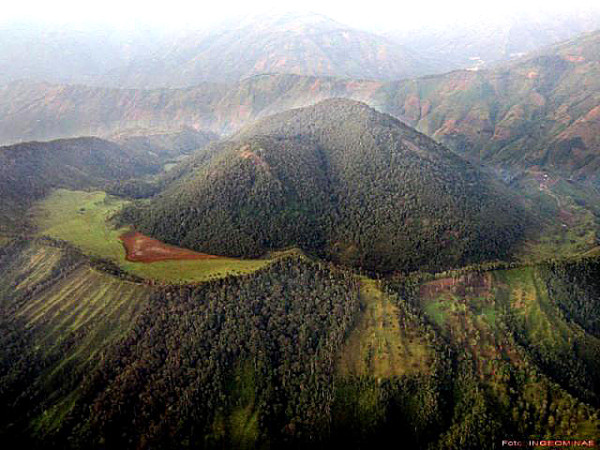
Subject: Bulletin of the level of activity of the Cerro Machín volcano.
The activity level continues at the yellow activity level or (III): changes in the behavior of volcanic activity.
Regarding the monitoring of the activity of the Cerro Machín volcano, the COLOMBIAN GEOLOGICAL SERVICE reports that:
Over the past week, recording of seismic activity related to rock fracturing in the volcanic edifice has continued. This seismic activity increased in number of earthquakes recorded and decreased in seismic energy released compared to the previous week.
The earthquakes were located to the south and southeast of the main dome, at depths between 2.5 and 4.6 km. The highest magnitude recorded during the week was 0.9 ML (Local Magnitude) corresponding to the earthquake recorded on February 8 at 02:42 (local time), located 0.3 km south of the main dome, at a depth of 3.8 km.
The other parameters used for the complete diagnosis of volcanic activity did not show significant changes during the period evaluated.
Source : SGC.
Photo : Ingeominas.

