February 03 , 2023.
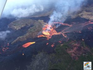
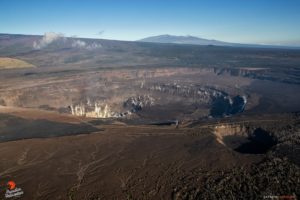
La Réunion , Piton de la Fournaise :
Seismicity
In January 2023, the OVPF-IPGP recorded at the level of the Piton de la Fournaise massif in total:
• 53 superficial volcano-tectonic earthquakes (0 to 2.5 km above sea level) under the summit craters;
• 3 deep earthquakes (below sea level);
• 33 long-period type earthquakes;
• 550 landslides.
The month of January 2023 will have been marked by low seismicity at the level of Piton de la Fournaise with an average of 1.7 volcano-tectonic earthquakes per day.
Most of these events were located under the southeast rim of the Dolomieu crater.
The month of January was also marked by many landslides in the Cratère Dolomieu, at Cassé de la Rivière de l’Est (especially during heavy rains on January 18 around 11:10 p.m. local time) and at the level of the flow of the September-October 2022 eruption.
Deformation
With the cessation of the last eruption on October 5, 2022, a resumption of inflation of the whole edifice was recorded until October 23 followed by a period without significant deformation of the edifice.
Between December 30, 2022 and January 3, 2023, a rapid inflation of the volcano was observed (with a dilation of the summit of about 1 cm max.), revealing a rapid pressurization of the superficial magmatic reservoir (located at 2-2.5 km below the summit).
Since then, a deflation of the summit zone has been observed, while a weak and slow inflation is still recorded in the far field. The slow inflation in the far field could testify to the pressurization of a deep magmatic source (below sea level) and/or deep fluid circulations.
Balance sheet
A short magmatic migration from the depths to the superficial reservoir, located 2-2.5 km deep, was highlighted between December 30, 2022 and January 3, 2023 by surface deformations. But since then, the replenishment of magma and the pressurization of the superficial reservoir have ceased.
At the same time, seismicity remained low with less than two volcano-tectonic earthquakes per day recorded under the summit craters in January 2023.
It should be noted that since 2016, the replenishments of the superficial magmatic reservoir under the Piton de la Fournaise are done by pulses, thus such phases of calm in the deformations and seismicity have already been observed on several occasions between 2016 and 2019 over periods ranging from 15 to 80 days approximately.
Source : OVPF
Photo : Nath Duverlie
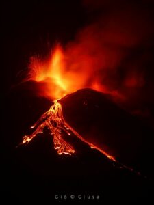
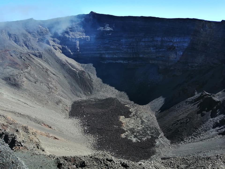
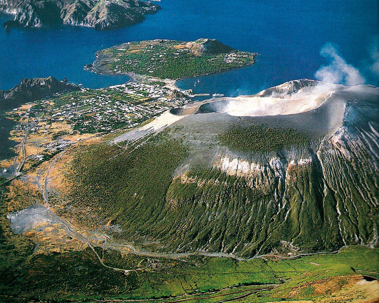
Italie , Vulcano :
WEEKLY BULLETIN, from January 23, 2023 to January 29, 2023. (issue date 31 January 2023).
ACTIVITY STATUS SUMMARY
In the light of the monitoring data, it is highlighted:
1) Temperature of the crater fumaroles: The temperatures recorded on the edge of the crater are stable at high values.
2) CO2 flux in the crater area: The CO2 flux in the crater area remains at high values.
3) SO2 flux in the crater area: Stable at a moderately medium-high level
4) Geochemistry of fumarolic gases: There are no updates.
5) CO2 fluxes at the base of the La Fossa cone and in the Vulcano Porto area: In the C. Sicilia, P4max and Rimessa sites, the CO2 fluxes show values above the background level and stable levels; on the Faraglione site the values recorded are close to the background level.
6) Geochemistry of thermal aquifers: In the Camping Sicilia well, there is an increasing trend in conductivity and stable values for temperature; in the Bambara well, a slight upward trend is observed in the parameters monitored.
7) Local seismicity: Very low values of the event occurrence rate
8) Regional seismicity: Low fracturing activity, 2 earthquakes were recorded with a maximum magnitude of 2.3
9) Deformations – GNSS: The permanent GNSS network did not measure any significant variations.
10) Deformations – Inclinometry: The inclinometric network did not record any significant variations.
11) Gravimetry: No significant change was recorded.
CRATER FUMEROLES TEMPERATURE:
The fumarolic field presented homogeneous emission temperatures along the summit fracture line, confirming a thermal anomaly maintained by a stable vapor flow. Along the summit rim, the emission temperature showed an hourly maximum of 364°C (T3). The hourly temperature range recorded on board is 311 to 364°C. The thermal signal to the reference sensor (T3) remained unchanged, while the emission temperature on 2 sensors (T1 and T2) has not yet returned to the values before January 20.
N.B. On January 21, more than 34 mm of rain fell, 23 mm concentrated in the first hour alone (Meteo System data)
Source : INGV.
Photo : voyages-lesiles.ch
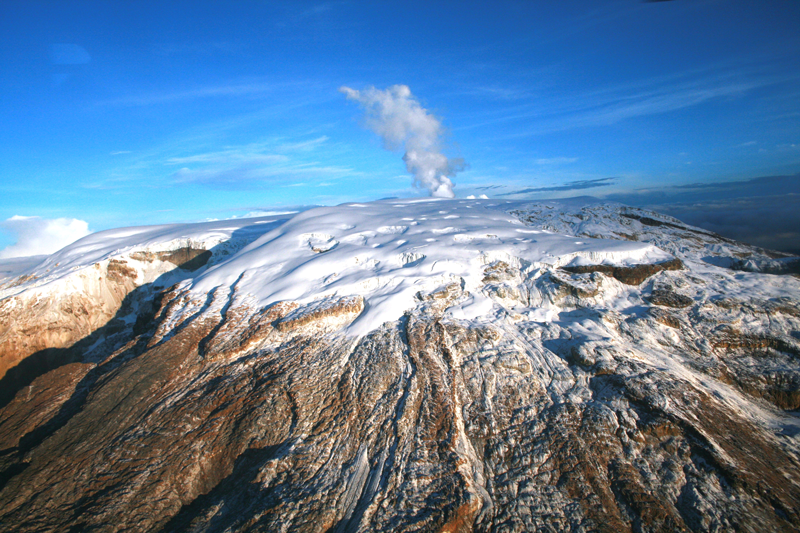
Colombia , Nevado del Ruiz :
The seismic activity related to fluid dynamics inside the volcanic conduits decreased in the number of events recorded and in the seismic energy released compared to the previous week. According to images captured by cameras installed in the volcano area, several gas and ash emissions associated with some of the seismic signals have been confirmed. It is important to mention that the volcanic ash remobilization phenomenon, which occurred last January 29 and caused ash falls in some municipalities of the Eje Cafetero area, could continue to occur if strong winds persist.
Seismic activity associated with rock fracturing decreased in number of recorded earthquakes and maintained a similar level of released seismic energy compared to the previous week. The earthquakes were located mainly in the northeast and north distal sectors of the volcano and, to a lesser extent, in the northwest, southeast and south sectors as well as in the Arenas crater; with depths between 1.0 and 5.0 km.
The maximum magnitude observed during the week was 1.3 ML (Local Magnitude) corresponding to the earthquake recorded on January 25 at 03:58 (local time), located 1.4 km north-northwest of the Arenas crater, at 4.2 km deep.
Source et photo : SGC.
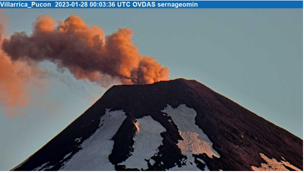
Chile , Villarica :
Special Report on Volcanic Activity (REAV), La Araucanía and Los Ríos regions, Villarrica volcano, January 27, 2023, 9:45 p.m. local time (mainland Chile)
The National Geology and Mining Service of Chile (Sernageomin) announces the following PRELIMINARY information, obtained through the monitoring equipment of the National Volcanic Monitoring Network (RNVV), processed and analyzed at the Observatory of Volcanoes of the Southern Andes (Ovdas):
On January 27, 2023, at 9:02 p.m. local time (Saturday, January 28 0:02 UTC), monitoring stations installed near the Villarrica volcano recorded an earthquake associated with fluid dynamics inside the volcanic system (type LP), with particle emission.
The characteristics of the 1st earthquake, after its analysis, are as follows:
ORIGINAL TIME: 9:02 p.m. local time (00:02 UTC)
REDUCED DISPLACEMENT: 25.7 (cm*cm)
ACOUSTIC SIGNAL: 4.8 Pascals (Pa) reduced to 1 km
The characteristics of this activity are as follows:
MAXIMUM HEIGHT OF THE COLUMN: 180 meters above the point of emission
DIRECTION OF SPREAD: East (E).
COMMENTS:
As previously reported, during the morning, Strombolian explosions were recorded at a height of around 100 m above the crater. The observed explosions are characterized by the emission of incandescent materials on the surroundings of the crater. In relation to seismic activity, the parameters recorded on previous days continue.
The volcanic technical alert is maintained at the Yellow level.
Source et photos : Sernageomin.
Ecuador , Cotopaxi :
information on the activity of the COTOPAXI volcano, Quito, Thursday February 02,
Since early this morning, the Cotopaxi volcano monitoring network has recorded continuous emissions with a low to moderate ash load. Ash clouds were directed mainly to the north and to a lesser extent to the south of the volcano. Consequently, ash falls were reported in the cantons of Quito and Mejía. In particular in: Amaguaña, Quitumbe, Conocoto, Guamaní, La Ecuatoriana, Turubamba, Chillogallo, La Magdalena, Machachi, Tambillo, Alóag, Cutuglahua, Uyumbicho, Aloasi y El Chaupi.
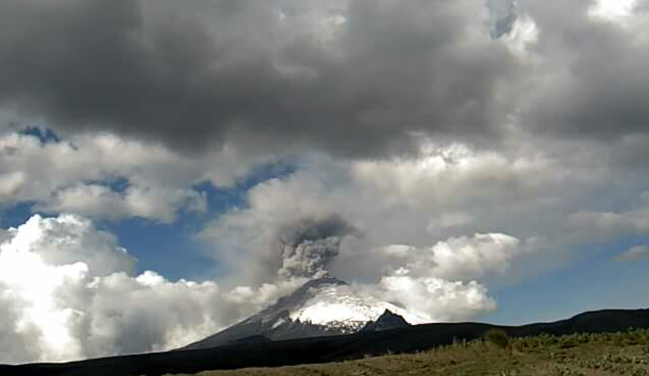
At present, the monitoring network continues to record ash emissions with heights varying between 1 and 2.5 km above the summit level and, therefore, the ash fall is expected to continue. Communities that may continue to be affected are those closest to the volcano based on wind direction; which has been very variable today.
The Geophysical Institute is monitoring and any new developments will be reported.
Source et photo: IGEPN