December 19 , 2022.
Alaska , Takawangha :
51°52’1″ N 178°1’37 » W,
Summit Elevation 4754 ft (1449 m)
Current Volcano Alert Level: ADVISORY
Current Aviation Color Code: YELLOW
The ongoing earthquake swarm near Takawangha volcano is continuing with several earthquakes observed during the past 24 hours. The earthquakes are generally shallow, having preliminary depths of about 2 to 7 miles (3 to 11 km) below sea level. This activity may be due to the movement of magma beneath the volcano. Clouds obscured satellite images over the last day.
Source : AVO.
Photo : Coombs, M. L.
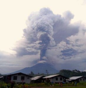
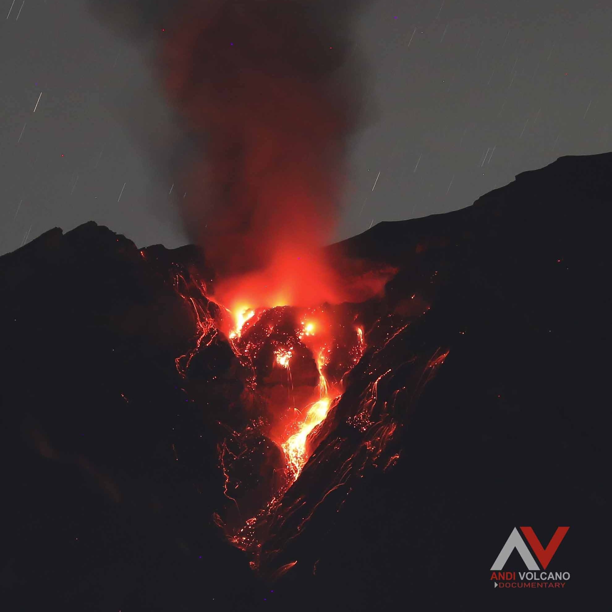
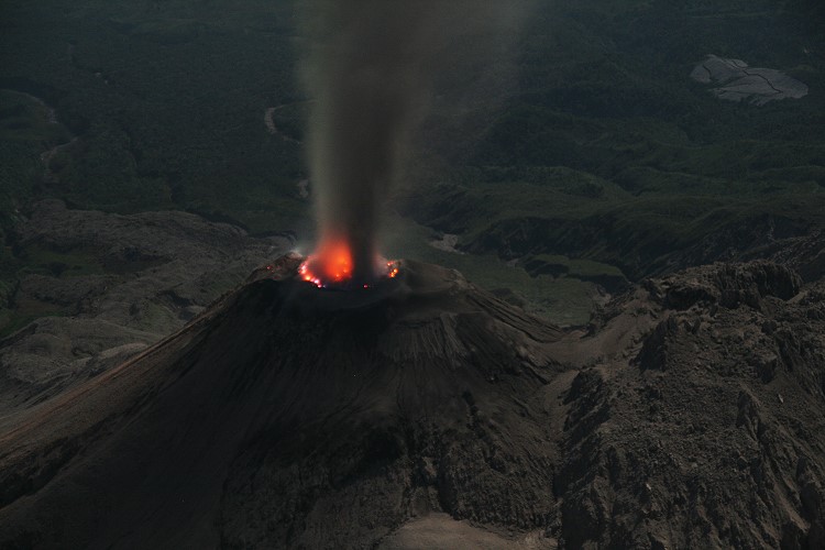
Indonesia , Semeru :
The Semeru presented an eruption on Monday, December 19, 2022 at 07:03 WIB with the height of the ash column observed at ± 700 m above the summit (± 4376 m above sea level). The ash column was observed to be white to gray with a thick intensity oriented towards the North. At the time of writing this report, the eruption was still ongoing
VOLCANO OBSERVATION NOTICE FOR AVIATION – VONA
Issued: December 19, 2022
Volcano: Semeru (263300)
Current Aviation Color Code: ORANGE
Previous Aviation Color Code: orange
Source: Semeru Volcano Observatory
Notification number: 2022SMR734
Volcano location: S 08 deg 06 min 29 sec E 112 deg 55 min 12 sec
Region: East Java, Indonesia
Summit elevation: 11763 FT (3676 M).
Volcanic Activity Summary:
Eruption with cloud of volcanic ash at 00:03 UTC (07:03 local).
Height of volcanic clouds:
The best estimate of the ash cloud top is approximately 14003 FT (4376 M) above sea level or 2240 FT (700 M) above the summit. May be higher than what can be observed clearly. Source of height data: ground observer.
Other Volcanic Cloud Information:
Ash cloud moving north. The volcanic ash is observed to be white to gray. It is observed that the intensity of volcanic ash is thick.
Remarks :
Eruption recorded on seismogram with a maximum amplitude of 22 mm and a maximum duration of 137 seconds.
Source : Magma Indonésie
Photo : Andi Volcanist.
Guatemala , Santiaguito :
Activity:
The observatory of the Santa María-Santiaguito volcanic complex reports sparse and constant degassing fumaroles 400 meters above the Caliente dome, which are moving west and southwest. Seismic stations around the dome complex recorded weak explosions and the presence of avalanches, which were observed descending with incandescent material towards the western and southern flanks. Active lava flow activity in the San Isidro and El Tambor channels continues with some boulder collapses, which generate ash clouds up to several hundred meters high, especially towards the ravine of San Isidro, ashes that are carried by the wind and cause fallout near the farms in this sector.
It is recommended not to approach the lava flow, due to the intense heat it gives off and the constant collapses that occur on its edges, which could cause burns and other serious injuries to those who come close. Extrusive activity remains at a high level and continues to pile material unstable in the lava flow, as well as in the cupola of the Caliente Dome, thus maintaining the possibility that some of this material will collapse and generates pyroclastic flows that can extend to the South-West, South and East.
Source : Insivumeh
Photo : Marc Szeglat , 2009 , wikimedia
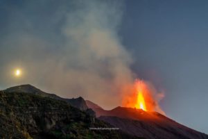
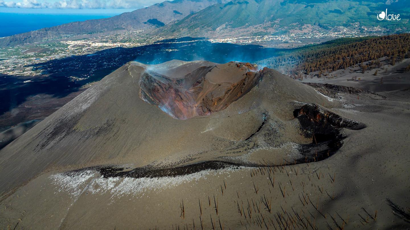
Canary Islands , La Palma / Tenerife :
Weekly volcanological bulletin of December 16, 2022
Seismo-volcanic activity recorded on the islands from Friday December 9 at 00:00 until Friday December 16 at 00:00.
The volcanic traffic lights in Tenerife, El Hierro, Lanzarote and Gran Canaria are currently in the GREEN position; the inhabitants of and visitors to these islands can therefore carry out their activities as normal.
A few months after the end of the eruption on the island of La Palma, the geophysical and geochemical parameters have still not returned to normal; therefore, its volcanic level is in YELLOW position. This means that residents and visitors should continue to be attentive to communications from civil protection authorities.
With regard to seismicity, we note that during the past week, the Canarian seismic network has recorded 77 low-magnitude seismic events, whose maximum value of 2.2 has been linked to an earthquake located on the island of La Palma last Saturday, December 10. The total seismic energy released last week in the archipelago was 0.05 gigajoules.
The earthquakes were located mainly on the islands of Tenerife and La Palma. In the latter, a low magnitude seismicity remains, much lower than the seismicity observed during the 2021 eruption.
The Canary Islands is also characterized by moderate tectonic activity; therefore, some earthquakes have also been recorded along some active seismic faults such as the one between Tenerife and Gran Canaria.
Regarding the deformation of the terrain, no significant variation was observed during the past week on any island. With regard to gas emissions and excluding the areas of La Bombilla and Puerto Naos, where abnormal emissions of carbon dioxide (CO2), the Canarian geochemical network shows that the values of diffuse emission of volcanic gases relatively higher are recorded in Tenerife, where we already know that from 2016 a process of pressurization of the volcanic-hydrothermal system is recorded. We have clarified that this process is normal in active volcanic systems and does not imply the possibility of a volcanic eruption in the short to medium term.
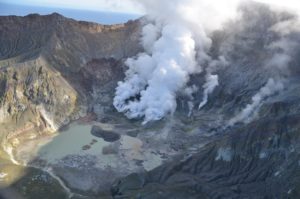
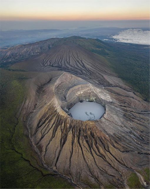
Costa Rica , Rincon de la Vieja :
latitude: 10.83°N;
Longitude: 85.34°W;
Altitude: 1916m
Current activity level: warning
Possible manifestations: Small eruptions, gush or geyser, significant gas emission, temperature rise (incandescence), seismic swarms or volcanic tremor,
slight inflation-expansion of the volcanic edifice, hot springs.
12 phreatic eruptions were recorded between November 25 and 30, the most energetic being that of November 25. The seismic energy decreased during the week, the tremor fragmented until presenting very short durations of the LP type. The number and width of « tornillos » type events have decreased. Small VT-type events were recorded in the southern zone (Las Pailas). During the month of November, low amplitude proximal VT type events and scattered distal VT events were recorded. The seismic activity pattern of the Rincón de la Vieja volcano changed recently after a deep earthquake occurred on November 18 under the Las Pailas sector. The GPS network does not show any significant deformation of the volcano. The SO2 flux remains variable with a daily average increasing since the end of November (~150 t/d).
Source : Ovsicori
Photo : Soy Tico