December 12 , 2022.
Guatemala , Fuego :
Activity:
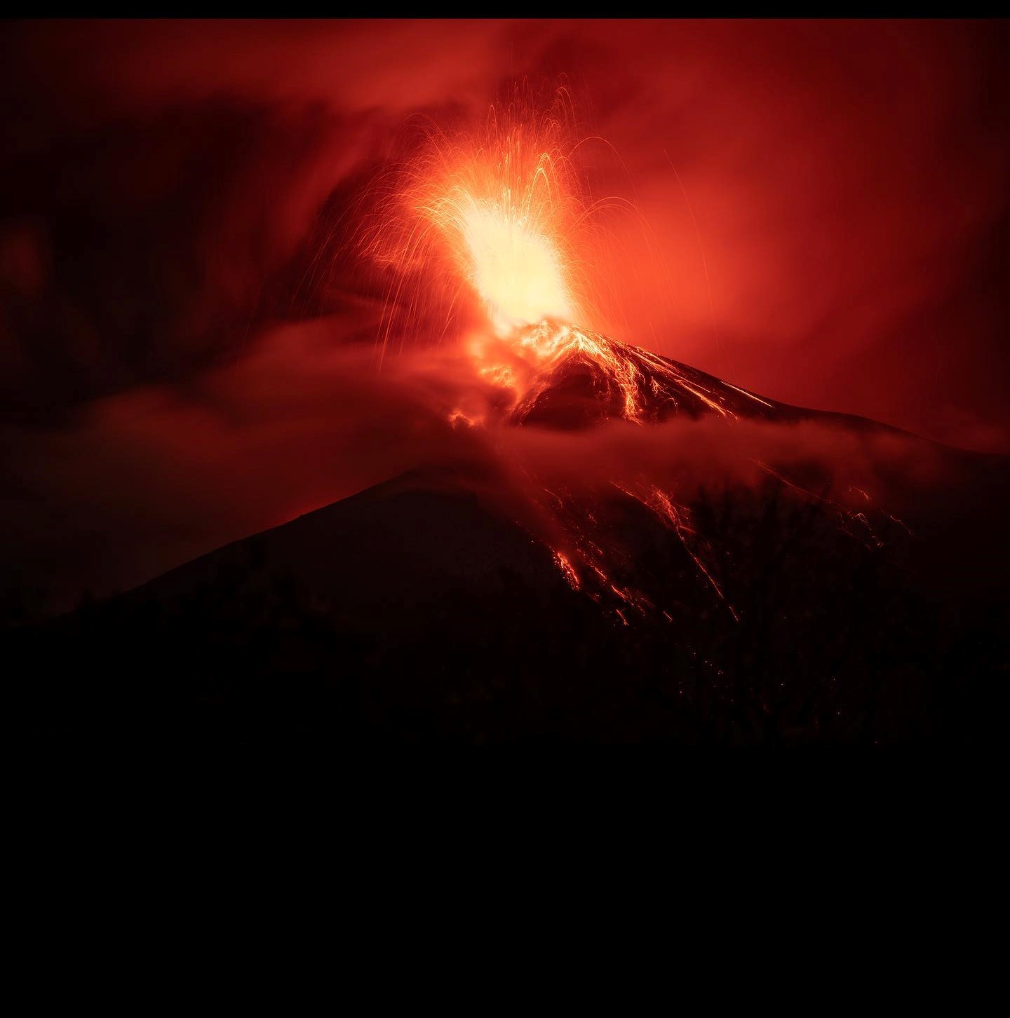
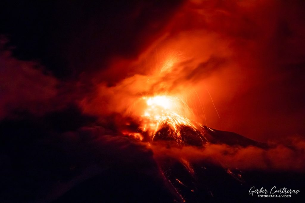
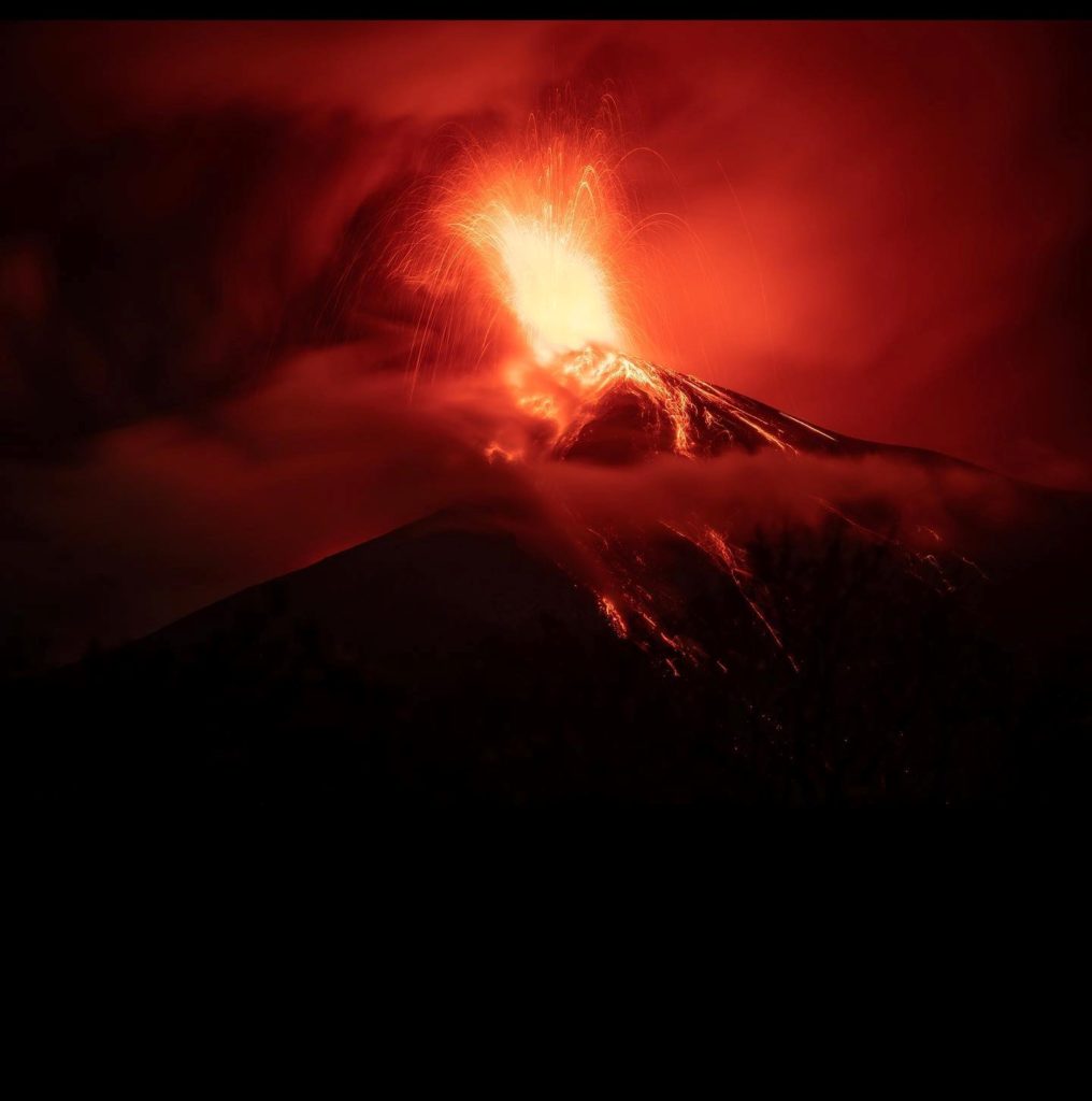
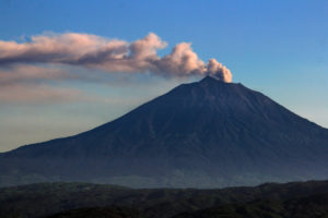
The -OVFGO- (Volcanological Observatory of the Fuego Volcano) reports that due to the Strombolian activity of the last days, a lava flow has formed in the direction of the Ceniza ravine, with an approximate length of 600 meters. During the night and early in the morning, weak, moderate and some strong explosions were observed, in a range of 4 to 6 per hour, expelling columns of ash at an approximate height of 4,500 to 4,800 meters above the sea level (14,763 – 15,748 feet) which disperse over 30 km in a westerly and southwesterly direction.
Explosions accompanied by weak to moderate avalanches fall around the crater towards the ravines of Ceniza, Santa Teresa, Las Lajas and Trinidad. The moderate to strong explosions generate rumblings, with shock waves vibrating the roofs and houses of the villages near the volcano. Ash falls are reported in Panimache I and II, Morelia, Santa Sofía, Yucales. Due to wind speed, ash may be deposited in towns such as Santa Lucia Cotz and other communities west of the Fuego Volcano. Sounds similar to a train locomotive are reported with a duration of 2-4 minutes. Due to the speed of the wind, curtains of ash rise from the ravines.
SPECIAL VOLCANOLOGICAL BULLETIN
As indicated in BEFGO bulletin No. 118-2022, the Fuego volcano has shown an increase in its activity, which has entered an eruption phase in recent minutes. We observe constant weak, moderate and strong explosions in the crater, with also incandescent sources of 500 meters high. The ash columns reach 5,000 meters above sea level (16,404 feet) dispersing over 30 kilometers to the west and northwest. In the Ceniza ravine, the lava flow is maintained for a length of 800 meters and in front of it are generated constant avalanches that reach the edge of the vegetation.
The eruption is mainly effusive accompanied by incandescent pulses from the lava source, this can also generate new lava flows towards the ravines, as well as produce violent ash-laden explosions which generate pyroclastic flows mainly towards the Ceniza ravines, Las Lajas and Seca. , as well as one of the other canyons of the Fuego volcano, so do not stay near or inside the canyons of the volcano.
Due to the direction of the wind, ashfall can be recorded northwest of the volcano in the communities of the municipalities of Acatenango, Yepocapa and Patzicia.
INSIVUMEH maintains visual and instrumental monitoring of volcanic activity through seismic stations, volcano spotters and web cameras.
Source : Insivumeh.
Photo : Gerber Contreras. Diego Rizzo .
Chile , Hudson :
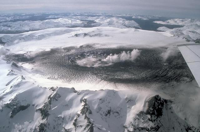
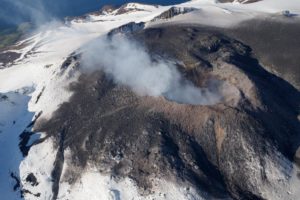
Special Report on Volcanic Activity (REAV), Aysen Del General Carlos Ibanez Del Campo Area, Hudson Volcano, December 11, 2022, 11:35 a.m. local time (mainland Chile).
The National Service of Geology and Mines of Chile (Sernageomin) publishes the following PRELIMINARY information, obtained through the monitoring equipment of the National Volcanic Monitoring Network (RNVV), processed and analyzed at the Volcanological Observatory of the Southern Andes ( Ovdas):
On Sunday December 11, 2022, at 11:07 local time (14:07 UTC), the monitoring stations installed near the Hudson volcano recorded an earthquake associated with both rock fracturing (volcano-tectonic type) and fluid dynamics in the volcanic system (hybrid type).
The characteristics of earthquakes after their analysis are as follows:
ORIGINAL TIME: 11:07 local time (14:07 UTC)
LATITUDE: 45.934° S
LONGITUDE: 72.929°E
DEPTH: 6.9 km
REDUCED TRAVEL: 511.6 (cm*cm)
LOCAL MAGNITUDE: 2.8 (ML)
COMMENTS:
Following the event, 1 hybrid-type earthquakes of lower energy were recorded
The volcanic technical alert remains at the Green level.
Sources : Sernageomin.
Photo : Norm Banks
New Zealand , White Island :
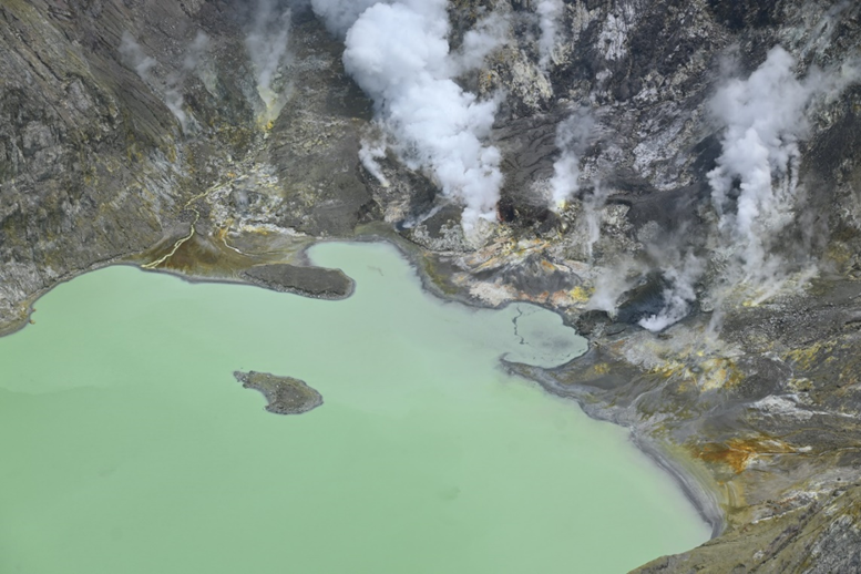
An observation-gas flight confirms the active vents are continuing to emit a minor-moderate steam and gas plume. The Volcanic Alert Level remains at 2.
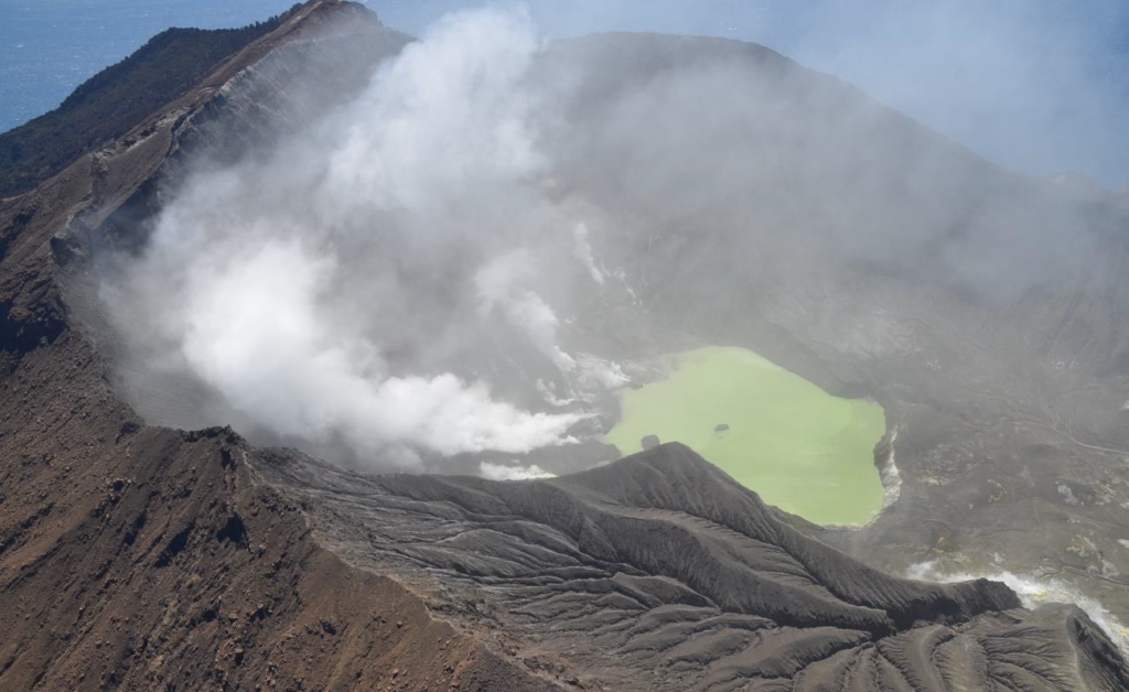
On 6 December 2022, GNS Science volcanologists completed a gas and observation flight. They observed the normal minor-moderate gas and steam plume at the island, which is originating from several sources behind the crater lake.
The observation-gas flight measured a low discharge rate of sulphur dioxide (SO2) of 273 ± 11 tonnes/day and 787± 178 tonnes/day of carbon dioxide (CO2). These outputs have not changed substantially from the 14 October levels.
Our observations have confirmed a lowering of the lake level on the island. Our North Rim web camera remains obscured. Our previous Volcanic Activity Bulletin in October mentioned rare observations of ash emission from Whakaari. There have not been any observations that support continued ash emission or other eruptive activity.
The VAL remains at Level 2 (moderate to heightened unrest) and the Aviation Colour Code remains at Yellow, acknowledging the current level of activity, but also continuing to acknowledge the greater level of uncertainty in our interpretation due to the current lack of consistent, useful real-time data.
As the weather allows, we will continue the frequent gas and observation flights over the island until we can service our on-island equipment and power supplies. We have access to webcam images from the island which are greatly obscured by wind-blown muddy ash, but still provide some level of visual monitoring between our flights.
The Volcanic Alert Level reflects the current level of volcanic unrest or activity and is not a forecast of future activity. While Volcanic Alert Level 2 is mostly associated with volcanic unrest hazards (including discharge of steam and hot volcanic gases, earthquakes, landslides, and hydrothermal activity), potential for eruption hazards also exists and eruptions can still occur with little or no warning.
Source : Geonet / Cameron Asher / Duty Volcanologist.
Photos : Geonet
Hawaii , Mauna Loa :
Sunday, December 11, 2022, 9:28 AM HST (Sunday, December 11, 2022, 19:28 UTC)
19°28’30 » N 155°36’29 » W,
Summit Elevation 13681 ft (4170 m)
Current Volcano Alert Level: WATCH
Current Aviation Color Code: ORANGE
Activity Summary:
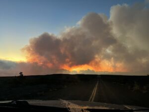
The Northeast Rift Zone eruption of Mauna Loa may still be active. Incandescence is restricted to the cone that formed around the fissure 3 vent, there was no observable activity anywhere on the rest of the flow field overnight.
As of 7:00 a.m. today, December 11, the M8 webcam shows very little incandescence and no lava movement in the F3 vent. The channels below the vent appear drained of lava and no longer feed the main flow front.
The inactive main flow front has stagnated about 1.7 mi (2.8 km) fromSaddle Road when last measured yesterday morning, December 10. The inactive main flow front still glows at a few spots at night and may inch northward very slowly as it continues to settle.
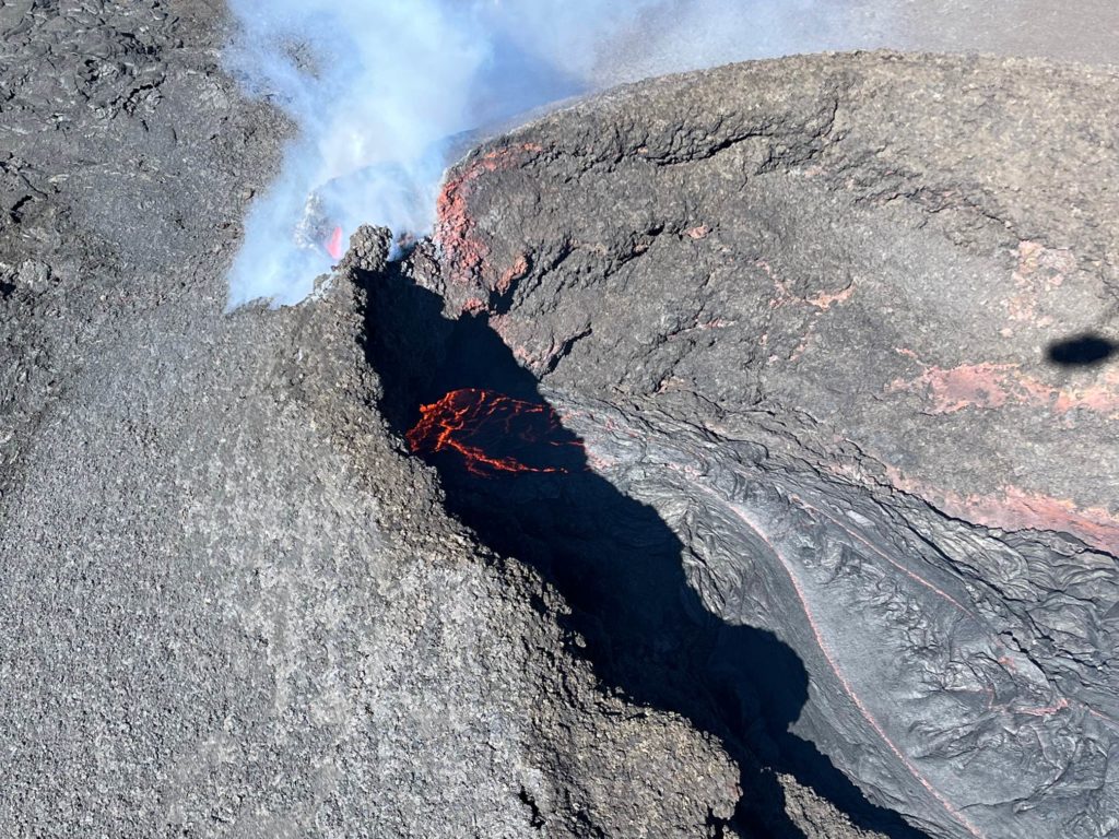
Aerial view of the fissure 3 cone on the Northeast Rift Zone of Mauna Loa. On December 10, 2022, Hawaiian Volcano Observatory geologists noted there are no fountains present in fissure 3. Only a lava pond is present with minor circulating activity.
Sulfur dioxide (SO2) emission rates continue to be reduced; on December 9, the emission rate was approximately 20,000 tonnes per day (t/d).
Tremor (a signal associated with subsurface fluid movement) is no longer detectable; summit and Northeast Rift Zone inflation started on December 7 and is continuing.
The significance of the continuing inflation while the flow field is inactive is not yet clear; it is common for eruptions to wax and wane or pause completely, but none of the eight recorded eruptions from Mauna Loa’s Northeast Rift Zone returned to high eruption rates after those rates decreased significantly. Nevertheless, the Hawaiian Volcano Observatory continues to closely monitor the current activity.
There is no active lava within Moku’āweoweo caldera nor in either rift zone. Satellite imagery shows the entire 2022 flow field cooling and no longer active.
Source : HVO.
Photo : K. Mulliken.
Ecuador , Cotopaxi :
DAILY REPORT OF THE STATE OF COTOPAXI VOLCANO, Sunday December 11, 2022.
Information Geophysical Institute – EPN.
Surface activity level: Moderate, Surface trend: Ascending.
Internal activity level: Moderate, Internal trend: Ascending.
Seismicity: From December 10, 2022, 11:00 a.m. to December 11, 2022, 11:00 a.m.:
At 09:30 TL, the seismic stations of the Cotopaxi volcano recorded a seismic signal linked to an emission of gas and ash. The signal amplitude is low compared to the activity of the volcano in 2015. The data corresponds to 24 hours of transmission from the BVC2 reference station.
Emission tremor (TREMI ) 5
Long Period (LP): 73
Volcano-tectonics (VT): 1
Rains / Lahars:
Yesterday afternoon, there were rains in the region without generating lahars.
Emission / Ash Column:
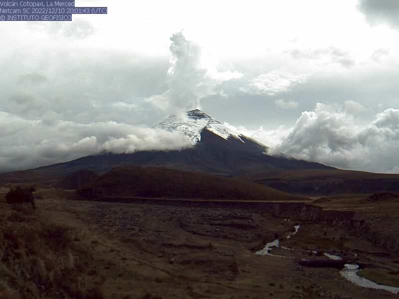
Yesterday afternoon, several steam and gas emissions were observed with heights up to 2000 meters in a West and North-West direction.
Other Monitoring Parameters:
No thermal anomaly has been recorded in the past 24 hours.
Gas:
The MOUNTS system reported 872.2 tons of SO2, measured on 12/10/2022 at 1:05 p.m. TL.
Observation:
Surface activity was characterized by steam and ash emissions with heights of up to 2,000 meters, oriented to the west. So far, ashfall has been reported in the Caspi Control sector located at the southern entrance to Cotopaxi National Park.
Alert Level: Yellow
Source et photo : IGEPN.

