December 09 , 2022 .
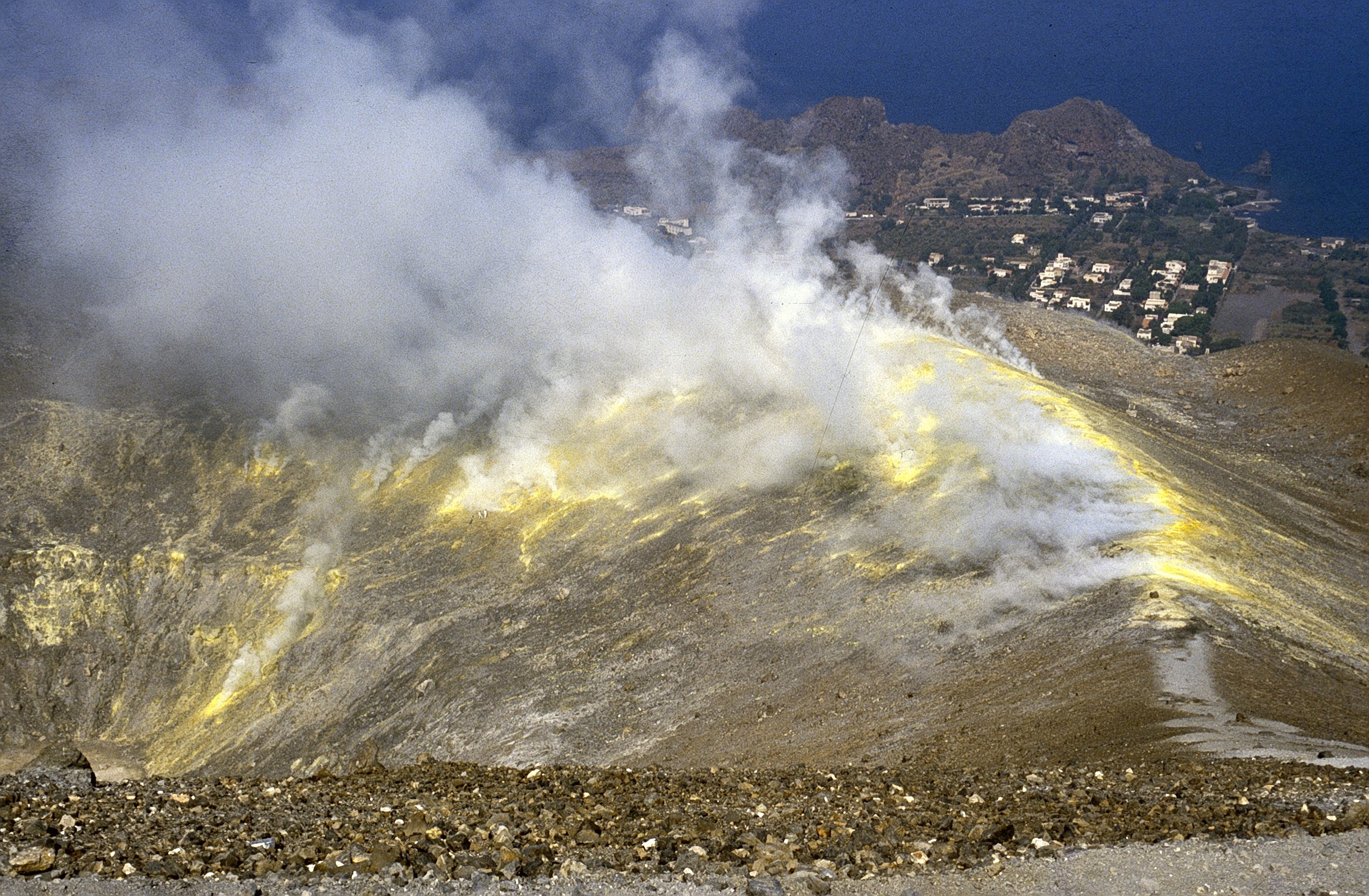
Italy , Vulcano :
WEEKLY Bulletin, from November 28, 2022 to December 04, 2022, (issue date December 06, 2022)
ACTIVITY STATUS SUMMARY
In the light of the monitoring data, it is highlighted:
1) Temperature of the crater fumaroles: Along the summit rim, the temperature values always remain stable at high values.
2) CO2 flux in the crater area: The CO2 flux in the crater area shows an increasing trend reaching high values.
3) SO2 flux in the crater area: at a medium-high level and moderately increasing
4) Geochemistry of fumarolic gases: There are no updates.
5) CO2 fluxes at the base of the La Fossa cone and in the Vulcano Porto area: Continuous monitoring: the CO2 fluxes recorded in the sites of Rimessa, C. Sicilia always show values above background levels; the P4max site displays average values, while the Faraglione site records values always close to the background level.
Monthly CO2 flux campaign: CO2 emissions in the Vulcano Porto region show strong growth compared to October, reaching very high values.
6) Geochemistry of thermal aquifers: Slightly lower but still high temperature values are recorded in the C. Sicilia well; the conductivity is stable on medium-high values; in the Bambara well, the piezometric level increases, while the conductivity is at low values.
7) Local seismicity: Low values of event occurrence rate.
8) Regional seismicity: Significant seismic activity resulting from fracturing linked to the occurrence of a swarm of earthquakes with a main shock of magnitude equal to 4.6.
9) Deformations – GNSS: The permanent GNSS network has not recorded any significant variations during the last week.
10) Deformations – Inclinometry: The data from the network of inclinometer stations on the island did not show any significant variations, with the exception of the significant co-seismic drop measured at the Sotto Lentia station (SLT) and due to the event seismic of ML = 4.6 of December 4, 2022.
11) Gravimetry: There are no significant medium-long term variations.
12) Other observations: CO2 flux campaign in the Vulcano Porto target areas: constant or modestly increasing emissions in the Palizzi-Discari and Camping Sicilia areas; strong increase in flow values compared to previous months in the Vasca di Fango-Spiaggia di Levante area.
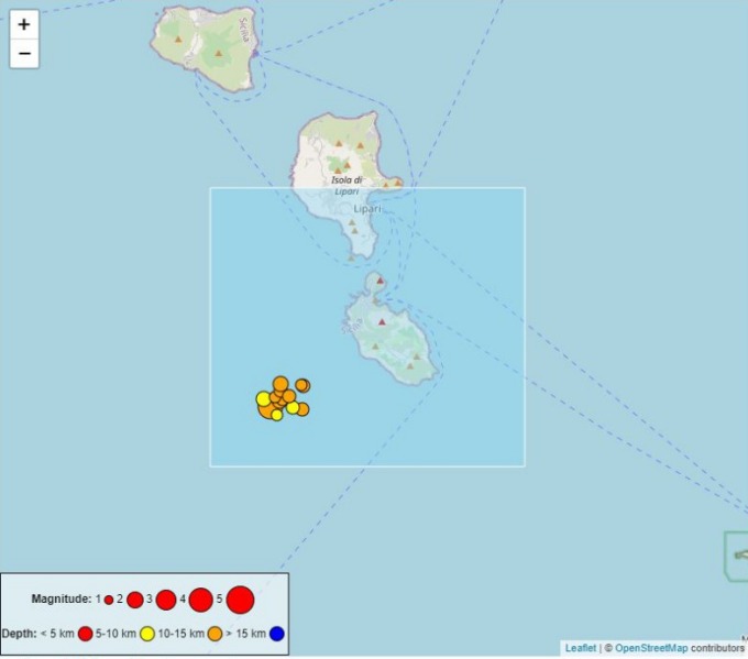
REGIONAL SEISMICITY
During the week, the seismicity resulting from the fracturing in the Vulcano area was characterized by the appearance of a large seismic swarm, characterized by a strong release of seismic energy.
This swarm, which began at 07:12 on December 4 with the main shock, of local magnitude (Ml) equal to 4.6, was composed of 13 earthquakes of Ml greater than 1.0, which occurred most of the same day. From an energetic point of view, only 2 of the responses reach or exceed an Ml equal to 2.0 (at 07:54, Ml=2.0; at 20:16, Ml=2.1). The focal volume of this swarm was located about 7-10 km southwest of the island of Vulcano, in the depth range between 8 and 13 km
Source : INGV.
Photos : Boris Behncke , INGV.
Colombia , Cerro Machin :
Cerro Machín volcano activity level bulletin.
The activity level continues at the yellow activity level or (III): changes in the behavior of volcanic activity.
Regarding the monitoring of the activity of the Cerro Machín volcano, the COLOMBIAN GEOLOGICAL SERVICE reports that:
Over the past week, recording of seismic activity associated with the fracturing of rocks around the volcano has continued. This seismic activity notably increased in number of earthquakes recorded and seismic energy released, compared to the previous week. We can distinguish the seismic swarms recorded on December 2 and 5, which were located in the southwestern sector of the volcanic edifice, at depths between 1.3 and 4.2 km. The highest magnitude recorded during the week was 4.5 ML (Local Magnitude), corresponding to the earthquake recorded at 12:36 p.m. (local time) during the December 1 seismic swarm.
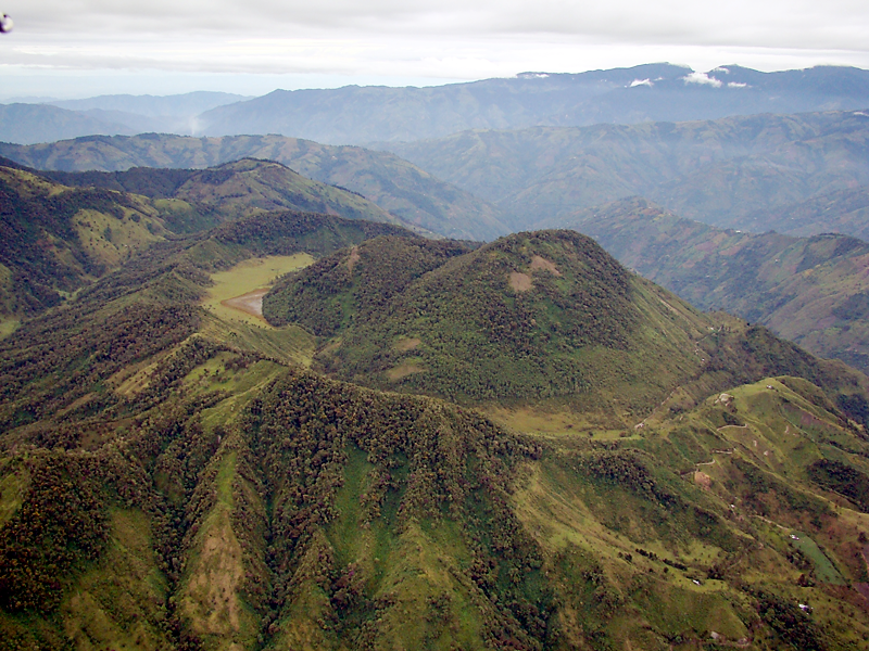
This earthquake was located 1.0 km south-southwest of the dome to the west of the volcano, at a depth of 3.2 km and was reported as felt in Cajamarca, Ibagué and other municipalities of Tolima. In the seismic swarm of December 5, the highest magnitude recorded was 1.2 ML (Local Magnitude), corresponding to the earthquake recorded at 9:31 p.m. (local time), located in the same sector as the aforementioned earthquake and at a depth 3.5 km.
The other parameters used for the complete diagnosis of volcanic activity did not show any changes during the evaluated period.
The COLOMBIAN GEOLOGICAL SERVICE remains attentive to the evolution of the volcanic phenomenon and will continue to report in a timely manner any changes that may occur.
Source et photo : SGC
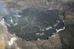
Hawaii , Mauna Loa :
19°28’30 » N 155°36’29 » W,
Summit Elevation 13681 ft (4170 m)
Current Volcano Alert Level: WARNING
Current Aviation Color Code: ORANGE
The Northeast Rift Zone eruption of Mauna Loa continues with one active fissure, fissure 3, feeding lava flows downslope.
Fissure 3 vent continues to erupt but the supply of lava was reduced this morning. Lava was overtopping channels near the vent with flows extending no farther than 2.75 mi (4.4 km) from the vent as of approximately 9:30 a.m. this morning, December 8. The channels below this point appear drained of lava and probably no longer feed the main flow front, which remains stalled about 1.7 mi (2.8 km) from Saddle Road . The lava flow is now inactive for most of its lower length, but the flow front may appear to advance a little as it settles.
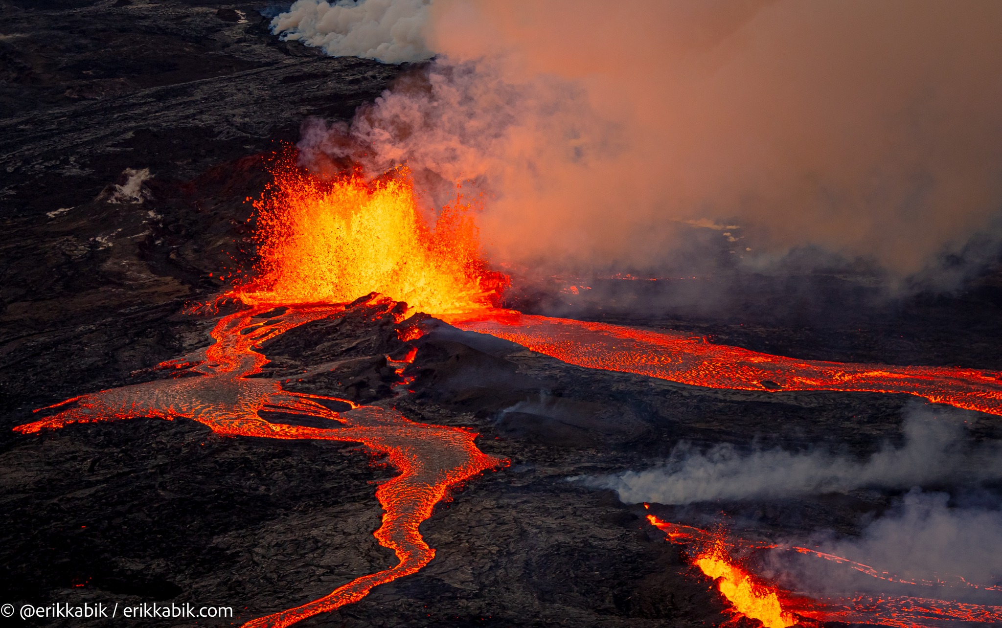
Sulfur dioxide (SO2) emission rates of approximately 130,000 tonnes per day (t/d) were measured on December 7, 2022, and remain elevated at this time. Volcanic gas is rising high and vertically into the atmosphere before being blown to the west at high altitude, generating vog (volcanic air pollution) in areas downwind.
Pele’s hair (strands of volcanic glass) fragments are being wafted great distances and have been reported as far Honoka‘a.
Tremor (a signal associated with subsurface fluid movement) continues beneath the currently active fissure. This indicates that magma is still being supplied to the fissure, and activity is likely to continue as long as we see this signal.
There is no active lava within Moku’āweoweo caldera nor the Southwest Rift Zone. We do not expect any eruptive activity outside the Northeast Rift Zone.
Source : HVO
Photo : Erik Kabik / erikkabik.com
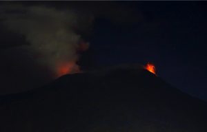
Italy , Stromboli :
Statement on Stromboli activity, 08 December 2022, 19:26 (18:26 UTC).
The National Institute of Geophysics and Volcanology, Osservatorio Etneo, communicates that today the staff of the INGV’OE of Catania carried out an inspection from the sea to make observations on the Sciara del Fuoco. The surveys revealed that the effusive activity continues, which remains confined to the upper part of the Sciara del Fuoco, the lava front is at an altitude of about 600 m above sea level.

Since the last press release published, the average amplitude of the volcanic tremor has not shown significant variations; slight fluctuations are always recorded in the range of the average values.
During the last 24 hours, the signals from the ground deformation monitoring networks (GNSS and tiltmeter) did not show any significant variations.
Further updates will be communicated soon.
Source : INGV.
Photo : Stromboli stati d’animo
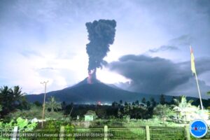
Russia / Kuril Islands , Ebeko :
VOLCANO OBSERVATORY NOTICE FOR AVIATION (VONA)
Issued: Décember 09 ,20221209/0350Z
Volcano: Ebeko (CAVW #290380)
Current aviation colour code: ORANGE
Previous aviation colour code: orange
Source: KVERT
Notice Number: 2022-188
Volcano Location: N 50 deg 41 min E 156 deg 0 min
Area: Northern Kuriles, Russia
Summit Elevation: 1156 m (3791.68 ft)
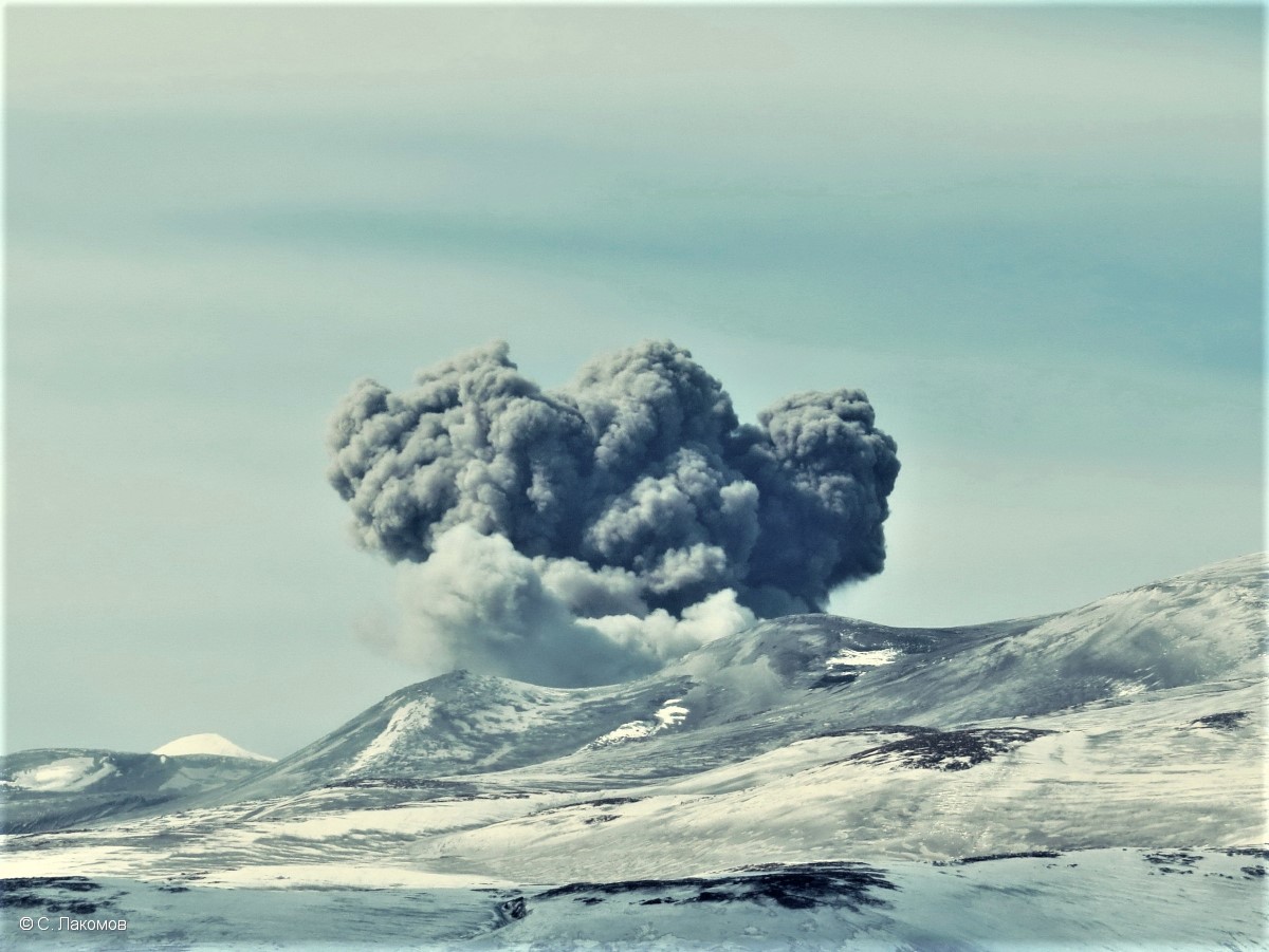
Volcanic Activity Summary:
A moderate explosive activity of the volcano continues. According to visual data by volcanologists from Severo-Kurilsk, an explosion sent ash up to 2.6 km a.s.l., an ash cloud is drifting to the east of the volcano
A moderate eruptive activity of the volcano continues. Ash explosions up to 6 km (19,700 ft) a.s.l. could occur at any time. Ongoing activity could affect low-flying aircraft and airport of Severo-Kurilsk.
Volcanic cloud height:
2600 m (8528 ft) AMSL Time and method of ash plume/cloud height determination: 20221209/0340Z – Visual data
Other volcanic cloud information:
Distance of ash plume/cloud of the volcano: 5 km (3 mi)
Direction of drift of ash plume/cloud of the volcano: E
Time and method of ash plume/cloud determination: 20221209/0340Z – Visual data
Source : Kvert
Photo : S. Lakomov