November 17 , 2022.
Italy , Stromboli / Etna :
Communication on the activity of STROMBOLI, November 16, 2022, 08:14 (07:14 UTC):
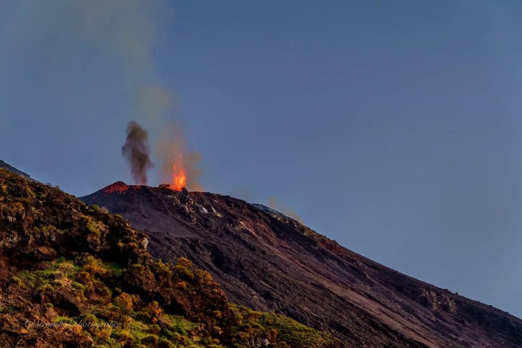
The National Institute of Geophysics and Volcanology, Osservatorio Etneo, reports that the surveillance networks recorded at 08:05 (07:05 UTC), that from 06:15 UTC, according to the network of surveillance cameras, it is observed, following an increase in spatter activity from the northern crater area, the formation of a lava overflow causing material to roll along the Sciara del Fuoco. The lava front is located in the upper part of the Sciara del fuoco.
In conjunction with the volcanic phenomenology, from 05:40 UTC, an increase in the average amplitude of the volcanic tremor is observed in the band of medium-high values. Subsequently, the tremor amplitude values returned to a low-medium level, comparable to the previous level. There are no significant variations in the occurrence rate and amplitude of explosive earthquakes.
Data from the island’s deformation monitoring networks do not show any significant variations related to volcanological phenomenology.
Communication on the activity of STROMBOLI, November 16, 2022, 18:21 (17:21 UTC):
The National Institute of Geophysics and Volcanology, Osservatorio Etneo, communicates the return of the parameters to normal activity.
In particular, the analysis of the images from the network of surveillance cameras has made it possible to observe that the lava overflow in the upper part of the Sciara del Fuoco is no longer fed and is cooling. Ordinary Strombolian activity at the N1 vent persists in the northern area of the crater, while spatter activity at the N2 vent has significantly decreased in intensity. Ordinary Strombolian activity also continues in the Center-South crater area.
The amplitude of the volcanic tremor remains almost unchanged, and in any case still at medium-low levels. In addition, the frequency and amplitude of transients attributable to explosive events do not show significant changes.
Since the last update, data from deformation monitoring networks on the island show no significant changes.
Further updates will be communicated soon.
Communication on ETNA activity, 16 November 2022, 11:16 (10:16 UTC):
The National Institute of Geophysics and Volcanology, Osservatorio Etneo, communicates the end of volcanic activity.
The return of the geophysical parameters to the levels observed before the previous multidisciplinary assessment announcement dated 11/15/22 at 6:22 p.m. is communicated. In particular, no volcanic activity was observed from the network of surveillance cameras.
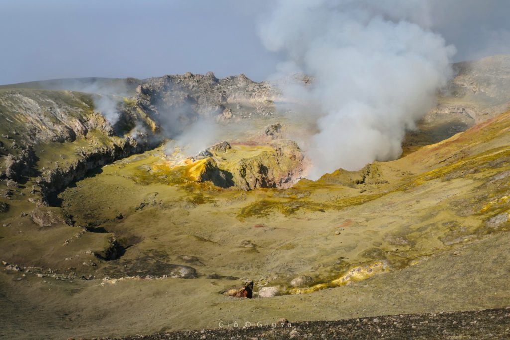
From a seismic point of view, the average amplitude of the tremor is characterized by wide fluctuations around average-high values, and sometimes high, in line with what has been observed since June. The sources of tremor and infrasonic activity are located in the Bocca Nuova crater area.
Etna’s GNSS and inclinometer networks do not show significant variations.
Further updates will be communicated soon.
Source : INGV.
Photos : Stromboli stati d’animo , Gio Giusa.
Ecuador , Sangay :
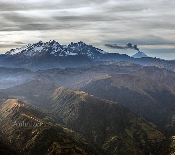
DAILY REPORT OF THE STATE OF SANGAY VOLCANO, Tuesday November 15, 2022.
Information Geophysical Institute – EPN.
Surface Activity Level: High, Surface Trend: No changes.
Internal activity level: High, Internal trend: No changes.
Seismicity: From November 14, 2022, 11:00 a.m. to November 15, 04, 2022, 11:00 a.m.:
Reference station data is complete for seismic statistics.
Explosions (EXP) 971
Emission Tremors (TREMI ) 44
Rains / Lahars:
In the early morning, rains were recorded, which generated a signal associated with the descent of mudslides and debris **In the event of heavy rains, secondary lahars can be generated in the Volcán, Upano and other tributaries**
Emission / Ash Column:
Over the past 24 hours, the Washington VAAC has released 4 reports of ash emissions, trending west and a maximum height of 1,470 meters above crater level.
Other Monitoring Parameters:
The FIRMS system recorded 4 thermal anomalies in the last 24 hours.
Observation:
Yesterday afternoon, the volcano cleared and an emission of gas and ash could be observed 500 meters above the summit to the west. For the moment the volcano is cloudy.
Alert level: Orange.
Informative VOLCAN SANGAY, Wednesday November 16, 2022
Today, from around 02:00 TL, the SAGA seismic station records seismic signals corresponding to the descent of mudslides and debris (lahars) on the Sangay volcano. This phenomenon has been recurrent since the start of activity in May 2019 and is due to the fact that the rains in the volcano remobilize the abundant volcanic material accumulated in recent weeks. As a precautionary measure, it is recommended not to enter or approach the channels of the Sangay Norte, Culebrillas, Palora, Volcán and Upano rivers.
The Geophysical Institute is monitoring and any news will be reported.
Source : IGEPN
Photos :Jorge Anhalzer
Kamchatka , Sheveluch :
VOLCANO OBSERVATORY NOTICE FOR AVIATION (VONA)
Issued: November 17 , 2022
Volcano: Sheveluch (CAVW #300270)
Current aviation colour code: ORANGE
Previous aviation colour code: orange
Source: KVERT
Notice Number: 2022-175
Volcano Location: N 56 deg 38 min E 161 deg 18 min
Area: Kamchatka, Russia
Summit Elevation: 3283 m (10768.24 ft), the dome elevation ~2500 m (8200 ft)
Volcanic Activity Summary:
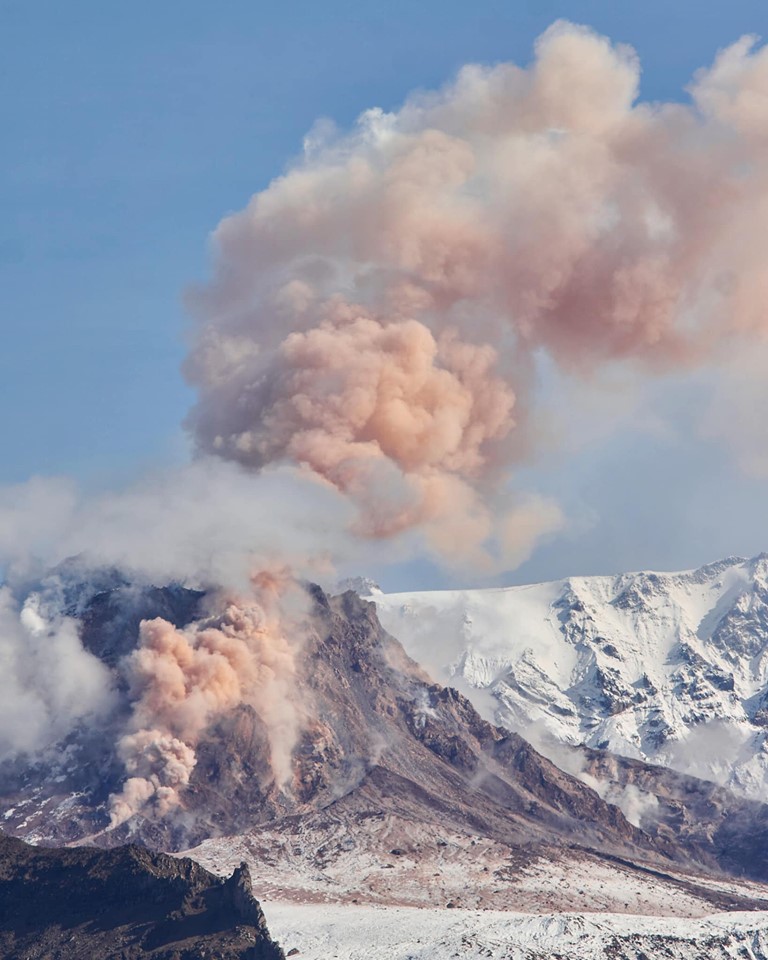
growth of the lava dome continues, a strong fumarole activity, an incandescence of the lava dome, explosions, and hot avalanches accompanies this process. Satellite data by KVERT showed an ash plume associated with hot avalanches collapses is extending for 80 km to the eastnortheast of the volcano.
The extrusive eruption of the volcano continues. Ash explosions up to 10-15 km (32,800-49,200 ft) a.s.l. could occur at any time. Ongoing activity could affect international and low-flying aircraft.
Volcanic cloud height:
4000 m (13120 ft) AMSL Time and method of ash plume/cloud height determination: 20221117/0236Z – Video data
Other volcanic cloud information:
Distance of ash plume/cloud of the volcano: 80 km (50 mi)
Direction of drift of ash plume/cloud of the volcano: ENE / azimuth 68 deg
Time and method of ash plume/cloud determination: 20221117/0130Z – Himawari-8 14m15
Source : Kvert.
Photo : Nickita Batischev
Vanuatu Archipelago , Ambae :
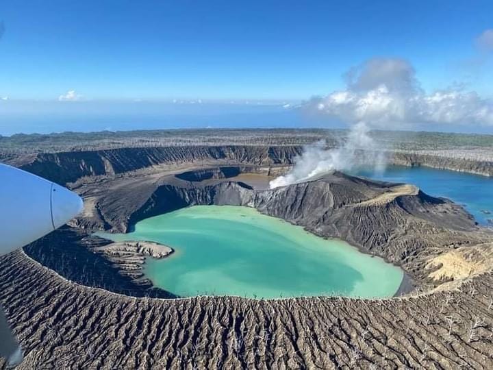
On 15 November the Vanuatu Meteorology and Geo-Hazards Department (VMGD) reported that at approximately 1300 satellite data showed a large sulfur dioxide emission from Ambae. Seismicity also slightly increased. Residents on the southern and northern parts of the island reported a strong smell of sulfur dioxide gas and heard explosions. The Alert Level remained at 2 (on a scale of 0-5) and the public was warned to stay outside of the Danger Zone, defined as a 2-km radius around the active vents in Lake Voui, and away from drainages during heavy rains.
The island of Ambae, also known as Aoba, is a massive 2,500 km3 basaltic shield that is the most voluminous volcano of the New Hebrides archipelago. A pronounced NE-SW-trending rift zone dotted with scoria cones gives the 16 x 38 km island an elongated form. A broad pyroclastic cone containing three crater lakes (Manaro Ngoru, Voui, and Manaro Lakua) is located at the summit within the youngest of at least two nested calderas, the largest of which is 6 km in diameter. That large central edifice is also called Manaro Voui or Lombenben volcano. Post-caldera explosive eruptions formed the summit craters about 360 years ago. A tuff cone was constructed within Lake Voui (or Vui) about 60 years later. The latest known flank eruption, about 300 years ago, destroyed the population of the Nduindui area near the western coast.
Sources:Meteorology and Geo-Hazards Department (VMGD) , GVP.
Photo : air taxi vanuatu
Chile , Hudson :
Seismology
The seismological activity of the period was characterized by the recording of:
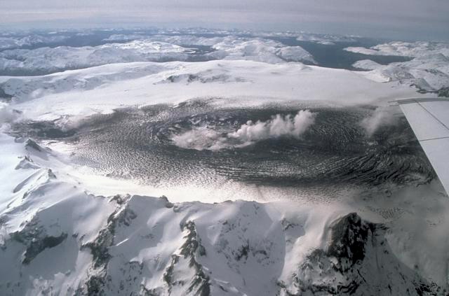
775 VT-type seismic events, associated with rock fracturing (Volcano-Tectonics). The most energetic earthquake presented a value of local magnitude (ML) equal to 2.9, located 2.0 km north-northwest of the volcanic edifice, at a depth of 1.4 km by relation to the caldera.
66 LP-type seismic events, associated with fluid dynamics within the volcanic system (Long Period type). The size of the largest earthquake assessed from the Reduced Displacement (DR) parameter was equal to 6 cm2.
25 HB-type seismic events, associated with both rock fracturing and fluid dynamics within the (hybrid) volcanic system. The most energetic earthquake presented a reduced displacement value (DR) of 3934 cm2 and a local magnitude value (ML) equal to 3.5, located 2.4 km north-northwest of the volcanic edifice, at a depth of 1.4 km in reference to the caldera.
Fluid Geochemistry
No anomalies in sulfur dioxide (SO2) emissions into the atmosphere have been reported in the area near the volcano, according to data published by the Tropospheric Monitoring Instrument (TROPOMI) and the Ozone Monitoring Instrument (OMI) Sulfur Dioxide Group.
Satellite thermal anomalies
During the period, no thermal alert was recorded in the area associated with the volcanic edifice, according to the analytical processing of Sentinel 2-L2A satellite images, in combination with false color bands.
Geodesy
According to the data provided by 2 GNSS stations in the volcanic edifice, no relevant abnormal displacement is observed, these being of low amplitude and with a seasonal trend. Therefore, no relevant deformation is observed in the volcanic system during the period.
Surveillance cameras
The images provided by the fixed camera, installed near the volcanic edifice, did not record any degassing columns or variations linked to surface activity.
Seismic activity remained at low to moderate levels, with possible increases in energy, such as the events highlighted in the REAVs. However, the rest of the monitoring parameters remained at levels considered low, suggesting stability of the volcanic system.
Although subject to special attention, the volcanic technical alert is maintained at:
GREEN TECHNICAL ALERT: Active volcano with stable behavior – There is no immediate risk
Sources : Sernageomin.
Photo : Norm Banks

