November 12 , 2022.
Indonesia , Merapi :
Report on the activity of Mount Merapi from November 04, 2022 to November 10, 2022, Published on November 12, 2022
RESULTS OF OBSERVATIONS
Visual
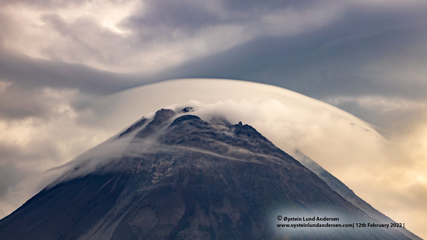
The weather around Mount Merapi is usually sunny in the morning and afternoon, while the evening is foggy. White smoke, thin to medium thickness, low pressure and 150 m high was observed from the Mount Merapi observation post of Babadan on November 04, 2022 at 06:45 WIB.
Avalanche sound was heard 9 times from Pos Babadan with low to medium intensity.
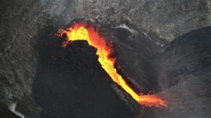
The central dome and the Southwest dome are still showing growth. The central dome is not measurable because covered with smoke. The volume of the South-West dome is estimated at 1,616,500 m3, a difference of -9,500 m3 compared to the aerial photo data of September 29, 2022, i.e. 1,626,000 m3.
Seismicity
This week, the seismicity of Mount Merapi showed:
325 deep volcanic earthquakes (VTA),
68 multi-phase earthquakes (MP),
323 avalanche earthquakes (RF),
12 emission earthquakes (DG),
1 tectonic earthquakes (TT).
The intensity of this week’s seismicity is still quite high.
Deformation
The deformation of Mount Merapi that was monitored using EDM and GPS this week shows no significant changes.
Rain and lahars:
This week, there was rain at Kaliurang observation post with a rain intensity of 44 mm/h for 95 minutes on November 10, 2022. It is reported that there was an increase in flow in the Gendok and Kuning rivers.
Conclusion
Based on the results of visual and instrumental observations, it is concluded that:
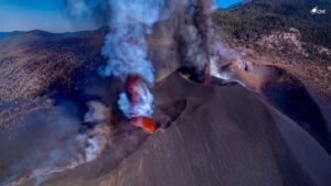
-The volcanic activity of Mount Merapi is still quite high in the form of effusive eruption activity. The state of the activity is defined at the « SIAGA » level.
-The current potential dangers are lava avalanches and hot clouds in the South-South-West sector including the Boyong River up to 5 km, the Bedog, Krasak, Bebeng Rivers up to 7 km. In the South-East sector, they cover the Woro River with a maximum of 3 km and the Gendol River for 5 km. While the ejection of volcanic materials during an explosive eruption can reach a radius of 3 km around the summit.
Source : BPPTKG.
Photo : Oystein Lund Andersen .
Alaska , Pavlof :
55°25’2″ N 161°53’37 » W,
Summit Elevation 8261 ft (2518 m)
Current Volcano Alert Level: WATCH
Current Aviation Color Code: ORANGE
Pavlof Volcano continues to erupt from the active vent just below the summit on its east flank. Explosions were detected on several days of the week in seismic and infrasound data. Nearly continuous volcanic tremor was recorded throughout the week on local seismic stations and elevated surface temperatures were observed in satellite data on November 5, 6, 8, and 10. Web cameras views were usually obscured by clouds during the week, but a few clear images showed nothing of note.
Periods of lava spatter and fountaining from the vent on the volcano’s upper east flank have been occurring since mid-November 2021. This activity has built a small cone and sent lava flows down the flank that melt the snow and ice and produce variable amounts of meltwater. The meltwater typically incorporates loose debris on the flank of the volcano and forms thin (less than 2 m thick) lahars. The lahar deposits extend down the east-southeast flank for several kilometers, not quite to the base of the volcano.
Previous eruptions of Pavlof indicate that the level of unrest can change quickly and the progression to more significant eruptive activity can occur with little or no warning.
Pavlof is monitored by local seismic and infrasound sensors, satellite data, web cameras, and regional infrasound and lightning networks.
Source : AVO.
Photo : Izbekov, Pavel / Alaska Volcano Observatory / University of Alaska Fairbanks, Geophysical Institute
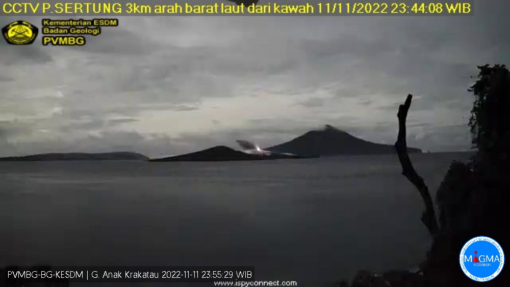
Indonesi , Anak Krakatau :
Mount Anak Krakatau erupted on Friday, November 11, 2022 at 11:43 p.m. WIB with an ash column height observed at ± 150 m above the summit (± 307 m above sea level). It is observed that the ash column is gray / black with a thick intensity oriented towards the North-East. This eruption was recorded on a seismograph with a maximum amplitude of 8 mm and a duration of 34 seconds.
SEISMICITY OBSERVATION
5 emission earthquakes with an amplitude of 10-32 mm and a duration of 15-30 seconds.
1 low frequency earthquake with an amplitude of 22 mm and a duration of 12 seconds.
Continuous tremor with an amplitude of 1-27 mm, dominant value 2 mm.
RECOMMENDATION
Communities/visitors/tourists/climbers should not approach Mount Anak Krakatau or engage in activities within 5 km of the active crater.
Source : Magma Indonésie .
Chile , Villarica :
Special Report on Volcanic Activity (REAV), Araucania and Los Ríos region, Villarrica volcano, November 10, 2022, 5:20 p.m. local time (mainland Chile)
The National Geology and Mining Service of Chile (Sernageomin) announces the following PRELIMINARY information, obtained through the monitoring equipment of the National Volcanic Monitoring Network (RNVV), processed and analyzed at the Volcanological Observatory of the Southern Andes ( Ovdas):
On Thursday, November 10 at 5:00 p.m. local time (20:00 UTC), the monitoring stations installed near the Villarrica volcano recorded an earthquake associated with fluid dynamics within the volcanic system (long Period type).
The characteristics of the earthquake after its analysis are as follows:
ORIGINAL TIME: 5:00 p.m. local time (8:00 p.m. UTC)
REDUCED DISPLACEMENT: 45.9 (cm*cm)
ACOUSTIC SIGNAL: 3.5 Pascals (Pa) reduced to 1 km
COMMENTS:
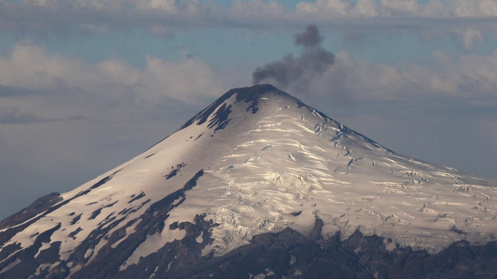
The climatic conditions prevailing in the area did not allow us to see the summit of the volcano.
The volcanic technical alert remains at the Yellow level.
Source : Sernageomin
Photo : 24 horas
Ecuador , Reventador :
DAILY REPORT OF THE STATE OF THE REVENTADOR VOLCANO, Friday November 12, 2022.
Information Geophysical Institute – EPN.
Surface Activity Level: Moderate, Surface Trend: No change
Internal activity level: Moderate, Internal trend: No change.
Seismicity: From November 11, 2022, 11:00 a.m. to November 12, 2022, 11:00 a.m.:
The seismic statistics were carried out at the REVS seismic station, which did not present any interruptions in the transmission of data.
Explosion (EXP): 47
Long Periods (LP): 30
Emission Tremors (TREMI): 18.
Harmonic Tremor (TRARM): 4
Rains / Lahars:
Yesterday afternoon there were rains in the area which did not generate lahars.
Emission / ash column:
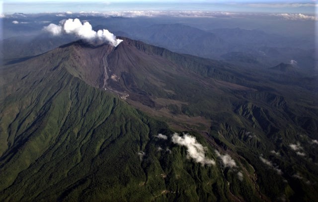
Yesterday afternoon, it was possible to observe ash emissions greater than 1000 meters above the level of the crater in a southwesterly direction. In addition, the Washington VAAC published two reports of ash emissions with a southwest direction and a height of 988 meters above crater level.
Other Monitoring Parameters:
The FIRMS satellite system records 3 thermal anomalies in the last 24 hours.
Observation:
At night, when the volcano was cleared, the reported emissions were observed, in addition to incandescence within the crater and rolling of incandescent material on all sides up to 800 m below crater level. Today in the morning the volcano was cloudy.
Alert level: Orange.
Source : IGEPN.
Photos :Patricio Ramon, 2005 (Instituto Geofisca, Escuela Politecnica Nacional).