November 04 , 2022.
La Réunion , Piton de la Fournaise :
Piton de la Fournaise activity, Monthly bulletin, October 2022.
Seismicity
In October 2022, the OVPF-IPGP recorded at the level of the Piton de la Fournaise massif in total:
• 252 superficial volcano-tectonic earthquakes (0 to 2.5 km above sea level) under the summit craters;
• 0 deep earthquake (below sea level);
• 144 long-period type earthquakes;
• 668 landslides (in the Cratère Dolomieu, the ramparts of the Enclos Fouqué and the Piton de Crac, and the Rivière de l’Est).

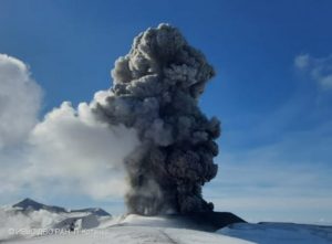
Volcano-tectonic activity in October 2022 at Piton de la Fournaise was marked by a sharp increase in summit seismicity between October 1 and October 5 (end of September 19 – October 5 eruption) under the south- East of the Dolomieu crater, with up to 65 earthquakes per day on October 2, 3 and 4. These volcano-tectonic earthquakes generally show first negative polarities on the entire OVPF-IPGP seismological network, suggesting a destabilization of the southern roof of the magmatic reservoir, probably linked to the emptying of the reservoir (also visible by the deflation of the summit area).
Following the cessation of the eruption on October 5, seismicity remained relatively low with less than 1 volcano-tectonic earthquake per day.
Note, however, the persistence of a very long-period seismicity (VLP) from October 11 to 24, probably linked to the resonance of a magmatic body under the summit. This magmatic body may correspond to the magmatic reservoir located at sea level or to the presence of residual magma in the building following the eruption of September 19 – October 5, 2022. This activity intensified on October 23 with a swarm of VLP events around 8:00 UTC, followed by the appearance of weak tremor-type signals at 8:38 UTC persisting for a few hours (without seismic crisis and without visible eruptive activity on the surface).
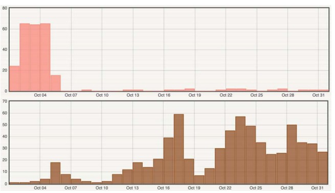
Histogram representing the number of superficial volcano-tectonic earthquakes (top) and landslides (bottom) per day recorded in October 2022 (© OVPF-IPGP)
Deformation
Following the propagation of the dike on September 19, which generated multi-decimetric displacements on the southern flank of the volcano (see OVPF-IPGP monthly bulletin of September 2022), a slight deflation of the edifice in the far field caused been recorded linked to the transfer of magma from the magmatic storage area below the summit to the eruptive site. The displacements then remained weak with only a very slight inflation of the summit zone and the base of the cone observed until the end of September.
On October 1, a deflation of the entire building was recorded on the entire OVPF-IPGP GPS network, indicating the depressurization of the volcano’s supply system located under the summit craters.
With the cessation of the eruption on October 5, 2022, a resumption of inflation of the entire building was recorded until October 23.
Source : OVPF.
Read the article : https://www.ipgp.fr/sites/default/files/ovpf_20221102_bullmensu.pdf
Photos :Imaz Press , OVPF/ IPGP.
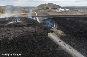
Italy , Vulcano :
WEEKLY BULLETIN, from October 25, 2022 to October 31, 2022, (issue date November 02, 2022)
ACTIVITY STATUS SUMMARY
In the light of the surveillance data, it is highlighted:
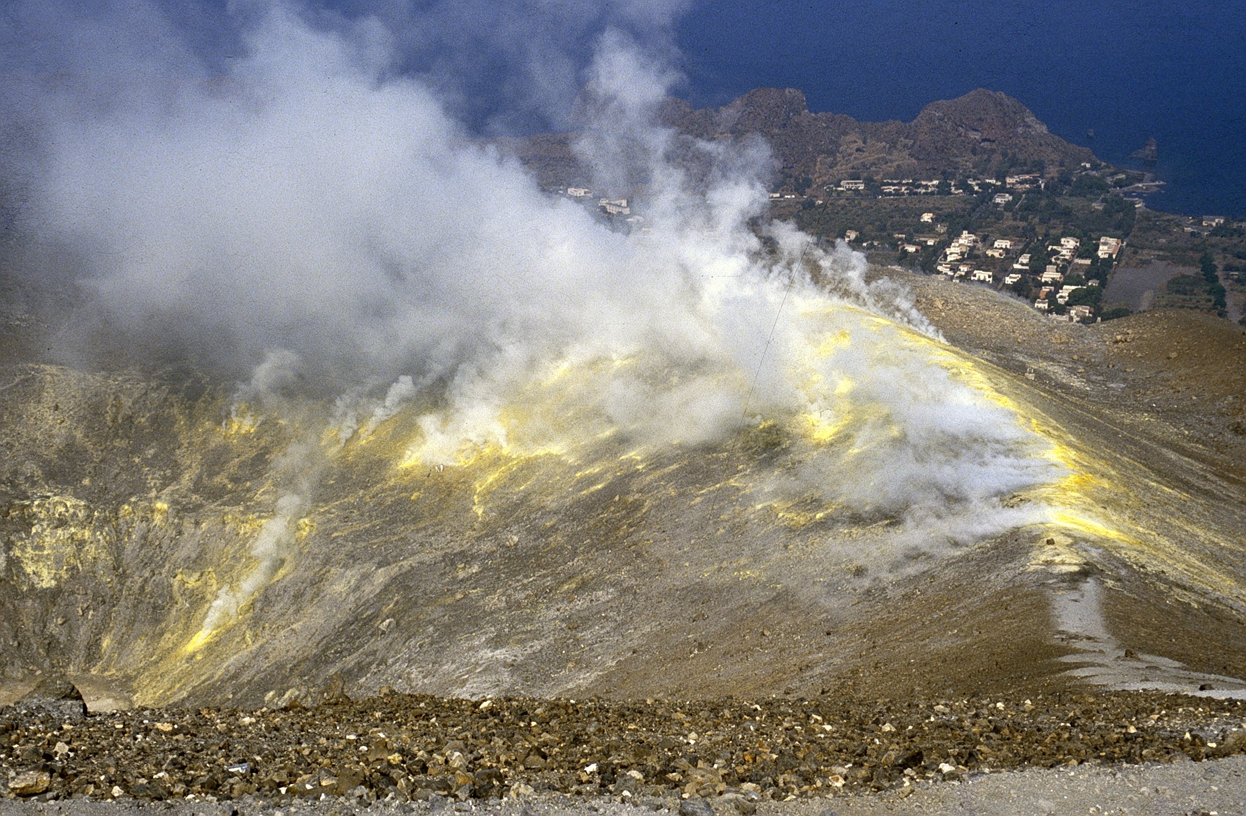
1) Temperature of the crater fumaroles: Along the upper edge, the maximum emission temperature has stable and high values, around 374°C.
2) CO2 flux in the crater area: The CO2 flux in the crater area remains at medium-high values.
3) SO2 flux in the crater area: stable at a moderately medium-high level
4) Geochemistry of fumarolic gases: There are no updates.
5) CO2 fluxes at the base of the La Fossa cone and in the Vulcano Porto area: The CO2 fluxes recorded in the Rimessa, C. Sicilia sites always show values above background levels. The P4max site displays average values, while at the Faraglione site there are values close to the background level.
Monthly CO2 Flux Campaign: CO2 emissions in the Vulcano Porto region show no significant change from the previous month and still remain at levels above background.
6) Geochemistry of thermal aquifers: in the Camping Sicilia well, still high temperature values and conductivity values at medium-low levels are recorded; in the Bambara well, the conductivity values do not show any significant changes, the level data is on a slightly decreasing trend.
Monthly drilling campaign: a stabilization of the supply of fluids of fumarolic origin to the thermal aquifer is generally observed, which still remains at abnormal levels in certain sites for certain monitored parameters.
7) Local seismicity: local activity with high frequency events and low VLP
8) Regional seismicity: No regional seismic activity
9) Deformations – GNSS: Data from the GNSS network does not show significant variations
10) Deformations – Inclinometry: The inclination network does not show significant variations
11) Gravimetry: There are no significant variations.
12) Other Notes: Mobile GNSS. The GNSS mobile network acquires and transmits movements in real time at a frequency of 1 Hz. The historical series acquired so far do not show significant variations around the Porto di Levante area.
CO2 FLOW IN THE CRATER AREA
The CO2 flux values on the ground in the upper zone of the VSCS station remain medium-high around 8000 g m-2 d-1. No significant change is observed compared to the previous week, and the values remain abnormal compared to those of the background level evaluated during the last decade of measurements.
Source : INGV.
Photo : Boris Behncke
Kuril Islands , Ebeko :
VOLCANO OBSERVATORY NOTICE FOR AVIATION (VONA)
Issued: November 04 , 2022
Volcano: Ebeko (CAVW #290380)
Current aviation colour code: ORANGE
Previous aviation colour code: orange
Source: KVERT
Notice Number: 2022-163
Volcano Location: N 50 deg 41 min E 156 deg 0 min
Area: Northern Kuriles, Russia
Summit Elevation: 1156 m (3791.68 ft)
Volcanic Activity Summary:
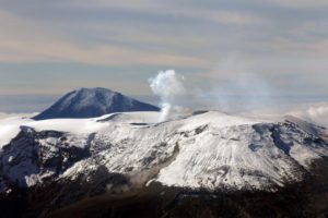
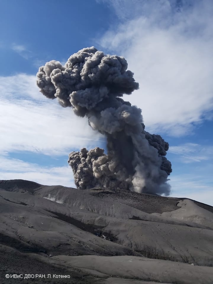
A moderate eruptive activity of the volcano continues. According to visual data by volcanologists from Severo-Kurilsk, explosions sent ash up to 2.2 km a.s.l., an ash cloud is drifting to the north-east of the volcano.
A moderate eruptive activity of the volcano continues. Ash explosions up to 6 km (19,700 ft) a.s.l. could occur at any time. Ongoing activity could affect low-flying aircraft and airport of Severo-Kurilsk.
Volcanic cloud height:
2200 m (7216 ft) AMSL Time and method of ash plume/cloud height determination: 20221104/0342Z – Visual data
Other volcanic cloud information:
Distance of ash plume/cloud of the volcano: 5 km (3 mi)
Direction of drift of ash plume/cloud of the volcano: NE / azimuth 50 deg
Time and method of ash plume/cloud determination: 20221104/0342Z – Visual data
Source : Kvert.
Photo : L. Kotenko. IVS FEB RAS.
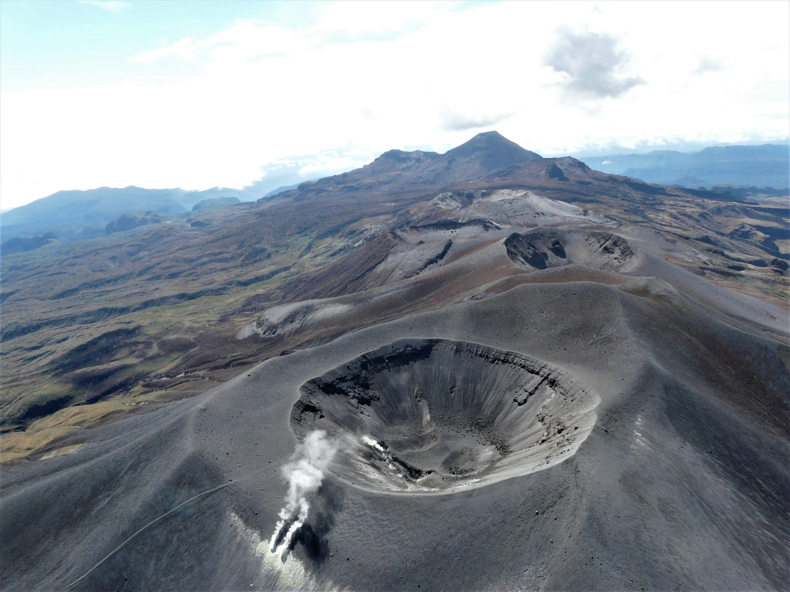
Colombia , Purace / Los Coconucos Volcanic Range :
Weekly bulletin of the activity of the Puracé volcano – Los Coconucos volcanic chain
Volcano activity level continues at Yellow or (III) Activity Level: changes in behavior of volcanic activity.
From the analysis and evaluation of the information obtained through the monitoring network of the Puracé volcano – Los Coconucos volcanic chain, during the week of October 25 to 31, 2022, the COLOMBIAN GEOLOGICAL SERVICE – Volcanological and Seismological Observatory of Popayan reports that:
• With regard to the seismic activity recorded, there were no notable variations in terms of the number of events and the energy released. During the week, 546 seismic events were recorded, of which 73 were associated with rock fracturing processes (VT type) and 473 with fluid dynamics in volcanic conduits.
• The geodetic network of GNSS (Global Navigation Satellite System) stations monitoring ground deformation continues to record a process associated with inflation.
• By monitoring the surface activity with the images obtained during the week ,according to the Mina, Lavas Rojas, Cerro Sombrero and Curiquinga web cameras, a degassing of the volcanic system was highlighted, with a white column oriented preferentially towards the North West.
• Concerning the monitoring of volcanic gases, the sulfur dioxide (SO2) measurements continue to evolve, with a maximum flow of 1955 t/day for the week evaluated. The other instruments for measuring the concentration of carbon dioxide (CO2) and radon gas (222Rn) in the volcanic influence zone register increases for the period evaluated, which is normal in active volcanic systems.
• Magnetic field and infrasonic wave monitoring sensors did not record variations associated with changes in volcanic activity.
It is concluded from the above that variations in volcanic activity continue to be recorded, consistent with the behavior expected at activity level III (yellow level), which could evolve towards states of greater activity. The Colombian Geological Service continues to monitor the evolution of the volcanic phenomenon and will report any changes that may occur in due course.
Source et photo : SGC.
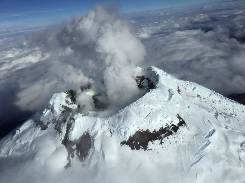
Ecuador : Cotopaxi :
DAILY REPORT OF THE STATE OF COTOPAXI VOLCANO, Thursday November 03, 2022.
Information Geophysical Institute – EPN.
Surface Activity Level: Low, Surface Trend: Downward
Internal activity level: Low, Internal trend: No change.
Seismicity: From November 02, 2022, 11:00 a.m. to November 03, 2022, 11:00 a.m.:
There was no interruption in the transmission of data from the BREF reference station for seismic statistics.
Long Periods (LP): 68
Emission Tremors (TREMI): 6.
Rains / Lahars:
Rains were recorded in the volcano area during the afternoon and evening yesterday, which did not generate lahars.
Emission / ash column:
During the morning, light steam and gas emissions were observed at a height of 500 meters above the level of the crater, facing west.
Observation:
During the morning today, a slight steam and gas emission described above was observed. At the moment, the area is partly cloudy.
Alert level: Yellow.
Source et photos : IGEPN.