October 09 , 2022.
Alaska , Pavlof :
55 25’2″ N 161 53’37 » W,
Summit Elevation 8261 ft (2518 m)
Current Volcano Alert Level: WATCH
Current Aviation Color Code: ORANGE
Low-level eruptive activity continues from a vent on the east flank, just below the summit of Pavlof Volcano. Seismic tremor continues and a small explosion was detected by infrasound at 15:03 local (23:03 UTC) but ash emissions could not be confirmed in satellite or web camera views due to cloudy conditions at the time and since. This along with discoloration of fresh snow near the vent area yesterday morning is suggestive of low-level explosive activity.
Small explosions associated with the current eruption could happen at any time and may be accompanied by small ash plumes within the immediate vicinity of the volcano. The level of unrest at Pavlof Volcano can change quickly and the progression to more significant eruptive activity can occur with little or no warning.
Pavlof Volcano is monitored by local seismic and infrasound sensors, satellite data, web cameras, and regional infrasound and lightning networks.
Source : AVO
Source : Izbekov, Pavel / Alaska Volcano Observatory / University of Alaska Fairbanks, Geophysical Institute.
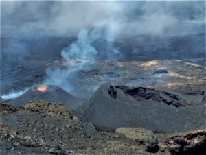
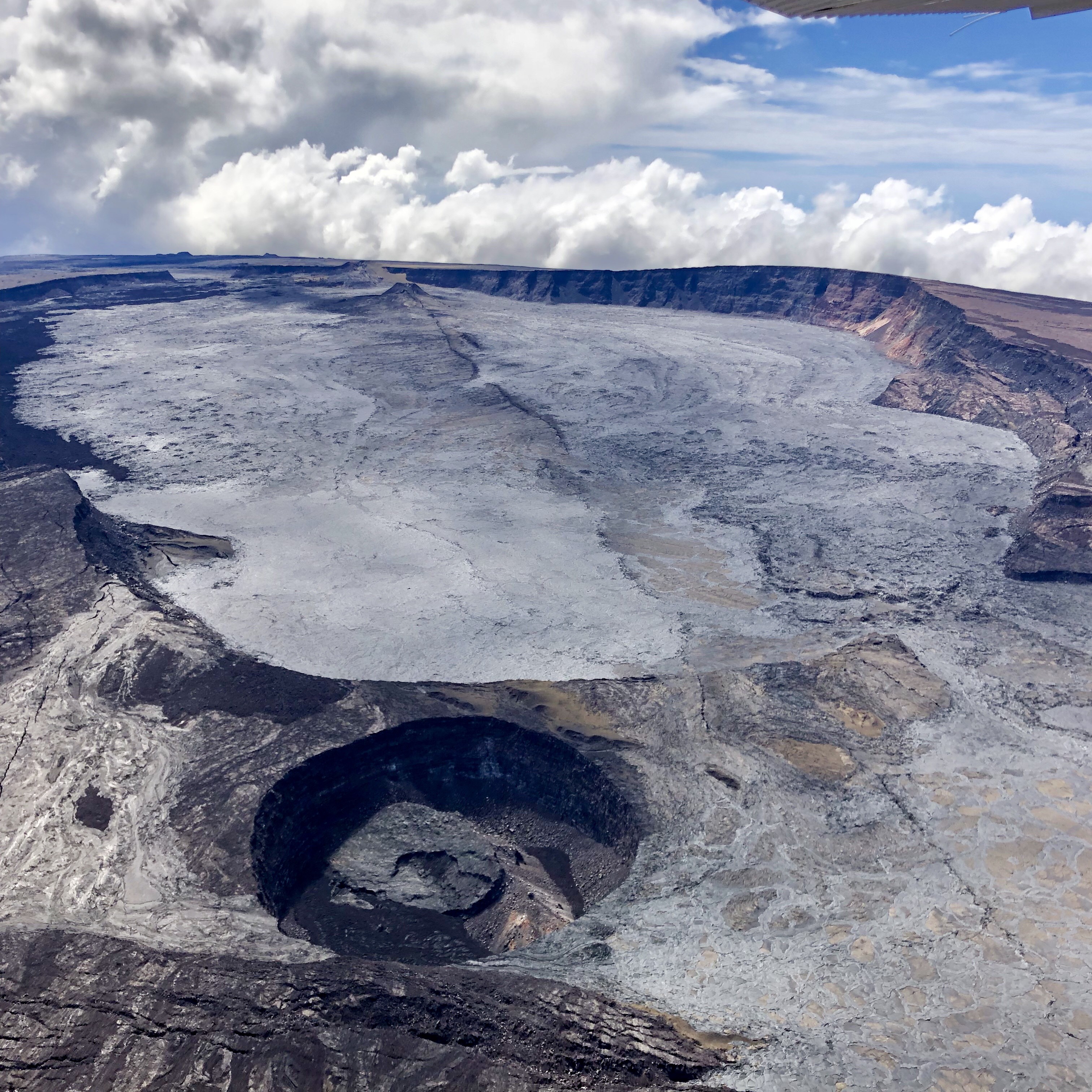
Hawaii , Mauna Loa :
19°28’30 » N 155°36’29 » W,
Summit Elevation 13681 ft (4170 m)
Current Volcano Alert Level: ADVISORY
Current Aviation Color Code: YELLOW
Activity Summary:
Mauna Loa is not erupting and there are no signs of an imminent eruption at this time. However, Mauna Loa continues to be in a state of heightened unrest as indicated by increased earthquake activity and inflation of the summit. The current unrest is most likely being driven by renewed input of magma 2-5 miles (3-8 km) beneath Mauna Loa’s summit. Monitoring data show no significant changes in the past day and conditions remain similar to those reported for the past week.
Observations:
During the past 24 hours, HVO located over three dozen small-magnitude (below M3.0) earthquakes 2-3 miles (3-5 km) below Mokuāʻweoweo caldera and 4-5 miles (6-8 km) beneath the upper-elevation northwest flank of Mauna Loa. Both of these regions have historically been seismically active during periods of unrest on Mauna Loa.
Global Positioning System (GPS) instruments at the summit and on the flanks of Mauna Loa continue to measure inflation at rates elevated since mid-September. However, tiltmeters at the summit are not showing significant surface deformation over the past week.
Concentrations of sulfur dioxide (SO2), hydrogen sulfide (H2S), and carbon dioxide (CO2), as well as fumarole temperatures, remain stable at the summit and at Sulphur Cone on the upper Southwest Rift Zone. Webcam and thermal camera views have shown no changes to the volcanic landscape on Mauna Loa over the past week.
Narrative:
Heightened unrest began in mid-September 2022 with increased earthquake rates below Mauna Loa summit (from 10-20 per day to 40-50 per day), an increased rate of inflation recorded by GPS stations, and inflation recorded on the MOK tiltmeter. The unrest is likely caused by renewed input of magma into Mauna Loa’s summit reservoir system. As the reservoir expands it is triggering small earthquakes directly beneath Mokuāʻweoweo caldera and in a region just to the northwest of the caldera. Deeper magma input (greater than 2 miles, 3 kilometers) is detected by the continued increase in upward movement and extension measured between GPS stations located on the ground surface. Shallower magma input (less than 2 miles, 3 kilometers) was likely responsible for inflation recorded on the summit tiltmeter during the last two weeks of September. The current locations of earthquakes and deformation do not necessarily mean that the next eruption will occur there. Mauna Loa remains at an elevated alert level of ADVISORY/YELLOW. The current increase in activity does not suggest that a progression to an eruption is certain, and there are no indications that an eruption is imminent.
Source : HVO
Photos : USGS , USGS / T. Elias.
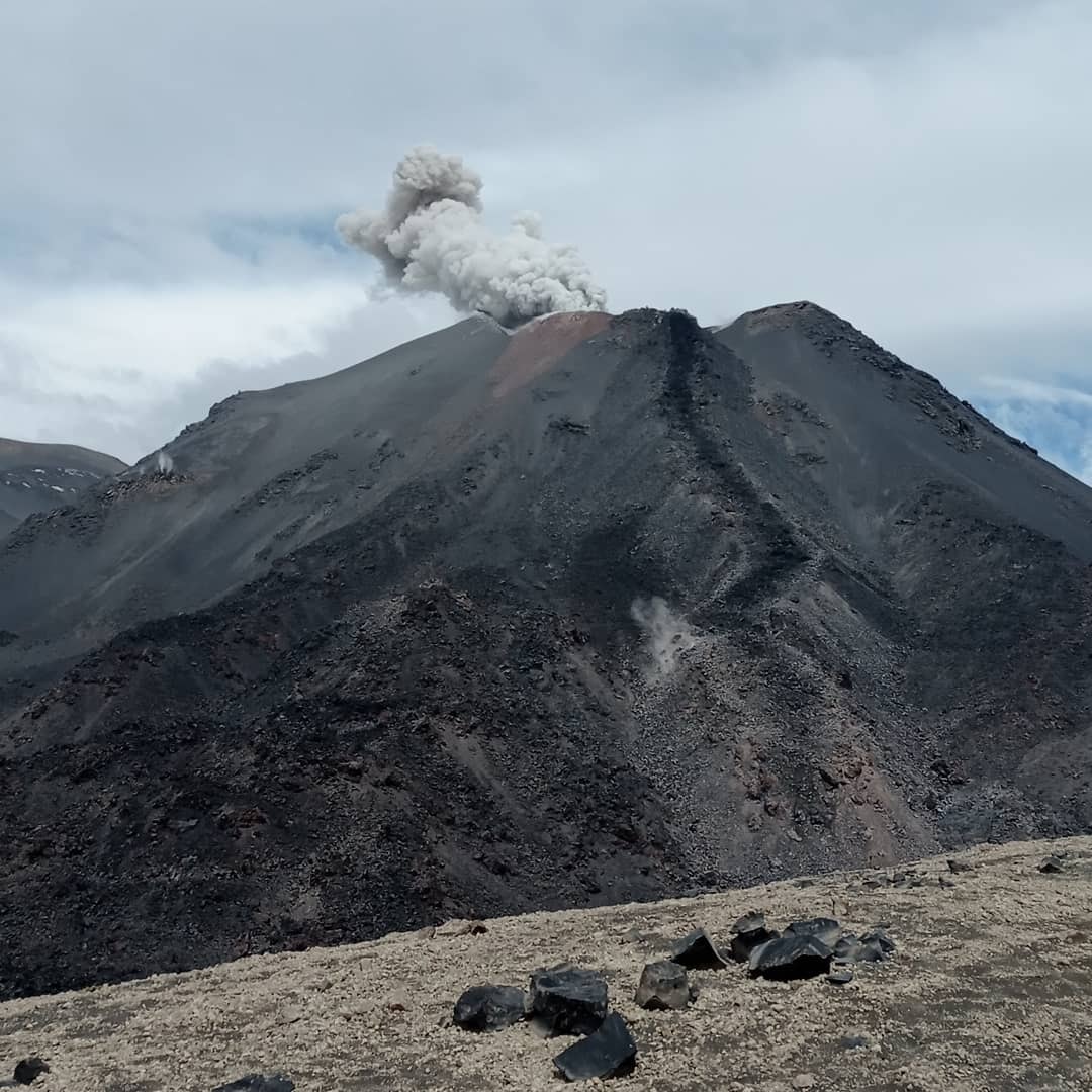
La Martinique , Mount Pelée :
Weekly report on the activity of Mount Pelée for the period from September 30, 2022 to October 07, 2022.
Between September 30, 2022 at 4 p.m. (UTC) and October 07, 2022 at 4 p.m. (UTC), the OVSM recorded at least 14 volcano-tectonic earthquakes of magnitude less than 0.1. 2 of these low energy earthquakes could be located. These are earthquakes identical to those of the well-known families on Pelee which are located inside the volcanic edifice around 0.4 km deep above sea level or about 1 km below the summit. This superficial volcano-tectonic seismicity is associated with the formation of micro-fractures in the volcanic edifice.
None of these earthquakes was felt by the population.

During volcanic reactivation phases of volcanoes similar to Mount Pelee, periods of higher seismic activity often alternate with phases of lower seismicity. Since the reactivation of the hydrothermal-magmatic system (end of 2018), several periods of zero or weak seismicity have been recorded by the OVSM, for example May 2019 (5 earthquakes), October 2019 (3 earthquakes), August 2020 (1 earthquake) , and only 8 earthquakes between June 24 and August 8, 2022 (period of 2 months).
The areas of degraded vegetation located between Morne Plumé and the Chaude River were observed during a helicopter flight carried out on February 9 and May 5, with the support of Dragon 972, and confirmed by analysis of satellite and drone images. (overview of May 11) and satellite analysis (June 2022). A new area of degraded vegetation, located just north of the Chaude River, was observed from August 26th.
The alert level remains YELLOW: vigilance.
Source : OVSM-IPGP.
Photo : rci.fm
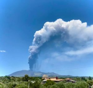
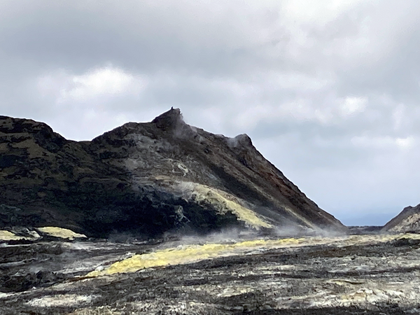
Chile , Nevados de Chillan :
Special Report on Volcanic Activity (REAV), De Nuble region, Nevados de Chillan volcanic complex, October 08, 2022, 7:40 p.m. local time (mainland Chile).
The National Service of Geology and Mines of Chile (Sernageomin) publishes the following PRELIMINARY information, obtained through the monitoring equipment of the National Volcanic Monitoring Network (RNVV), processed and analyzed at the Volcanological Observatory of the Southern Andes ( Ovdas):
Saturday October 08, 2022, at 7:06 p.m. local time (22:06 UTC), the monitoring stations installed near the Nevados de Chillan volcanic complex recorded an earthquake associated with fluid dynamics (long period type), inside the volcanic system. .
The characteristics of earthquakes after their analysis are as follows:
ORIGINAL TIME: 7:06 p.m. local time (22:06 UTC)
LATITUDE: 36.874°S
LONGITUDE: 71.403°W
DEPTH: 2.4 km
REDUCED DISPLACEMENT: 1089 cm2
ACOUSTIC SIGAL: 114.5 Pascals reduced to 1 km
The characteristics of surface activity are as follows:
MAXIMUM HEIGHT OF THE COLUMN: 1680 m above the point of emission
DISPERSION DIRECTION: North-North-East
The volcanic technical alert remains at the Yellow level.
Sources : Sernageomin.
Photos : Sernageomin.
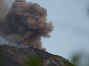
Mexico , Popocatepetl :
October 08, 11:00 a.m. (October 08, 4:00 p.m. GMT)
During the past 24 hours, according to the monitoring systems of the Popocatépetl volcano, 176 exhalations have been detected, accompanied by water vapor, volcanic gases and slight amounts of ash. There were also 4 minor explosions. Additionally, 17 minutes of tremor and 55 minutes of exhalation sequence were recorded.
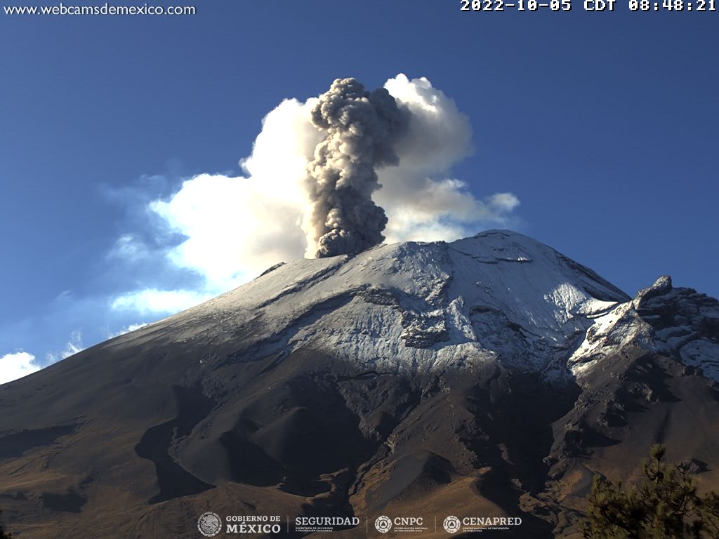
During the morning and at the time of this report, a slight emission of water vapor and volcanic gases is observed, heading northwest.
CENAPRED urges NOT TO APPROACH the volcano and especially the crater, because of the danger of falling ballistic fragments and, in case of heavy rains, to stay away from the bottom of the ravines because of the danger of mudslides and of debris.
The Popocatépetl volcanic alert traffic light is in YELLOW PHASE 2.
Source and photo : Cenapred .