September 01 , 2022 .
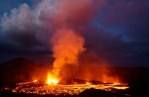
Ethiopia , Erta-Ale :
Thermal anomalies of variable intensities at Erta Ale’s N and S pit craters were periodically identified in satellite images during August. On 1 August there were two anomalies in the S pit crater and none in the N pit crater. Images were cloudy on 6 and 11 August. On 16 August two anomalies were again visible in the S pit crater while one large anomaly occupied the N crater. Translucent weather clouds obscured views on 21 August, though two anomalies were visible in the S pit crater. Dense weather clouds covered the N pit crater on 26 August and obscured the S pit crater, though one anomaly was visible.
The Erta Ale basaltic shield volcano is the most active in Ethiopia, with a 50-km-wide edifice that rises more than 600 m from below sea level in the barren Danakil depression. It is the namesake and most prominent feature of the Erta Ale Range. The volcano includes a 0.7 x 1.6 km elliptical summit crater hosting steep-sided pit craters. Another larger 1.8 x 3.1 km wide depression elongated parallel to the trend of the Erta Ale range is located SE of the summit and is bounded by curvilinear fault scarps on the SE side. Fresh-looking basaltic lava flows from these fissures have poured into the caldera and locally overflowed its rim. The summit caldera usually also holds at least one long-term lava lake that has been active since at least 1967, or possibly since 1906. Recent fissure eruptions have occurred on the N flank.
Source : Sentinel Hub , GVP
Photo : G Vitton
Indonesia , Ibu :
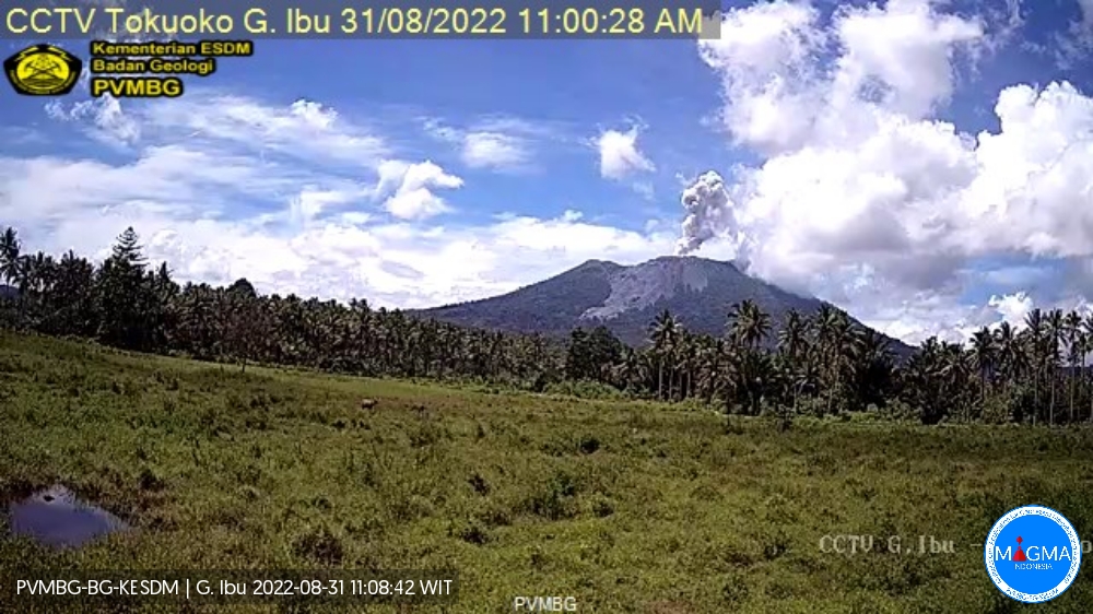
Mount Ibu erupted on Wednesday August 31, 2022 at 11:02 WIT with the ash column height observed at ± 800 m above the summit (± 2125 m above sea level). It is observed that the ash column is gray in color with a thick intensity, oriented towards the North-West. This eruption was recorded on a seismograph with a maximum amplitude of 15 mm and a duration of 70 seconds.
Visual observations:
The volcano is clearly visible until it is covered by fog. Smoke from the crater is white / gray with low, medium to thick intensity, about 200-800 meters above the summit. Sunny to stormy weather, weak to strong winds in the West and North-West.
Comments:
The tremors are dominated by an amplitude value of 2 to 3 mm. A rumble was heard all the way to the PGA station. A fine rain of ash fell on the villages of residents northwest and west of Mount Ibu.
Seismicity:
It was recorded:
71 earthquakes of eruptions/explosions with an amplitude of 15 to 30 mm and a duration of 16 to 70 seconds.
26 avalanche earthquakes with an amplitude of 2 to 3 mm and a duration of 15 to 50 seconds.
6 emission earthquakes with an amplitude of 5 to 14 mm and a duration of 10 to 50 seconds.
1 harmonic tremor with an amplitude of 11 mm, and a duration of 50 seconds.
44 shallow volcanic earthquakes with an amplitude of 3-8 mm and a duration of 4-7 seconds.
3 deep volcanic earthquakes with an amplitude of 2-5 mm, S-P 1-2 seconds and a duration of 3-4 seconds.
5 distant tectonic earthquakes with an amplitude of 4-26 mm, and a duration of 16-116 seconds.
Source and photo: Magma Indonésie
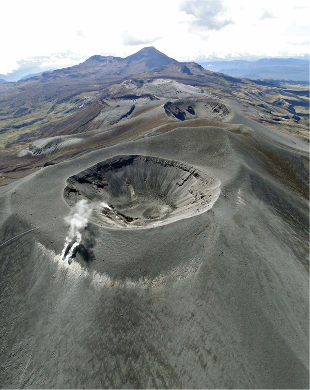
Colombia , Purace / Los Coconucos Volcanic Chain :
Weekly bulletin of the activity of the Puracé volcano – Los Coconucos volcanic chain
The activity level of the volcano continues at the Yellow activity level or (III): changes in the behavior of volcanic activity.
From the analysis and evaluation of the information obtained through the monitoring network of the Puracé volcano – Los Coconucos volcanic chain, during the week of August 23 to 29, 2022, the COLOMBIAN GEOLOGICAL SERVICE – Volcanological and Seismological Observatory of Popayan reports that:
• During the evaluated period, a total of 823 seismic events were recorded, which were associated with both rock fracturing processes and fluid dynamics in volcanic conduits, the latter type of seismicity being the one that predominated throughout the week assessed.
• On August 24, between 1:43 p.m. and 5:30 p.m. (local time), there was a significant increase in the number and energy of seismic signals associated with rock fracturing processes and fluid dynamics inside the conduits volcanic, events that were on average 1 km below the summit of the Puracé volcano.
• The geodetic network of GNSS (Global Navigation Satellite System) stations monitoring ground deformation continues to record a process associated with inflation.
• In the monitoring of surface activity, the images obtained during the week thanks to the Anambío, Mina, Lavas Rojas, Cerro Sombrero and Curiquinga web cameras showed degassing of the volcanic system, with a white column oriented preferentially towards the North West.
• With regard to the monitoring of volcanic gases, the sulfur dioxide (SO2) flux emissions recorded by the telemetric stations, showed an increase, reaching flow values in the permanent stations with a maximum emitted of 4600 tons/ day for August 23. The other gas analysis instruments in the volcanic influence zone do not show any relevant changes for the evaluated period.
• Magnetic field and infrasonic wave monitoring sensors did not record variations associated with changes in volcanic activity.
Based on the above, it is concluded that significant variations in volcanic activity continue to be recorded, in accordance with the behavior expected at activity level III (yellow level), which could evolve towards activity states more important. The Colombian Geological Service continues to monitor the evolution of the volcanic phenomenon and will report any changes that may occur in due course.
Source et photo : SGC .
Peru , Sabancaya :
Analysis period: from August 22, 2022 to August 28, 2022, Arequipa, August 31, 2022.
Alert level: ORANGE
The Geophysical Institute of Peru (IGP) reports that the eruptive activity of the Sabancaya volcano remains at moderate levels, that is to say with the recording of an average of 48 daily explosions, with columns of ash and of gas up to 2.5 km altitude above the summit of the volcano and their subsequent dispersion. Therefore, for the following days, no significant change is expected in eruptive activity.
The IGP recorded and analyzed the occurrence of 340 earthquakes of volcanic origin, associated with the circulation of magmatic fluids inside the Sabancaya volcano. An average of 48 explosions was recorded daily, in addition to recording Volcano-Tectonic (VT) type events associated with rock fracturing inside the Sabancaya volcano.
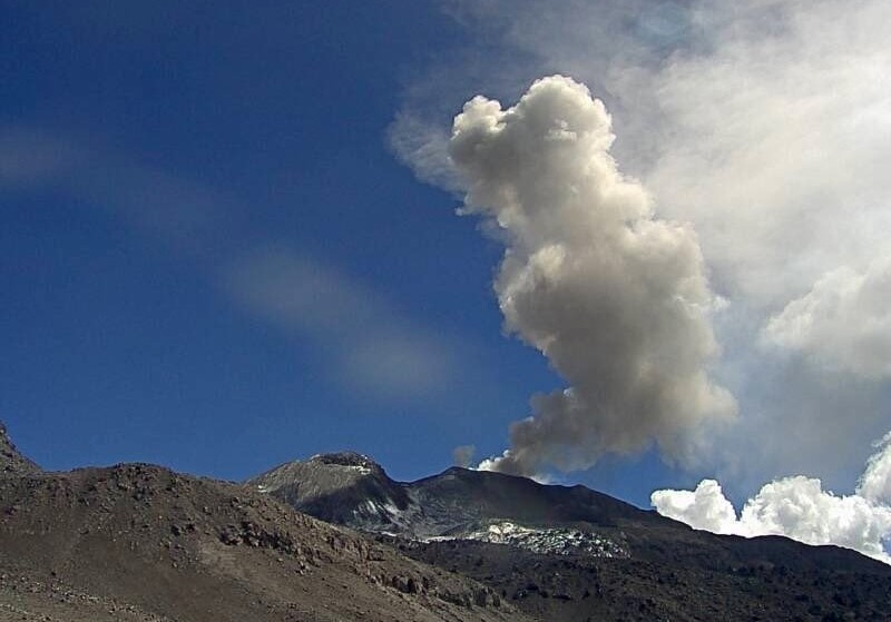
Monitoring the deformation of the volcanic structure using GNSS techniques (processed with fast orbits) does not show any significant anomalies. However, in general, an inflation process was observed in the northern sector (surroundings of the Hualca Hualca volcano). Visual surveillance identified columns of gas and ash up to 2.5 km above the summit of the volcano, which were scattered towards the east, southeast and southwest sectors of Sabancaya. Satellite recordings have identified the presence of 15 thermal anomalies, with a maximum value of 25 MW, associated with the presence of a lava body on the surface of the volcano’s crater.
RECOMMENDATIONS
• Keep the volcanic alert level orange.
• Do not approach within a radius of less than 12 km from the crater.
Source : Cenvul
Photo : Ingemmet.
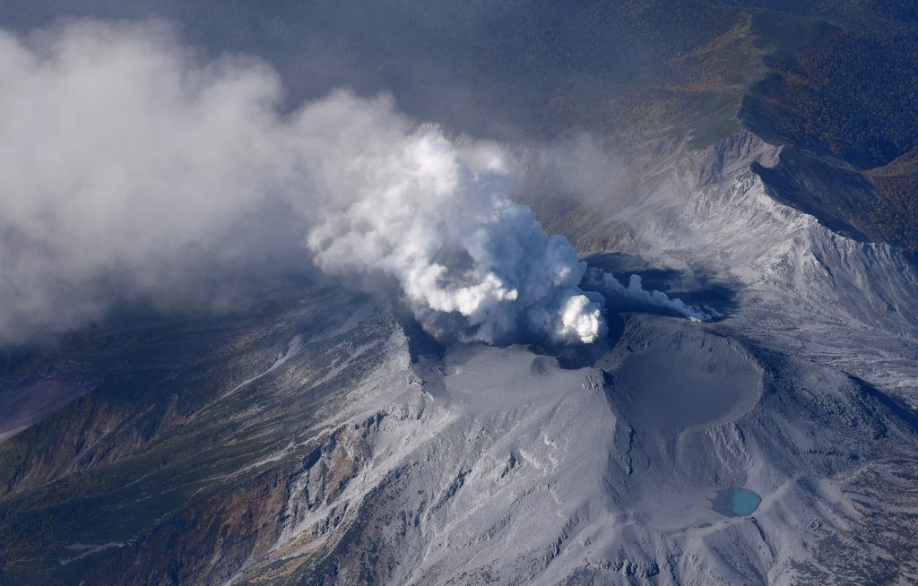
Japan , Suwanosejima :
At 21h51 on 28 August a large eruptive event at Suwanosejima’s Ontake Crater ejected large bombs 800 m above the vent and produced an eruption plume that rose into overhead weather clouds. Crater incandescence was visible in webcam images overnight. By 09h00 on 29 August three more explosions were recorded and produced ash plumes that rose as high as 1.3 km above the vent. The Alert Level remained at 2 and the public was warned to stay 1 km away from the crater.
The 8-km-long island of Suwanosejima in the northern Ryukyu Islands consists of an andesitic stratovolcano with two historically active summit craters. The summit is truncated by a large breached crater extending to the sea on the east flank that was formed by edifice collapse. One of Japan’s most frequently active volcanoes, it was in a state of intermittent Strombolian activity from Otake, the NE summit crater, between 1949 and 1996, after which periods of inactivity lengthened. The largest recorded eruption took place in 1813-14, when thick scoria deposits blanketed residential areas, and the SW crater produced two lava flows that reached the western coast. At the end of the eruption the summit of Otake collapsed, forming a large debris avalanche and creating the open Sakuchi caldera, which extends to the eastern coast. The island remained uninhabited for about 70 years after the 1813-1814 eruption. Lava flows reached the eastern coast of the island in 1884. Only about 50 people live on the island.
Source: Japan Meteorological Agency (JMA), GVP.
Photo : Masanori Genko