August 19 , 2022.
Iceland , Meradalur :
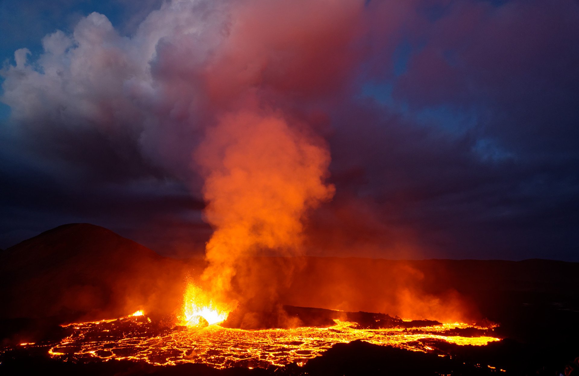
In recent days, the flow has been much lower than at the beginning. The number of volcanic explosions has decreased and the lava flow is flowing less than before.
« Yes, that’s a significant reduction, maybe two-thirds or more. » I suspect productivity is now approx. 3-5 cubic meters per second and at first it was about 15 cubic meters per second. So it’s a huge reduction,” says volcanologist Thorvaldur Thordarson.
Eruption activity has changed, pulsating activity has increased, and magma is rising higher in the air than before. « The crater is almost overflowing with lava. This accumulation of magma in the crater itself, it delays it a bit, it holds back the eruption so that it accumulates more, then a pulse comes and we have plumes of magma , then there are these little pulses that follow and then it’s quiet for a while, so it’s like the eruption is going into this cascading activity that the 2021 eruption went into, » says Thorvaldur.
Unlikely to flood Meradalur in the near future
For a while it was thought that lava would flow from Meradalur and towards Suðurstrandaveg, but given the current state of the lava flow, Thorvaldur thinks this is unlikely to happen in the near future. “The lava flow is mostly restricted to the crater area itself, and since then a lava flow has been flowing into Meradalur and following the northern slopes of the valley, and with such low productivity I think it is very unlikely that the lava will reach beyond Meradalur. »
Source : RUV
Photo : T Basset / http://www.geol.ch
Ecuador , Sangay :
DAILY REPORT OF THE STATE OF SANGAY VOLCANO, Thursday August 18, 2022.
Information Geophysical Institute – EPN.
Surface Activity Level: High, Surface Trend: No change.
Internal activity level: High, Internal trend: No change.
Seismicity: From August 17, 2022, 11:00 a.m. to August 18, 2022, 11:00 a.m.:
The SAGA seismic station is intermittent. Therefore, the number of events for a 15-hour period the station operated is shown below.
Explosion (EXP) 68
Long Periods (LP) 4
Emission Tremors (TREMI ) 10
Rains / Lahars:
No rain was recorded. **In the event of heavy rains, these could remobilize the accumulated materials, generating mudslides and debris that would descend on the flanks of the volcano and flow into the adjacent rivers.**
Emission / ash column:
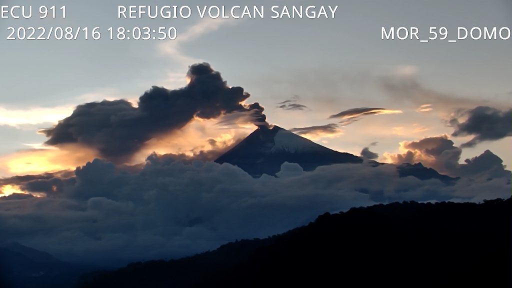
Since yesterday afternoon until today morning, emissions of gas, steam and ash have been observed with heights greater than 1000 meters above the level of the crater to the west. The Washington VAAC published 3 reports of ash emissions between 1,770 and more than 2,000 meters above the summit, heading west and northwest. At night, the SNGRE reports a slight fall of ash in the cantons of Alausí (municipalities of Achupallas, Multitud, Sibambe and Tixán) and Guamote (municipalities of Cebadas and Palmira).
Observation:
In the afternoon and morning of today, on the images provided by ECU911, the volcano is observed cleared with emission of gas and ash in the west direction. During the night, a slight emission at low altitude towards the West was observed on the satellites.
Other Monitoring Parameters:
The FIRMS system records 8 thermal alerts on the Sangay in the last 24 hours.
Alert level: Orange.
Source : IGEPN.
Photo : IGEPN/ECU 911
Colombia , Nevado del Ruiz :
Bulletin of activity level of the Nevado del Ruiz volcano.
The level of activity continues at the Yellow Activity Level or (III): changes in the behavior of volcanic activity.
Regarding the monitoring of the activity of the Nevado del Ruiz volcano, the COLOMBIAN GEOLOGICAL SERVICE reports that:
During the last week, according to the analysis and evaluation of the parameters taken into account in the monitoring of volcanic activity, it is evident that the Nevado del Ruiz volcano continues to show instability in its behavior.
The seismicity related to the dynamics of the fluids inside the volcanic conduits had a similar level both in number of earthquakes and released seismic energy, compared to the previous week. In general, the seismic signals associated with this process presented moderate energy levels, and were located mainly in the Arenas crater. Thanks to the cameras installed in the volcano area and the report of the officials of the National Natural Park of Los Nevados on the ground, the gas and ash emissions associated with some of these seismic signals have been confirmed. Likewise, changes in the relative temperature of the material observed in the gas and ash columns were observed.
The seismicity associated with rock fracturing decreased in the number of earthquakes and increased in the seismic energy released, compared to the previous week. This seismic activity was located mainly in the North-East and North-West sectors of the volcanic edifice, in the Arenas crater, and to a lesser extent in the South and South-West sectors. The depth of the earthquakes varied between 0.6 and 11.0 km. The maximum magnitude recorded during the week was 0.9 ML (Local Magnitude), corresponding to the earthquake of August 15 at 08:11 (local time), located 3.5 km southwest of the Arenas crater at a depth of 4.0 km.
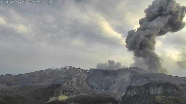
This Thursday, at 5:51 p.m., it was possible to observe from Manizales, Villamaría and Alto de Letras an emission of ash from the Nevado del Ruiz volcano. The Colombian Geological Commission (SGC) reported that it had recorded a seismic signal of fluids associated with an ash emission which reached a height of 3200 m, vertical direction with a slight dispersion towards the West-Northwest. “This was visible from most of the cameras installed in the area of the volcano and the city of Manizales. There is no ash fall report.
Source et photo : SGC. La Patria .
Peru , Sabancaya :
Period of analysis: from August 8, 2022 to August 14, 2022, Arequipa, August 16, 2022.
Alert level: ORANGE
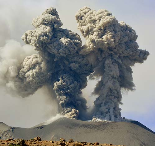
The Geophysical Institute of Peru (IGP) reports that the eruptive activity of the Sabancaya volcano remains at moderate levels, that is to say with the recording of an average of 25 daily explosions, with columns of ash and of gas up to 2.4 km altitude above the summit of the volcano and their subsequent dispersion. Therefore, for the following days, no significant change is expected in eruptive activity.
The IGP recorded and analyzed the occurrence of 366 earthquakes of volcanic origin, associated with the circulation of magmatic fluids inside the Sabancaya volcano. An average of 25 explosions was recorded daily, in addition to recording Volcano-Tectonic (VT) type events associated with rock fracturing inside the Sabancaya volcano.
Monitoring the deformation of the volcanic structure using GNSS techniques (processed with fast orbits) does not show any significant anomalies. However, in general, an inflation process has been observed in the northern sector (surroundings of the Hualca Hualca volcano). Visual surveillance identified columns of gas and ash up to 2.4 km above the summit of the volcano, which were dispersed towards the North-West, North-East, South, South- East and East of Sabancaya. Satellite recordings have identified the presence of 7 thermal anomalies, with a maximum value of 22 MW, associated with the presence of a lava body on the surface of the volcano’s crater.
RECOMMENDATIONS
• Keep the volcanic alert level orange.
• Do not approach within a radius of less than 12 km from the crater.
Source : Cenvul
Photo : IGP.
Russia / Kuril Islands , Ebeko :
50.69 N, 156.01 E;
Elevation 1156 m (3792 ft)
Aviation Colour Code is ORANGE
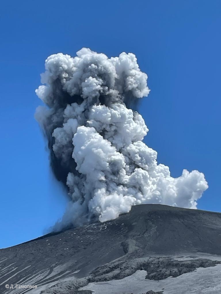
A moderate eruptive activity of the volcano continues. Ash explosions up to 6 km (19,700 ft) a.s.l. could occur at any time. Ongoing activity could affect low-flying aircraft and airport of Severo-Kurilsk.
A moderate eruptive activity of the volcano continues. According to visual data by volcanologists from Severo-Kurilsk, explosions sent ash up to 3.5 km a.s.l. on 15-18 August. Satellite data by KVERT showed a thermal anomaly over the volcano on 13, and 18 August; ash clouds moved for 65 km to the southeast of the volcano on 17-18 August.
Source : Kvert
Photo : D. Ermolaev

