July 31 , 2022.
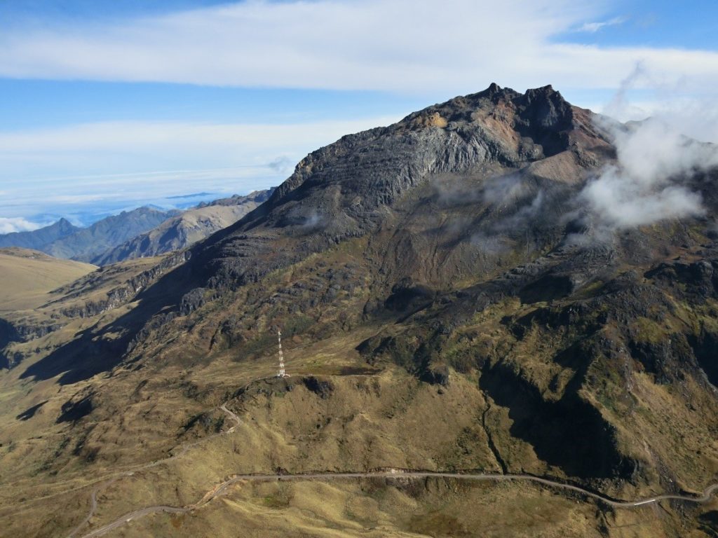
Ecuador / Colombia , Chiles / Cerro Negro :
DAILY REPORT OF THE STATE OF VOLCANOES CHILE / CERRO NEGRO, Friday July 29, 2022.
Information Geophysical Institute – EPN.
Surface activity level: Very low, Surface trend: No change.
Internal activity level: Moderate, Internal trend: Ascending.
Seismicity: As of July 29, 2022, 11:00 a.m.
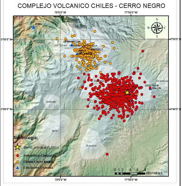
Since the earthquake of 07/25/2022, 376 events have been located under the Chiles Cerro Negro volcanic complex. The following table shows the number of earthquakes at the CHL2 reference station, in the last 24 hours.
– Volcano-tectonic types (VT): 1175.
Location of events recorded under the Chiles-Cerro Negro volcanoes (orange dots) and at Potrerillos-Chalpatán (red dots) since the earthquake of 07/25/2022 (yellow star) to date
Seismicity at Potrerillos-Chalpatán:
After the earthquake of magnitude 5.2 MLv (5.6 Mw) which occurred on 07/25/2022, in the Potrerillos-Chalpatán region, about 15 km southeast of the Chiles-Cerro Negro volcanic complex, 572 earthquakes of magnitudes between 0.5 to 4.2 Mlv have been located at less than 10 km depth in the epicentral zone.
Observation:
In the early hours of the morning today, the area was clear with no surface level activity.
Alert level: Orange.
Source : IGEPN.
Photos : IGEPN ,
Iceland , Reykjanes Peninsula :
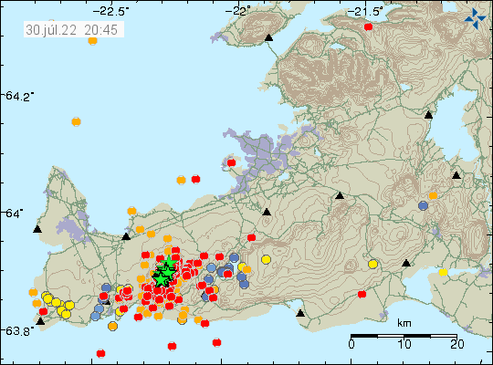
A strong seismic swarm is ongoing north of Fagradalsfjall since noon today. Largest earthquake measured M4.0 at 14:03. The swarm is currently at 5-7 km depth.
Yesterday evening at 22:58 a earthquake of M4.2 was measured in southern Mýrdalsjökull Glacier, with around ten smaller earthquakes detected in the same area shortly after. IMO received a report that the earthquake was felt in Mýrdalshreppur.
A very strong earthquake swarm has started north of Fagradalsfjall. About 350 to 400 earthquakes were measured in a very short time; many were measured as of 2:03 p.m. (2:03 p.m.) today. The National Police Commissioner, in consultation with the Suðurnes Police Chief, has stated the level of uncertainty for civil protection due to the earthquakes. The Icelandic Meteorological Office has issued a yellow aviation weather code due to seismic activity and has drawn attention to the fact that rockfalls and landslides can be triggered on steep terrain, it is therefore good to be careful on steep slopes.
Earthquakes recorded in the last 48 hours in the Reykjanes area according to IMO:
Magnitude less than 1 in all: 175
Magnitude 1 to 2 in total: 182
Magnitude 2 to 3 in all: 75
Magnitude greater than 3 in all: 10
Total: 442
The depth of these earthquakes varies from near the surface to less than 8 km below the surface. It is a clear sign of volcanic activity but still too early to say whether an eruption will occur or not. But the risk is certainly clear.
Source : Vedur is, Iceland Geology .
Photos : IMO.
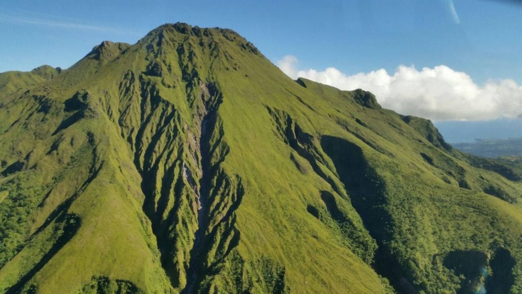
La Martinique , Mount Pelée :
Weekly report on the activity of Mount Pelee for the period from July 22, 2022 to July 29, 2022.
Between July 22, 2022 at 4 p.m. (UTC) and July 29, 2022 at 4 p.m. (UTC), the OVSM recorded at least one volcano-tectonic earthquake of magnitude less than 0.1. This low energy earthquake was located inside the volcanic edifice between 0.5 and 0.9 km deep below the surface. This superficial volcano-tectonic seismicity is associated with the formation of micro-fractures in the volcanic edifice. This earthquake was not felt by the population.
During volcanic reactivation phases, periods of higher seismic activity often alternate with phases of lower seismicity. Since the reactivation of the hydrothermal-magmatic system (end of 2018), the OVSM has not recorded any earthquakes of volcanic origin during the month of May 2019 and less than 3 earthquakes in October 2019 and August 2020. This variability in the number of earthquakes has already, for example been observed following the reactivation of Soufrière de Montserrat.
An extension of two areas of degraded vegetation located between Morne Plumé and the Chaude River was observed during a helicopter flight carried out on February 9 and May 5, with the support of Dragon 972, and confirmed by analysis of satellite images. and drone (overflight of May 11).
The alert level remains YELLOW: vigilance.
Source : OVSM-IPGP.
Photo : Auteur inconnu
Alaska , Pavlof :
55 25’2″ N 161 53’37 » W,
Summit Elevation 8261 ft (2518 m)
Current Volcano Alert Level: WATCH
Current Aviation Color Code: ORANGE
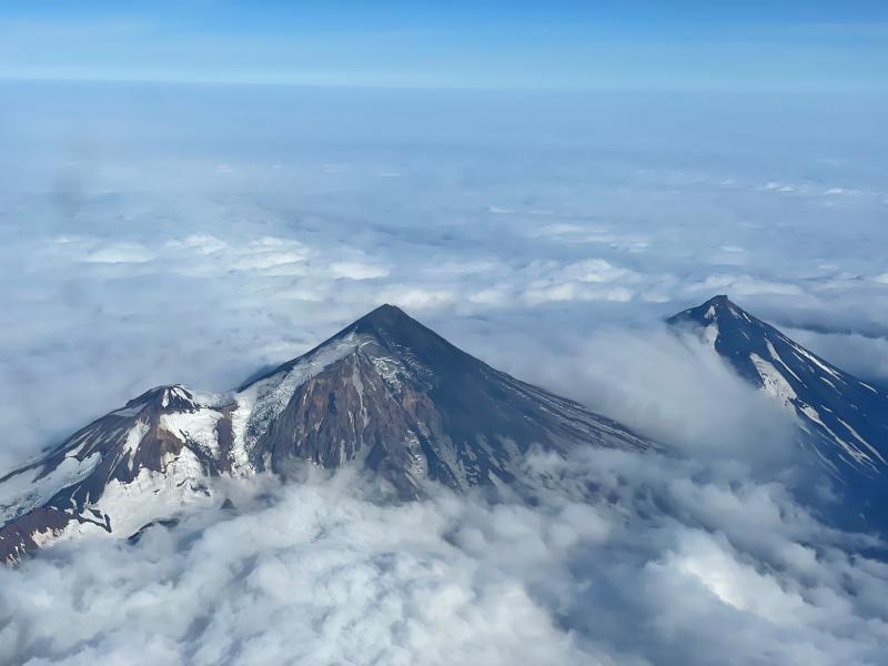
Pavlof Volcano continues to erupt from the active vent on its east flank, just below the summit. Seismic tremor and elevated surface temperatures in satellite data were observed throughout the week, and numerous minor explosions were detected daily in seismic and infrasound data. When web camera viewing conditions allowed, these explosions were associated with weak ash emissions to altitudes under 10,000 ft (about 3 km) above sea level that dissipated quickly. No ash emissions were large enough to be observed in satellite data, but sulfur dioxide gas emissions were detected on July 26.
Periods of lava spatter and fountaining from the vent on the volcano’s upper east flank have been occurring since mid-November 2021. This activity has built a small cone and sent flows down the flank that melt the snow and ice and produce variable amounts of meltwater. The meltwater typically incorporates loose debris on the flank of the volcano and forms thin (less than 2 m thick) lahars. The lahar deposits extend down the east-southeast flank for several kilometers, not quite to the base of the volcano. Previous eruptions of Pavlof indicate that the level of unrest can change quickly and the progression to more significant eruptive activity can occur with little or no warning.
Source : AVO.
Photo : Ben David Jacob.
Indonesia , Ibu :
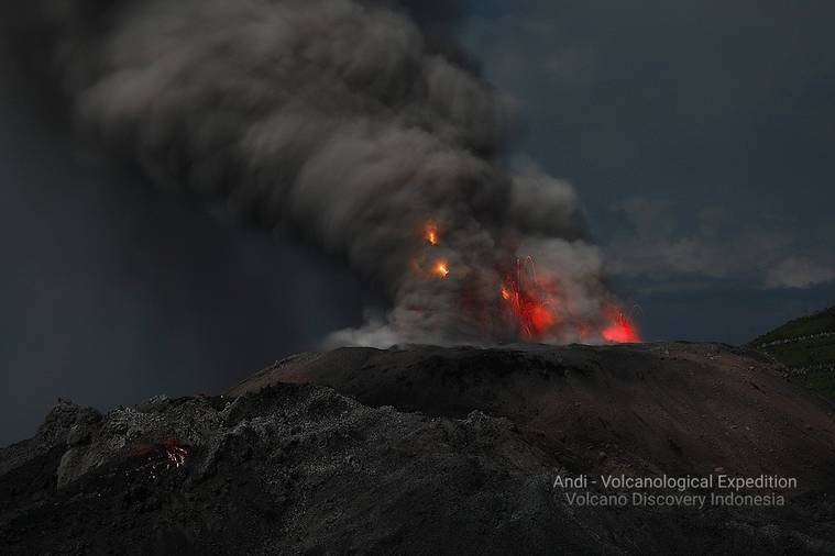
An eruption of Mount Ibu occurred on Saturday July 30, 2022 at 7:36 p.m. WIT with an ash column height observed at ± 3000 m above the peak (± 4325 m above sea level). It is observed that the ash column is gray in color with a thick intensity, oriented towards the West. This eruption was recorded on a seismograph with a maximum amplitude of 27 mm and a duration of 139 seconds.
VOLCANO OBSERVATORY NOTICE FOR AVIATION – VONA
Issued : July 30 , 2022
Volcano : Ibu (268030)
Current Aviation Colour Code : ORANGE
Previous Aviation Colour Code : orange
Source : Ibu Volcano Observatory
Notice Number : 2022IBU45
Volcano Location : N 01 deg 29 min 17 sec E 127 deg 37 min 48 sec
Area : North Maluku, Indonesia
Summit Elevation : 4240 FT (1325 M)
Volcanic Activity Summary :
Eruption with volcanic ash cloud at 10h36 UTC (19h36 local).
Volcanic Cloud Height :
Best estimate of ash-cloud top is around 13840 FT (4325 M) above sea level, may be higher than what can be observed clearly. Source of height data: ground observer.
Other Volcanic Cloud Information :
Ash-cloud moving to west.
Remarks :
Eruption and ash emission is continuing.
Source : Magma Indonésie.
Photo : Andi Rosati / Volcanodiscovery.
Guatemala , Fuego :
Weather conditions: Clear weather
Wind: East
3.8mm precipitation
Activity :
The Fuego OVFGO volcano observatory reports a weak fumarole at a height of 4,800 meters above sea level which disperses in a west and southwest direction. Incandescent pulses were observed at a height of 200 meters above the crater, these generate avalanches on the edge of the crater of weak to moderate characteristics. Faint sounds similar to those of a train locomotive continue to be heard constantly.
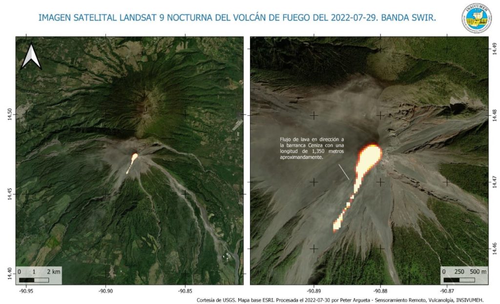
The lava flow towards the Ceniza ravine is 1,000 meters long. It generates constant low to moderate avalanches from its front. During the descent of these avalanches a curtain of ash is raised with a height of 500 meters from the surface, which is scattered to the west and southwest. As a result of this activity, ash falls are reported in the areas of Panimaché I, Morelia, Santa Sofía, El Porvenir, Sangre de Cristo, Finca Palo Verde, Yepocapa and others. Due to wind variability, there is a likelihood of ash fall in communities northwest of the volcano, such as Quisaché and neighboring communities.
Source : Insivumeh.
Photo : USGS / Landsat.

