June 29 , 2022.
New Zealand , White Island :
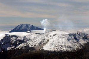
Whakaari/White Island: Update on recent observations. Minor volcanic unrest continues. Published: Tue Jun 28 2022 9:00 AM
Volcanic Alert Level remains at 1
Aviation Colour Code remains at Green
Recent monitoring data, including flights to make visual observations and measure gas emissions, confirm volcanic unrest remains at low level at Whakaari/White Island. The Volcanic Alert Level for Whakaari/White Island remains at Level 1. The Aviation Colour Code also remains at Green.
Last week we completed a flight to measure gas emissions, and an observation flight to document any recent changes at the volcano and to remotely measure fumarole temperatures. Data from these flights, together with automatically collected monitoring data indicate that the level of volcanic unrest remains low and there has been little change in activity in the last few weeks.
The gas flight established that emission rates remain within typical long-term levels, with a decrease in the amount of gas being emitted from the active vents since the last observations in mid-May 2022. The temperature of the emitted gas and steam remains low with an observation of approximately 170 °C from 22 June 2022.
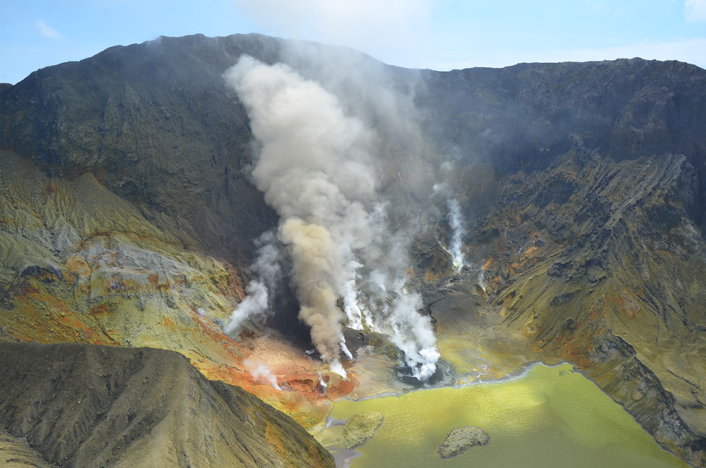
No activity beyond moderate fumarole emissions was observed from vents on the crater floor in the active vent area. Fumarole emissions were free of volcanic ash. Satellite based ground deformation indicates minor changes about the active vent-lake area. Seismic activity remains low.
These observations are consistent with low levels of volcanic unrest. The Volcanic Alert Level remains at Level 1 and the Aviation Colour Code remains Green.
The Volcanic Alert Level reflects the current level of volcanic unrest or activity and is not a forecast of future activity. Volcanic Alert Level 1 indicates the primary hazards are those expected during volcanic unrest; steam discharge, volcanic gas, earthquakes, landslides and hydrothermal activity. While Volcano Alert Level 1 is mostly associated with environmental hazards, potential for eruption hazards also exists and eruptions can still occur with little or no warning.
Our on-island equipment has degraded over the past two and a half years. However, we are still able to retrieve data from the island due to some rerouting of data to the mainland.
Source : Geonet / Steven Sherburn / Duty Volcanologist .
Photo : Geonet .
Nicaragua , San Cristobal :
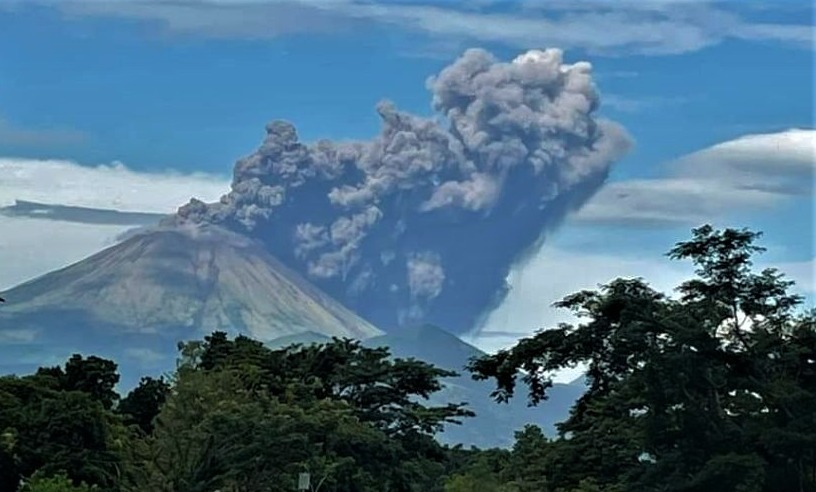
The San Cristóbal volcano had an eruption with gas and ash emissions at Chinandega in Nicaragua.
According to locals, around 7:35 a.m. there was an earthquake followed by the expulsion of ash and gas.
« There was an explosion in the area of the San Cristóbal volcano, there was an expulsion of ash, it caused a movement at that time and an explosion inside the volcano, we did not have another aftershock, » engineer Agustín Moreira told 100% NEWS, from the Natural Phenomena Observatory.
According to the expert, « volcanoes expel this type of material when they clean the ducts of their chimneys », he explained.
In several photographs posted on social networks, Internet users shared a series of images showing the volcano with a column of smoke visible several kilometers away.
So far, it is not known how many communities or towns are affected by the ash fall.
The San Cristóbal volcano is the highest volcano in the country and is located in northwest Nicaragua, in the Maribios mountain range. According to the monitoring carried out by OFENA, there have been no aftershocks, nor major eventualities endangering the inhabitants. « According to seismographs, the seismic activities of the volcano remain normal, » he explained. The San Cristóbal volcano is considered one of the most active in the country due to its constant eruptions.
So far, government authorities have not published a preliminary report on this event, which has caused astonishment among the inhabitants of the western zone of Nicaragua.
The expert advised the population to remain calm, cover containers with drinking water and wear masks to protect the respiratory tract due to the toxicity of gases and ashes.
Source et photo : Ineter , 100% Noticias .
Italy / Sicily , Etna :
WEEKLY NEWSLETTER, from June 20, 2022 to June 26, 2022. (issue date June 28, 2022).
ACTIVITY STATUS SUMMARY
In the light of the surveillance data, it is highlighted:
1) VOLCANOLOGICAL OBSERVATIONS: Pulsating degassing from the Bocca Nuova crater, fumarolic activity from different points on the Southeast Crater, modest fumarolic activity from the Northeast Crater.
2) SEISMOLOGY: Low seismic activity of fracturing; average amplitude of the volcanic tremor in the average level.
3) INFRASOUND: moderate infrasound activity.
4) GROUND DEFORMATIONS: Over the past week, ground deformation monitoring networks have not recorded any significant changes, confirming trends already highlighted in previous bulletins.
5) GEOCHEMISTRY: SO2 flux at an average level
Soil CO2 fluxes recorded last week show a downward trend, settling on medium-low values
The partial pressure of CO2 of Ponteferro shows a peak above 0.25 Atm in the last period.
6) SATELLITE OBSERVATIONS: Thermal activity in the summit area was at a high level consistent with effusive activity which ended on June 16th. In the days that followed, especially this last week, the level was low.
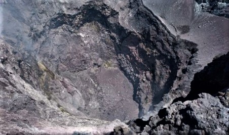
Internal walls of the northeast crater, with the bottom completely obstructed.
VOLCANOLOGICAL OBSERVATIONS
During the week, the monitoring of the volcanic activity of Etna was carried out by analyzing the images of the surveillance cameras of the INGV, Osservatorio Etneo (INGV-OE) and through a
field survey carried out by INGV-OE staff on 23 June.
After the cessation of effusive activity in the Valle del Bove, on the night of June 15 to 16, no eruptive activity was observed on Etna. The degassing of the summit craters continued, with the exception of the Voragine crater, where fumarolic activity is almost absent. Gas emissions were observed in a few small fumaroles in the inner walls of the northeast crater, the bottom of which was completely obstructed.
The collapse craters of the Bocca Nuova crater inside the central crater of the volcano
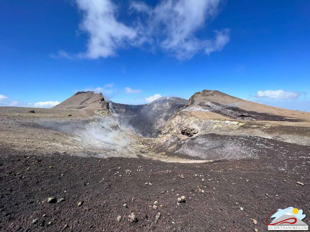
A generalized degassing activity continued at the level of the Southeast Crater, fed by numerous fumaroles largely concentrated along the northern edge of the crater and in correspondence with the mouth which opened on May 12 on the same edge, which was the site of explosive activity until mid-June. Other fumaroles were inside the collapse niche formed during the February 10 paroxysm in the southern flank of the cone. No eruptive activity was observed after June 15, 2022.
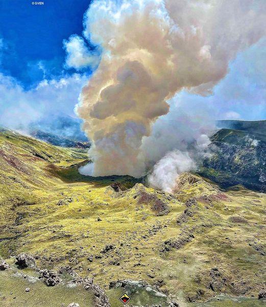
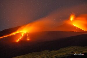
The Bocca Nuova crater was the one with the most obvious signs of activity during the week. In the western part of the crater, in correspondence with the BN-1 crater, there are two open wells, which are the site of strong pulsed degassing, often accompanied by audible rumblings even several kilometers away on the flanks of the volcano. In the absence of wind and good visibility conditions, this outgassing formed a robust and dense plume. During the night hours, weak lightning was visible at BN-1, as documented by the visual surveillance camera on Montagnola and by a new high-resolution visual camera at Piedimonte.
Source : INGV.
Photos : Gruppo Guide Alpine e Vulcanologiche Etna Nord , INGV , Vincenzo Greco ( Guide Vulcanologiche Etna Nord ) .
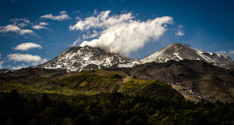
Colombia , Chiles / Cerro Negro :
Weekly activity bulletin of the Chiles and Cerro Negro volcanoes.
Volcano activity continues at YELLOW LEVEL ■ (III): CHANGES IN THE BEHAVIOR OF VOLCANIC ACTIVITY.
From monitoring the activity of the CHILES AND CERRO NEGRO VOLCANOES, the COLOMBIAN GEOLOGICAL SERVICE (SGC) reports that:
Between June 21 and 27, 2022, the seismic swarm process that began on May 27, 2022 continued, exhibiting fluctuations in both the number and daily energy of earthquakes. During this week, 18,425 events associated with a fracture of the crustal material inside the volcano were recorded. The earthquakes were located near the summit of the Chiles volcano and to the south of it, with epicentral distances of up to 4 km with depths less than 6 km from its summit (4700 m). Of these earthquakes, 22 occurred with local magnitudes (ML) between 2.0 and 4.4, 3 of which were reported as felt within the volcanic influence zone: June 21 at 11:50 p.m. (ML 4.4 ), June 22 at 3:31 a.m. (ML 3.5) and June 23 at 7:59 a.m. (ML 2.5).
Some sensors that are part of the deformation network show changes that, although small in magnitude, may be associated with volcanic activity that has manifested itself seismically. No manifestation of surface activity has been observed and the other volcanic monitoring parameters remain stable.
The COLOMBIAN GEOLOGICAL SERVICE and the GEOPHYSICAL INSTITUTE OF THE NATIONAL POLYTECHNICAL SCHOOL of ECUADOR remain attentive to the evolution of the volcanic phenomenon and will inform on any changes that may occur in due course.
Source : SGC.
Photo : agence uno , biobiochiles.
Indonesia , Anak Krakatau :
VOLCANO OBSERVATORY NOTICE FOR AVIATION – VONA
Issued : June 28 , 2022
Volcano : Anak Krakatau (262000)
Current Aviation Colour Code : ORANGE
Previous Aviation Colour Code : orange
Source : Anak Krakatau Volcano Observatory
Notice Number : 2022KRA56
Volcano Location : S 06 deg 06 min 07 sec E 105 deg 25 min 23 sec
Area : Lampung, Indonesia
Summit Elevation : 502 FT (157 M)
Volcanic Activity Summary :
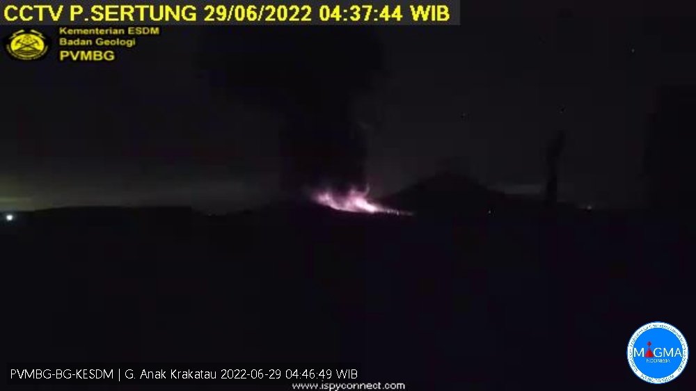
-Eruption with ash clouds at 07:09 UTC (02:09 local time). The eruption lasted for 24 seconds.
-Eruption with ash clouds at 22:36 UTC (04:36 local time). The eruption lasted for 77 seconds
Volcanic Cloud Height :
Best estimate of ash-cloud top is around 3702 FT (1157 M) above sea level, may be higher than what can be observed clearly. Source of height data: ground observer.
Other Volcanic Cloud Information :
Visuals directly from the cctv were observed eruptions with the color of the thick black eruption smoke 1000m from the top of the volcano, the wind direction slowly to north.
Remarks :
-Eruption recorded on seismogram with maximum amplitude 60 mm and maximum duration 24 second.
-Eruption recorded on seismogram with maximum amplitude 60 mm and maximum duration 77 second.
Mount Anak Krakatau erupted on Wednesday June 29, 2022 at 04:36 WIB with an ash column height observed at ± 1000 m above the summit (± 1157 m above sea level). It is observed that the ash column is black with a thick intensity towards the north. This eruption was recorded on a seismograph with a maximum amplitude of 60 mm and a duration of 77 seconds.
Source et photo : Magma Indonésie.
Chile , Villarica :
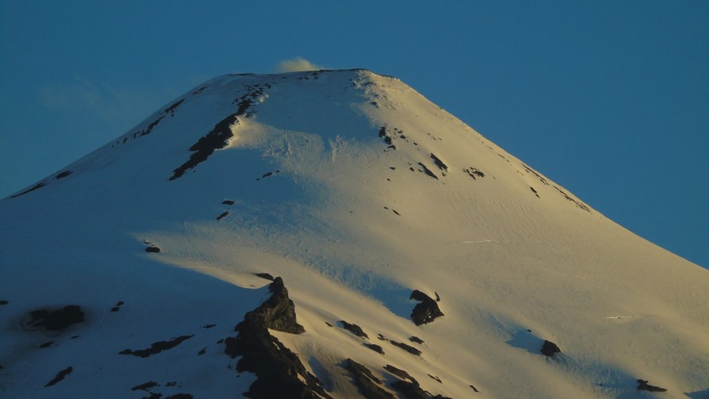
Special Report on Volcanic Activity (REAV), Auracania Region, Villarica volcano, June 28, 2022, 1:05 p.m. local time (mainland Chile)
The National Geology and Mining Service of Chile (Sernageomin) publishes the following PRELIMINARY information, obtained through the monitoring equipment of the National Volcanic Monitoring Network (RNVV), processed and analyzed in the Volcanological Observatory of the Southern Andes (Ovdas) :
On Tuesday June 28 at 12:47 p.m. local time (4:47 p.m. UTC), the monitoring stations installed near the Villarica volcano recorded an earthquake associated with fluid dynamics (long period type) inside the volcanic system.
The characteristics are as follows:
ORIGINAL TIME: 2:47 a.m. local time (4:47 p.m. UTC)
REDUCED DISPLACEMENT: 72.01 cm2
ACOUSTIC SIGNAL: 3.0 Pa reduced to one km.
The characteristics of surface activity are as follows:
MAXIMUM COLUMN HEIGHT: Cloudy
DISPERSION DIRECTION: Cloudy
COMMENTS:
No changes in activity have been recorded since this event. Despite the cloudiness, no surface activity was recorded following these events.
The volcanic technical alert remains at the Green level.
Source : Sernageomin.
Photo : Franco Vera

