May 22 , 2024.
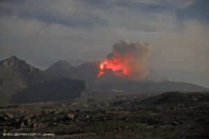
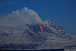
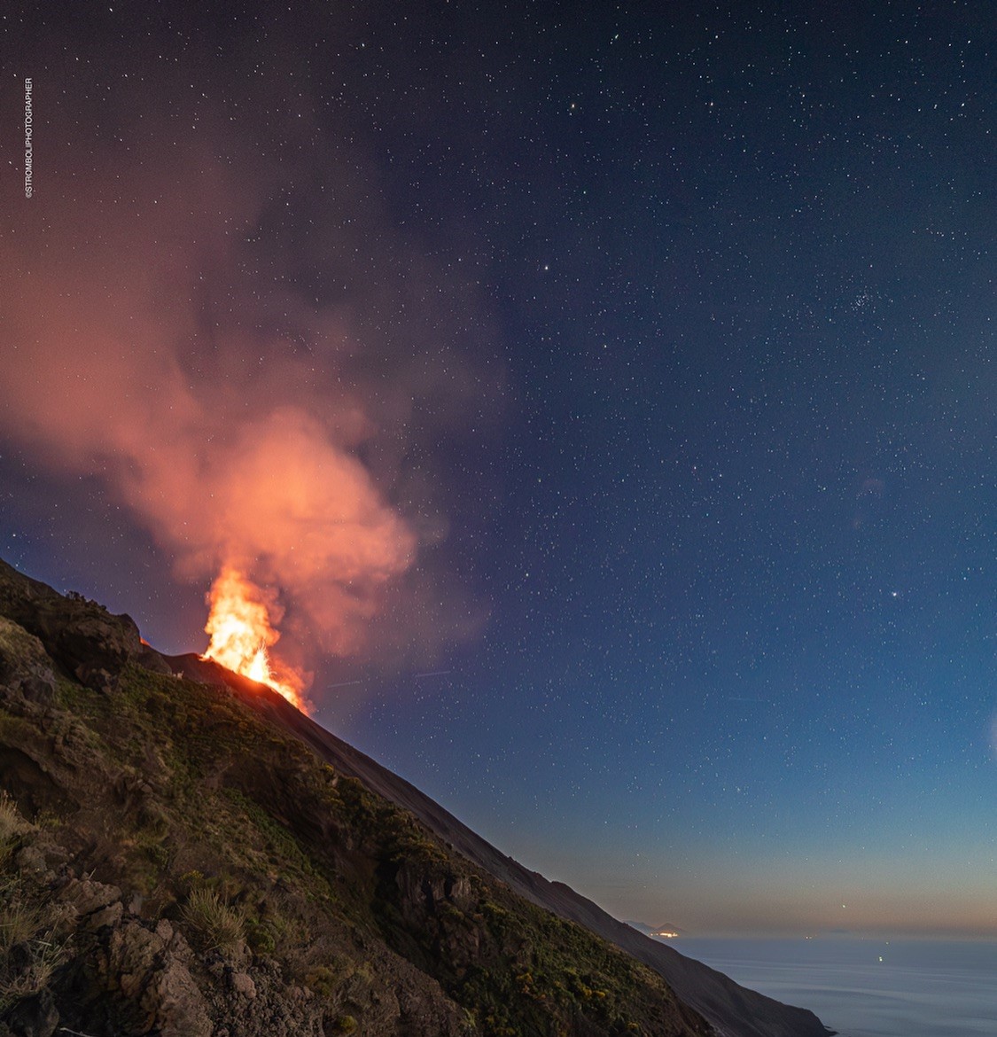
Italy , Stromboli :
WEEKLY BULLETIN, from May 13, 2024 to May 19, 2024. (issue date May 21, 2024)
SUMMARY STATEMENT OF ACTIVITY
In light of the monitoring data, it appears:
1) VOLCANOLOGICAL OBSERVATIONS: During this period, normal Strombolian activity with projection activity was observed. Overall, the total hourly frequency was at a high level, (18-25 events/h) with explosion intensity mainly low and medium in the North Crater area and variable from low to high in the Center Crater area. South.
2) SISMOLOGY: The monitored seismological parameters do not show significant variations.
3) GROUND DEFORMATIONS: The island’s ground deformation monitoring networks showed no significant changes to report for the period under review.
4) GEOCHEMISTRY: SO2 flux at an average and moderately increasing level.
The CO2 flux in the summit zone is at average values.
The C/S ratio in the plume increases moderately at high values.
There are no updates to the helium isotope ratio in the thermal aquifer.
CO2 flow in Mofeta in the San Bartolo area: medium-low values.
CO2 flux in Scari: stable values at average levels.
VOLCANOLOGICAL OBSERVATIONS
In the observed period, the eruptive activity of Stromboli was characterized through the analysis of images recorded by the INGV-OE surveillance cameras located at Pizzo (SPT), at altitude 190m (SCT-SCV) and at Punta dei Corvi (SPCT). The explosive activity was mainly produced by 2 (two) eruptive vents located in the North area of the crater and by 2 (two) vents located in the South Central area.
Observations of explosive activity captured by surveillance cameras
In the area of the North crater (N), with one vent located in sector N1 and one in sector N2, explosive activity was observed which was mainly of low intensity (less than 80 m in height) to medium (less than 80 m in height). 150 m high), coupled with almost continuous and sometimes intense projection activity in sector N1. The products emitted in eruption were mainly coarse materials (bombs and lapilli) with an average frequency of explosions fluctuating between 10 and 18 events/h.
In the South-Central (CS) zone, sectors C and S1 showed no eruptive activity, while in sector S2, with two emission points, the explosions varied in intensity from low (less than 80 m from high) to high (greater than 150 m), emitting coarse materials sometimes mixed with fine materials. The average frequency of explosions varied from 5 to 8 events/h.
Source : INGV.
Photo : Stromboli stati d’animo / Sebastiano Cannavo.
Italy , Campi Flegrei :
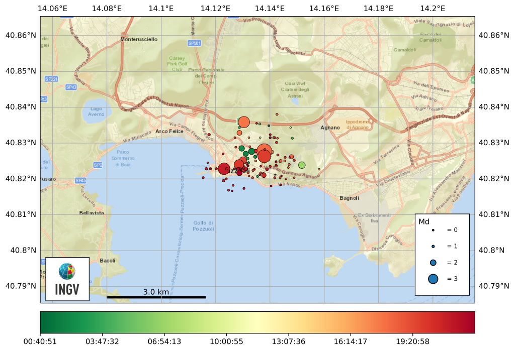
Campi Flegrei, Seismic swarm of May 20, 2024. May 21, 2024
Since 7:51 p.m. local time on May 20, 2024 (UTC 5:51 p.m.), a seismic swarm was underway in the Campi Flegrei area which, until 12:31 a.m. local time on May 21, 2024, preliminarily recorded approximately 150 earthquakes of duration Magnitude (Md) ≥ 0.0 (95 localized) and a maximum magnitude (Md) of 4.4 (±0.3).
The Md 4.4 event was the most energetic among those recorded since the start of the current bradyseismic crisis which began in 2005. The epicenter is located inside Solfatara at a depth of 2.6 km .
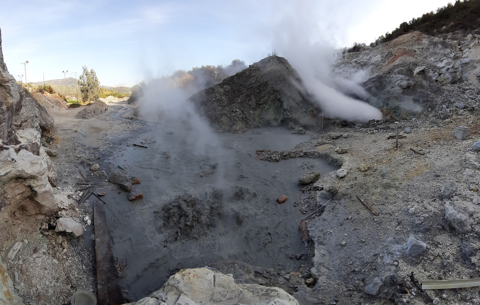
The Pisciarelli fumarollian field. In the foreground, the bubbling pool of mud.
Currently there is no increase in lifting speed which is currently 2 cm/month. So far, there is no change in the evolution of horizontal deformations or local ground deformations different from the previous trend.
It should be remembered that during the bradyseismic crisis of 1982-84, ground uplift reached 9 cm per month, and even the 1,300 seismic events per month were exceeded. However, currently around 450 events with Md≥0.0 have been recorded in the past month.
The geochemical parameters measured with the continuous stations (Temperature and carbon dioxide flux) do not show significant variations compared to the trends of recent months, other than the well-known increase in temperature and pressure that characterizes the hydrothermal system .
Seismicity is not a predictable phenomenon, so we cannot exclude that other seismic events could occur, even of an energy similar to that already recorded during the current swarm.
The INGV Vesuvian Observatory continues its ordinary and extraordinary monitoring activities in order to identify the slightest variations in monitoring parameters useful for a better definition of the current phenomenon in progress.
The structures of the National Institute of Geophysics and Volcanology (INGV) dedicated to monitoring the Campi Flegrei caldera area are still operational 24 hours a day and on May 21 measurements and sampling will be carried out in certain sites of the caldera.
The INGV, with its Section of the Vesuvian Observatory of Naples, is in permanent contact with the national and regional Civil Protection and with the Municipalities involved, as well as with all the Authorities competent for the protection of the territory.
Source : INGV Vulcani.
Photos : Pisciarelli , Tullio Ricci, dicembre 2019 , INGV .
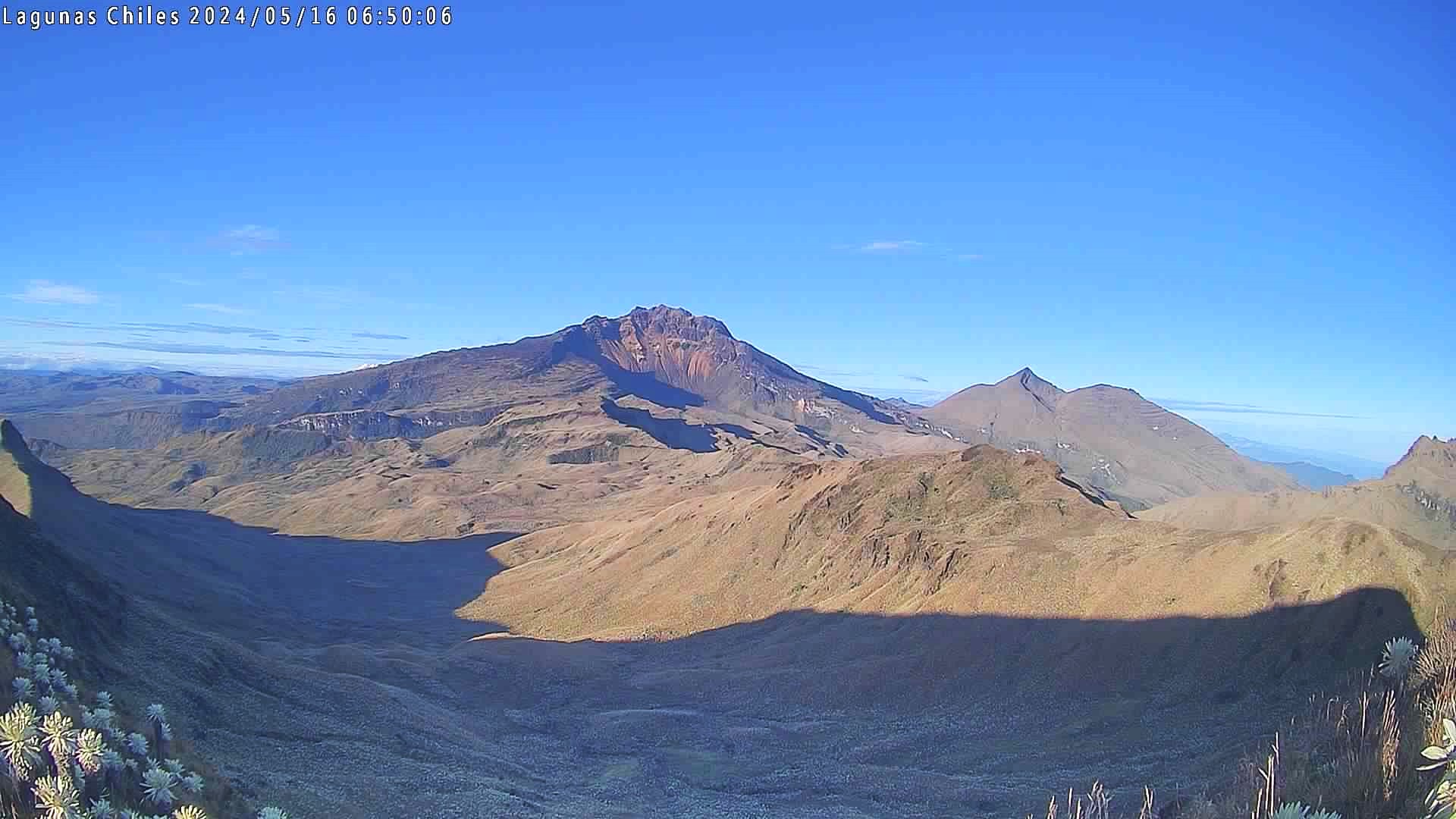
Colombia , Chiles / Cerro Negro :
Weekly Activity Bulletin: Chiles Volcanic Complex and Cerro Negro (CVCCN)
Regarding the monitoring of the activity of the CHILES AND CERRO NEGRO VOLCANOES, the COLOMBIAN GEOLOGICAL SERVICE (SGC), an entity attached to the MINISTRY OF MINES AND ENERGY, reports that:
For the period from May 14 to 20, 2024, fluctuations in the levels of occurrence and energy of earthquakes continued, presenting an increase compared to what was recorded during the last week. The predominance of seismicity linked to rock fracture continues, followed by earthquakes associated with fluid movement.
The locations of events associated with rock fracture continue to occur mainly in three sources: the first with earthquakes located towards the South-South-East of the Chiles volcano, at distances of up to 10 km from the volcano, with depths of up to 11 km from its summit (4,700 m above sea level) and a maximum magnitude of 1.5.
The second source was concentrated in the collapse zone north of the summit of Chiles Volcano, at distances up to 1.5 km, with depths less than 4 km from its summit and magnitudes less than 1.0. The third source was located south of Chiles Volcano, at distances up to 3.0 km, at depths less than 4 km from its summit, and at magnitudes less than 1.
Volcanic deformation processes recorded by sensors installed on the ground and by remote satellite sensors continue. The evolution of activity in the CVCCN is the result of internal processes derived from the complex interaction between the magmatic system, the hydrothermal system and the geological faults of the area. Therefore, the probability of the occurrence of energetic earthquakes that can be felt by residents in the CVCCN zone of influence persists.
Volcanic activity remains in a YELLOW ALERT state: active volcano with changes in the behavior of the base level of monitored parameters and other manifestations.
Source et photo : SGC
Hawaii , Kilauea :
Tuesday, May 21, 2024, 8:52 AM HST (Tuesday, May 21, 2024, 18:52 UTC)
19°25’16 » N 155°17’13 » W,
Summit Elevation 4091 ft (1247 m)
Current Volcano Alert Level: ADVISORY
Current Aviation Color Code: YELLOW
Activity Summary:
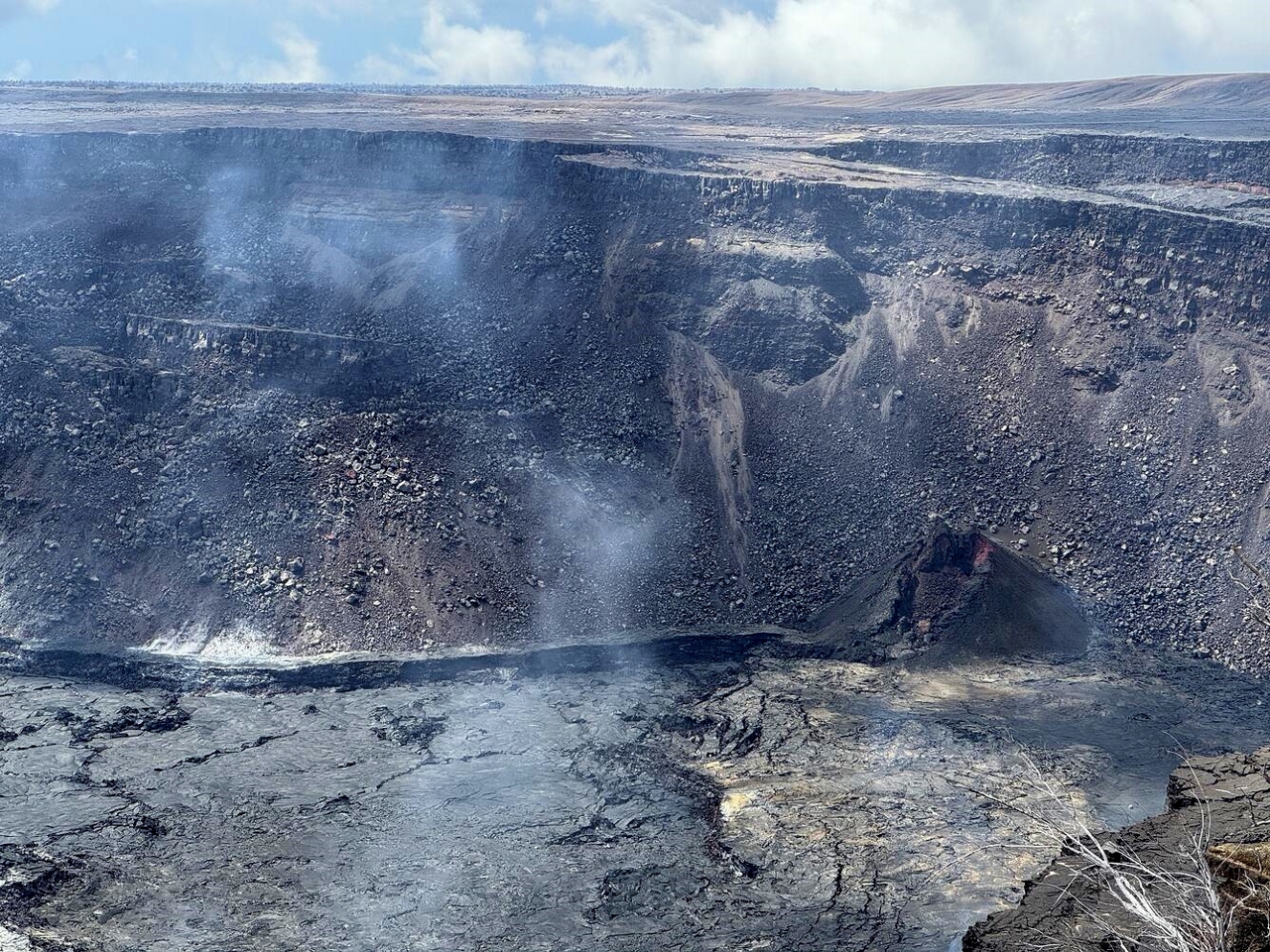
Kilauea volcano is not erupting. Unrest continues beneath the upper East Rift Zone. The summit and south caldera are at background levels.
Summit Observations and Upper East Rift Zone Observations:
Over the past day, earthquake counts along the UERZ are above background levels. Earthquakes in the summit and south caldera are at background levels. Earthquake depths have averaged 1–3 km (0.6–1.9 miles) beneath the surface, and magnitudes have been mostly below M2.0. For now, earthquake rates appear to be slowing down, but that could change at any time.
Ground deformation continues beneath Halemaʻumaʻu and the south caldera region. The Uēkahuna tiltmeter northwest of the summit registered flat tilt over the past day. At the same time, the Sand Hill tiltmeter southwest of the summit showed flat tilt.
Sulfur dioxide (SO2) gas emission rates remain low. An SO2 emission rate of approximately 62 tonnes per day was recorded on May 2.
Rift Zone Observations:
Elevated seismic activity in the Upper East Rift Zone is scattered along this zone. Currently, seismicity in Kilauea’s Southwest Rift Zone is relatively low outside the summit region. Measurements from continuous gas monitoring stations downwind of Puʻuʻōʻō in the middle East Rift Zone remain below detection limits for SO2, indicating that SO2 emissions from Puʻuʻōʻō are negligible.
Analysis:
Magma has been pressurizing the system beneath Halemaʻumaʻu and the south caldera region, activating seismicity in the upper East Rift Zone, and in the caldera south of Halemaʻumaʻu. At this time, it is not possible to say whether this increase in activity will lead to an intrusion or eruption in the near future, or simply continue as seismic unrest at depth. Changes in the character and location of unrest can occur quickly, as can the potential for eruption.
Source : HVO
Photo : USGS/ M. Patrick.
La Guadeloupe , La Soufrière :
Press release from the Paris Institute of Globe Physics, Volcanological and Seismological Observatory of Guadeloupe. Monday May 20, 2024 at 7:00 a.m. (local time) – 11:00 a.m. UTC
Volcanic activity release / Sequence of earthquakes in the La Soufrière area of Guadeloupe – Basse Terre
The sequence of volcanic earthquakes which began on Wednesday May 15, 2024 at 7:30 p.m. local time (Wednesday May 15, 2024 at 11:30 p.m. UT*) in the La Soufrière volcano area ended on Saturday May 18, 2024 at 1:20 a.m. local time (Saturday May 18 2024 at 05:20 UT*).
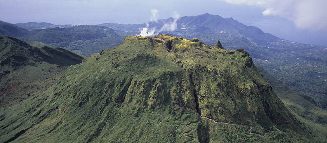
During this sequence, the OVSG-IPGP networks recorded 179 earthquakes of very low magnitude (M < 1).
No earthquakes were reported felt. The events are located at a depth of <2.5 km below the summit of the La Soufrière dome
The alert level remains: yellow, vigilance.
Source : Direction de l’OVSG-IPGP
Photo : P Giraud / ctig